
![Carte Reduite Des Iles Antilles . . . [and] Carte reduite des debouquements de St. Domingue . . . . 1775 [Includes Bahamas]](/map/small/58201.jpg)
A magnificent two-in-one map of the Lesser Antilles (from the eastern tip of Puerto Rico to St. Vincent and Barbados) and of the Turks and Caicos (including part of the Bahamas and the northern coast of Hispaniola). A later reissue and compilation of...
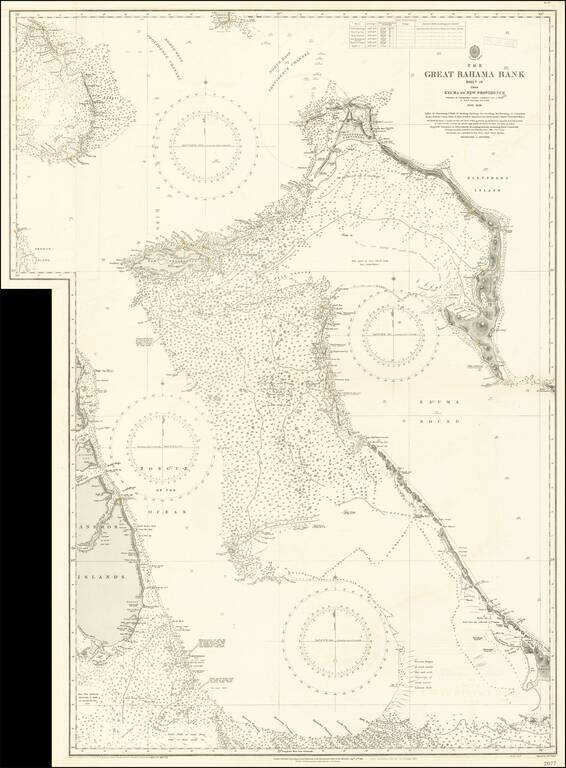
Large engraved sea chart of the Bahamas, issued by the British Admiralty first in 1851, and with numerous corrections over the years to this edition in 1921. The map shows parts of the Andros Islands, New Providence Island with Nassau (Lyford Cay is...
![Canal De La Providence (Bancs De Bahama) . . . 1857 [with] Mouillage De La Point Du Trou Dans Mur (Ile Abaco) . . . [with] Cay Gun (Grand Banc De Bahama)](/map/small/63072.jpg)
Rare set of 3 regional charts of the Bahamas. The largest map shows Little Bahama Bank, Little Abaco, Grand Abaco, Bahama Island, and the region extending southward to New Providence and Andros Island. The Second map shows the southern part of Grand...
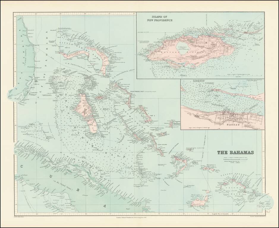
Fine and highly detailed map of the Bahamas from Stanford's London Atlas. Includes an inset map of Nassau and an inset map of the Island of New Providence.
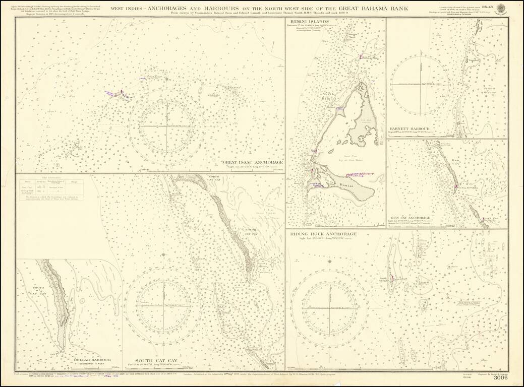
A detailed map showing several harbors in the Bahamas, first published by the British Admiralty in 1898. Seven separate maps show different anchorages, covering most of the islands in the northwesternmost part of the Great Bahama Bank. The charts show...