George F. Cram (1842-1928), or George Franklin Cram, was an American mapmaker and businessman. During the Civil War, Cram served under General William Tecumseh Sherman and participated in his March to the Sea. His letters of that time are now important sources for historians of the Civil War. In 1867, Cram and his uncle, Rufus Blanchard, began the company known by their names in Evanston, Illinois.
Two years later, Cram became sole proprietor and the company was henceforth known as George F. Cram Co. Specializing in atlases, Cram was one of the first American companies to publish a world atlas. One of their most famous products was the Unrivaled Atlas of the World, in print from the 1880s to the 1950s.
Cram died in 1928, seven years after he had merged the business with that of a customer, E.A. Peterson. The new company still bore Cram’s name. Four years later, the Cram Company began to make globes, a branch of the business that would continue until 2012, when the company ceased to operate. For the final several decades of the company’s existence it was controlled by the Douthit family, who sold it just before the company was shuttered.
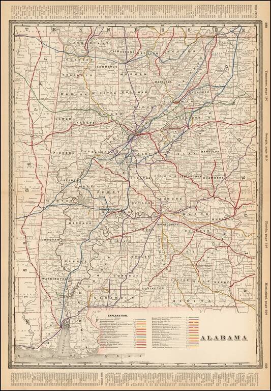
Detailed railroad map of Alabama, showing counties, railroad lines, towns, rivers, township surveys, lakes, mountains, creeks, and a host of other information. The Explanation Key locates approximatley 40 Railroad Lines.
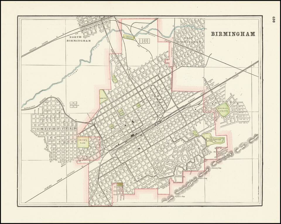
Detailed city plan of Birmingham, Alabama showing streets, buildings, train lines, public places, rivers etc. Cram was one of the pre-eminent American mapmakers of the late 19th century, relying upon a cerographic printing process first applied to...
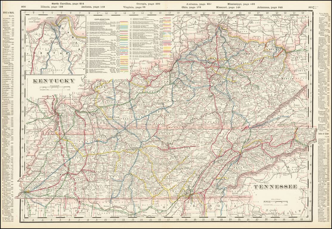
Highly detailed railroad map of Kentucky and Tennessee. Shows counties, railroads, railway stations, township surveys, mountains, rivers, lakes, and a host of other early details. Large inset of Covington, Newport and Vicinity.
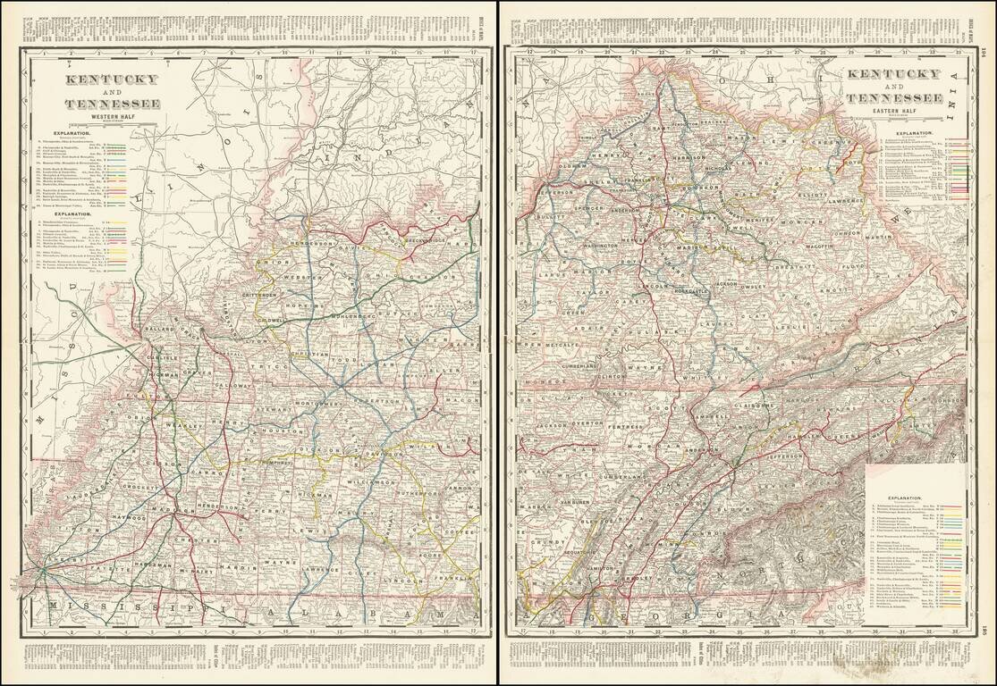
Highly detailed 2-sheet railroad map of Kentucky and Tennessee. Shows counties, railroads, railway stations, township surveys, mountains, rivers, lakes, and a host of other early details.
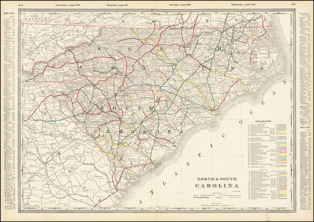
A fabulously detailed railroad map of the Carolinas, from Cram's scarce Standard American Railway Atlas. Shows over 60 different railroads, stations, and numerous other details. The best atlas railroad map of the time period.
![Western Part of North and South Carolina [and] Eastern Part of North and South Carolina](/map/small/69547.jpg)
A fabulously detailed railroad map of the Carolinas, from Cram's scarce Standard American Railway Atlas. Shows over 60 different railroads, stations, and numerous other details. The best atlas railroad map of the time period.
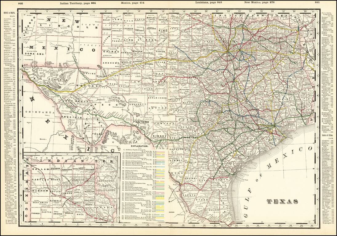
Detailed and interesting railroad map of Texas, which appeared in Cram's Standard American Railway Atlas. Includes the routes of approximately 40 different railroads (with each identified by name and color key), towns, counties, post offices, rivers,...
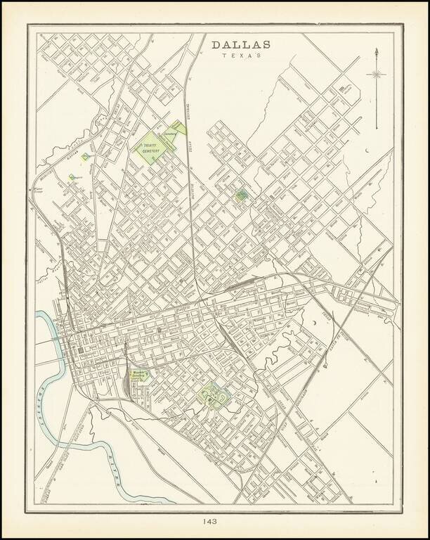
A detailed plan of the city of Dallas highlighting major parks and cemeteries and showing a portion of the Trinity river as well as local creeks. The first separate map of Dallas to appear in a Commercial Atlas and one of the few maps of Dallas...
![Illinois Northern Half [and] Illinois Southern Half](/map/small/69643.jpg)
Fine large Railroad map of Illinois, published in Chicago by George Cram. Includes a list of over 60 railroads operating in the state, with color coding.
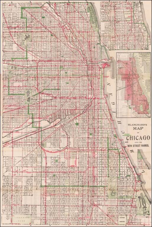
Scarce issued map of the City of Chicago by Rufus Blanchard, one of the leading map makers in Chicago during the late 19th Century. Provides a detailed look at the City of Chicago. The present example was apparently re-issued by George Cram and would...
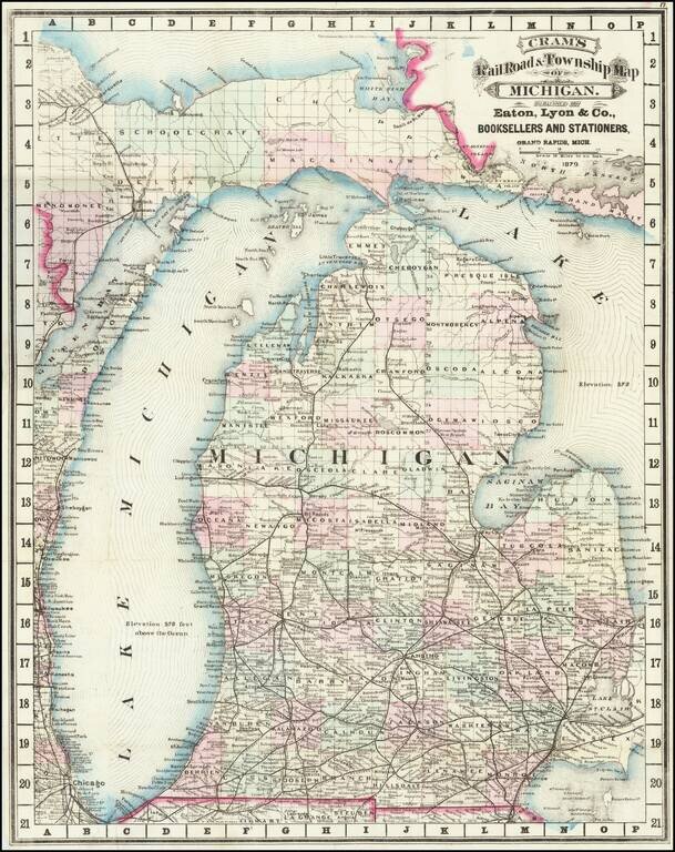
Cram's rare 1879 railroad map of Michigan, based on his first edition of 1875. Michigan prospered after the Civil War, with the lumber, dairy, and railroad industries taking off. This map reflects the booming economy, as the railroads stretched across...
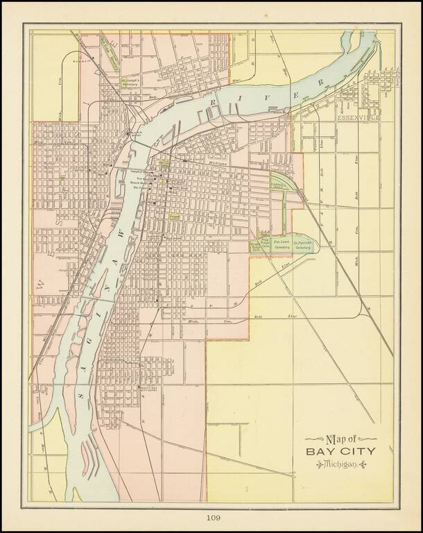
Detailed map of Bay City, Michigan, from George Cram's Family Atlas. The maps shows streets, buildings, train lines, public places, rivers etc. Cram was one of the pre-eminent American Mapmakers of the late 19th Century, relying upon a cerographic...
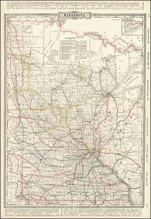
Detailed railroad map of Minnesota, published in Chicago by George Cram. The map shows counties, railroad lines, towns, rivers, lakes, post offices, railroad depots, Indian Reservations, and a host of other information. The map shows nearly 30...
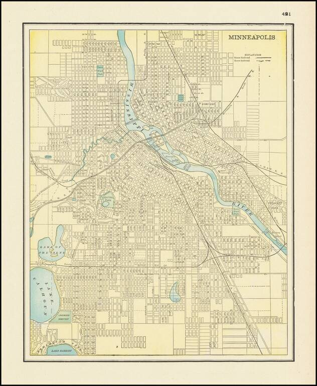
Detailed city plan of Minneapolis, showing streets, buildings, train lines, public places, rivers etc. Cram was one of the pre-eminent American Mapmakers of the late 19th Century, relying upon a cerographic printing process first applied to maps by...
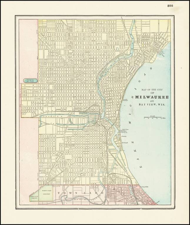
Detailed city plan of Milwaukee and environs by George Cram. The map show streets, buildings, train lines, public places, rivers etc.
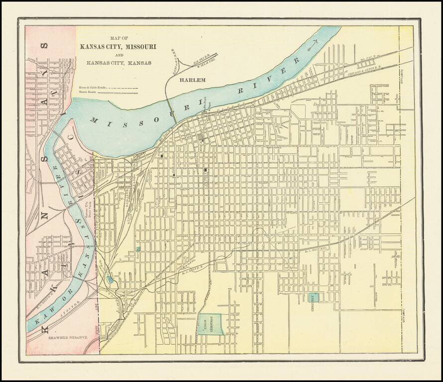
Detailed city plan of Kansas City, showing streets, buildings, train lines, public places, rivers etc. Cram was one of the pre-eminent American Mapmakers of the late 19th Century, relying upon a cerographic printing process first applied to maps by...