George F. Cram (1842-1928), or George Franklin Cram, was an American mapmaker and businessman. During the Civil War, Cram served under General William Tecumseh Sherman and participated in his March to the Sea. His letters of that time are now important sources for historians of the Civil War. In 1867, Cram and his uncle, Rufus Blanchard, began the company known by their names in Evanston, Illinois.
Two years later, Cram became sole proprietor and the company was henceforth known as George F. Cram Co. Specializing in atlases, Cram was one of the first American companies to publish a world atlas. One of their most famous products was the Unrivaled Atlas of the World, in print from the 1880s to the 1950s.
Cram died in 1928, seven years after he had merged the business with that of a customer, E.A. Peterson. The new company still bore Cram’s name. Four years later, the Cram Company began to make globes, a branch of the business that would continue until 2012, when the company ceased to operate. For the final several decades of the company’s existence it was controlled by the Douthit family, who sold it just before the company was shuttered.
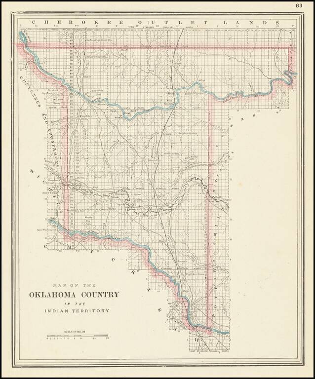
Unusual map of the "Oklahoma Country," published by George Cram in Chicago.
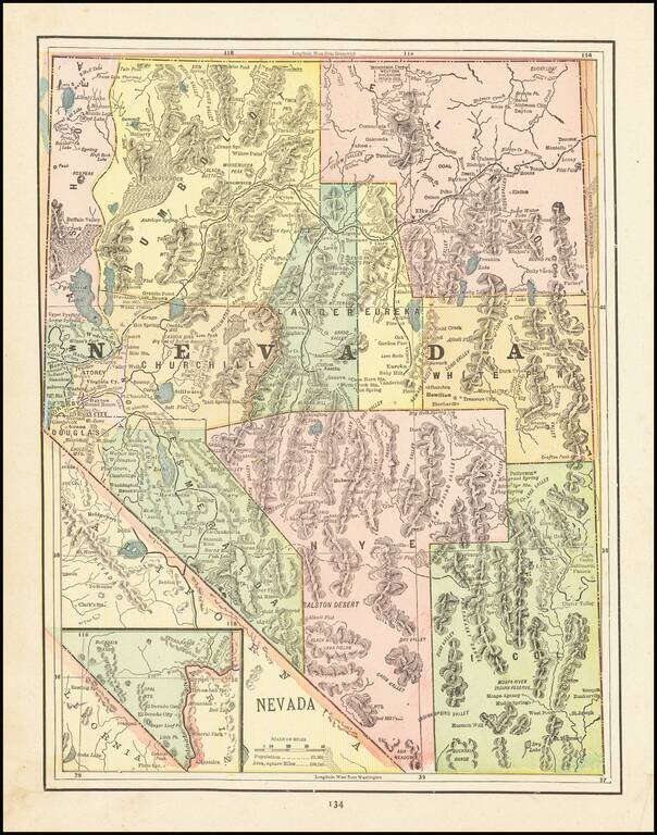
Detailed map of Nevada, colored by Counties, showing Indian Reservations, forts, Military Reserves, mines, forests, towns, railroads, railroad stations, post offices, rivers, forts and other places of interest. A nice late 19th Century map, printed...
![[California & Nevada] California and Nevada Northern Half / California and Nevada Southern Half](/map/small/69248.jpg)
Remarkable large 2 sheet Railroad Map of California & Nevada, published by George Cram. Includes a list of about 20 Railroads, including some very rare names, including: Carson & Colorado RR Chino Valley RR Coronado RR (Narrow Gauge...
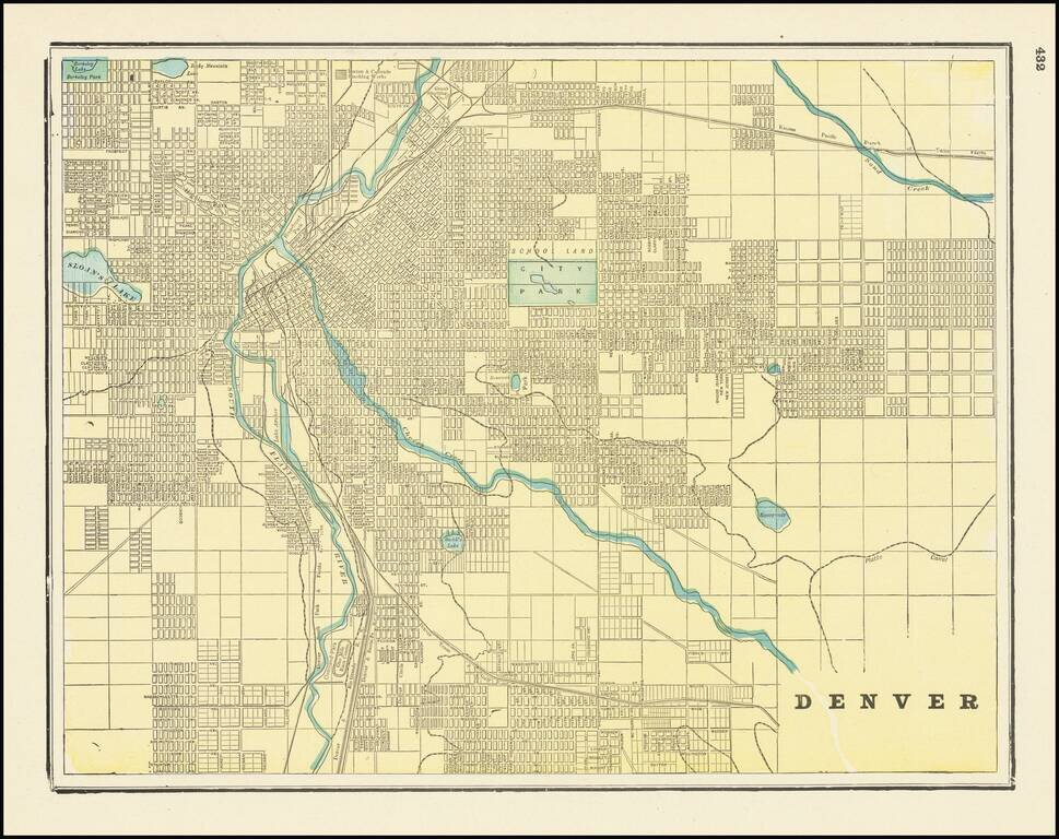
Scarce 19th-century city plan of Denver, Colorado, showing streets, buildings, train lines, public places, rivers etc. Cram was one of the pre-eminent American mapmakers of the late-19th century, relying upon a cerographic printing process first...
Early and highly detailed map showing railroads, towns, cities and mountain ranges. Early county configurations. Many early roads, rivers, mining areas, Indian names and other details.
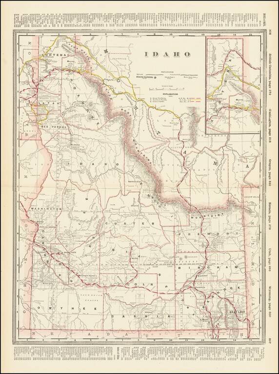
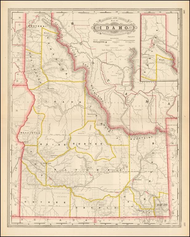
Early and highly detailed map of Idaho showing railroads, towns, cities and mountain ranges. Includes early county configurations. Includes many early roads, rivers, mining areas, Indian names and other details.
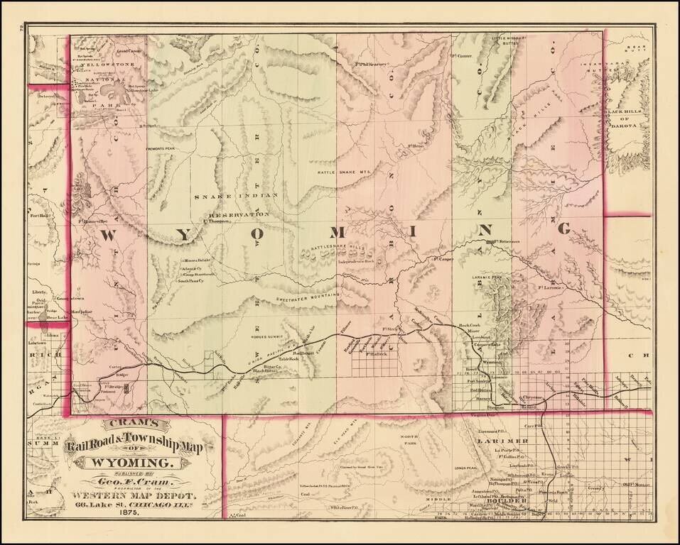
First edition of Cram's first map of Wyoming Territory. One of the few obtainable maps of Wyoming showing only 5 counties, illustrating the earliest township surveys within the Territory. The map shows Wyoming shortly before Custer's expedition...
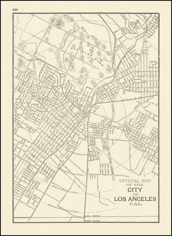
Scarce early Cram map of Los Angeles, one of the earliest obtainable separately issued maps of Los Angeles, most likely from the Atlas of the Pacific Coast. The city is shown at a much earlier stage in its development than Cram's later map of Los...
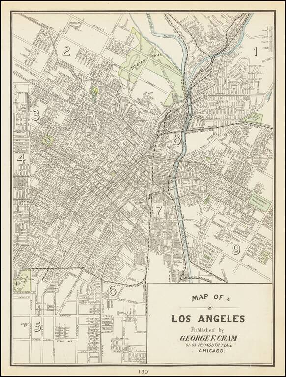
One of the Earliest Obtainable Separately Issued Maps of Los Angeles This is the rare Cram map of Los Angeles, showing the city roughly from Echo Park to Alameda. Detail is extensive on this street map, with many roads named in this region. To the...
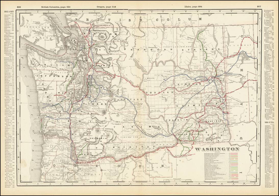
Detailed railroad map of Washington State, showing counties, railroad lines, towns, rivers, township surveys, lakes, mountains, creeks, waterfalls, and a host of other information. Includes a list of over 20 operating railroad lines in Washington...
![Western Part of Washington [with] Eastern Part of Washington](/map/small/69112.jpg)
Scarce two-sheet George Cram map of Washington State. The map, which appeared only in a few 1890s editions of the Cram railroad atlases, contains a wealth of information on late-19th century railroads in Washington. This is the first time we have had...
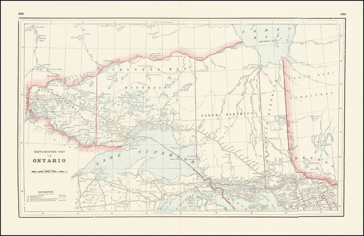
Detailed railroad map, showing counties, railroad lines, towns, rivers, township surveys, lakes, mountains, creeks, waterfalls, and a host of other information. Focuses on the northern Great Lakes, specifically Lake Superior, and shows Ontario north...
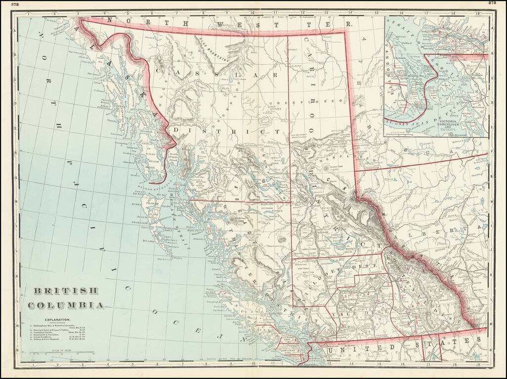
Fine large format map of British Columbia, published in Chicago by George Cram. Includes topographical features, towns, rivers, mountains and early railroads (completed and proposed) The map divides British Columbia into Districts, including...
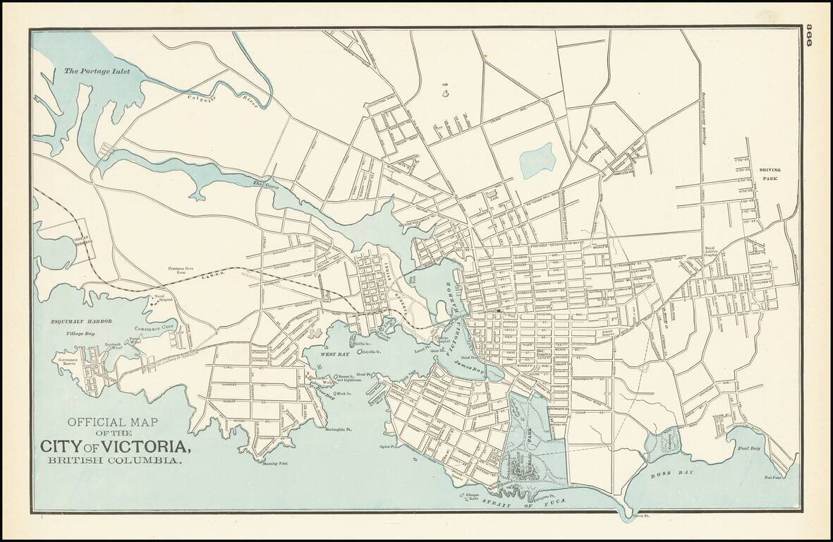
Detailed map of Victoria and environs, published by George Cram in Chicago. The map is centered on Victoria harbor, with a large Indian Reserve on the waterfront. The line of the E & N Railroad extends westward from downtown and a large park in...
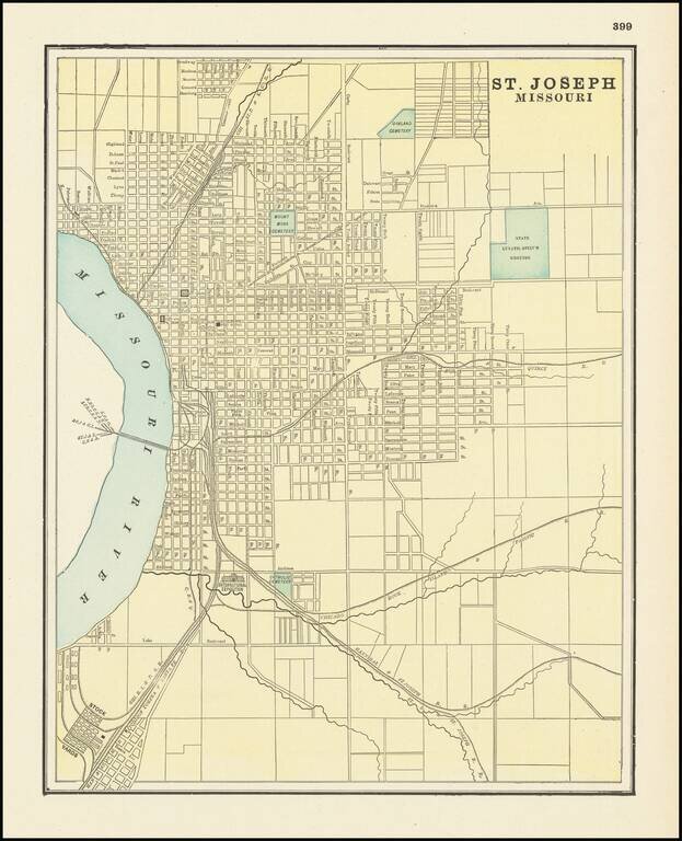
Detailed city plan of St. Joseph, showing streets, buildings, train lines, public places, rivers etc. Cram was one of the pre-eminent American Mapmakers of the late 19th Century, relying upon a cerographic printing process first applied to maps by the...
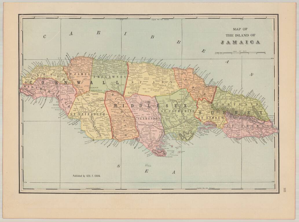
Attractive and highly detailed map of Jamaica, issued in Cram's scarce American Railway Atlas.