Homann Heirs was a German publishing firm that enjoyed a major place in the European map market throughout the eighteenth century. Founded in 1702 by Johann Baptist Homann, the business passed to his son, Christoph, upon Johann’s death in 1724. Christoph died in 1730, aged only 27, and the firm was inherited by subsequent Homann heirs. This altered the name of the company, which was known as Homann Erben, or Homann heirs. The firm continued in business until 1848.
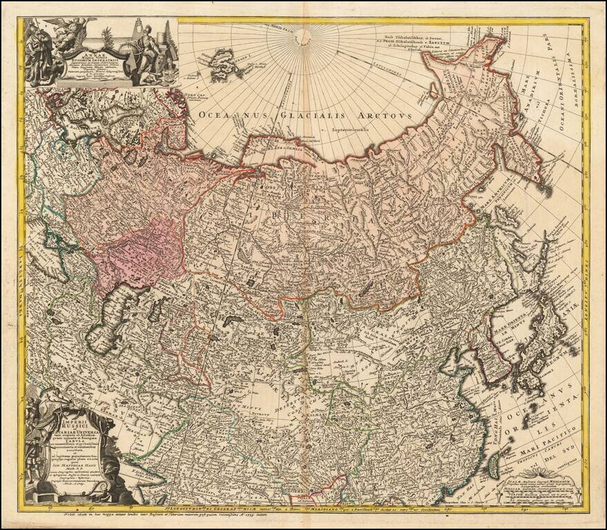
Detailed map of the Asian part of the Russian Empire, from the Caspian Sea and Bergen Island to Japan and the Pacific. The present example includes the portrait of Anna Ioannovna, who was regent of the duchy of Courland from 1711 until 1730 and then...
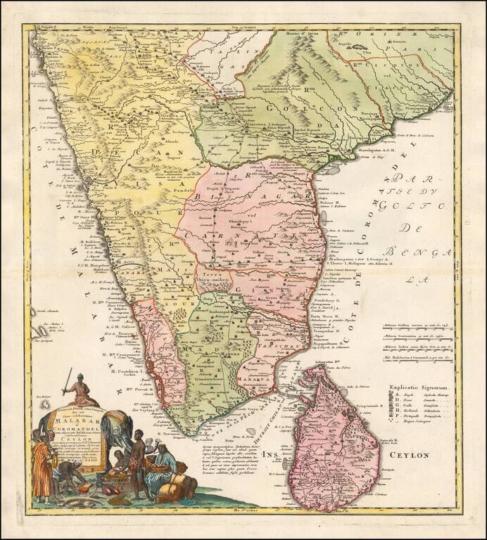
Homann's Map of India Large and attractive map of Sri Lanka and the southern part of the Indian Peninsula, with an elaborate cartouche showing an elephant and elaborately clothed indigenous people. The map includes towns, roads, rivers, mountains,...
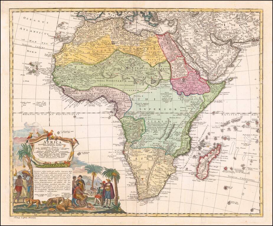
Nice example of the Homann family's second map of Africa, based upon the work of De L'Isle. The map is dominated by a beautiful cartouche showing Europeans, Africans, and various African animals with views of Cape Town, South Africa.
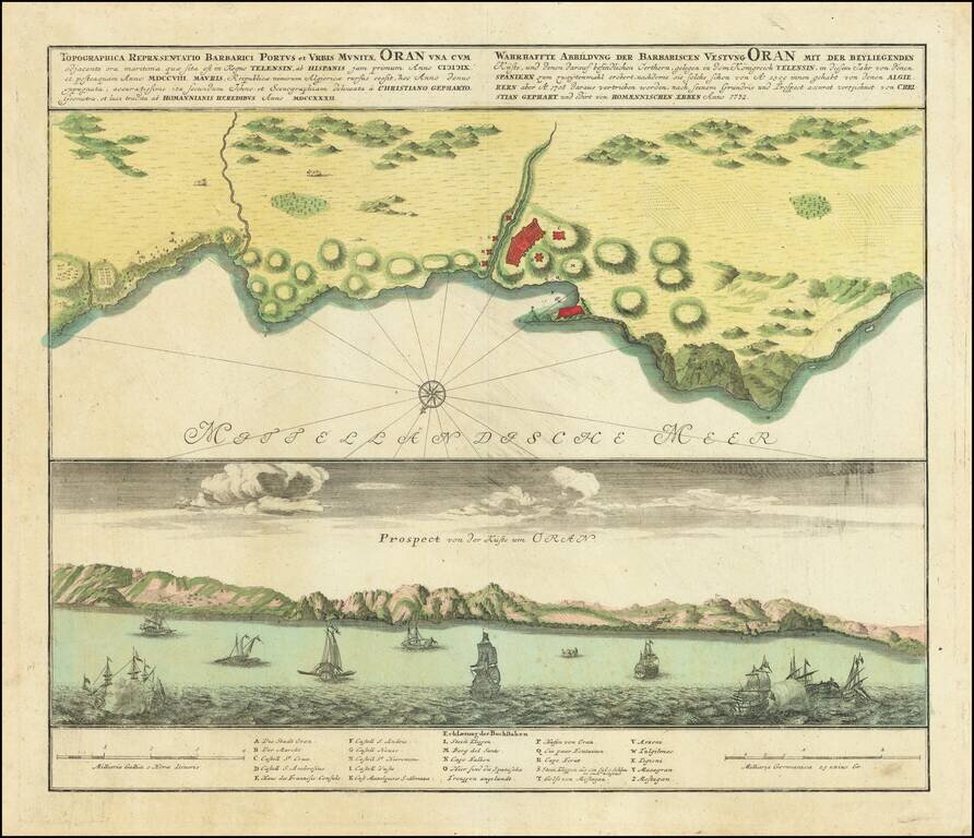
Scarce antique engraved view and plan of Oran, in Algeria, by the German mapmakers Homann Heirs, published in Nuremberg in 1732. In the view at the bottom, there are xebecs and other sailing vessels, including some firing on one another, possibly...
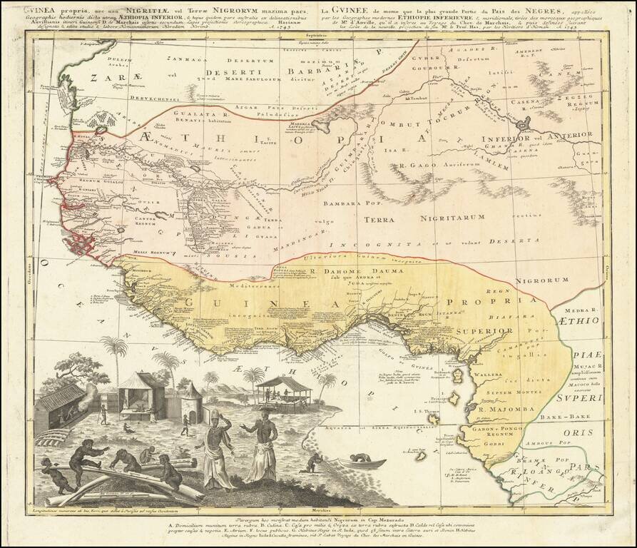
Strikingly-Illustrated Eighteenth-Century Atlas Map of West Africa Dynamic example of this highly decorative and detailed antique map of West Africa, published by the Homann Heirs in 1743. This is one of the best atlas maps of the region made during...
![[Title Page] Atlas Homannianus Mathematico-Historice delineatus . . . 1762](/map/small/46744.jpg)
Rare Homan Title page, with a decorative allegorical scene centered around a globe and other scientific instruments.