Homann Heirs was a German publishing firm that enjoyed a major place in the European map market throughout the eighteenth century. Founded in 1702 by Johann Baptist Homann, the business passed to his son, Christoph, upon Johann’s death in 1724. Christoph died in 1730, aged only 27, and the firm was inherited by subsequent Homann heirs. This altered the name of the company, which was known as Homann Erben, or Homann heirs. The firm continued in business until 1848.
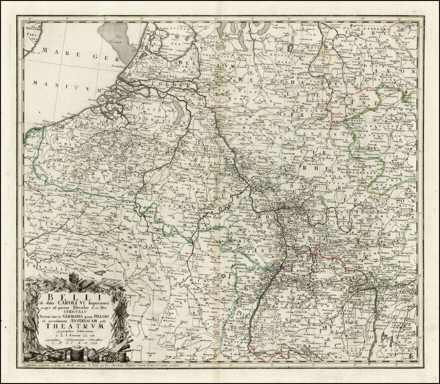
Interesting map of a part of the Theater of War in Europe, celebrating the signing of the Treaty of Dresden, on December 25, 1745. The Treaty of Dresden was signed on December 25, 1745 at the Saxon capital of Dresden between Austria, Saxony and...
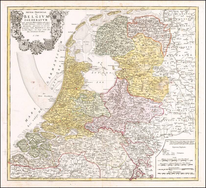
Detailed map of the Low Countries, published by the Homann Heirs in Nuremberg. The map includes a large decorative cartouche, including the 7 coats of arms of Geldern, Holland, Zeeland, Utrecht, Friesland, Ober Issel, and Groningen.
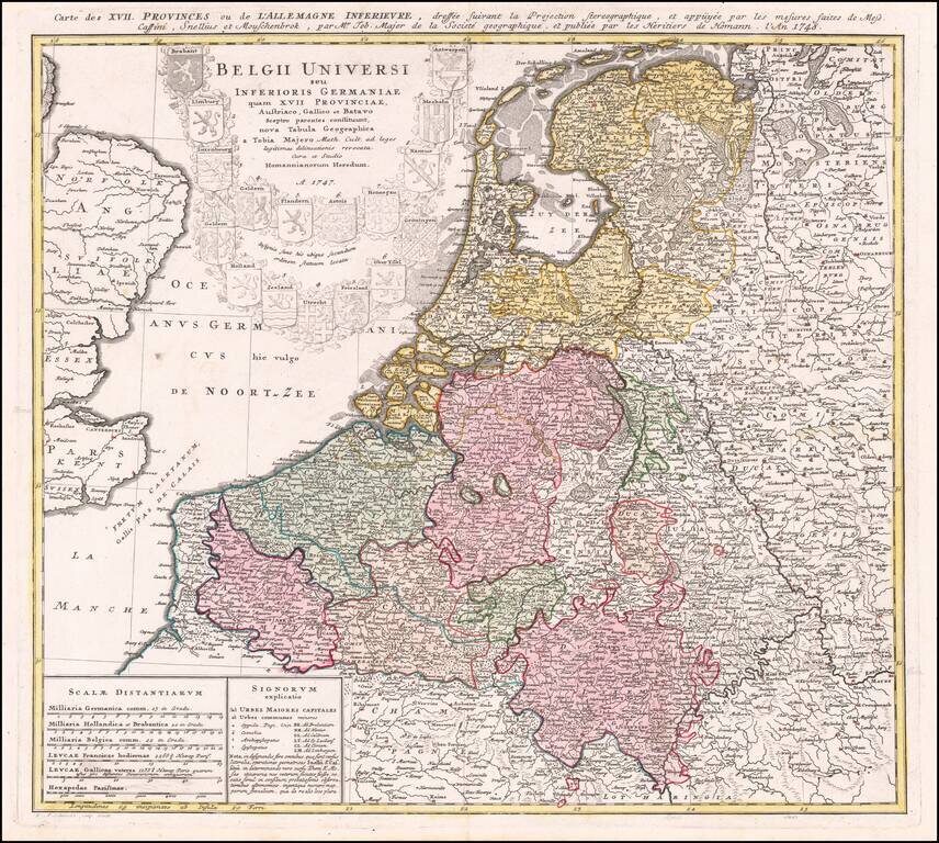
Nice regional map of the Low Countries, published by Homann Heirs in Nuremberg. Shows the coats of arms of the 17 United Provinces.
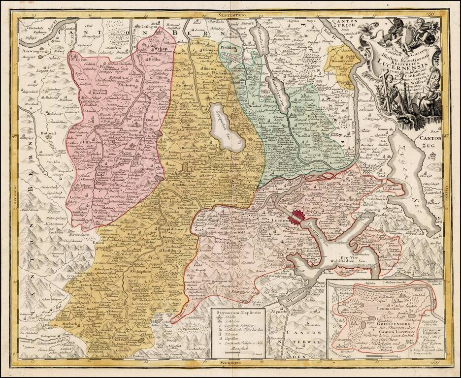
Detailed map of the Kanton of Luzerne in Switzerland with decorative cartouche.
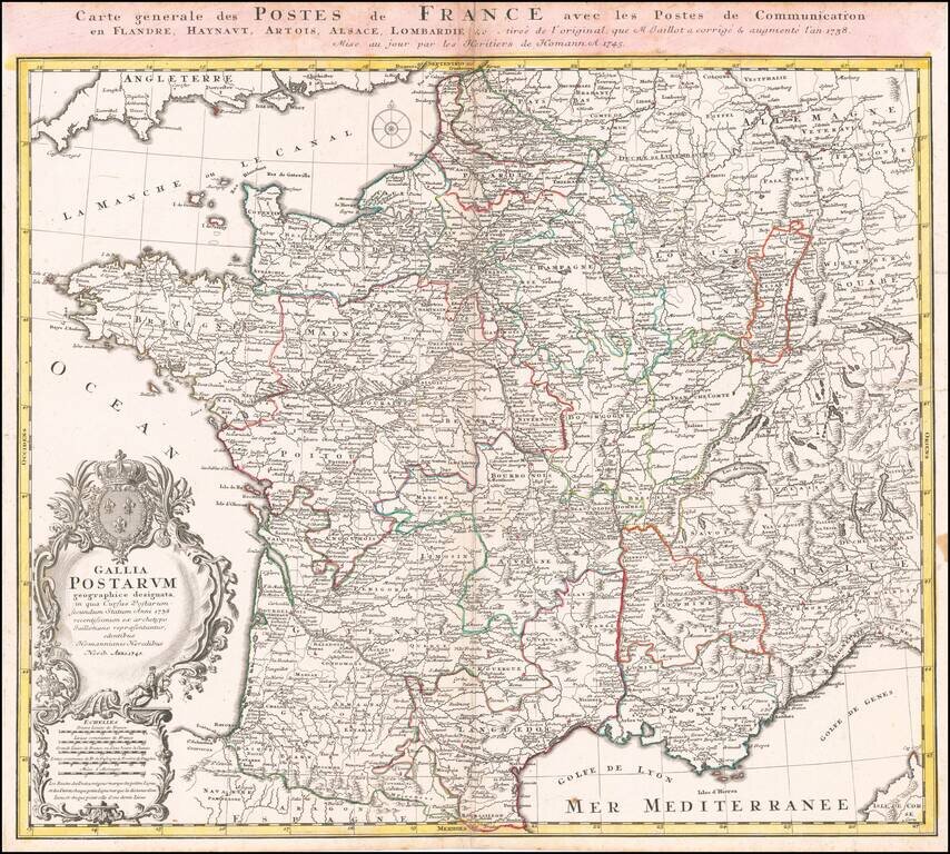
Scarce early postal map of France, published in Nuremberg. Includes an elaborate cartouche with coat of arms.

Highly detailed map of the Alsace region, tracking the course of the Rhein from the Strassbourg area to just east of Landau. Large decorative cartouche.
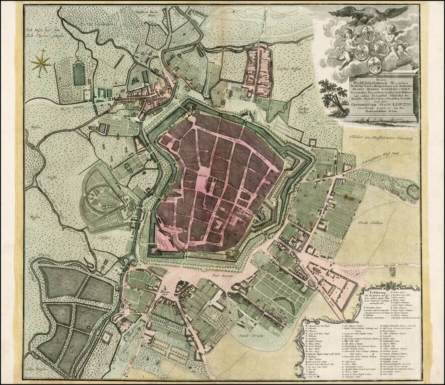
Scarce plan of Leipzig, from one of Germany's leading publishers of the 18th Century. Includes a key locating more than 50 points of interest.
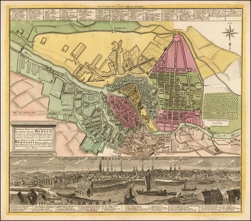
Striking plan of Berlin, with a detailed panoramic view of the city at the bottom, with a key locating 33 landmarks. Homann engraved views of a number of the major European cities during the early 18th century, which were added to his composite atlases.
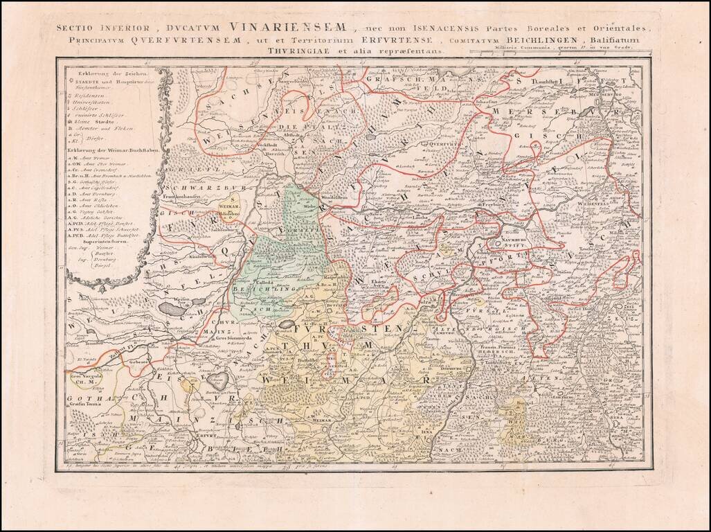
Detailed regional map of a part of the Thuringia region of Eastern Germany.
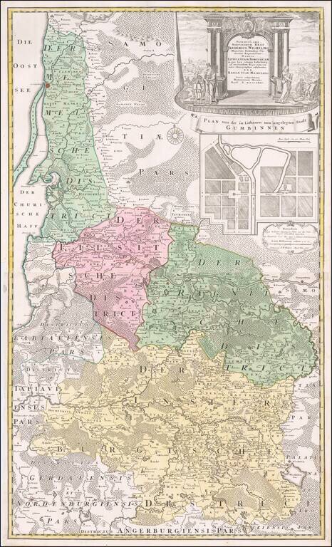
Fine large map of the Baltic and Poland, published by the Homann Heirs. The map illustrates what was then 'Lithuania Minor', the most easterly province of the Kingdom of Prussia, given the name because of the large number of Lithuanian speakers. The...
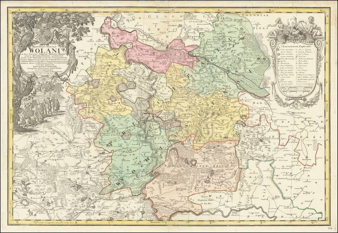
Fine large map of part of Wohlau, Parchwitz, Lüben and Herrnstad, the northwestern part of Breslau, originally drawn by Johann Wolfgang Wieland (?-1736) and Mattheus von Schubarth (1723-1758). The map is dissected by the Oder River, The Atlas...
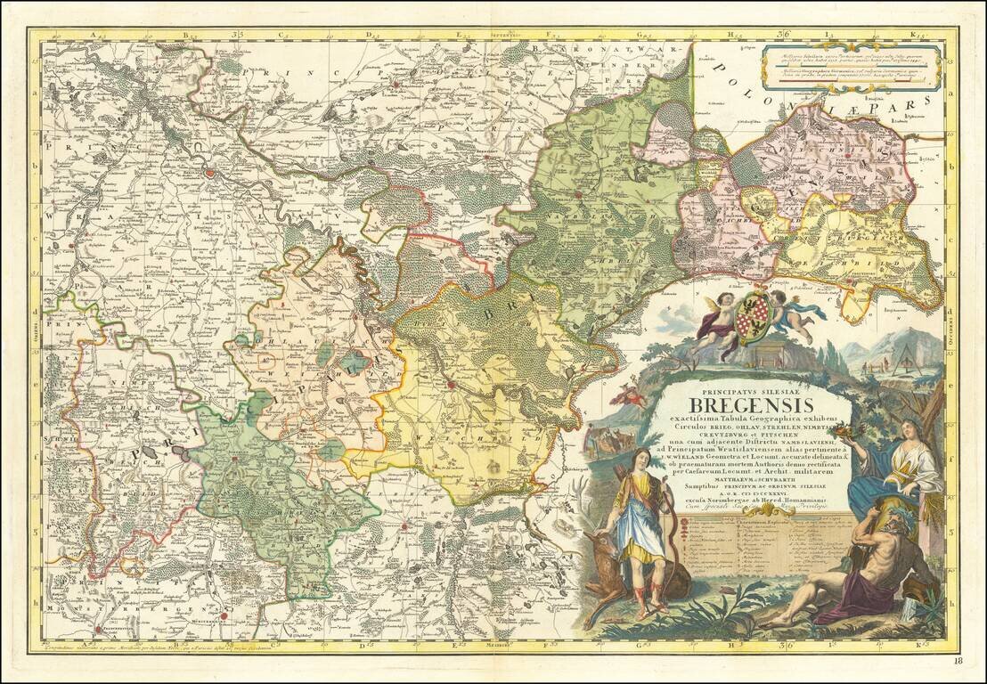
Fine large map of part of the Northern part of Silesia, originally drawn by Johann Wolfgang Wieland (?-1736) and Mattheus von Schubarth (1723-1758). The map is dissected by the Oder River, The Atlas Silesiae, was a large scale atlas of Silesia,...
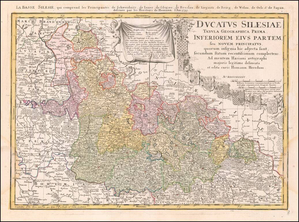
From The First Official Survey of Silesia Detailed map of Lower Silesia, with title cartouche including coat-of-arms of Schweidniz, Iaver, Glogau, Breslau, Lignitz, Brieg, Wolau, Oels and Sagan, with early pencil notes next to each coat of arms. The...
![[Wroclaw] Carte du Diocese de Breslau, avec ses IV. Archidiaconats, subdivses en ses Cercles Archiprebyteriales desineee sous la Directiondu bien reverend Sieur Felbiger . . . MDCCLI](/map/small/59627.jpg)
From The First Official Survey of Silesia Detailed regional map of the Diocese of Breslau (Wroclaw), published in Nuremberg. The map was originally published separately in about 1736 and was later issued in the Homann Heirs Atlas Silesiae Id Est...
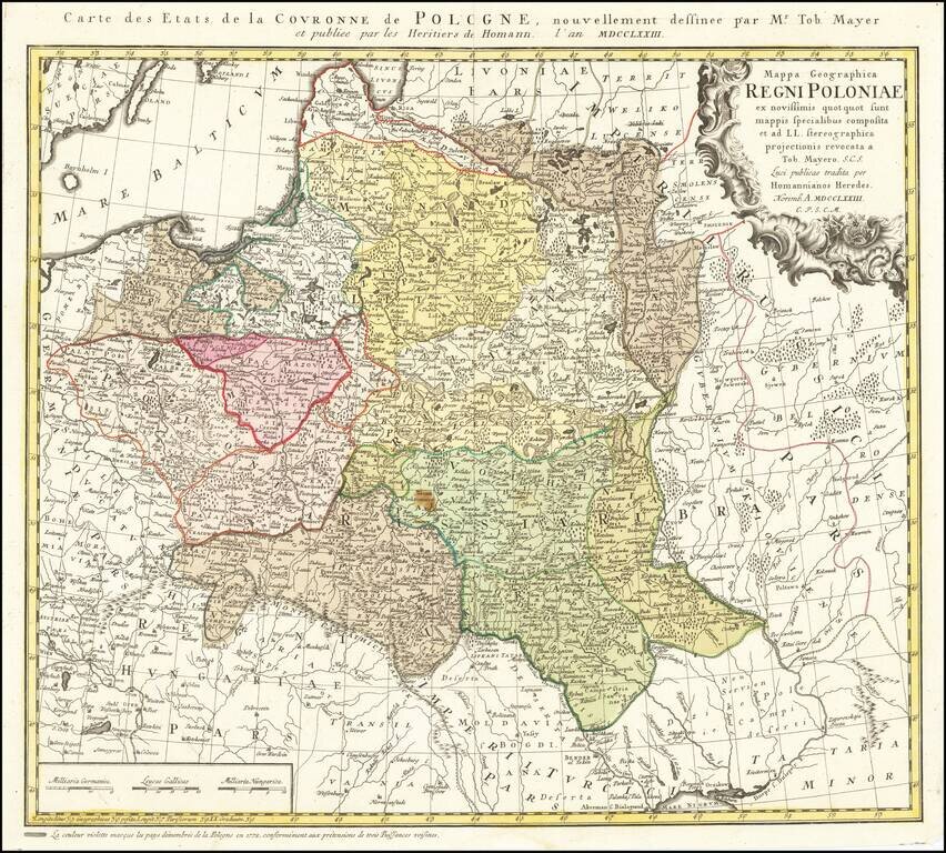
Detailed map of Poland, by Tobias Mayer, dated 1773 in the title cartouche. Poland extends from Glogau and Breslau in the west, to Braclaviensis in the south along the Dniestr River, east to the Dniepr River and Mscislaw and north to include parts of...
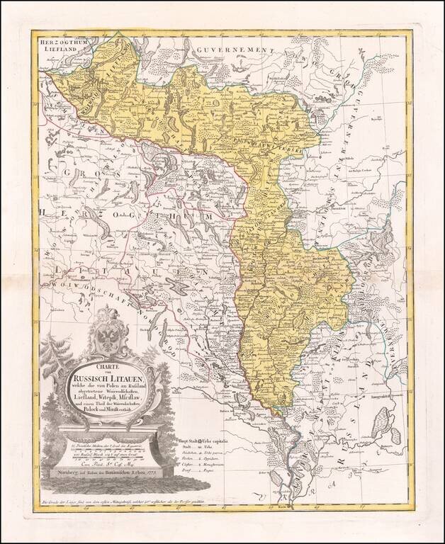
Antique Map of Russian Lithuania After The First Partition Interesting regional map of Russian Lithuania, showing remarkable detail along the upper Dniepr and Dwina River regions, from Liefland to Mscislaw and Woiwodschaft. This 1775 map depicts...