Homann Heirs was a German publishing firm that enjoyed a major place in the European map market throughout the eighteenth century. Founded in 1702 by Johann Baptist Homann, the business passed to his son, Christoph, upon Johann’s death in 1724. Christoph died in 1730, aged only 27, and the firm was inherited by subsequent Homann heirs. This altered the name of the company, which was known as Homann Erben, or Homann heirs. The firm continued in business until 1848.
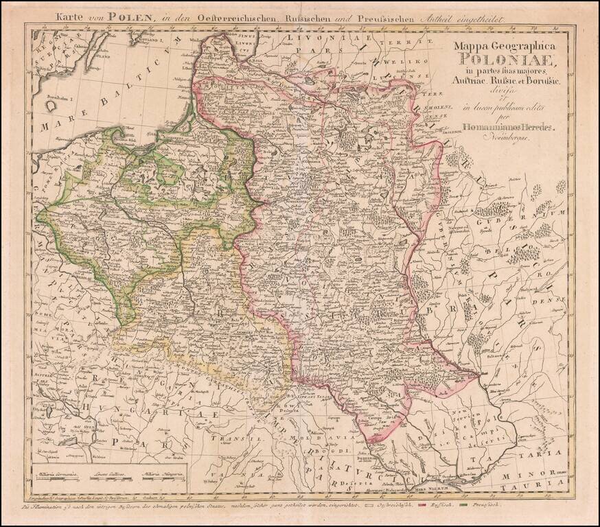
Rare map of Poland, published by the Homann Heirs is Nuremberg. This is the rare final state Tobias Mayer map of Poland. Additional title in upper margin: "Karte von Polen, in den Oesterreichischen, Russischen und Preussischen Antheil Eingetheilet"....
![Ingermanlandiae seu Ingriae novissima Tabula luci tradita MDCCXXXIV [Includes inset view of St. Petersberg]](/map/small/25206.jpg)
Highly detailed regional map of Russia, showing the area around St. Petersburg. Includes a large birdseye view of the harbor and two decorative cartouches.
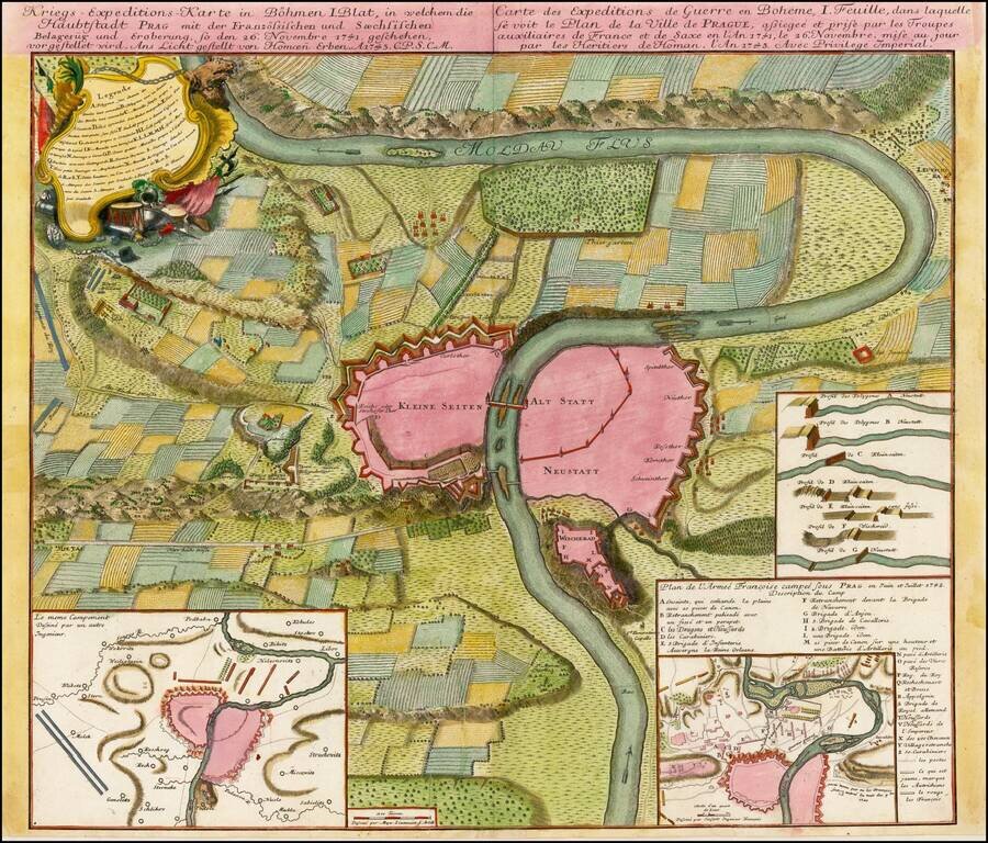
Plan of the fortifications of Prague, published by Homann Heirs in Nuremberg. The plan shows a region extending up and down the Moldava River and illustrating a battle fought between the French and Saxon Troops in November 1741. Shows battle plans,...
![Italia in suos Status divisa et ex prototypo del Isliano desumta . . . [shows Sicily]](/map/small/69246.jpg)
Detailed map of Italy, Sicily, Corsica, Sardinia, etc., extending south to Malta and showing the Gulf of Venice and the contiguous Balkans. Includes a decorative cartouche.
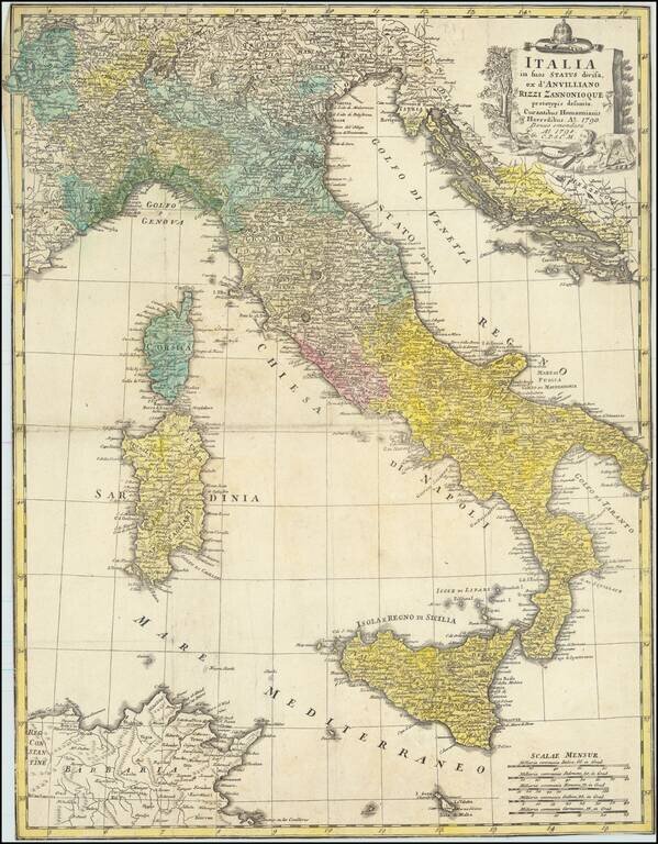
Rare separately issued map of Italy, Sicily, Corsica, Sardinia, etc., extending south to Malta and showing the Gulf of Venice and the contiguous Balkans.
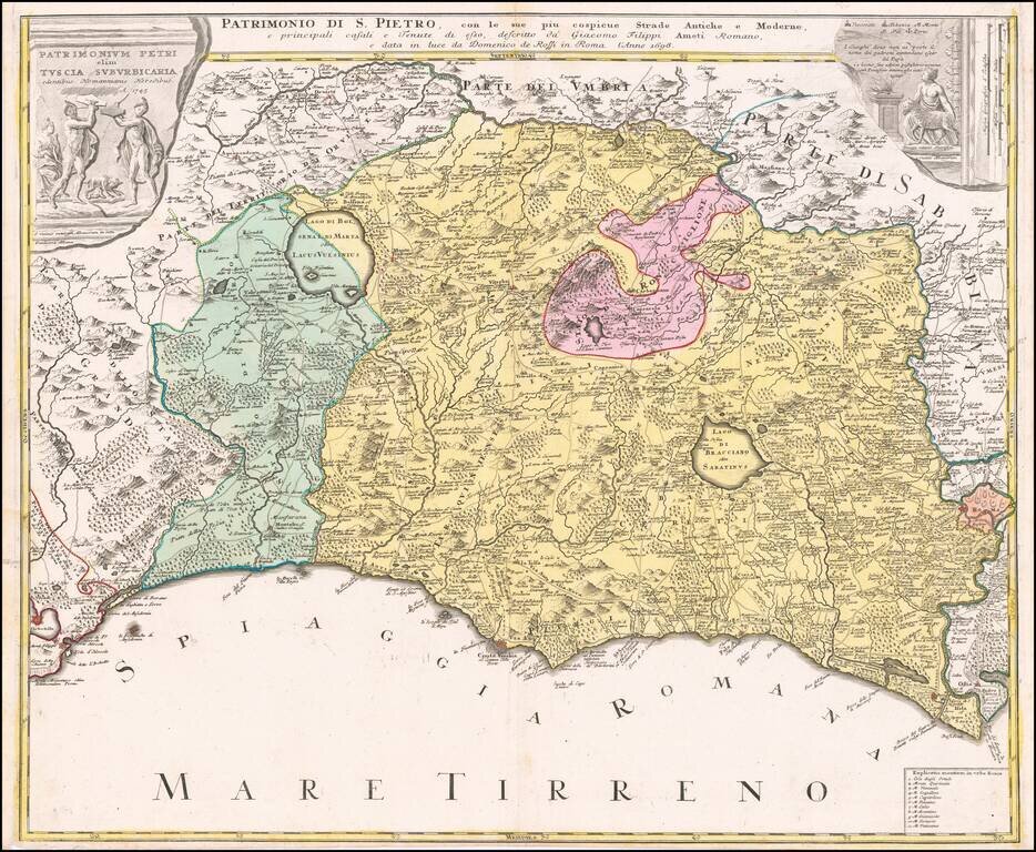
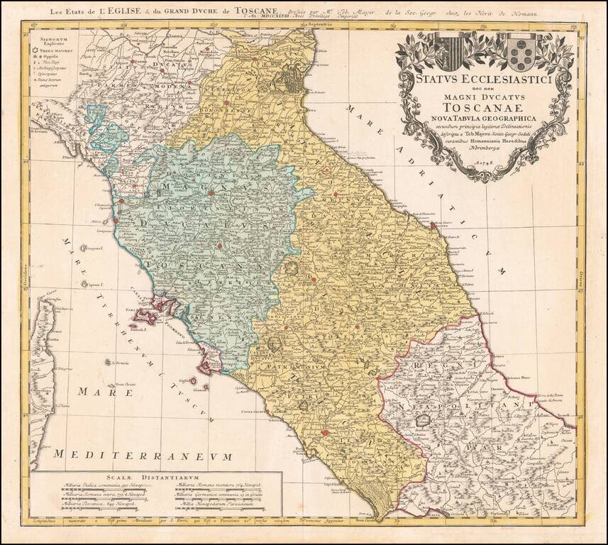
Decorative regional map of Tuscany and the northern part of Lazio, centered on Lago Bolseno and including a massive decorative cartouche. The map is based upon Giovanni Giacomo Rossi's 4-sheet map of the region, published in 1696.
Nice example of Homann's second map of Central Italy, from Ferrara, Parma and Cremona to Territorium Romanum, centered on Florence and Sienna and showing Rome. Includes 2 coats of arms and other details.
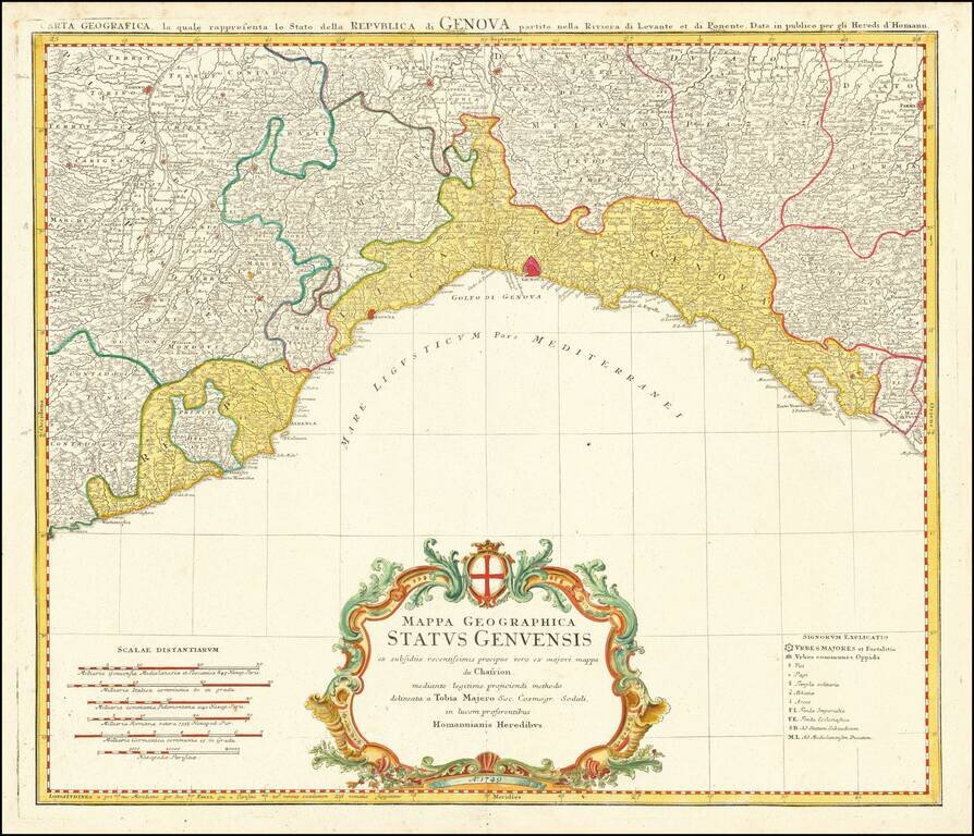
Decorative regional map of Italy, centered on Genoa. Extends from Monaco (named) to Mostrone. Shows roads, rivers, towns, lakes and mountains. Decorative cartouche with coat of arms.
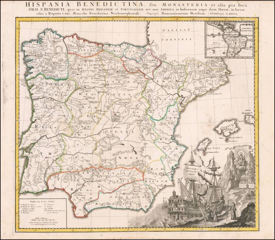
Interesting and highly decorative map of Spain and Portugal, with a large inset of Central and South America. The map illustrates the various Benedictine Monasteries on the Iberian Peninsula and in South America.
![Turcia Asiatica exhibens Natoliam Modernam….Georgiae, Armeniae, Mesopotamiae, Syriae aet Arabiae…1771 [shows Cyprus]](/map/small/40124.jpg)
Scarce regional map of the Asiatic regions of the Turkish Empire, first published in Nuremberg in 1771. The map is centered on the Black Sea and extends from Cyprus and Greece in the west to the Caspian in the East.
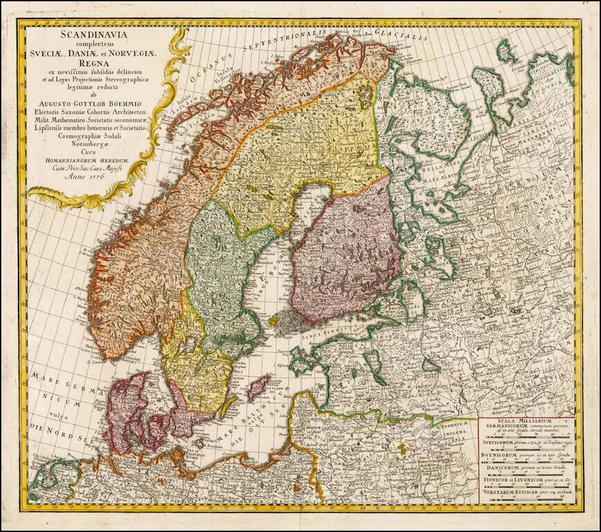
Nice example of Homann's map of Scandinavia. Provides excellent detail throughout the region. Includes an elaborate title cartouche, with portrait and allegorical vignette.
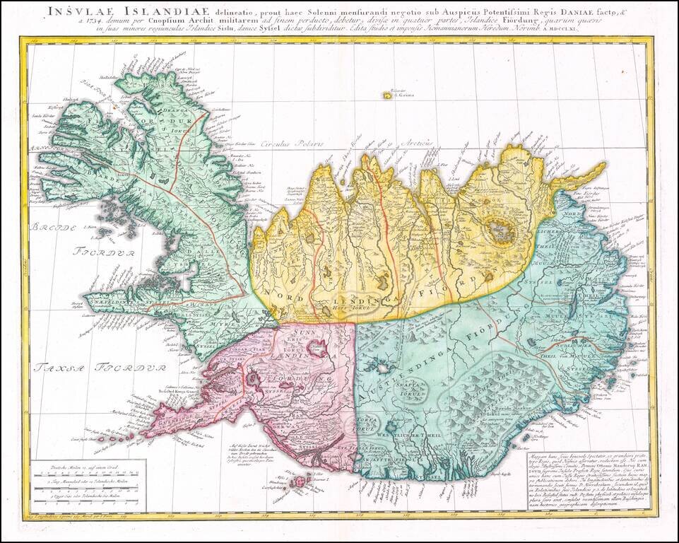
Detailed map of Iceland, published in Nuremberg by the heirs of J.B. Homann.
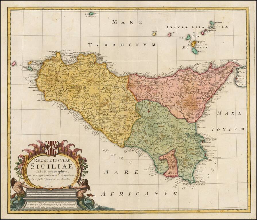
Fine detailed map of Sicily, published in Nuremberg by the heirs of J.B. Homann. Includes a coat of arms and an allegorical cartouche. Excellent detail in the interior of the map.
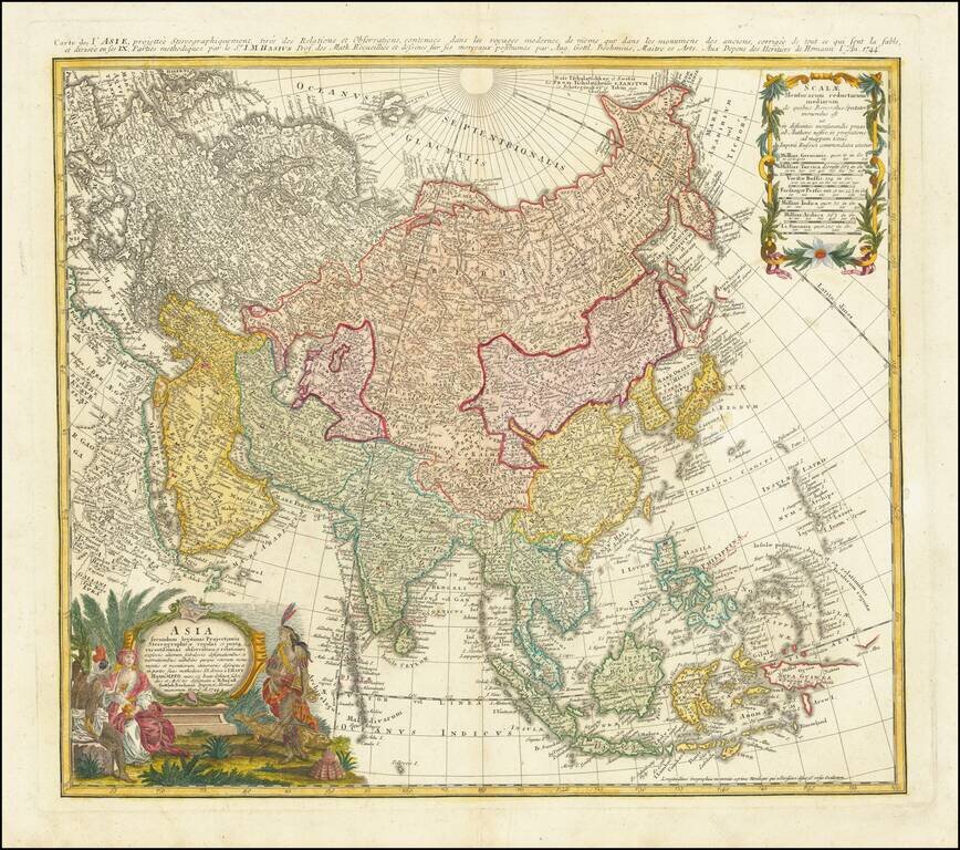
Antique Map of Asia Published in Nuremberg Detailed map of Asia, based upon Johann Mattheus Haas' stereographical projection of the world. As noted in the key at the bottom center, the map is colored based upon the Religious Groups within Asia,...
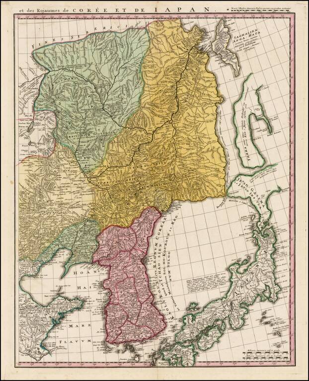
Fine example of the Homann Heir map of Korea, Japan, Manchuria and easternmost Russia, published in Nuremberg. The map is the eastern sheet of a pair of maps published by the Homann Heirs showing China, Korea, Tartaria, Japan, etc. The Kingdom of...
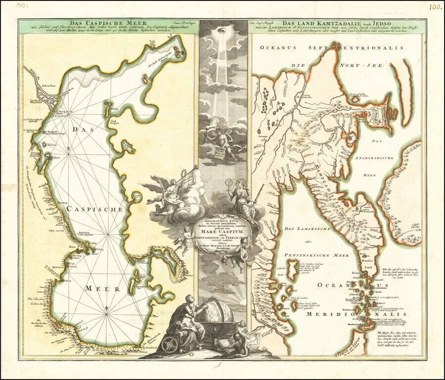
Decorative pair of antique engraved maps on one sheet, focusing on the Caspian Sea and Northeastern Russia and Kamtchatka. Includes an elaborate cartouche.