Mathaus Merian (1593-1650) was the father of engraver Matthäus the Younger, and of the painter, engraver, and naturalist Maria Sibylla Merian. He was born in Basel, Switzerland and trained in engraving in Zurich. After a time in Nancy, Paris and Strasbourg, he settled in Frankfurt. While there, he worked for Johann Theodor de Bry, the publisher and son of the travel writer. In 1617, he married Maria Magdalena de Bry, Johann Theodor’s daughter. In 1623, Merian took over the de Bry publishing house upon the death of his father-in-law. Merian’s best known works are detailed town views which, due to their accuracy and artistry, form a valuable record of European urban life in the first half of the sixteenth century
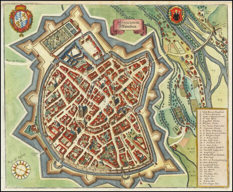
A detailed antique town plan of Munich, showing fortified walls, city gates, important public buildings, squares, and more. A key names thirty-one important places in Munich. The coats of arms of the city of Munich and of Bavaria are shown at the top...
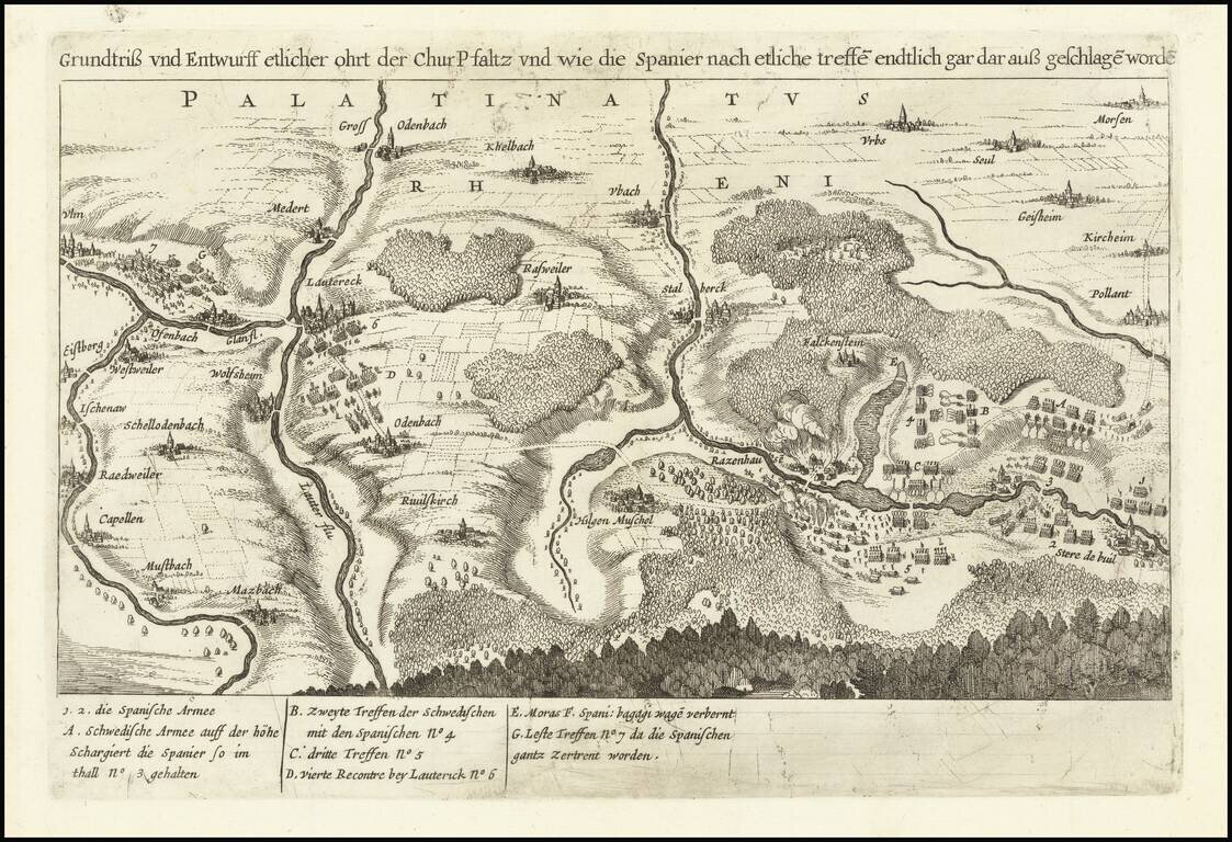
A Rare Example of a Forgotten Battle of the Thirty Years' War An antique map showing troop movements near Lautereck in the Palatinate of the Rhine. Text identifies the troops as Spanish and Swedish, and the location and period indicate that this is...
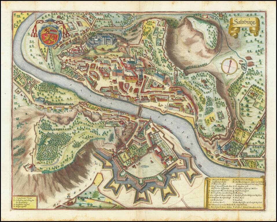
Striking map of Salzburg, Austria, published by Merian. The map includes a large coat of arms and fine depiction of the fortified walls on either side of the river.
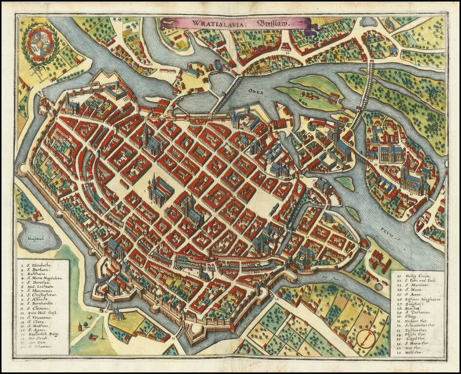
A detailed antique town plan of Wroclaw, once known as Breslau, in Poland. The map shows fortified walls, city gates, important public buildings, squares, and more. A key names thirty-eight important places in Worclaw. The coats of arms of the city of...
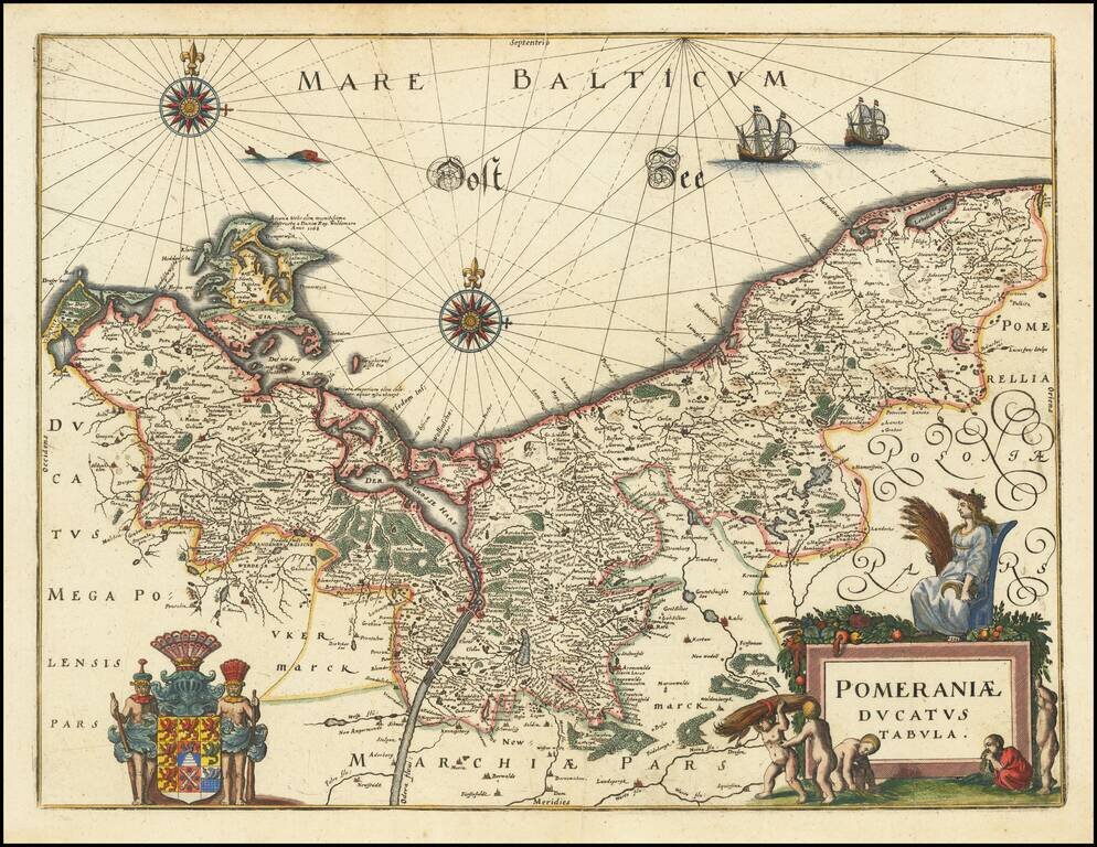
Decorative map of Pomerania and the Baltic Sea, from Merian's Neuwe Archontologica Cosmica . . .. Includes a decorative coat of arms and title cartouche. Based on earlier maps by Blaeu.
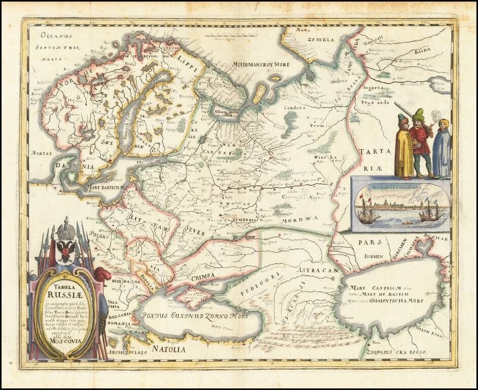
Nice example of the Merian edition Hessel Gerritsz's map of Russia, with view of Archangelsckagoroda. The map was compiled from manuscript maps and work brought back by Isaac Massa. Includes a decorative birdseye view. Richly decorated a large title...
![[Moscow] Moscua](/map/small/37897.jpg)
Striking birdseye view of Moscow, from Merian's Neuwe Archontologica Cosmica . . ., published in 1638. Shows detailed town plan, Moscua River, Iausa River, Neglina River, three sets of fortified walls, Kremlin, public buildings, churches, bridges,...
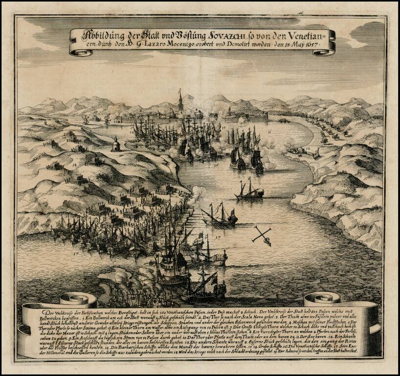
Early battle scene of the attack on Split on the Adriatic coast, on May 18, 1657. The bay is filled with ships shrouded in clouds of smoke and armies are shown throughout the countryside. German text explanation in banner at bottom.
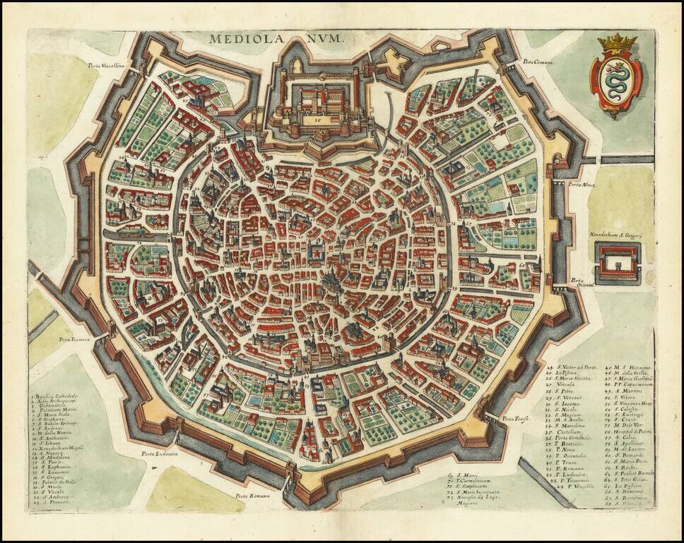
A detailed town plan of Milan, showing the fortified walls, city gates, inner ring and important public buildings, squares, and much more. A key names seventy three places of interest. The coat of arms of the Visconti, once rulers of the city, is shown...
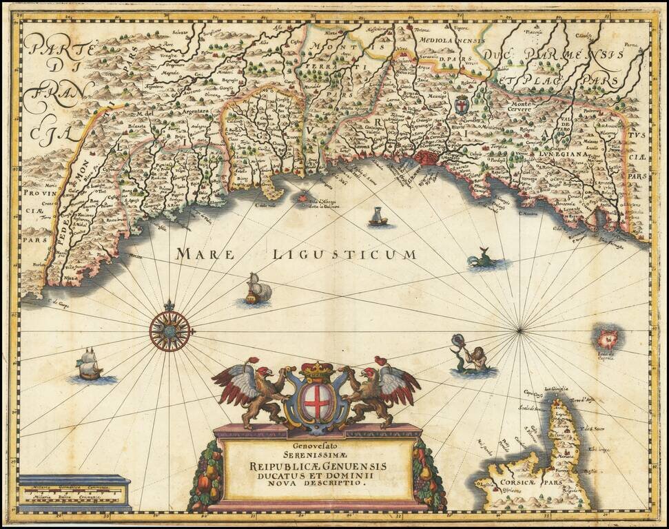
Fine example of Merian's map of the Republic of Genoa. Includes a decorative cartouche, compass rose, sailing ships and sea monsters.
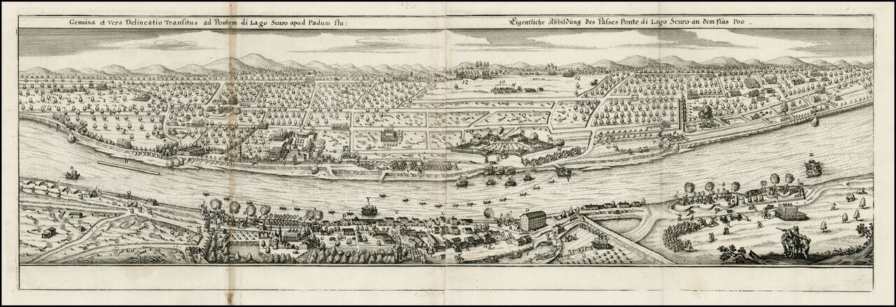
Decorative view of the Po River, near the Lake Scuro, from Merian's Theatrum Euopaeum.
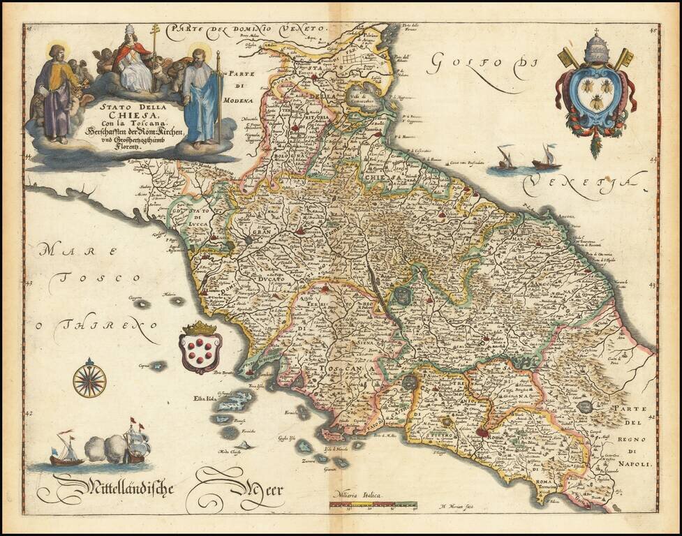
Detailed map of Tuscany and the State of the Church, including a decorative cartouche, two coats of arms and a sailing ship. The present example is very similar to Merian's map, but does not include a signature to the right of the scale of miles and...
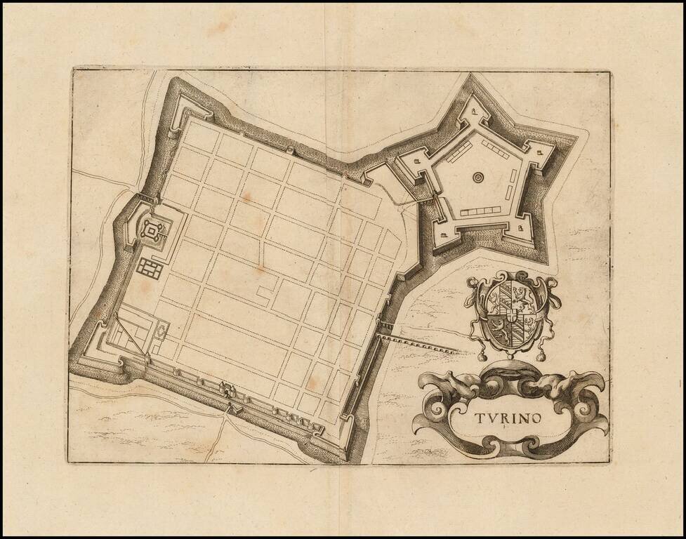
Detailed town plan of Torino, showing the fortified walls. Cartouche and coat of arms. Fine full color example.
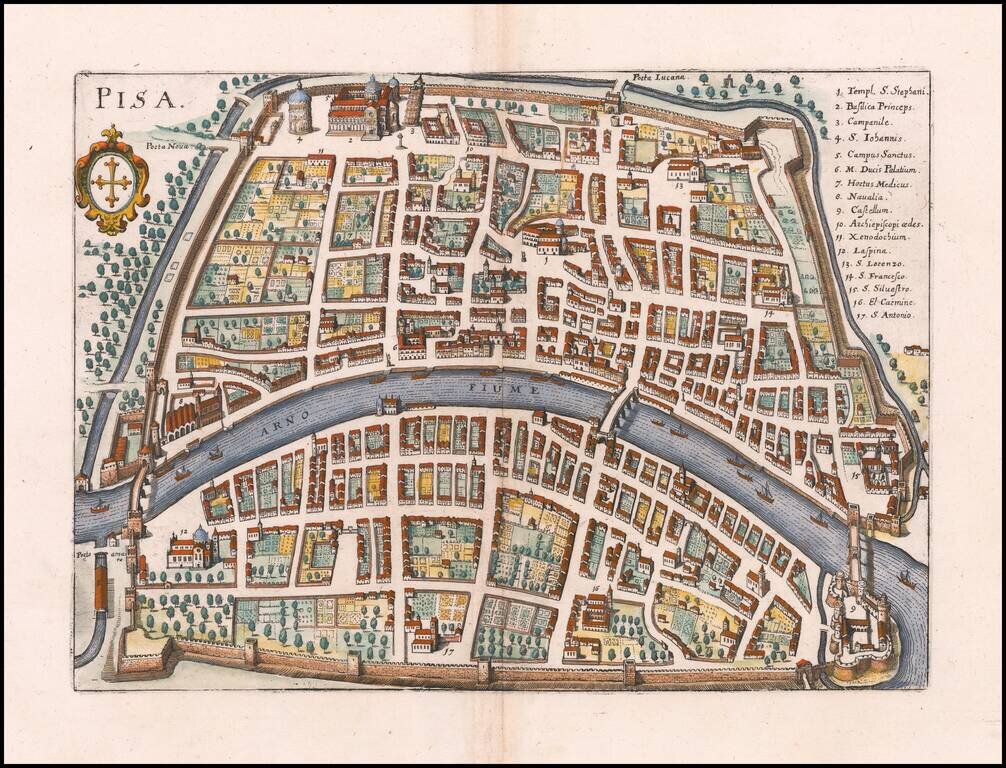
Detailed town plan of Pisa, showing the fortified walls, City Gates, major buildings, squares and streets. The Leaning Tower is #3 in the key of 16 locations. Includes a key naming 73 places. Coat of arms in upper right corner. Fine full color example.
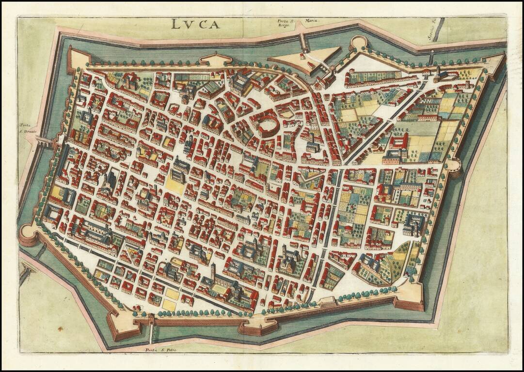
Detailed plan of Luca and vicinity, from Merian's Neuwe Archontologica Cosmica . . ., published in 1638. Shows town plan, buildings, churches, bridges, fortified walls of the city, etc.