Mathaus Merian (1593-1650) was the father of engraver Matthäus the Younger, and of the painter, engraver, and naturalist Maria Sibylla Merian. He was born in Basel, Switzerland and trained in engraving in Zurich. After a time in Nancy, Paris and Strasbourg, he settled in Frankfurt. While there, he worked for Johann Theodor de Bry, the publisher and son of the travel writer. In 1617, he married Maria Magdalena de Bry, Johann Theodor’s daughter. In 1623, Merian took over the de Bry publishing house upon the death of his father-in-law. Merian’s best known works are detailed town views which, due to their accuracy and artistry, form a valuable record of European urban life in the first half of the sixteenth century
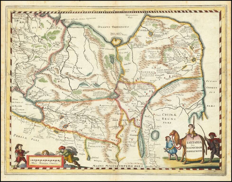
An attractive antique map of China, Tartary, and Central Asia. This map covers a vast area in intriguing detail which reflects European knowledge about the world at the time during which it was made. The detail shown includes many rivers, mountain...
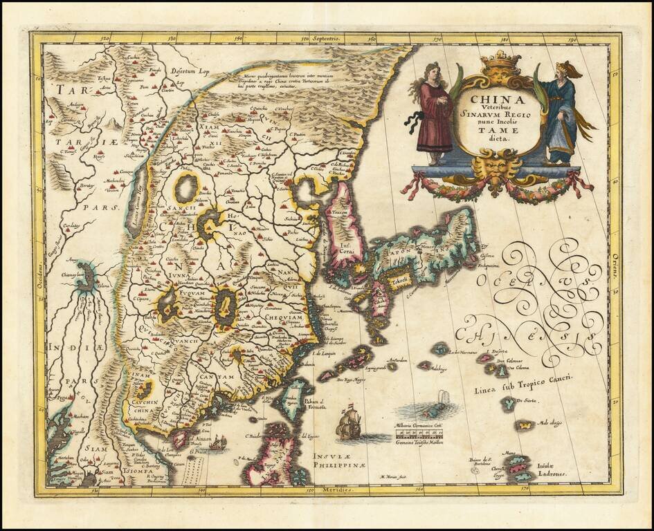
Decorative map of China, Japan, the Island of Korea, and the northern part of Luzon. Notes Pakan al I. Formosa Sailing ships and decorative cartouche. A very detailed and highly decorative map, based upon Blaeu's map of the same title.
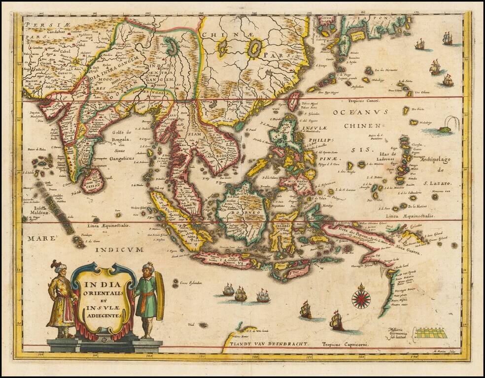
Southeast Asia with an Early Depiction of Northwestern Australia Based on Gerrit Frederikszoon de Witt's Discoveries in 1628 Scarce decorative map of Southeast Asia, China, India, the Philippines and western Oceana, along with the newly discovered...
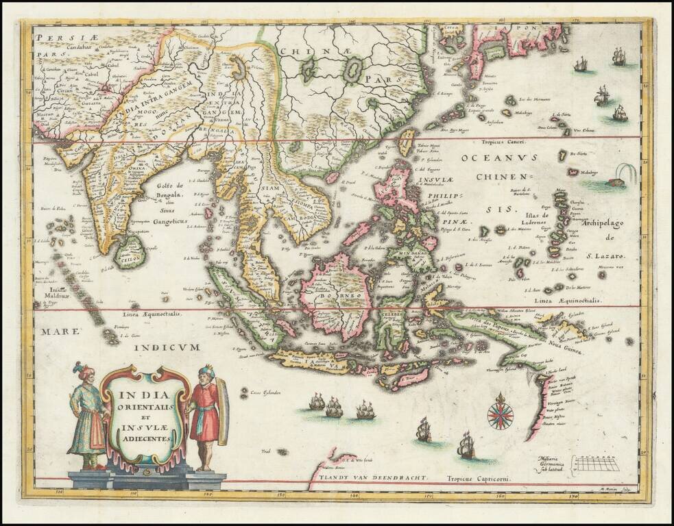
Southeast Asia with an Early Depiction of Northwestern Australia Based on Gerrit Frederikszoon de Witt's Discoveries in 1628 This is a scarce decorative map of Southeast Asia, China, India, the Philippines, and western Oceania. Perhaps the most...
![[Hangchow] Xuntien alias Quinzay](/map/small/69890.jpg)
Scarce early and unusual plan of the Chinese city of Quinzay [Hangchow], based upon the magnificent account given by Venetian Marco Polo in the late 12th Century of the great city of Quinzay. Quinzay is derived from the Chinese name King-sze meaning...
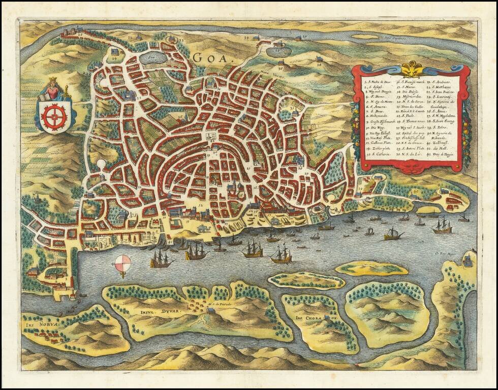
A detailed birdseye view plan of Goa, showing the various streets and buildings of the city, the city's riverine harbor, and the fields surrounding the city. Several decorative features are added. The view includes a key naming forty-three points of...
![(V.O.C. Forts) Amboyna [and] I. Nera](/map/small/48714.jpg)
Antique engraving of two Dutch East India Company settlements in the Spice Islands: Ambon and Fort Belgica on Banda Neira. Fort Belgica was an important fort in the area for centuries, originally starting as a Portuguese installation in the 16th...
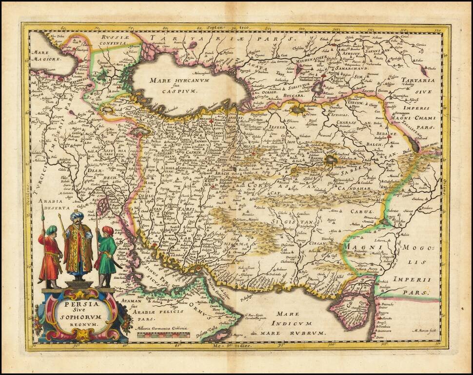
The Persian Empire in the 17th Century Decorative map of Persia extending from Saudi Arabia and Turkey to the Indus River, centered on Persia, with the Red Sea and the Persian Gulf in the South and Caspian and Tartaria in the North. A very detailed...
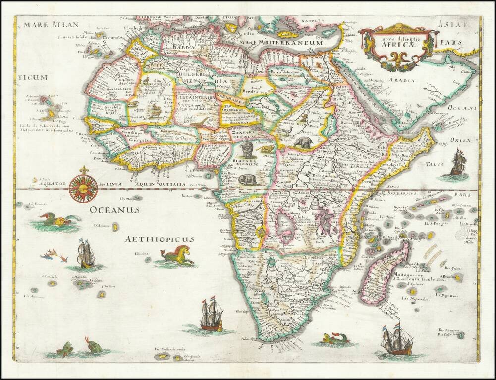
Decorative example of Merian's map of Africa. This map is richly embellished with animals, including elephants, monkeys, ostriches, gazelles, lions, cheetahs and camels. In the oceans are numerous sailing ships, sea monsters, flying fish, and a...
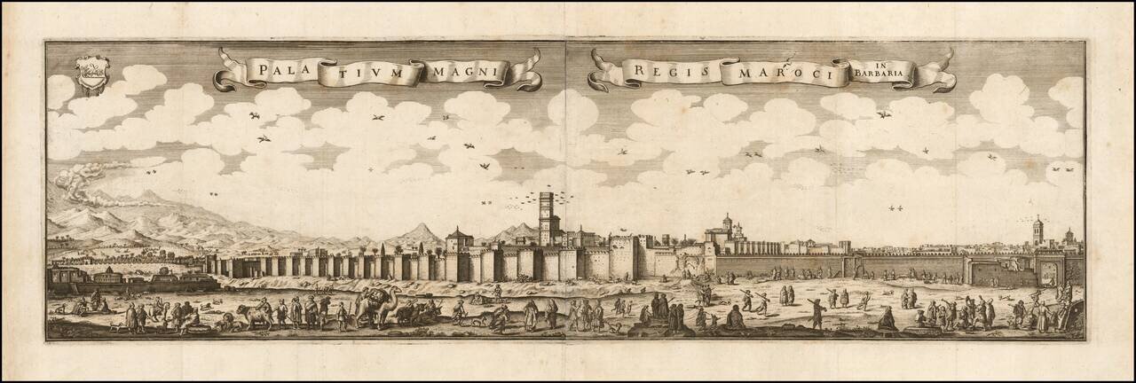
Rare early view of Marakesh. Rare and superb view of the city of Marrakech and its walled fortifications, from the book Archontologia Cosmica published in 1649. The view is derived from a print of 1646 by Adriaen Matham, who accompanied in 1641 the...
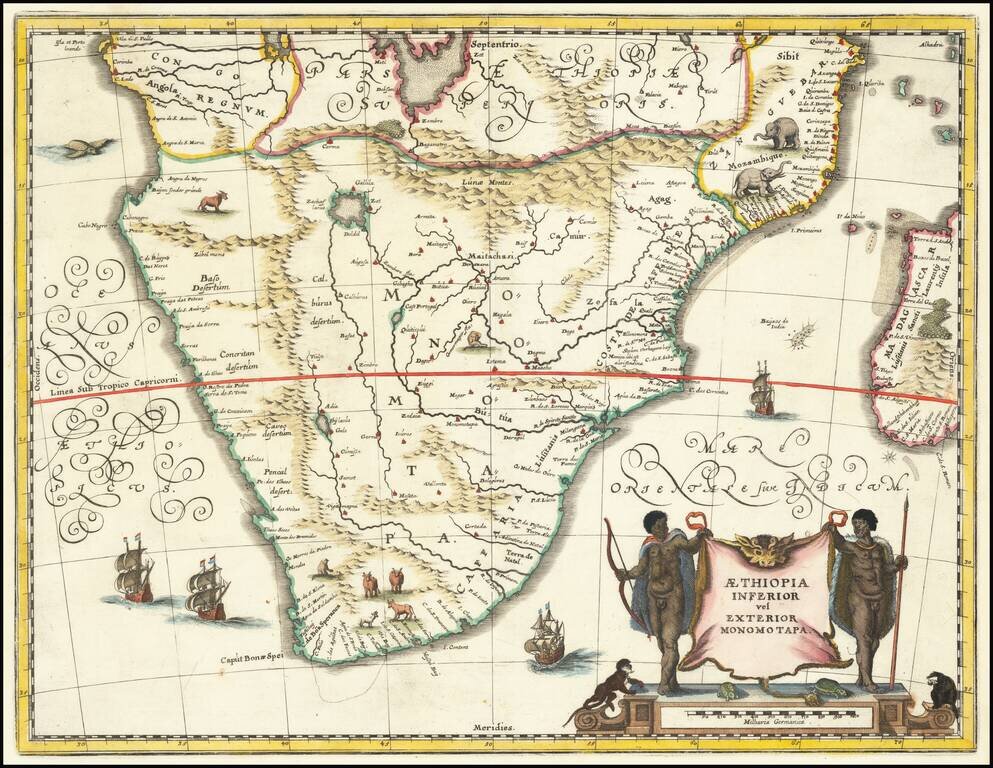
Attractive map of Southern Africa and part of Madagascar, shortly before the first Dutch settlement in the region. The area shown is from the Congo River basin around the Cape of Good Hope and up the east coast as far as northern present-day...
![[The Spanish fleet in the Ladrone Islands]](/map/small/48713.jpg)
Antique engraving of the Spanish fleet interacting with Polynesian outriggers and sailing vessels in the vicinity of Guam. The engraving was page 475 from Newe Welt und Americanische Historien by Johann Ludwig Gottfried, published by Mattaeus Merian,...
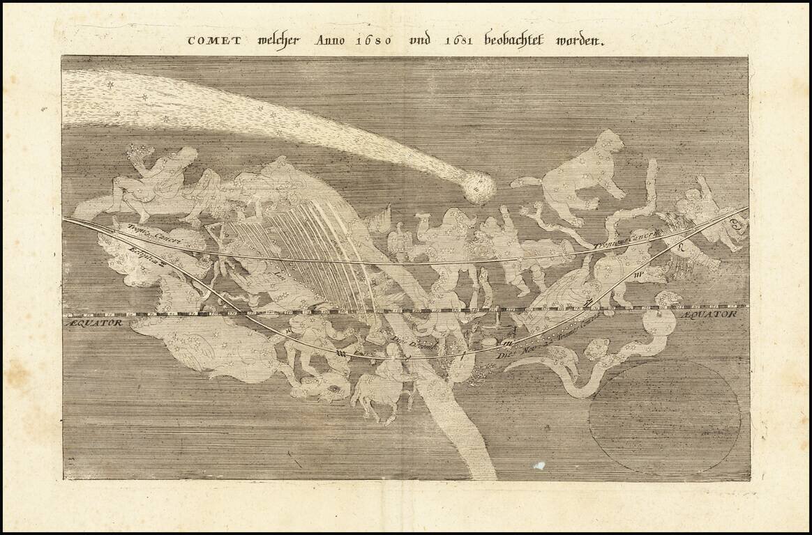
The Great Comet of 1680 Scarce map showing passage of the Great Comet of 1680, which appeared in Merian's Theatri Europaei, Zwölffter Theil. The map illustrates a comet seen by Sir Edmund Halley in 1680 and 1681, notably the year prior to his...