John Senex (1678-1740) was one of the foremost mapmakers in England in the early eighteenth century. He was also a surveyor, globemaker, and geographer. As a young man, he was apprenticed to Robert Clavell, a bookseller. He worked with several mapmakers over the course of his career, including Jeremiah Seller and Charles Price. In 1728, Senex was elected as a Fellow of the Royal Society, a rarity for mapmakers. The Fellowship reflects his career-long association as engraver to the Society and publisher of maps by Edmund Halley, among other luminaries. He is best known for his English Atlas (1714), which remained in print until the 1760s. After his death in 1740 his widow, Mary, carried on the business until 1755. Thereafter, his stock was acquired by William Herbert and Robert Sayer (maps) and James Ferguson (globes).
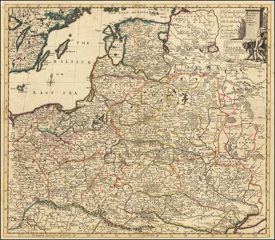
Detailed map of the Polish Empire, published by John Senex. This is the second edition of the map, which was first published by Morden & Browne in 1710. The remnants of the earlier printing , which have been burnished out of the cartouche, are...
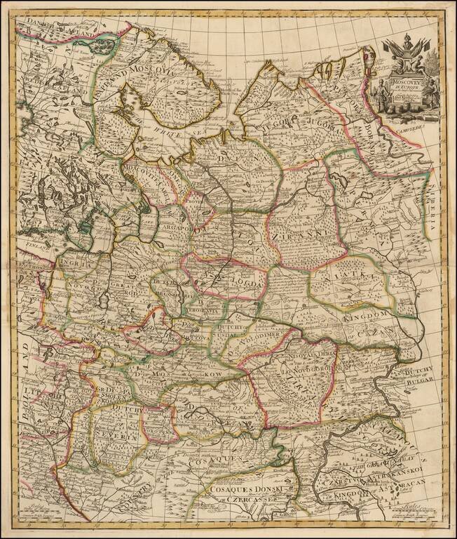
Fine example of Senex's scarce map of European Russia. The map extends to the "Cosaque" regions in the south, including the "Country of the Cosaques " and "Cosaques Donski or Czercasses". Highly detailed and colored by regions, with a small...
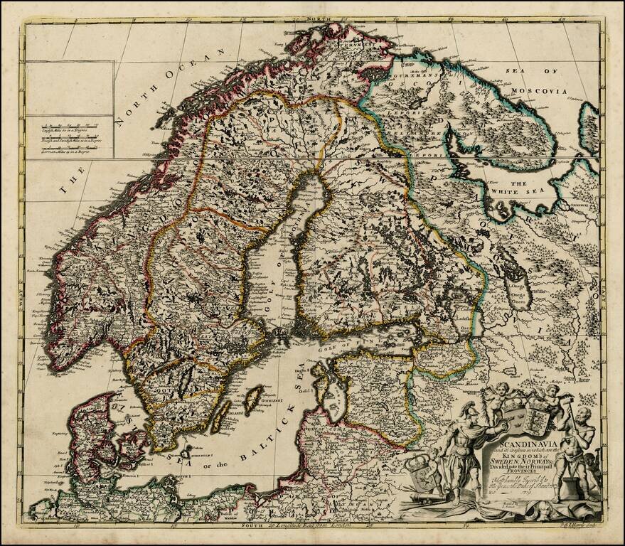
Nice example of John Senex's map of Scandinavia and the Baltic Sea, from his New General Atlas. Fine dark impression of this scarce map, including a decorative cartouche, 3 coats of arms and a dedication to the Duke of Shando.
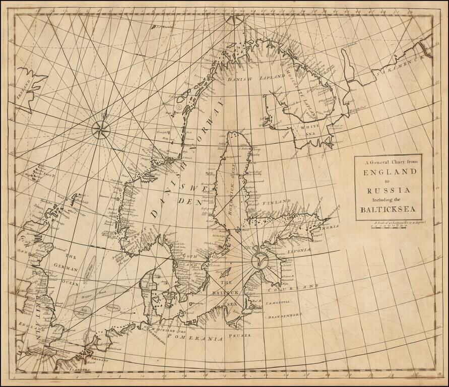
Rare Chart of Northern Europe from an Influential Atlas Scarce engraved sea chart comprising Scandinavia, the Baltic Sea, and the North Sea (here "German Ocean"). Interestingly, Norway is separate from Danish Norway, and there is a separation drawn...
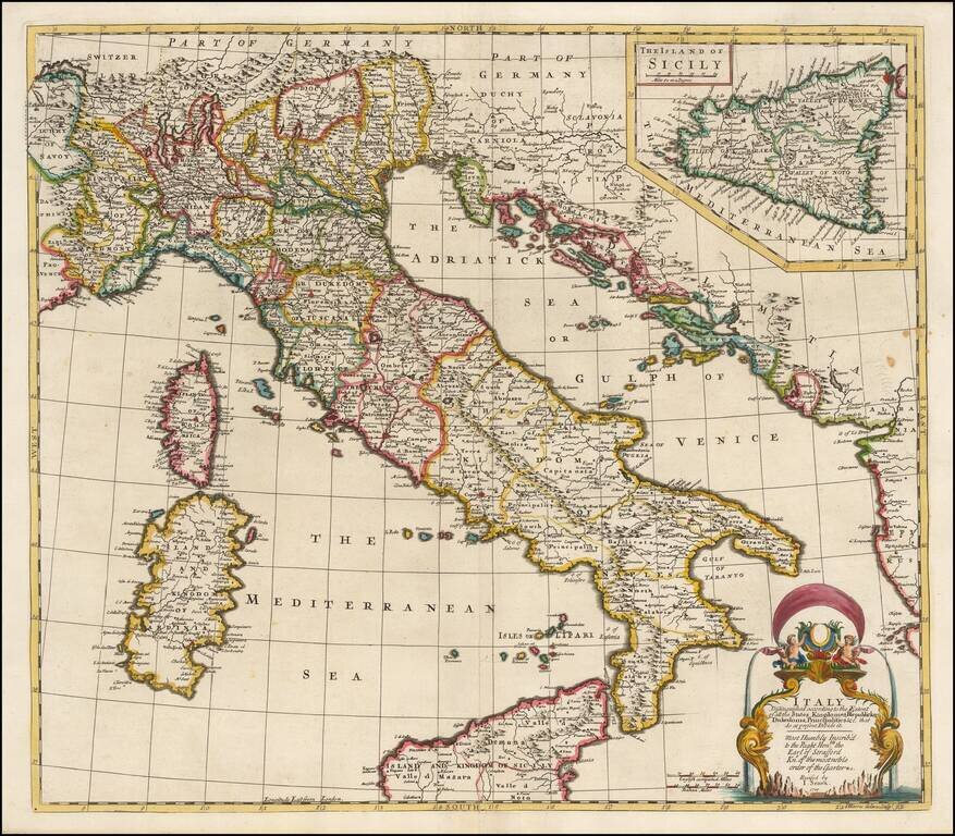
Striking and highly detailed map of Italy, divided into its various regions, from Senex's General Atlas. Includes decorative cartouche and a large inset of Sicily, with dedication to the Earl of Stafford, Knight of the Order of the Garter.
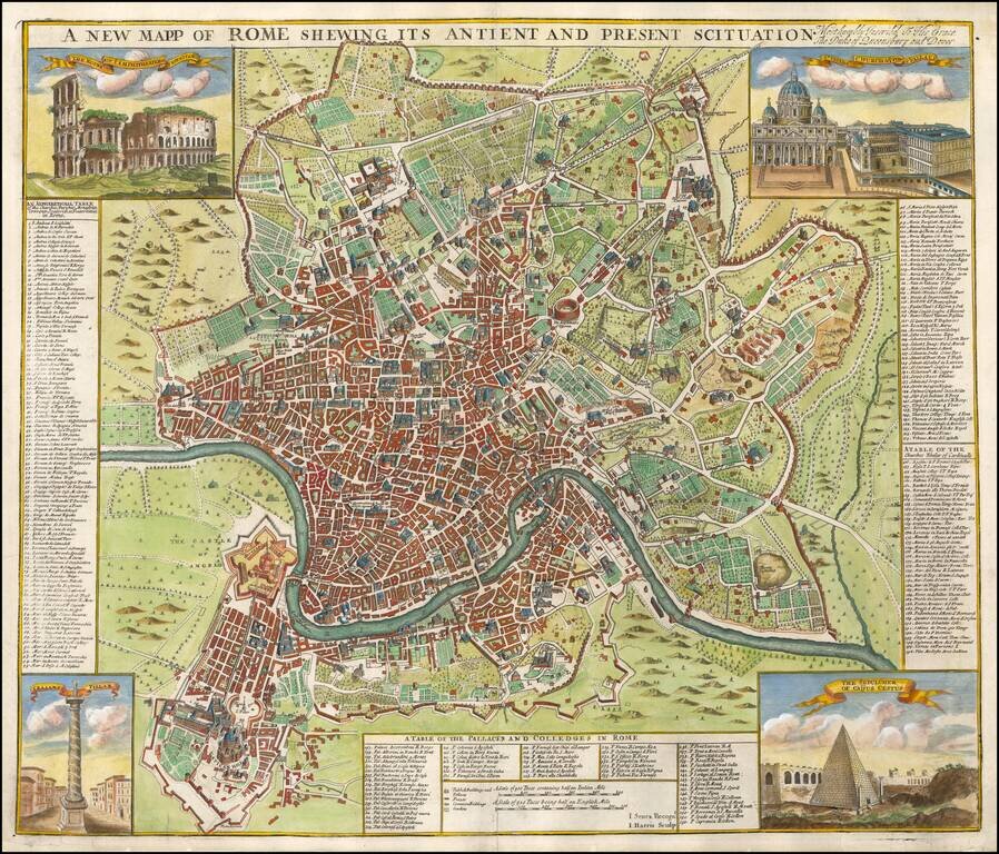
Finely colored and highly detailed map of Rome. Includes 4 vignettes showing the Coliseum, St. Peters, The Sepulcher of Caijus Cestus, and Trajan's Pillar. The keys to the map identify 155 Churches, Parishes, Monasteries, etc., 56 Palaces and Colleges...
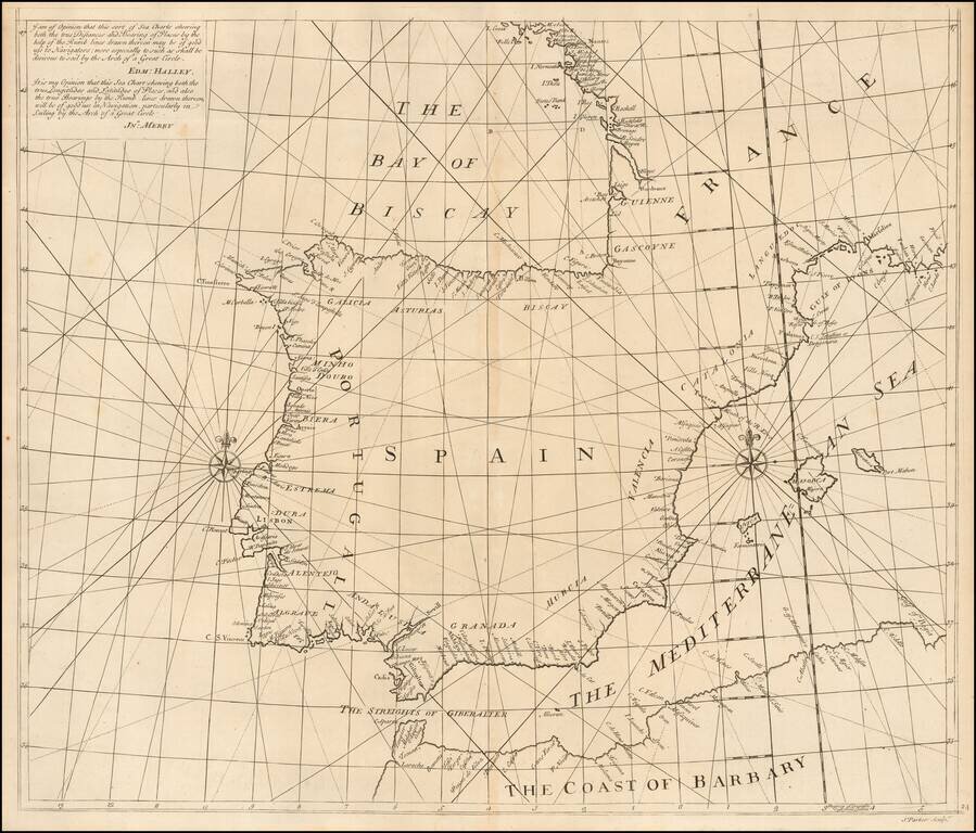
Southern Sheet of Scarce Sea Chart Exhibiting a New Projection Rare chart showing the Iberian Peninsula on a 'globular projection' (i.e. on the same projection as a double-hemisphere map). The charts consists of two sheets, and this is the...

Decorative map of Greece and part of Turkey, including a decorative view of Constantinople, from John Senex's General Atlas. Includes decorative cartouches, compass rose and other embellishments.
![The Severn or Channel of Bristol [with a chart of the Irish Sea.]](/map/small/47485.jpg)
Fine Charts of British and Irish Waterways Scarce pair of sea charts printed on a single sheet, comprising a chart of the Severn estuary and another of the eastern Irish Sea. The former includes Bristol, while the latter features the Isle of Man. The...

Striking map of the region centered on Saudi Arabia, Cyprus and the Mediterranean Sea. Includes a large decorative cartouche and annotations throughout the map. Excellent detail and nice color.
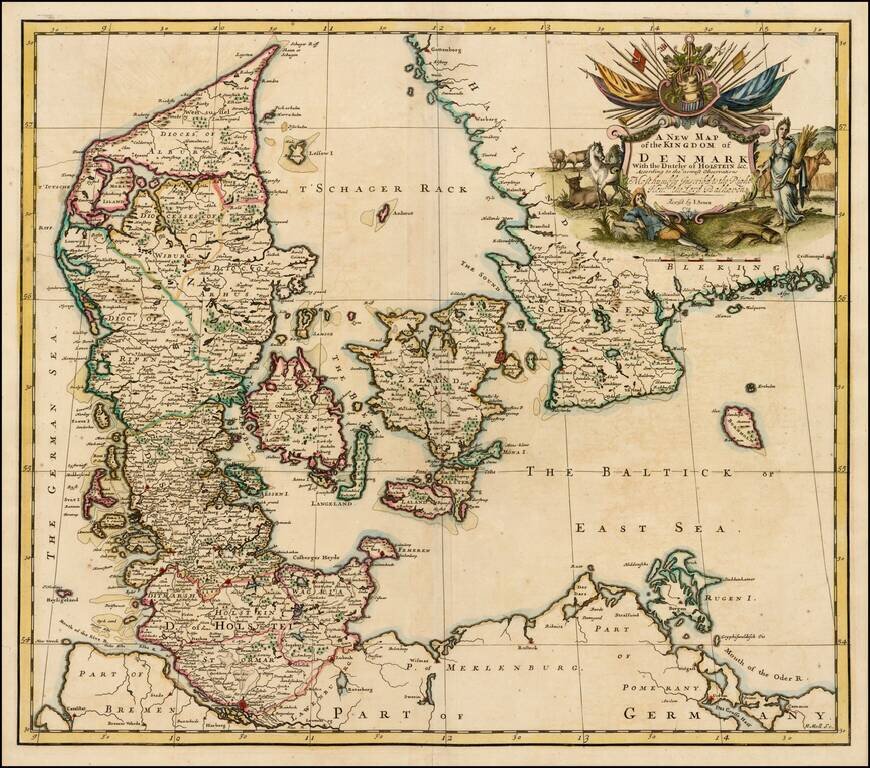
Nice example of John Senex's map of Denmark from his New General Atlas. Fine dark impression of this scarce map, including a decorative cartouche, dedication to Lord Balhaven.
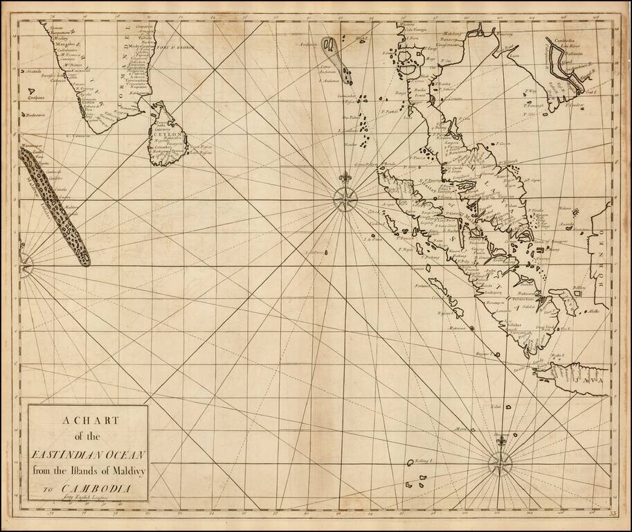
Fine Chart of the Indian Ocean in an Influential Atlas Scarce sea chart of the Straits of Singapore, the Malay Peninsula, Sumatra, the southern part of India and the Maldives, from the Atlas Maritimus & Commercialis, published in London in 1728....
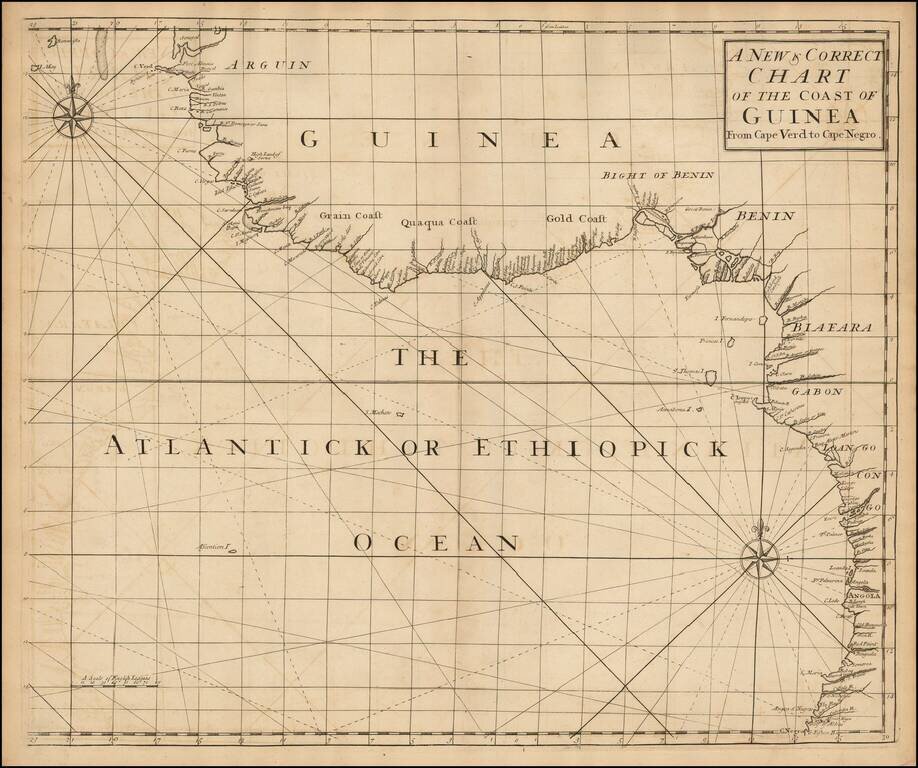
English Chart of the African Coast from an Influential Atlas Scarce sea chart of the west coast of Africa from Senegal to Angola, from the Atlas Maritimus & Commercialis . . . , published in London in 1728. Atlas Maritimus et Commercialis This...
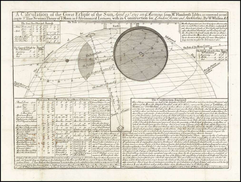
Rare Eclipse Map of the 1715 Solar Eclipse by Polymath William Whiston Important early astronomical broadside, prepared by William Whiston (1667-1752), a prominent and prolific English theologian and mathematician, of the first solar eclipse to be...

Edmund Halley's Controversial Star Chart, Drawn From the Observations of John Flamsteed Nice example of this important early 2 sheet chart of the Zodiac, first published by John Senex in London in 1718. John Senex was one of the first English...
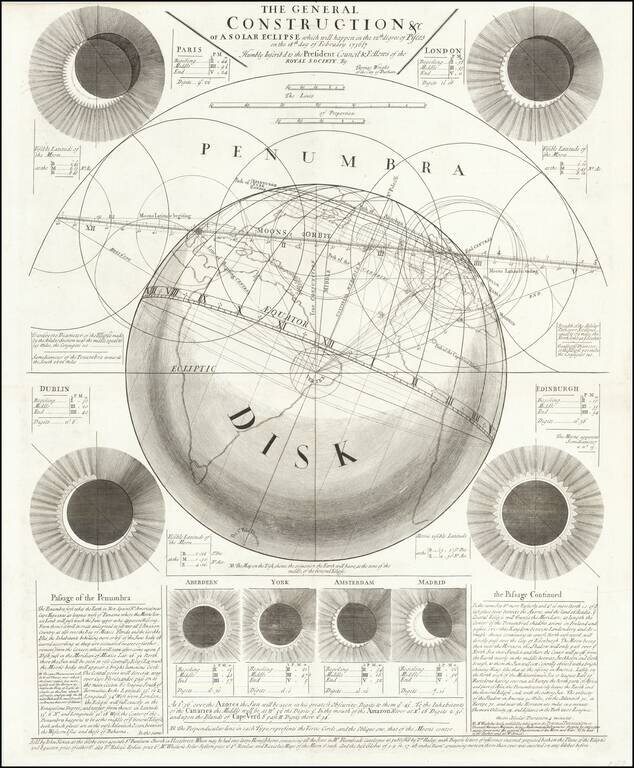
Rare Eclipse Broadside by Thomas Wright and Published by John Senex, the Foremost Producer of Astronomical Broadsides in the Eighteenth Century Fine, large broadside illustrating a prediction of the path of the solar eclipse of February 18, 1737. It...