Map size in jpg-format: 3.70936MiB
Click to open in high resolution (open in new tab).
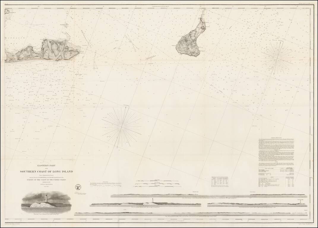
Fine separately issued chart of the coast of Long Island, published by the United States Coast survey in 1857.
The chart extends from Montauk Point to Block Island, with full land & marine detail; view of Montauk Light; and 4 coastal recognition views.
Between 1851 and 1857, the Island was mapped by the Coast Survey in 3 sections, the last two of which appeared in 1857. While in theory the 3 can be joined as a single map, they were issued separately and we have never seen the 3 sections offered together as a single set.
The United States Office of the Coast Survey began in 1807, when Thomas Jefferson founded the Survey of the Coast. However, the fledgling office was plagued by the War of 1812 and disagreements over whether it should be civilian or military controlled. The entity was re-founded in 1832 with Ferdinand Rudolph Hassler as its superintendent. Although a civilian agency, many military officers served the office; army officers tended to perform the topographic surveys, while naval officers conducted the hydrographic work.
The Survey’s history was greatly affected by larger events in American history. During the Civil War, while the agency was led by Alexander Dallas Bache (Benjamin Franklin’s grandson), the Survey provided the Union army with charts. Survey personnel accompanied blockading squadrons in the field, making new charts in the process.
After the Civil War, as the country was settled, the Coast Survey sent parties to make new maps, employing scientists and naturalists like John Muir and Louis Agassiz in the process. By 1926, the Survey expanded their purview further to include aeronautical charts. During the Great Depression, the Coast Survey employed over 10,000 people and in the Second World War the office oversaw the production of 100 million maps for the Allies. Since 1970, the Coastal and Geodetic Survey has formed part of the National Oceanic and Atmospheric Administration (NOAA) and it is still producing navigational products and services today.
If you are a student, write to us in telegram: @antiquemaps and indicate what material you need and for what work you need a map in high detail. We are ready to provide material on special terms. For students only!

![[Site of A Presidential Assassination] Plan of the Pan American Exposition to be held at Buffalo, New York (May 1 - Nov. 1, 1901)](/map/small/69181.jpg)