The United States Office of the Coast Survey began in 1807, when Thomas Jefferson founded the Survey of the Coast. However, the fledgling office was plagued by the War of 1812 and disagreements over whether it should be civilian or military controlled. The entity was re-founded in 1832 with Ferdinand Rudolph Hassler as its superintendent. Although a civilian agency, many military officers served the office; army officers tended to perform the topographic surveys, while naval officers conducted the hydrographic work.
The Survey’s history was greatly affected by larger events in American history. During the Civil War, while the agency was led by Alexander Dallas Bache (Benjamin Franklin’s grandson), the Survey provided the Union army with charts. Survey personnel accompanied blockading squadrons in the field, making new charts in the process.
After the Civil War, as the country was settled, the Coast Survey sent parties to make new maps, employing scientists and naturalists like John Muir and Louis Agassiz in the process. By 1926, the Survey expanded their purview further to include aeronautical charts. During the Great Depression, the Coast Survey employed over 10,000 people and in the Second World War the office oversaw the production of 100 million maps for the Allies. Since 1970, the Coastal and Geodetic Survey has formed part of the National Oceanic and Atmospheric Administration (NOAA) and it is still producing navigational products and services today.
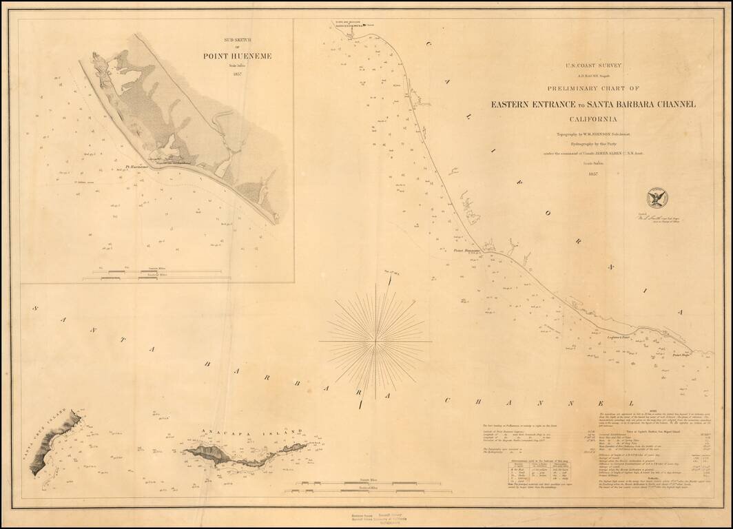
Fine Example on Thick Paper Early sketch chart, showing the Santa Barbara Channel from the Town and Mission of Santa Buenaventura (Ventura) to Point Magu and extending east to Anacapa Island and the western coastline of Santa Cruz Island. Includes...
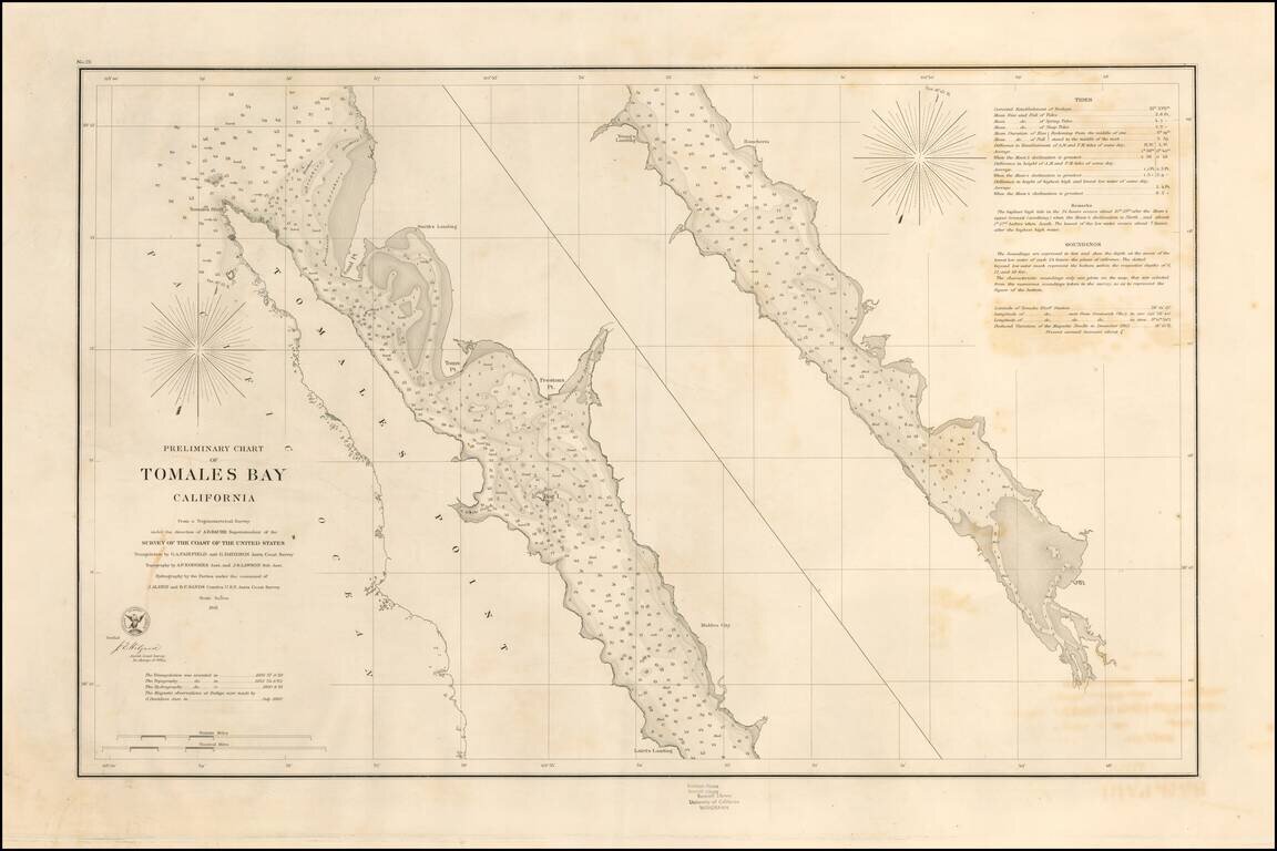
Rare separately pubilshed thick paper example of George Davidson's copy of the US Coast Survey Chart of Tomales Bay, first published in 1861. Tomales Bay's history is quite interesting, having been discovered by the English in the 16th Century,...
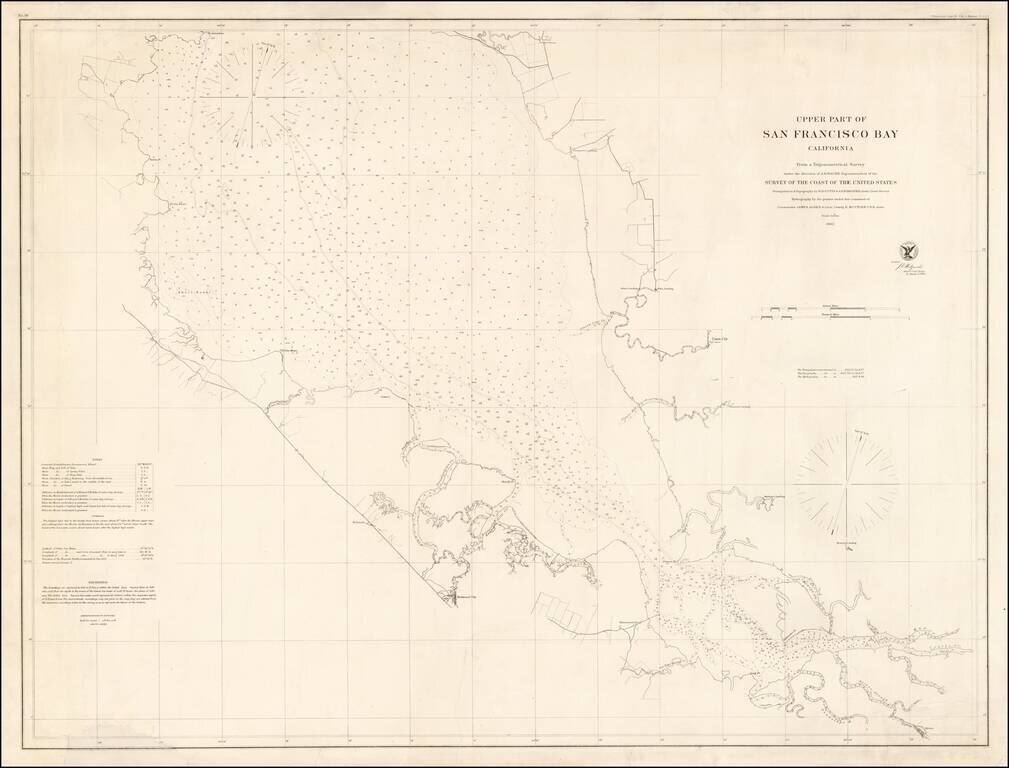
Rare separately issued chart of "Upper San Francisco Bay," published by the United States Coast Survey in 1862. The most northerly point on the map is Pt. Avisadero, just north of Candlestick Point and extending south to San Jose. The chart provides a...
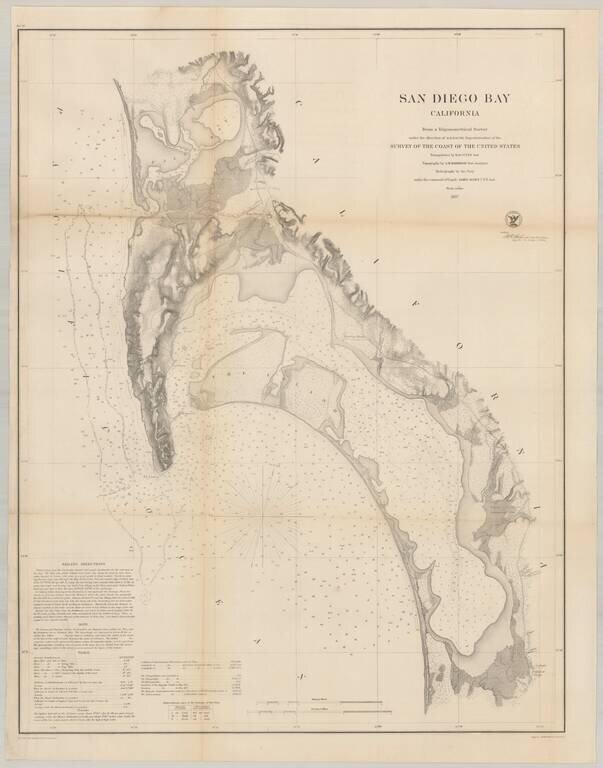
Nice example of the much sought after large format survey of San Diego Bay, form the US Coast Survey. Extends from False (Mission) Bay and the Pacific Beach area, south to Imperial Beach and the Mexican border. Hundreds of soundings. Shows several of...
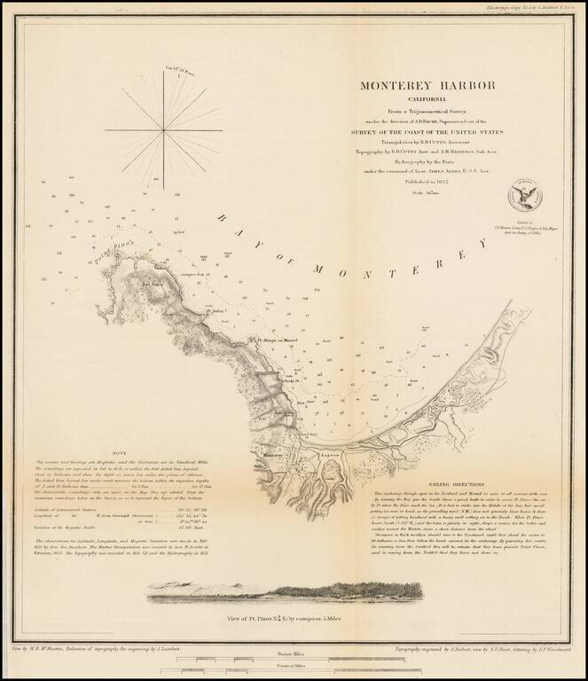
Nice example of this important early survey of Monterey Bay, published by the United States Coast Survey. Incudes a profile view of Pt. Pinos. Shows a Monterey town plan, Point Pinos, Pt. Anlon, Pt Almejor Mussell, the Lagoon, Fort, Ruins of the old...
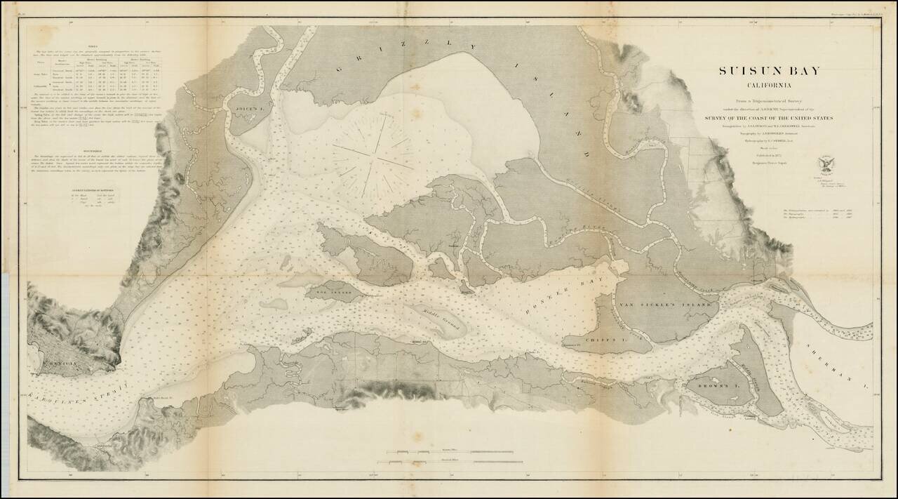
Detailed view of Suisun Bay, from Benicia to Sherman's Island and Brown's Island. Includes soundings, tides and other details. One of the earliest detailed surveys of the region.
![Reconnaissance of the Western Coast of the United States From Monterey To The Columbia River in three sheets. Sheet No. 3. [Columbia River to Umpquah River]](/map/small/42733.jpg)
Interesting early coastal chart of the Oregon Coastline, the northern most of 3 charts published to cover the region by the US Coast Survey.
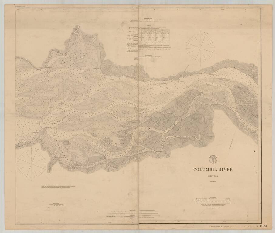
Detailed chart of the Columbia River, extending from the area near Astoria in the west to Skamokawa in the east. The chart is based upon Triangulation data compiled in 1852 and 1871, with topographical data compiled in 1868, 1870 and 1871 and...
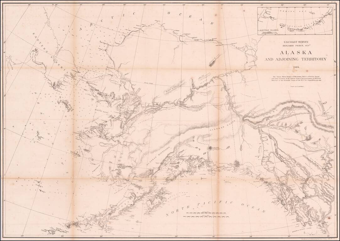
An Important Early Map of Alaska, Shortly After The US-Russia Sale of 1867 The map shows the results of the American explorations in the Yukon region in 1867 and 1868. The map notes: The Yukon River, ranges of mountains, shores of Norton Sound and...