John Speed (1551 or '52 - 28 July 1629) was the best known English mapmaker of the Stuart period. Speed came to mapmaking late in life, producing his first maps in the 1590s and entering the trade in earnest when he was almost 60 years old.
John Speed's fame, which continues to this day, lies with two atlases, The Theatre of the Empire of Great Britaine (first published 1612), and the Prospect of the Most Famous Parts of the World (1627). While The Theatre ... started as solely a county atlas, it grew into an impressive world atlas with the inclusion of the Prospect in 1627. The plates for the atlas passed through many hands in the 17th century, and the book finally reached its apotheosis in 1676 when it was published by Thomas Bassett and Richard Chiswell, with a number of important maps added for the first time.
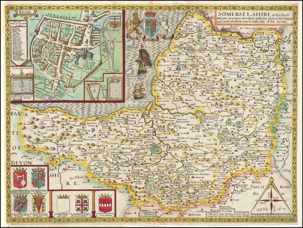
Early (Sudbury & Humble) edition of this fine decorative map of Somerset, from Speed's Theatre of Great Britain. Includes a plan of Bath, a number of coats of arms and other embellishments. John Speed (1552-1629) is arguably the most famous...
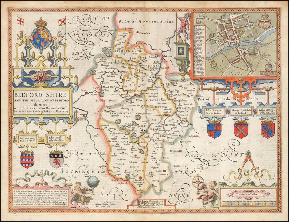
Striking map of Bedford, with an inset plan of Bedford. Includes 5 coats of arms of local Earls and Dukes. Engraved by Jodocus Hondius. From Speed's The Theatre of the Empire of Great Britaine.
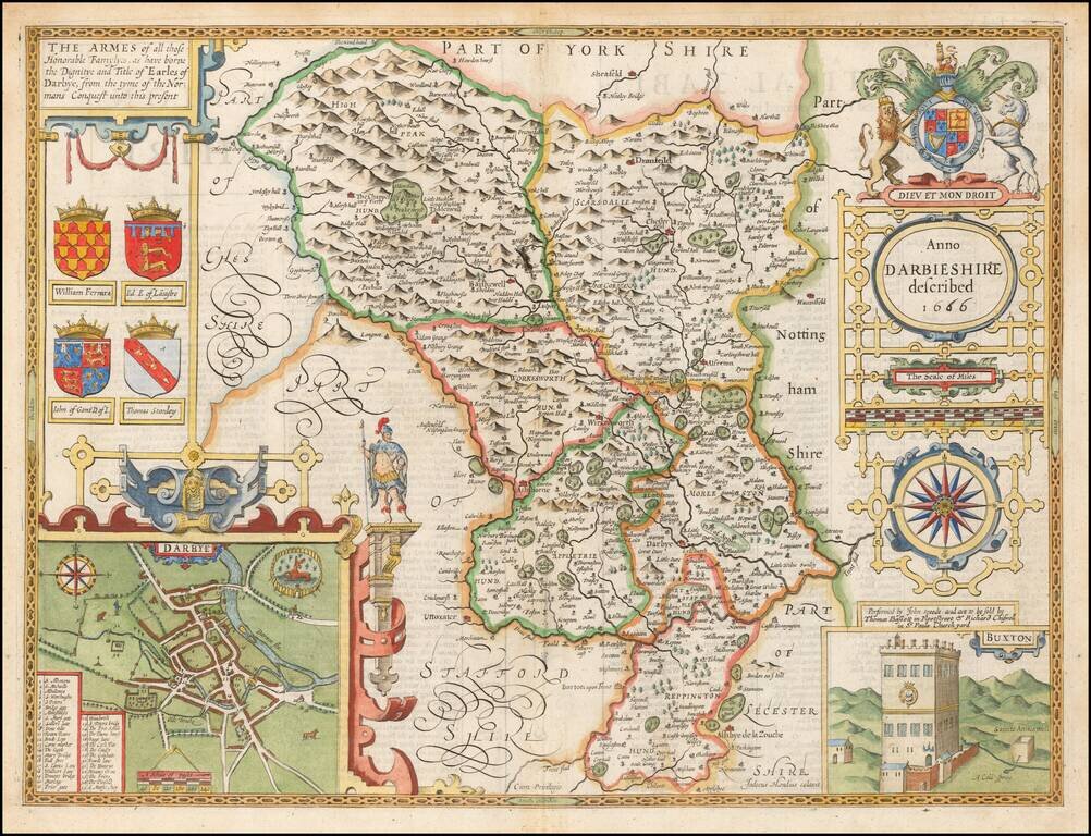
Decorative map of Darbyshire, from the 1676 edition of Speed's Theatre of Great Britain. Includes a view of Buxton, a plan of Darby and the coats of arms of 4 noble families.
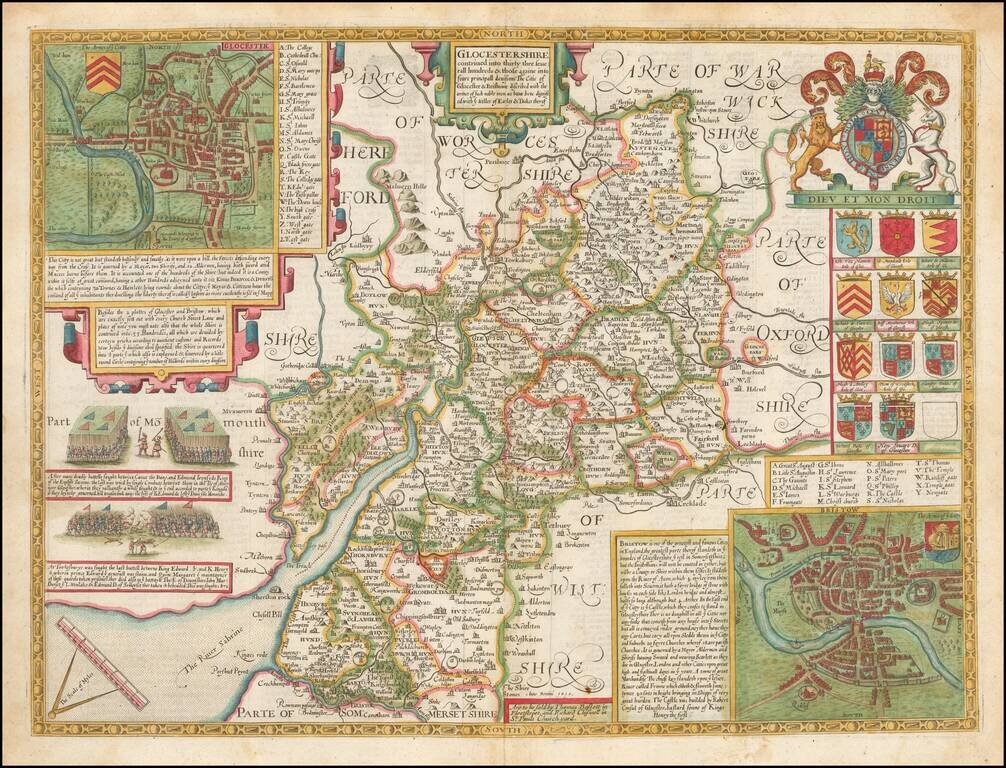
Attractive full color example of Speed's map of Gloucester, from the 1676 edition of Speed's Theatre of Great Britain. Includes multiple coats of arms and a large inset plan of the town of Gloucester and Bristow. At the left, two ancient battles are...
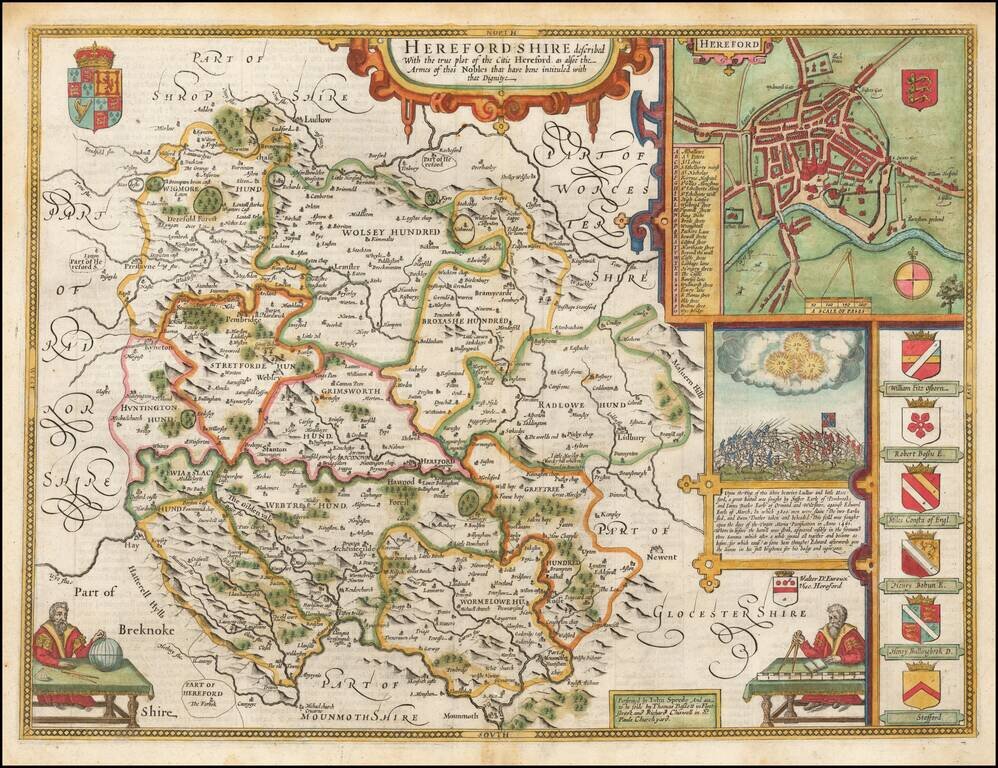
A nice example of this decorative County map by John Speed. Includes an inset plan of Hereford, 7 coats of arms, a battle seen from 1461 and inset of a globe maker.
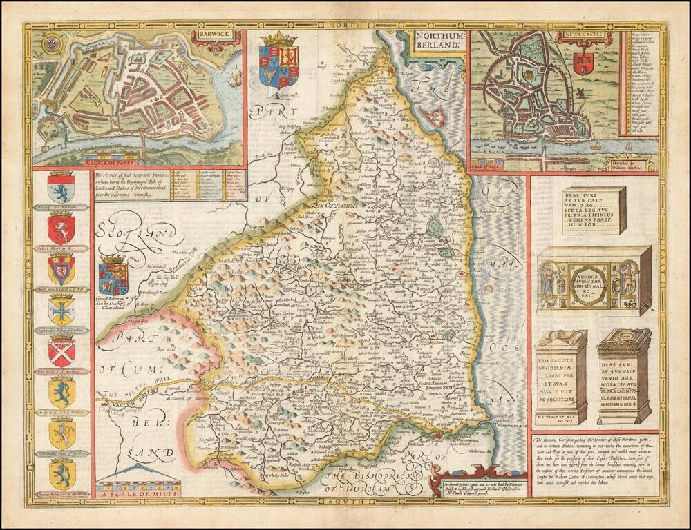
Attractive full color example of Speed's map of Northumberland, from the 1676 edition of Speed's Theatre of Great Britain. Includes multiple coats of arms and large inset plans of the towns of Newcastle and Barwick, along with renderings of Roman...
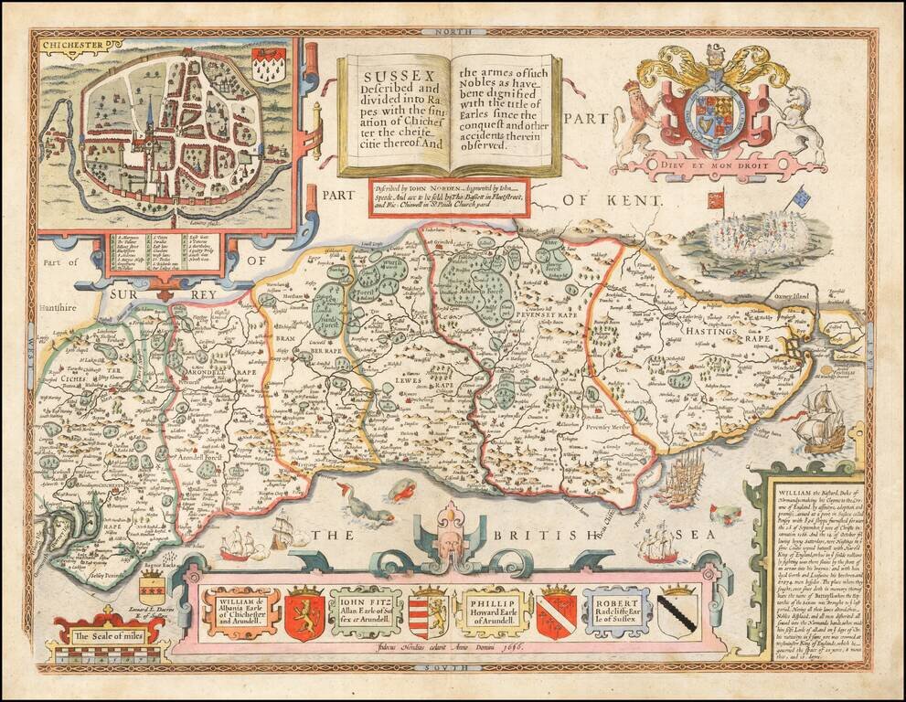
Attractive full color example of Speed's map of Sussex, including a plan of Chichester, coats of arms and other decorative embellishments. Includes a plan of Chichester, the Royal Arms supported by lion and unicorn, the coats of arms of the various...
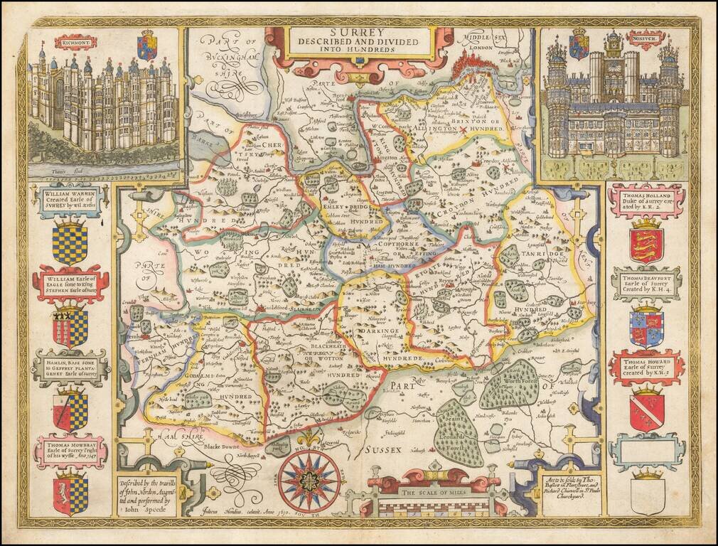
1676 edition of Speed's map of Surrey, from Speed's Theatre of Great Britain, published in 1611 (with credit to John Sudbury and George Humble). Includes elaborate views of Richmont and Nonsuch and 7 coats of arms. London appears on the Thames, just...
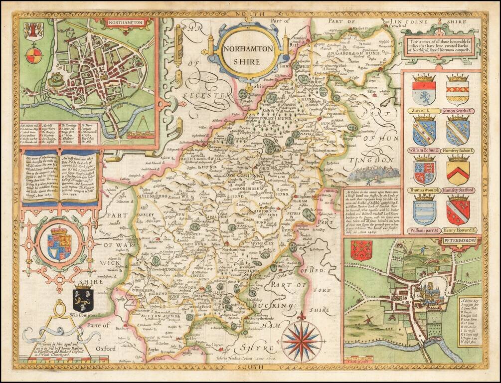
Attractive full color example of Speed's map of Northamptonshire, from an early edition of Speed's Theatre of Great Britain, first published in 1611. Includes large inset plan of Peterborow and Northampton, along with multiple coats of arms.
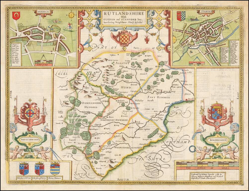
Attractive full color example of Speed's map of the county of Rutland, from the 1676 edition of Speed's Theatre of Great Britain. Includes multiple coats of arms and a large inset plan of the town of Stanford (Stamford) and Oukham (Oakham). British...
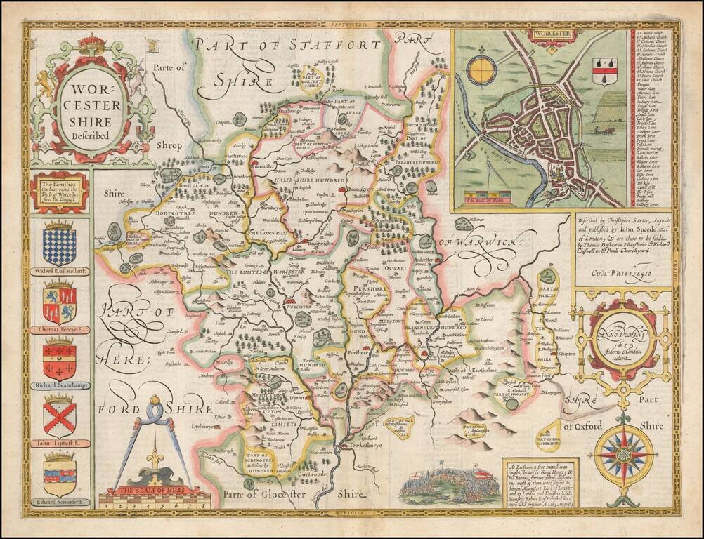
Attractive full color example of Speed's map of the county of Worcester, from the 1676 edition of Speed's Theatre of Great Britain. Includes multiple coats of arms and a large inset plan of the town of Worcester. British historian John Speed is...
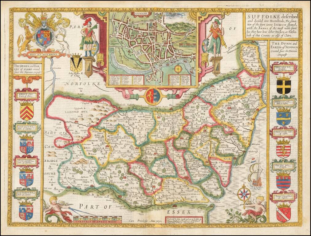
Attractive full color example of Speed's map of the county of Suffolk, from the 1676 edition of Speed's Theatre of Great Britain. Includes multiple coats of arms and a large inset plan of the town of Ipswich. British historian John Speed is perhaps...
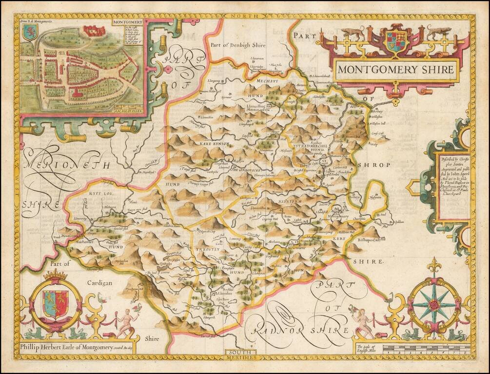
A nice full color example of Speed's map of the County of Montgomery, including coats of arms and detailed town plans of Bangor and Montgomery. Speed's Theatre of the Empire of Great Britain… was first published in 1612, employing maps which Speed...
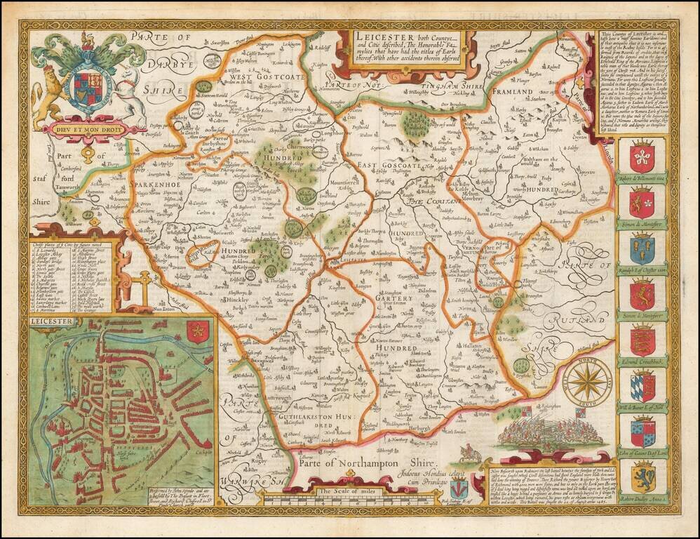
A nice example of this decorative double-page engraved county map of Leicester by John Speed. Includes insets of Leicester, eight coats of arms, plus a large English coat of arms, battle scenes, etc.
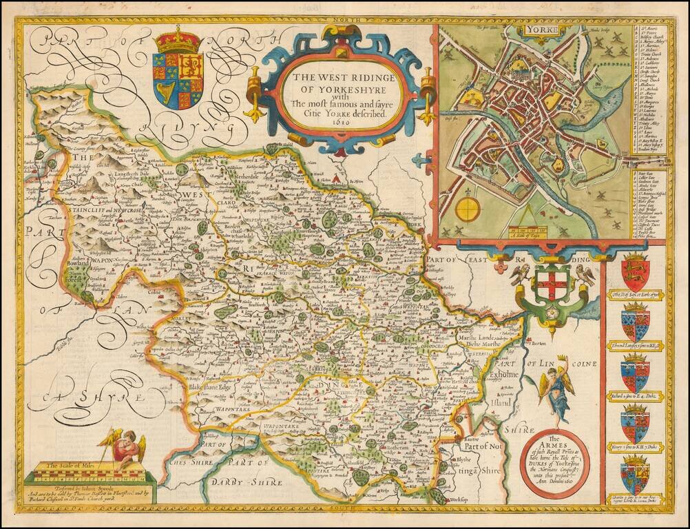
A nice example of this decorative county map by John Speed, covering the West Riding of Yorkshire. Includes inset of Yorke, along with seven coats of arms.
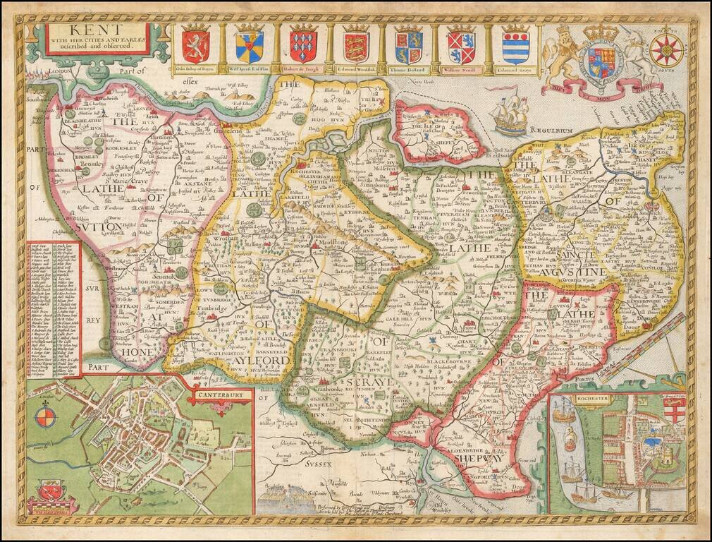
Decorative map of Kent based on the work of Philip Symonson, from Speed's Atlas. Insets of the cathedral cities of Canterbury and Rochester, and seven coats of arms. Due to Kent's extensive coastline, and proximity to France and the Netherlands, it...