John Speed (1551 or '52 - 28 July 1629) was the best known English mapmaker of the Stuart period. Speed came to mapmaking late in life, producing his first maps in the 1590s and entering the trade in earnest when he was almost 60 years old.
John Speed's fame, which continues to this day, lies with two atlases, The Theatre of the Empire of Great Britaine (first published 1612), and the Prospect of the Most Famous Parts of the World (1627). While The Theatre ... started as solely a county atlas, it grew into an impressive world atlas with the inclusion of the Prospect in 1627. The plates for the atlas passed through many hands in the 17th century, and the book finally reached its apotheosis in 1676 when it was published by Thomas Bassett and Richard Chiswell, with a number of important maps added for the first time.

John Speed's highly decorative double-page engraved map of Lancaster. The map features the portraits of Henry IIII, Henry V, Henry VI, and Henry VII under the heading "Blessed are, the Peace-Makers." It also shows Edward IIII, Edward V, Richard III,...
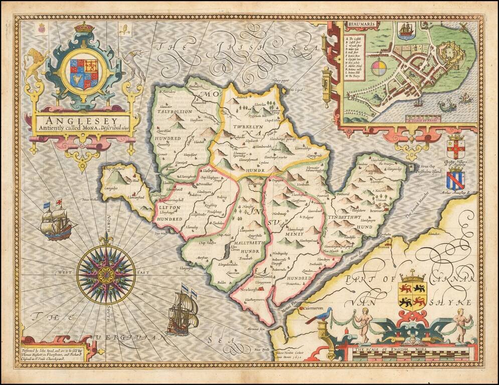
Attractive full color example of Speed's map of the island of Anglesey, off the coast of Wales, published by John Speed. Includes a plan of Beaumaris, the Royal Arms supported by lion and unicorn, the coats of arms of 2 Earls, ships full sail, and an...
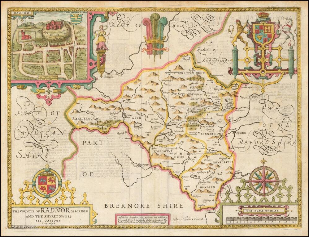
A nice full color example of Speed's map of the County of Radnor, including coats of arms and a detailed town plan of Radnor. Speed's Theatre of the Empire of Great Britain… was first published in 1612, employing maps which Speed began publishing...
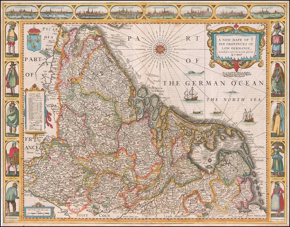
A fine example of John Speed's highly decorative map of the Low Countries. This attractive map embraces all of the 17 traditional provinces of the Netherlands, including the modern nations of the Netherlands, Belgium and Luxembourg. At the time, the...
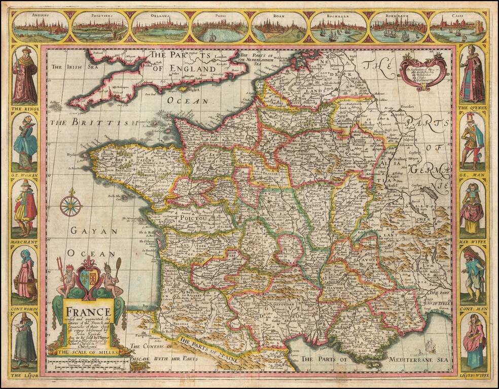
Decorative map of France, published in London by John Speed. Side panels depict costumed figures, while above are vignettes of notable places including Orleans, Paris, Calais, Bordeaux, and Poitiers. The map was engraved by Dirck Gryp in 1626, but...
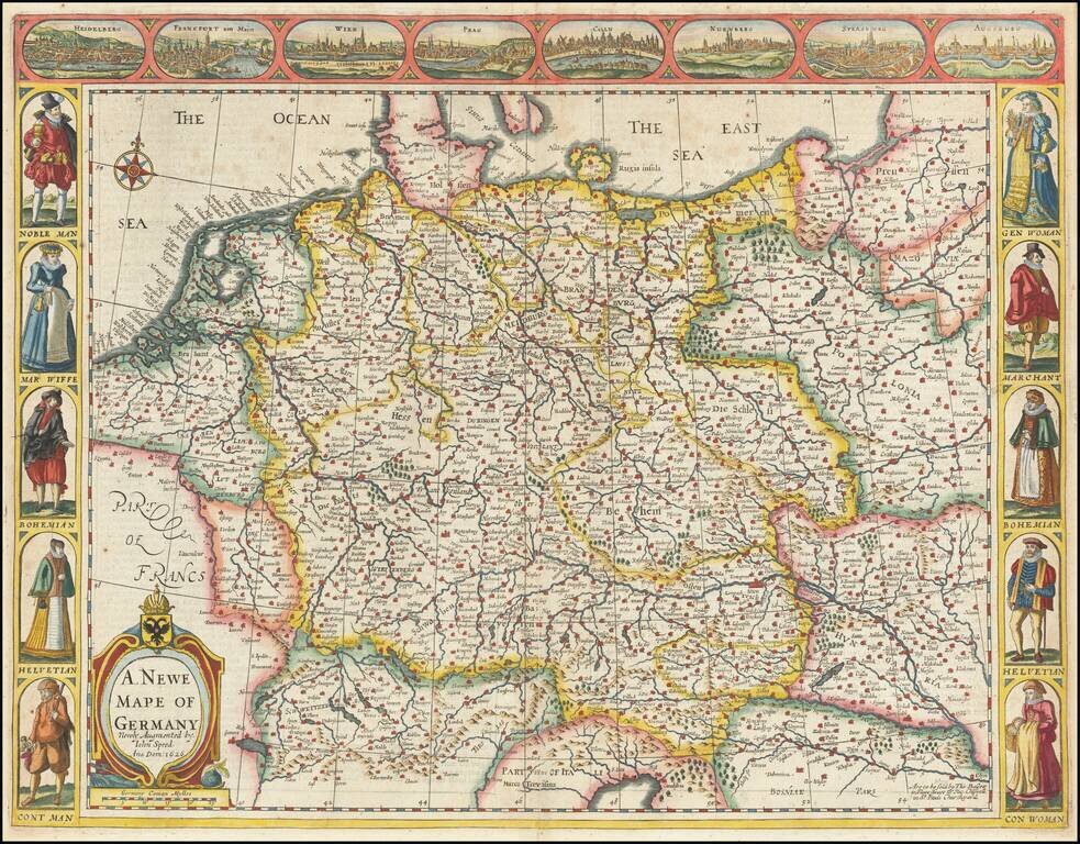
Nice example of Speed's map of the German Empire, extending from Poland in the Northeast to the Danube. Includes birdseye views of Heidelberg, Frankfurt, Vienna, Prague, Cologne, Nuremberg, Strassborg and Augsburg across the top and indigenous...
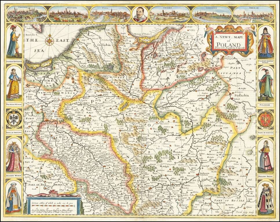
The First Map of Poland Published in England Decorative example of John Speed's highly sought after map of Poland, the first map of Poland to appear in an English Atlas. The map includes birdseye views of Cracow, Dantzick, Posna, Crossen, Sandomiria...
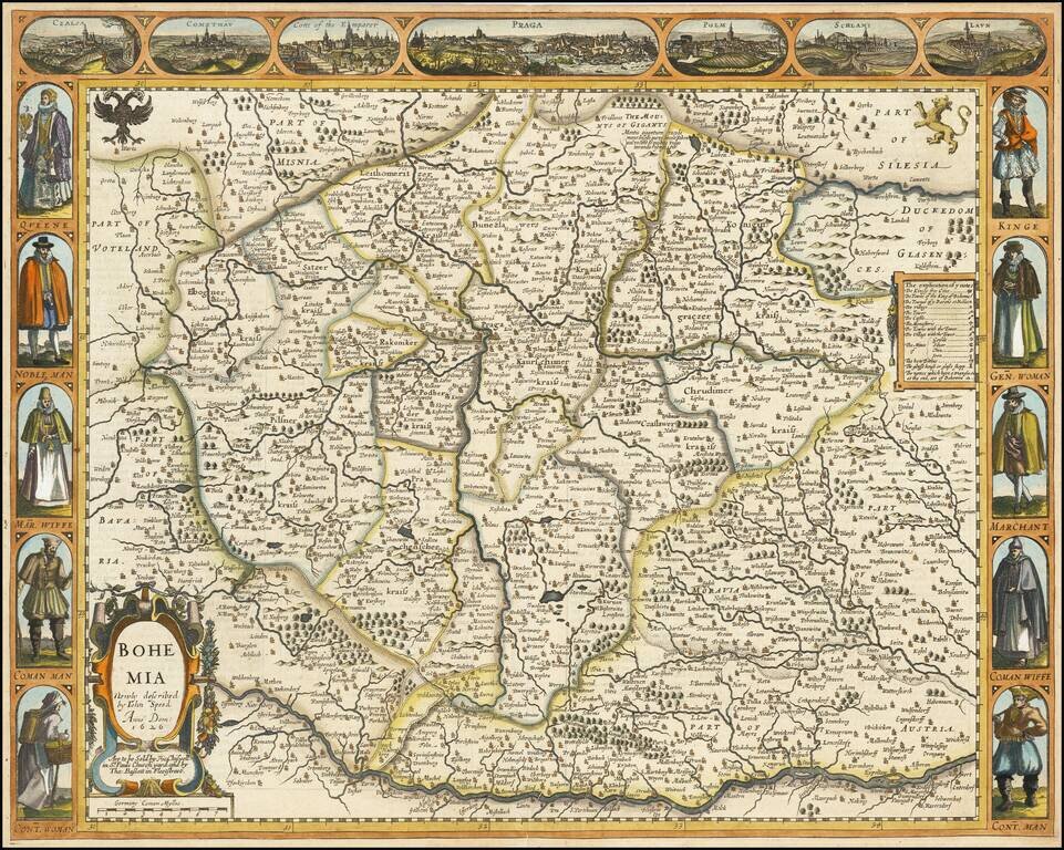
Decorative map of Bohemia, from Speed's Prospect of the World. Includes 7 cities across the top and costumed figures on either side of the map.
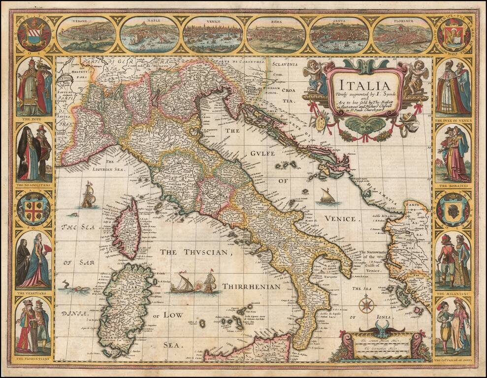
Nice example of John Speed's map of Italy, from the 1676 edition of his Prospect of the Most Famous Parts of the World. Widely regarded as the most beautiful and decorative map of Italy to appear in an English language atlas in the 17th century....
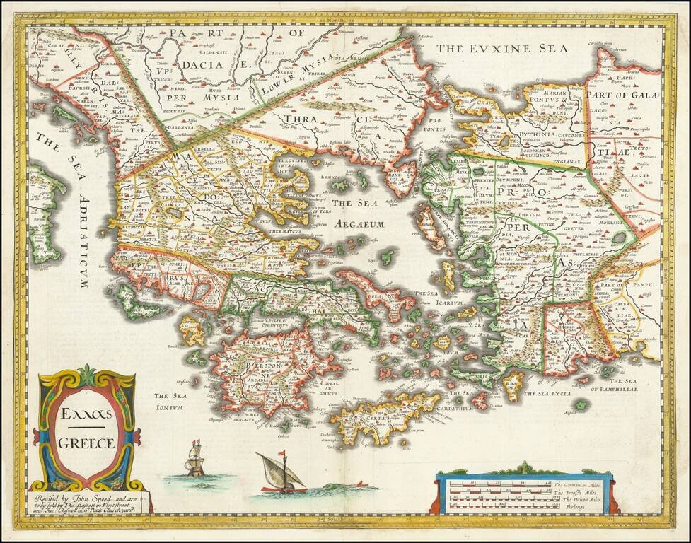
Nice example of John Speed's map of Greece. Extends north to include part of the Black Sea. A highly detailed early depiction of Greece, with fascinating English text description on the verso. The first folio sized map of Greece published in England.
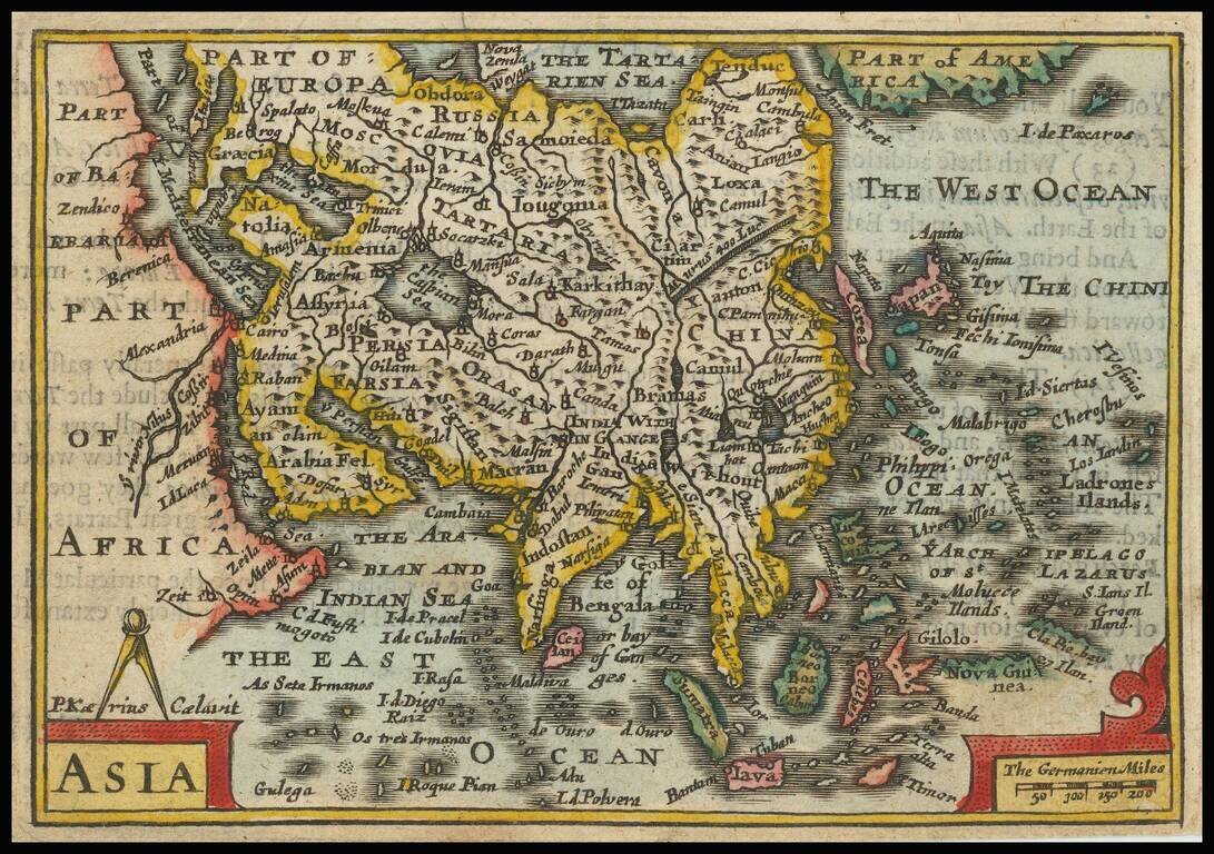
Nice full color example of Speed's rare scarce miniature map of Asia, from Speed's Epitome. The map shows Corea as an Island, a badly misprojected Japan and a small part of the Great Wall of China. Part of America is shown, as is the Straits of Anian....
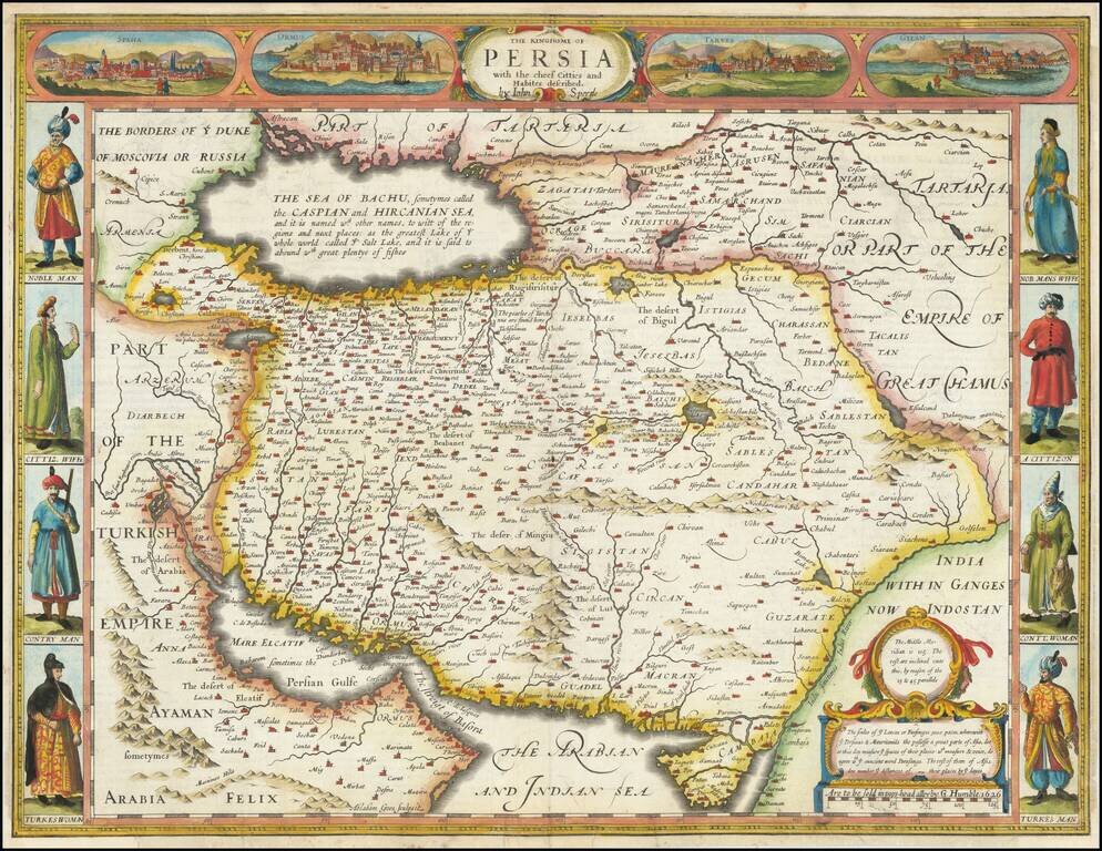
First state of this scarce decorative map of the Persian Empire from the final edition of John Speed's Atlas. Includes four town view vignettes across the top and 4 sets of costumes. The text on the verso provides a colorful Anglo-centric view of life...
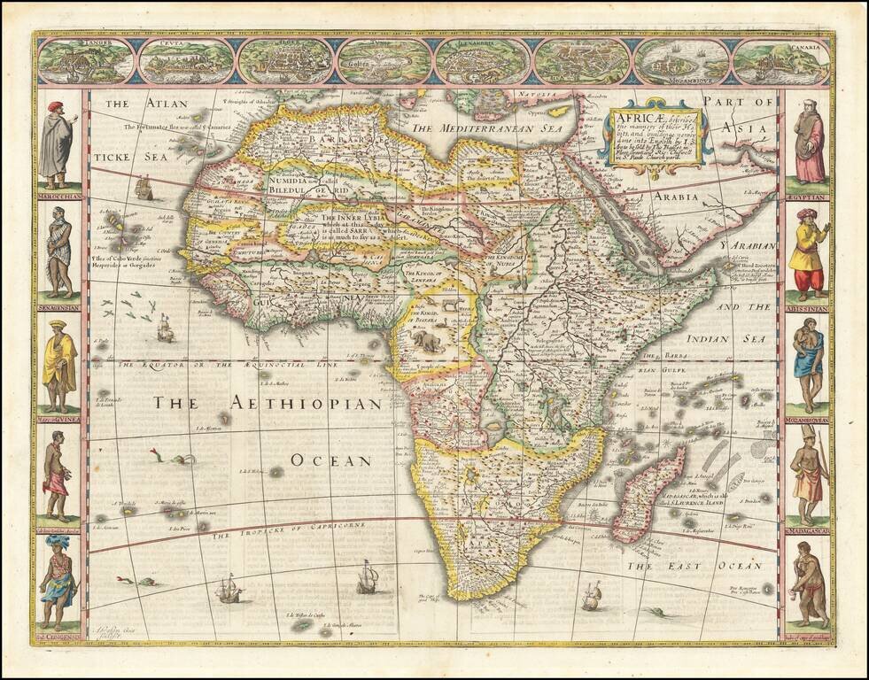
Striking example of John Speed's decorative map of Africa. The side borders contain two sets of five decorative costumes of various African peoples; the top border shows views of eight African cities. The source of the Nile is based upon Ptolemy (two...