![Charte von Den Vereinigten Staaten von Nord-America nebst Louisiana . . . 1805 [Rare 1st State of Gussefeld's Louisiana Purchase Map]](/map/small/63496.jpg)
Rare first state of Gussefeld's map of the United States, published in the same year as the Louisiana Purchase and highlighting Jefferson's United States on the eve of the expedtitions of Lewis & Clark, Zebulon Pike, etc. Following the Louisiana...
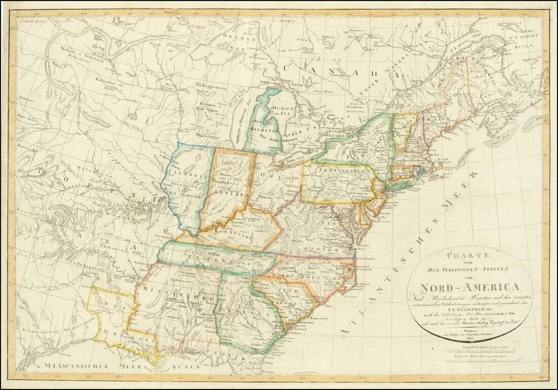
With an unusual appearance of "Neu Orleans" Territory. Rare late state of Gussefeld's map of the United States, published in the same year as the Louisiana Purchase and highlighting Jefferson's United States on the eve of the expeditions of Lewis...
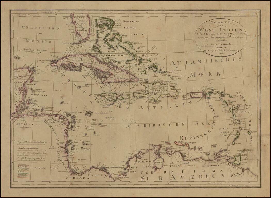
Rare edition of Gussefeld's map of South Florida, the Caribbean and coastlines of Central America. The map would be updated and re-issued for at least the next 20 years, with corrections. A comparison of this edition to the 1816 edition which we...
![Tabula Regni Borussiae Borussiam Orientalem exhibens MDCCLXXV [and] Borussiae Occidentalis Tabula . . . 1780](/map/small/58775.jpg)
Scarce map of Poland, Lithuania, Kalingrad, Pomerania, etc. The maps were created by Gussefeld, one of his earliest maps, and published by Homann Heirs.
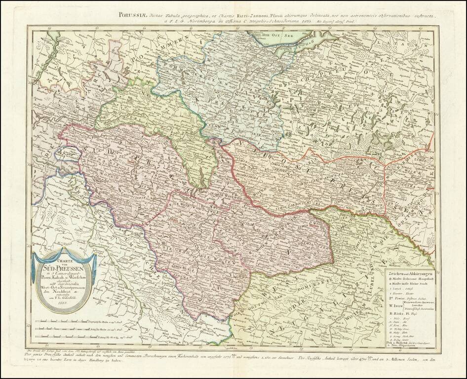
Rare map of western Poland, published by Gussefeld. At the bottom left the title cartouche, with explanations and representation of the new political affiliation of the districts and areas that had fallen to Prussia after the division in 1793.
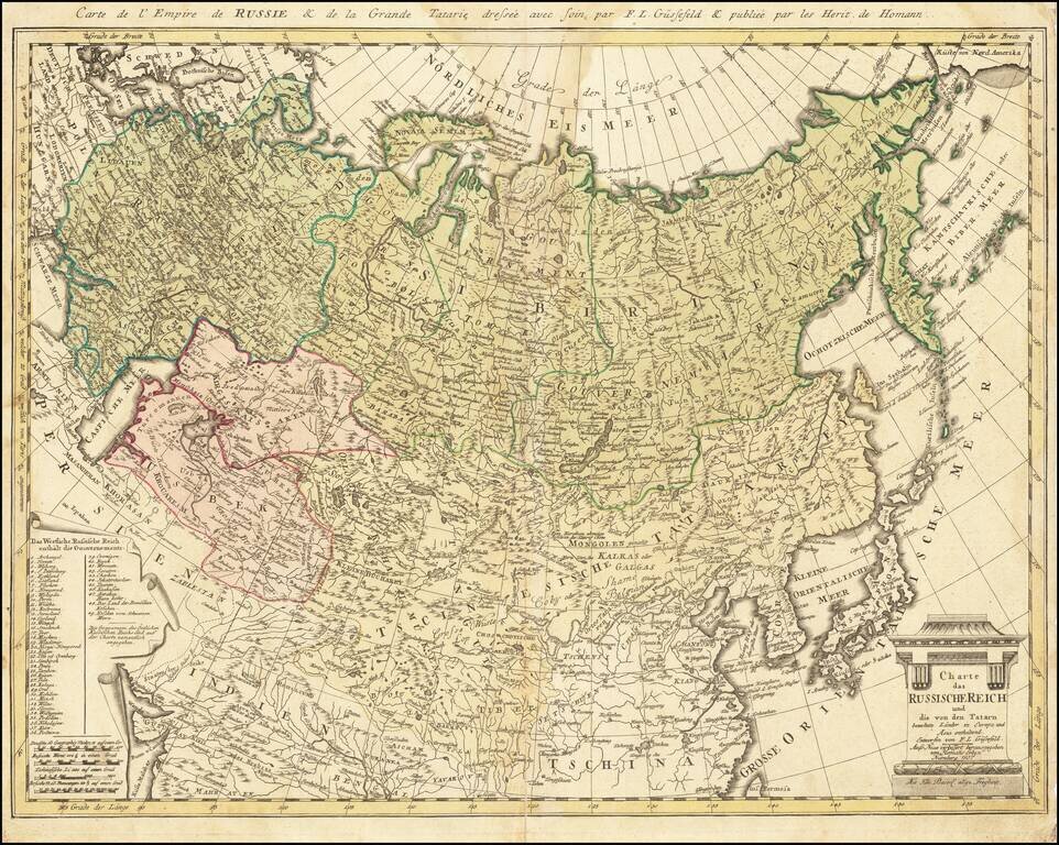
Rare late edition of this detailed map of the whole of Russia and parts of China and Central Asia. Interesting and highly detailed. This is the first time we have seen this state of the map.
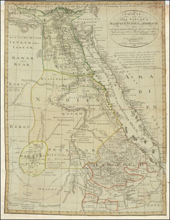
A detailed chart of Egypt, Sudan, and Ethiopia focused on the course of the Nile. Extensive detail is shown, with the many towns along the Nile, Red Sea, and other areas all labeled. Trade routes are shown through the desert and the mountain ranges of...
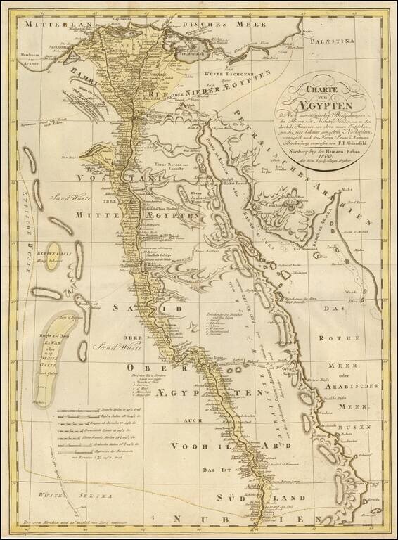
Detailed map of Egypt adn the Nile River to just South of Assuan, published by the Homann Heirs. In the west, the Grand Oasis and Small Oasis are noted, as is the beginning of the Caravan Route to Fez in Morocco. Further south, the Caravan Route to...