The British Admiralty has produced nautical charts since 1795 under the auspices of the United Kingdom Hydrographic Office (HO). Its main task was to provide the Royal Navy with navigational products and service, but since 1821 it has also sold charts to the public.
In 1795, King George III appointed Alexander Dalrymple, a pedantic geographer, to consolidate, catalogue, and improve the Royal Navy’s charts. He produced the first chart as the Hydrographer to the Admiralty in 1802. Dalrymple, known for his sticky personality, served until his death in 1808, when he was succeeded by Captain Thomas Hurd. The HO has been run by naval officers ever since.
Hurd professionalized the office and increased its efficiency. He was succeeded by the Arctic explorer Captain William Parry in 1823. By 1825, the HO was offering over seven hundred charts and views for sale. Under Parry, the HO also began to participate in exploratory expeditions. The first was a joint French-Spanish-British trip to the South Atlantic, a voyage organized in part by the Royal Society of London.
In 1829, Rear-Admiral Sir Francis Beaufort was appointed Hydrographer Royal. Under his management, the HO introduced the wind force scale named for him, as well as began issuing official tide tables (1833). It was under Beaufort that HMS Beagle completed several surveying missions, including its most famous voyage commanded by Captain FitzRoy with Charles Darwin onboard. When Beaufort retired in 1855, the HO had nearly two thousand charts in its catalog.
Later in the nineteenth century, the HO supported the Challenger expedition, which is credited with helping to found the discipline of oceanography. The HO participated in the International Meridian Conference which decided on the Greenwich Meridian as the Prime Meridian. Regulation and standardization of oceanic and navigational measures continued into the twentieth century, with the HO participating at the first International Hydrographic Organization meeting in 1921.
During World War II, the HO chart making facility moved to Taunton, the first purpose-built building it ever inhabited. In 1953, the first purpose-built survey ship went to sea, the HMS Vidal. Today, there is an entire class of survey vessels that make up the Royal Navy’s Hydrographic Squadron. The HO began to computerize their charts in the late 1960s and early 1970s. In 1968, the compilation staff also came to Taunton, and the HO continues to work from there today.
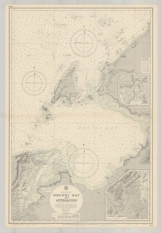
Finely executed harbor chart of the Bay of Brunei, published by the British Admiralty. Includes inset maps of Batang Limbang and the continuation of Padas Bay,
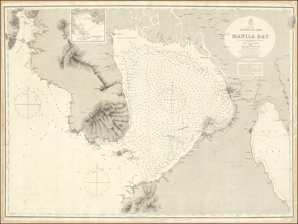
One of the Largest Obtainable English Language Maps of Manila Bay Highly detailed chart of the Bay of Manila, published by the British Hydrographical Survey. The map is a remarkably detailed work, based upon the Spanish Philippine Hydrographical...
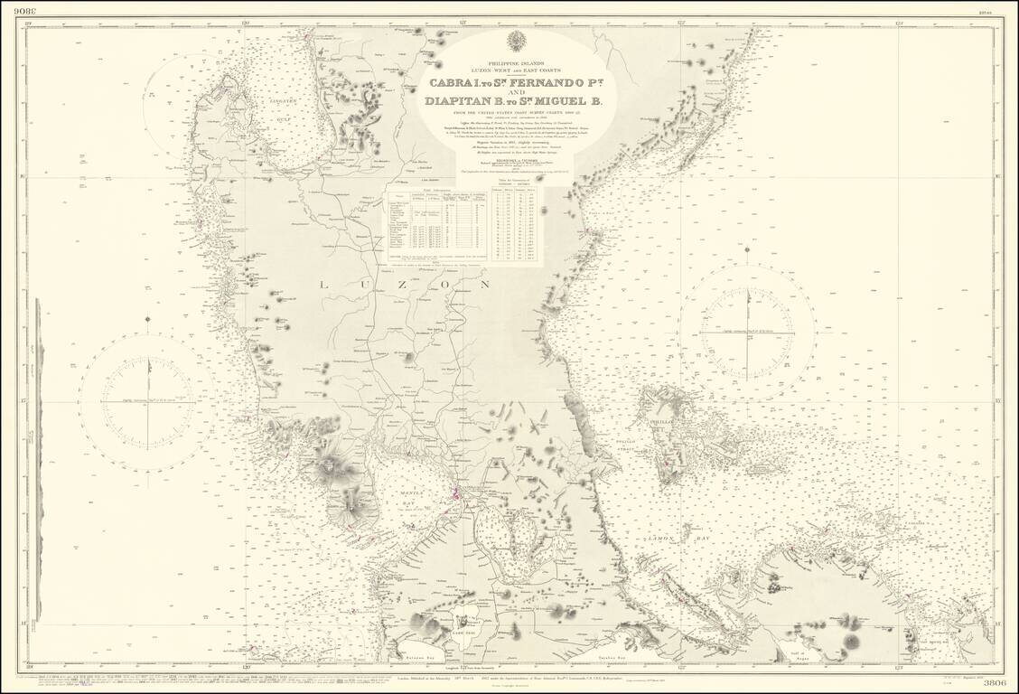
Scarce British Admiralty chart covering a large part of Luzon, including Manila Bay.
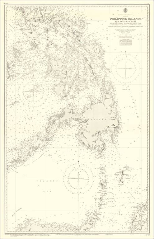
Finely executed British Admiralty Chart of a large portion of the Philippine Islands and regions to the south. The map includes extensive soundings, coastal details, light houses, etc.
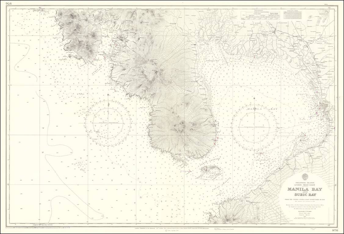
Highly detailed chart of the Bay of Manila, published by the British Hydrographical Survey. The map is a remarkably detailed work, based upon the US Coast Survey Hydgrographical surveys of 1920.
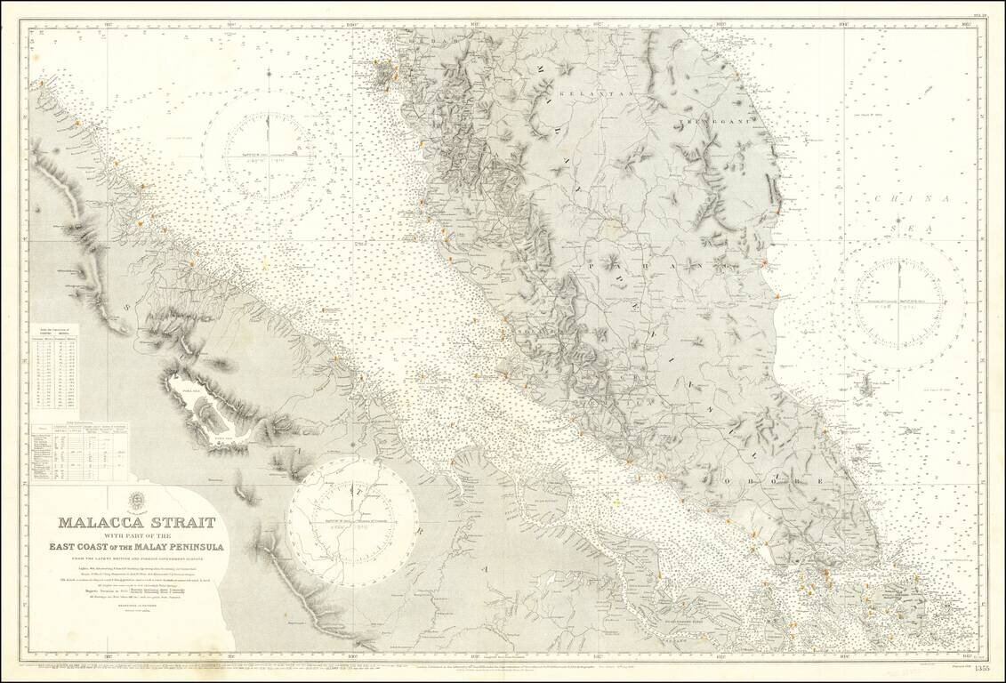
Detailed sea chart of the Malaya Peninsula and the northeast coast of Sumatra, featuring Singapore and the surrounding area. The chart was published by the British Admiralty first in 1898, and then as a new edition in 1922. This example has been...
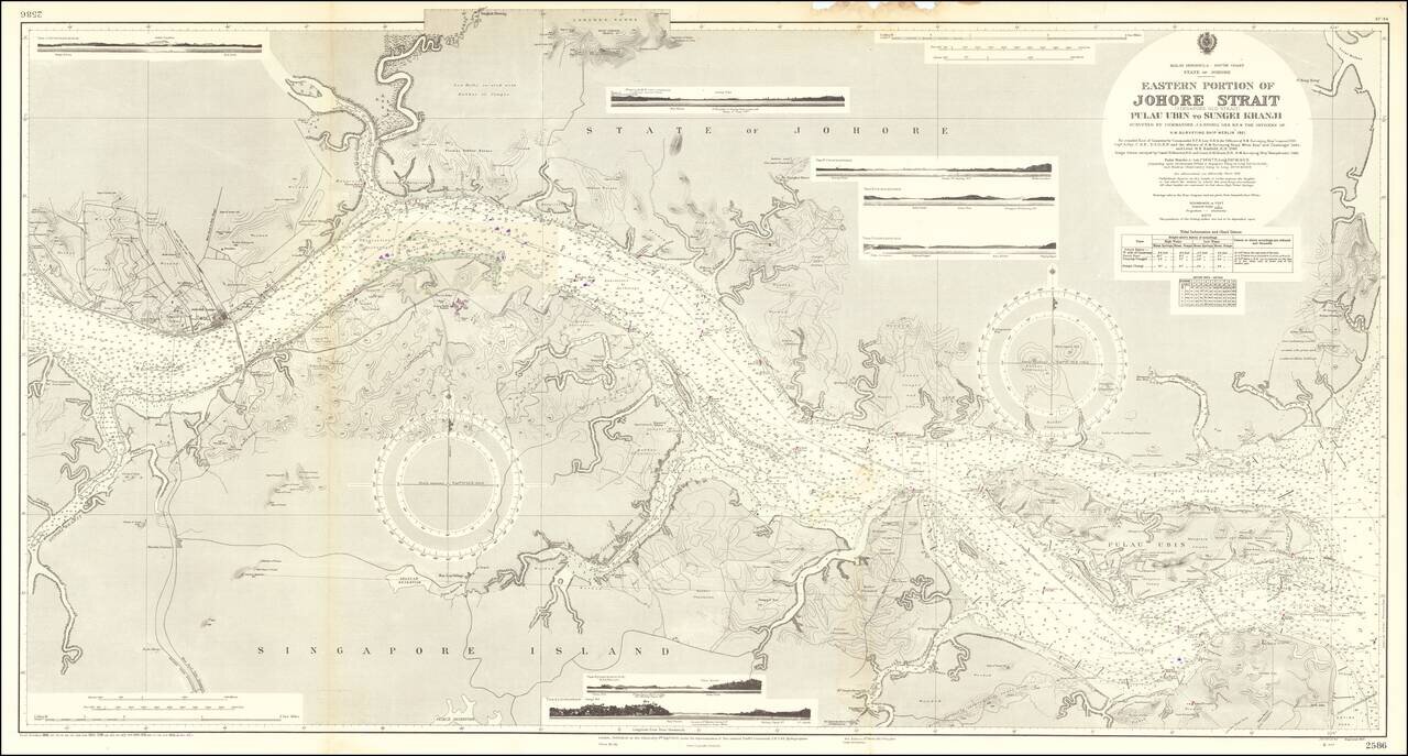
Fine large sea chart centered on the Johor Strait, published in London by the British Admiralty. Drafted from surveys by the H.M.S. Merlin conducted in 1921, the map includes hundreds of soundings and an exceptionally detailed treatment of the...
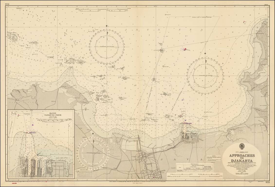
Fine large format map of the approaches to the Harbor of Jakarta, published by the British Admiralty, based on an Indonesian Chart published in 1956. Includes a large inset map of Haven Tandjung Priok.
![[Myanmar] Gulf of Bengal Sheet VII Bassein, Rangoon, Martaban Compiled from various Surveys by Captns. D. Ross and J. Crawford, Bombay Marin, Lieut. Roe, R.N. Lieuts. W. Fell and C.Y. Ward, I.N. and Captn. Beckford 1859.](/map/small/67658.jpg)
Finely detailed British Sea Chart, showing the region drained by the Irawaddy River in Myanmar.
![[Mocha, Yemen] Arabia -- Red Sea -- Mokha Road Surveyed by Commander Aldrich assisted by Lieutenants Pullen, Helby, Keary and Cust, H.M.S. Fawn 1882. [With an early View of Mocha!]](/map/small/68944.jpg)
Detailed map of the area around the town and port of Mocha in Western Yemen, published by the British Admiralty. The map includes extensive offshore soundings and coastal features, including the location of the city pier, 3 minarets, 4 mosques and...
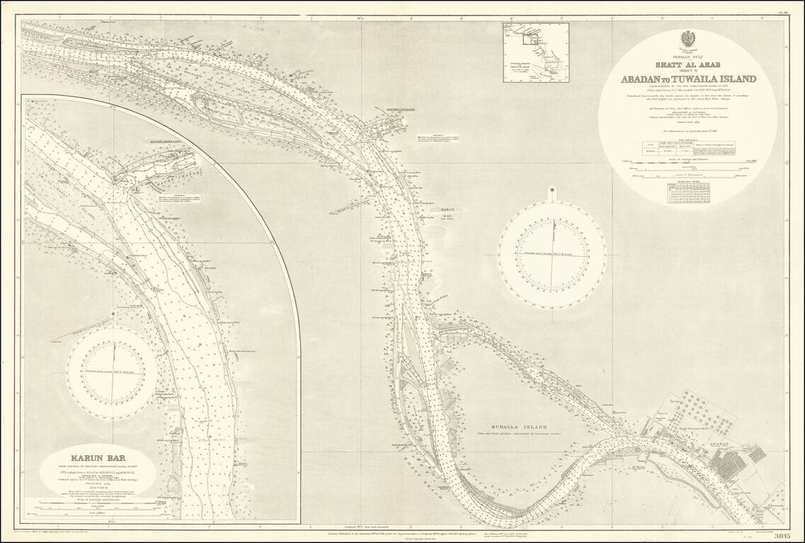
The Largest Oil Refinery In The World Detailed map of a section of the Karun River, on the Iran-Iraq Border, published by the British Admiralty. The map extends to Abadan and the complex of the Anglo-Persian Oil Company, which includes offices,...
Detailed sea chart of the easternmost tip of the Arabian Peninsula in present-day Oman. Interestingly, the map was made from surveys of the Indian Navy in 1849. Muscat is shown towards the top of the map. Hundreds, if not thousands, of soundings dot...
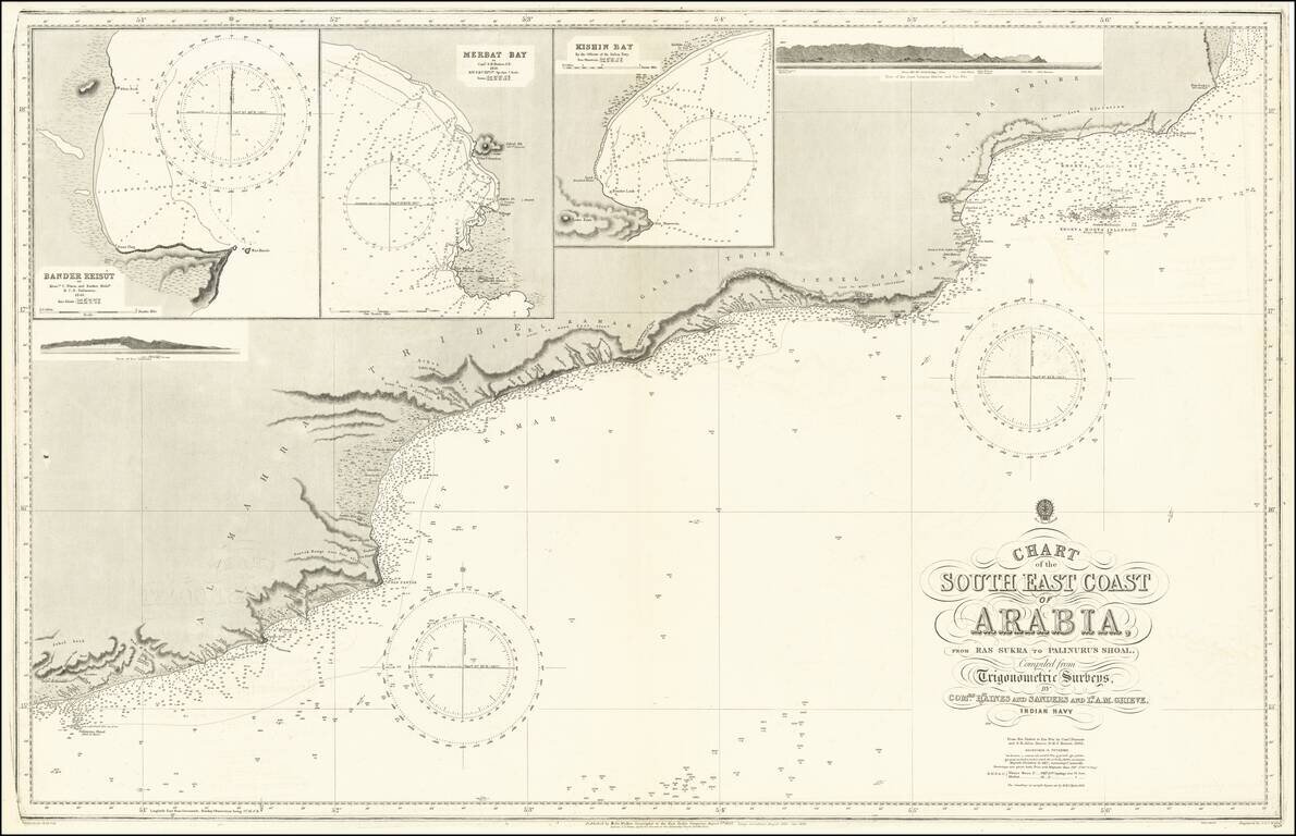
Fine map of the South Coast of Arabia from southern Oman and northern Yemen. Large inset maps of Bander Reisut, Merbat Bay, Kishin Bay and two profile views.
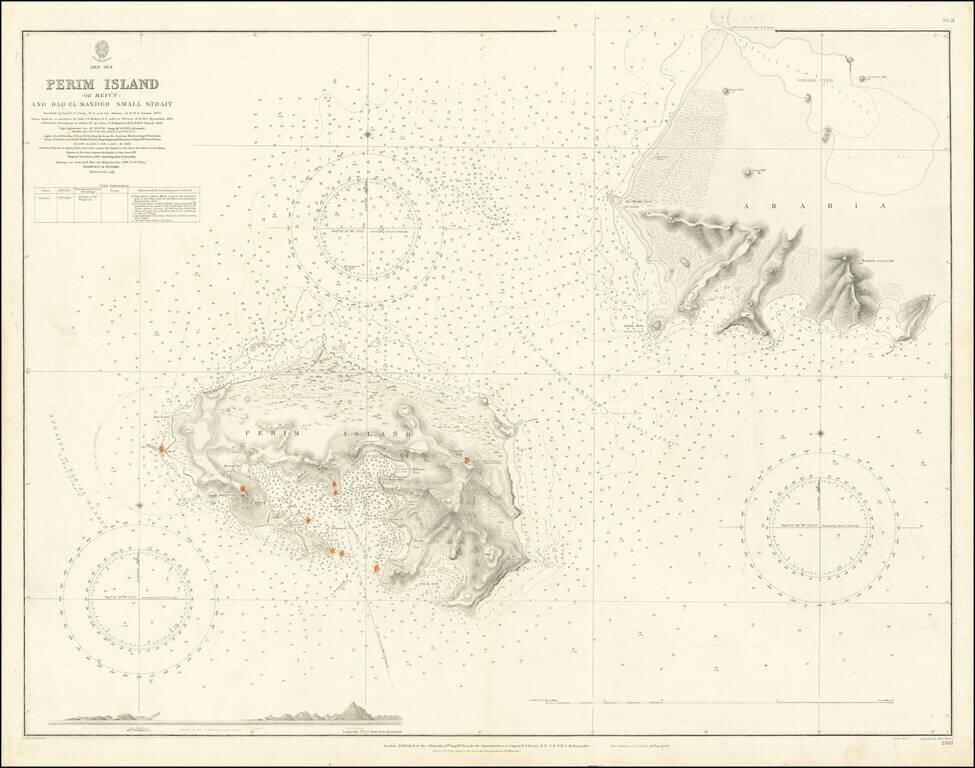
Extremely detailed chart of Perim Island (also called Mayyun in Arabic) in the Strait of Mandeb, at the southern entrance to the Red Sea. Perim is a small but geopolitically important island at the entrance to the Red Sea. With the beginning of the...
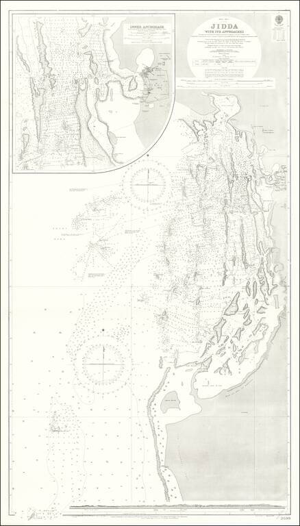
Detailed British Admiralty chart of the approaches to Jeddah, present-day Saudi Arabia, with an inset chart Jeddah Harbor and the city itself. This is undoubtedly one of the better antiquarian maps of the gateway city to Mecca and Medina. Jeddah was...
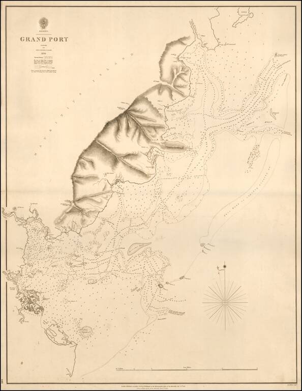
A Rare Chart of Mauritius by its Surveyor General Rare separately published sea chart of Grand Port, Mauritius, published in 1843 by the British Admiralty. The map is based upon the surveys led by John Augustus Lloyd in 1836. The map is centered on...