The British Admiralty has produced nautical charts since 1795 under the auspices of the United Kingdom Hydrographic Office (HO). Its main task was to provide the Royal Navy with navigational products and service, but since 1821 it has also sold charts to the public.
In 1795, King George III appointed Alexander Dalrymple, a pedantic geographer, to consolidate, catalogue, and improve the Royal Navy’s charts. He produced the first chart as the Hydrographer to the Admiralty in 1802. Dalrymple, known for his sticky personality, served until his death in 1808, when he was succeeded by Captain Thomas Hurd. The HO has been run by naval officers ever since.
Hurd professionalized the office and increased its efficiency. He was succeeded by the Arctic explorer Captain William Parry in 1823. By 1825, the HO was offering over seven hundred charts and views for sale. Under Parry, the HO also began to participate in exploratory expeditions. The first was a joint French-Spanish-British trip to the South Atlantic, a voyage organized in part by the Royal Society of London.
In 1829, Rear-Admiral Sir Francis Beaufort was appointed Hydrographer Royal. Under his management, the HO introduced the wind force scale named for him, as well as began issuing official tide tables (1833). It was under Beaufort that HMS Beagle completed several surveying missions, including its most famous voyage commanded by Captain FitzRoy with Charles Darwin onboard. When Beaufort retired in 1855, the HO had nearly two thousand charts in its catalog.
Later in the nineteenth century, the HO supported the Challenger expedition, which is credited with helping to found the discipline of oceanography. The HO participated in the International Meridian Conference which decided on the Greenwich Meridian as the Prime Meridian. Regulation and standardization of oceanic and navigational measures continued into the twentieth century, with the HO participating at the first International Hydrographic Organization meeting in 1921.
During World War II, the HO chart making facility moved to Taunton, the first purpose-built building it ever inhabited. In 1953, the first purpose-built survey ship went to sea, the HMS Vidal. Today, there is an entire class of survey vessels that make up the Royal Navy’s Hydrographic Squadron. The HO began to computerize their charts in the late 1960s and early 1970s. In 1968, the compilation staff also came to Taunton, and the HO continues to work from there today.
![(Maui). Harbours and Anchorages in the Hawaiian or Sandwich Islands. [Maalaea Bay and Kahului Harbor and Approaches]](/map/small/69674.jpg)
Maui Harbors Rare British Admiralty Chart, showing Kahului Harbor and Maalaea Bay, on the island of Maui Maalaea Bay includes a number of early placenames, including Kihei. Kahului Harbor shows the breakwaters, town plan, etc., extending north to...
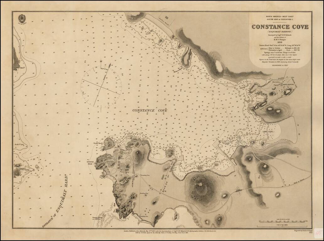
Surveyed For The New Headquarters of the British Navy's Pacific Fleet Rare British Admiralty Chart of Constance Cove, Esquimalt Harbour, home to the British Royal Navy's Pacific Fleet beginning in 1865 and thereafter the Canadian Royal Navy. This is...
![[Vancouver] Fraser River and Burrard Inlet](/map/small/68029.jpg)
Attractive Chart Showing a Nascent City of Vancouver This is a navigational chart of the area around the Burrard Inlet on the Salish sea. The map extends inland along the Fraser River inland to Pitt Lake. Navigational detail on the map is extensive,...
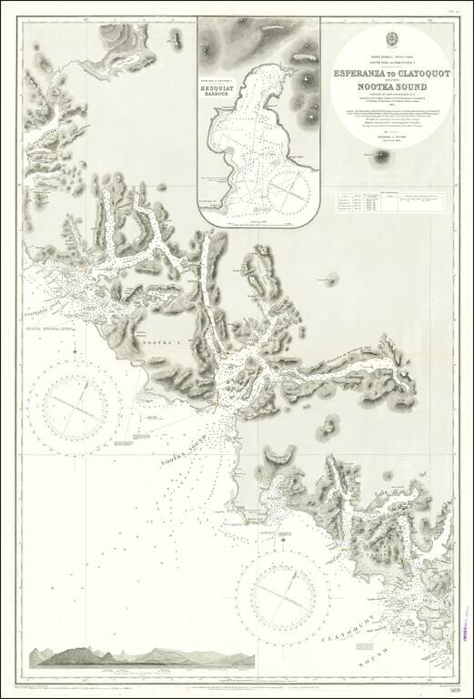
Finely detailed sea chart of a portion of the Western Coast of Vancouver Island, published by the British Admiralty. The chart is centered on Nootka Sound and extends north to Atluck Lake and the Fair Harbor area, and south to Vargas Island and...
![[Victoria, B.C.] Vancouver Island -- Victoria Harbour Surveyed By Captn. G. H. Richards & The Officers of H.M.S. Plumper. 1859. The Entrance from a Survey by Lieut. B.M. Chambers. R.N. 1895. Amendments by Capt. J.F. Parry, H.M. Surveying Ship Egeria](/map/small/69236.jpg)
Finely executed British Admiralty Sea Chart, illustrating Victoria, British Columbia and environs. The chart shows a well developed waterfront around James Bay and the Harbor, with an outline of the streets shown in great detail in interior. At the...
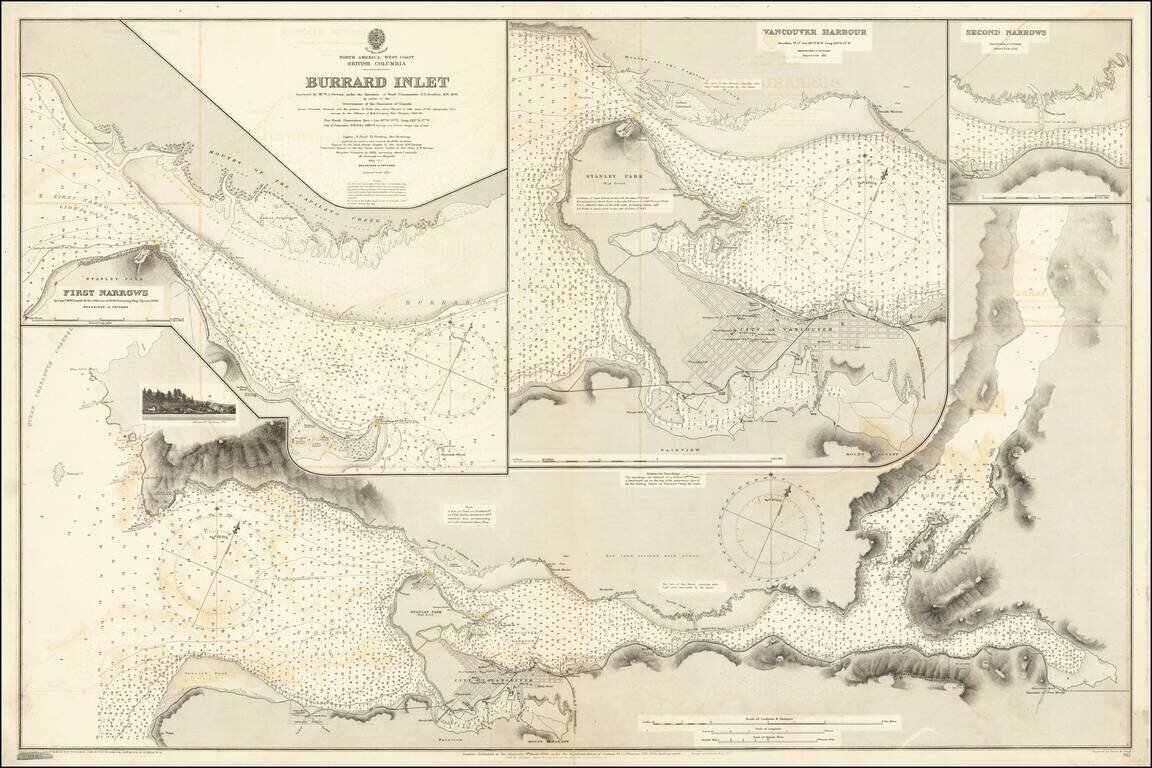
Attractive Chart Showing a Nascent City of Vancouver This is a navigational chart of the area around the Burrard Inlet on the Salish sea. The map, comprised of several detailed inlays, extends inland to Harrison Lake. Navigational detail on the map is...
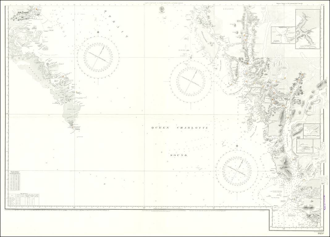
Detailed Coastal Chart of a section of British Columbia, published by the British Admiralty. The chart includes the southern part of Queen Charlotte Island in the west and extends from Bramham Island and Allison Harbor area in the south to the area...
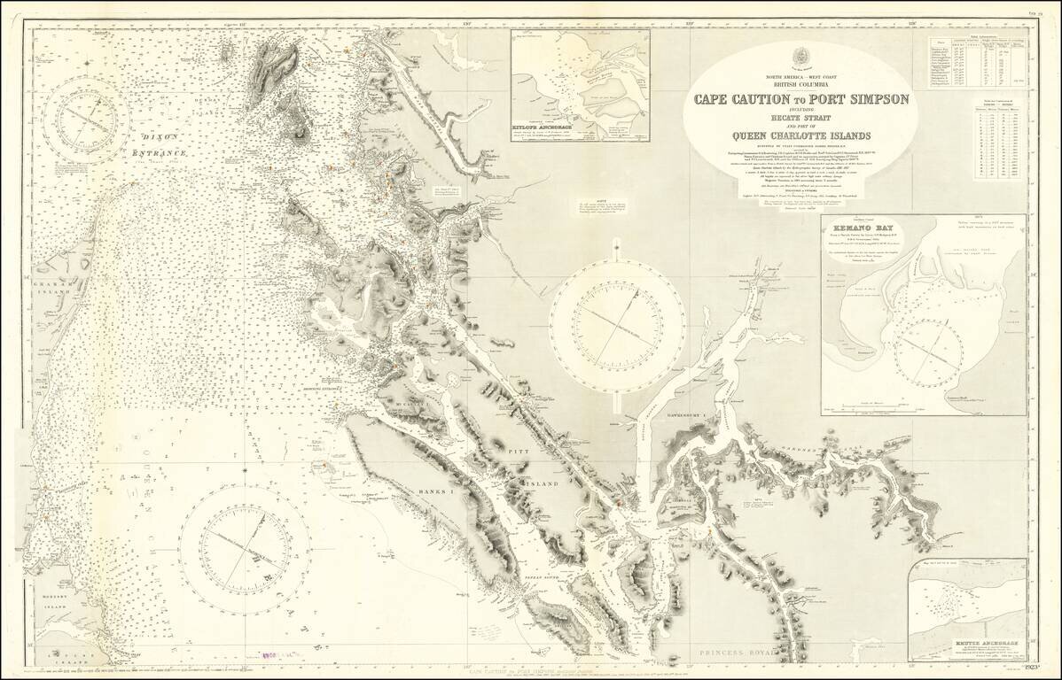
Large engraved chart of the Pacific coast of British Columbia just below the border with Alaska. The map covers the area known as the Hecate Strait between Graham Island and the archipelago to the east. There are extensive soundings and some...
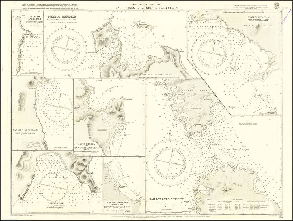
Detailed chart of the anchorages in the Gulf of California, including those on the eastern shores of Baja California. Much of the information comes from Henry Kellett's important 1845 hydrographical survey for the Royal Navy, undertaken on HMS Herald...
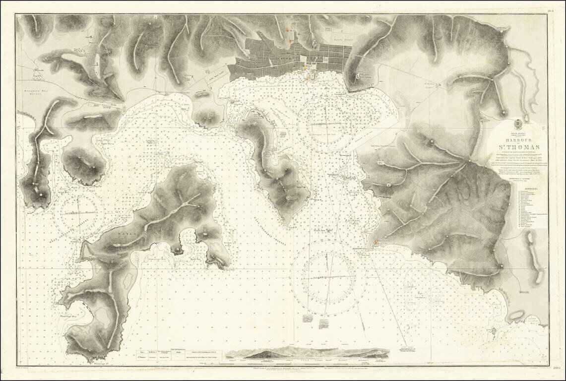
Detailed chart of the harbor at St. Thomas and environs, including a profile view of the approach to the harbor and remarkable details for both land and sea. The chart includes a plan of Charlotte Amalia, and a detailed depiction of the topography,...
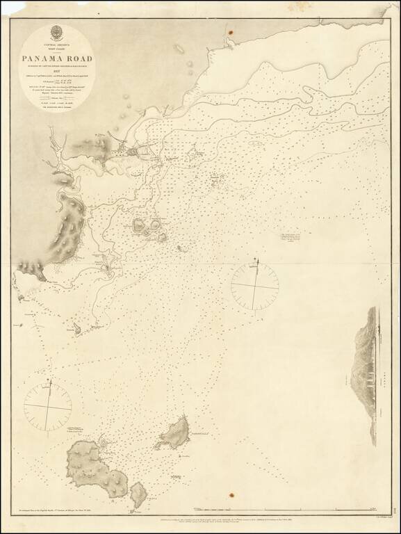
Detailed sea chart of the approaches to Panama City, published by the British Admiralty in 1858. The chart extends to Taboga Island and the smaller neighboring islands. Includes sailing directions, soundings, and some topographical features.
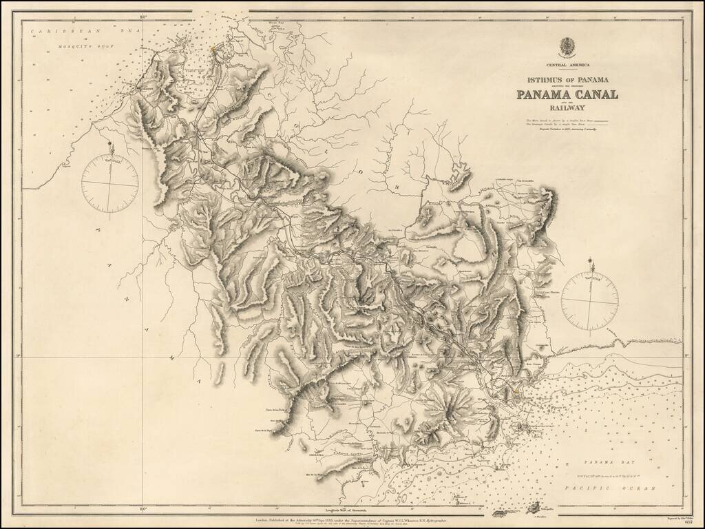
Highly detailed map of the Isthums of Panama, published by the British Admiralty. Extending from Mosquito Bay in the Caribbean Sea to Panama Bay in the Pacific, the map provides a remarkable topographical treatment of the region. This British Admiralty...
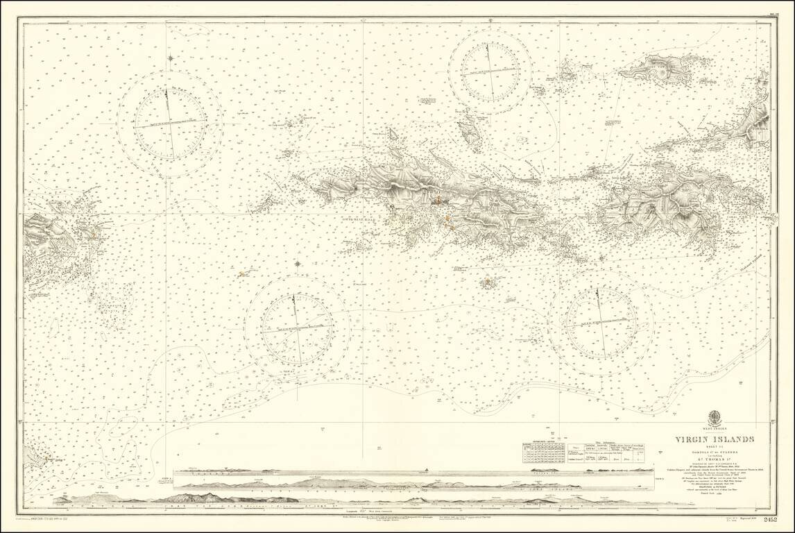
Finely detailed map, extending from Culebra and Vieques Island in the west to St. John, Tortola and Jost Van Dyke Island in the east, centered on St. Thomas. Includes profile views across the bottom. A fine detailed sea chart of this portion of the...
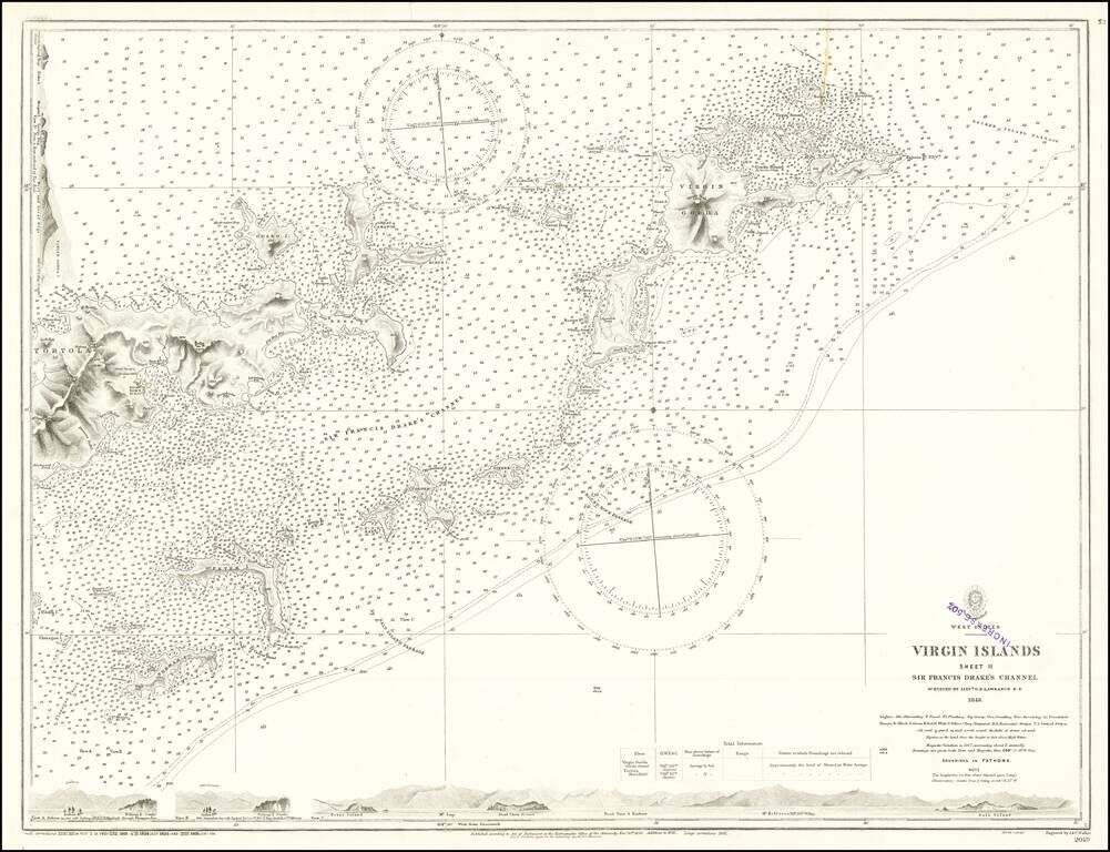
Finely detailed map, extending from Virgin Gorda and Necker Island in the northeast to Tortola and Norman Island in the west, centered on Sir Francis Drake's Channel. Includes profile views across the bottom and the top left. This is one of the...
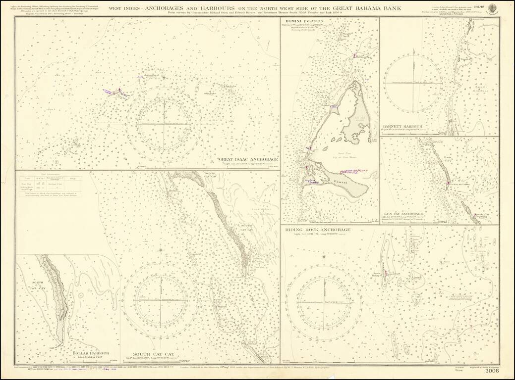
A detailed map showing several harbors in the Bahamas, first published by the British Admiralty in 1898. Seven separate maps show different anchorages, covering most of the islands in the northwesternmost part of the Great Bahama Bank. The charts show...
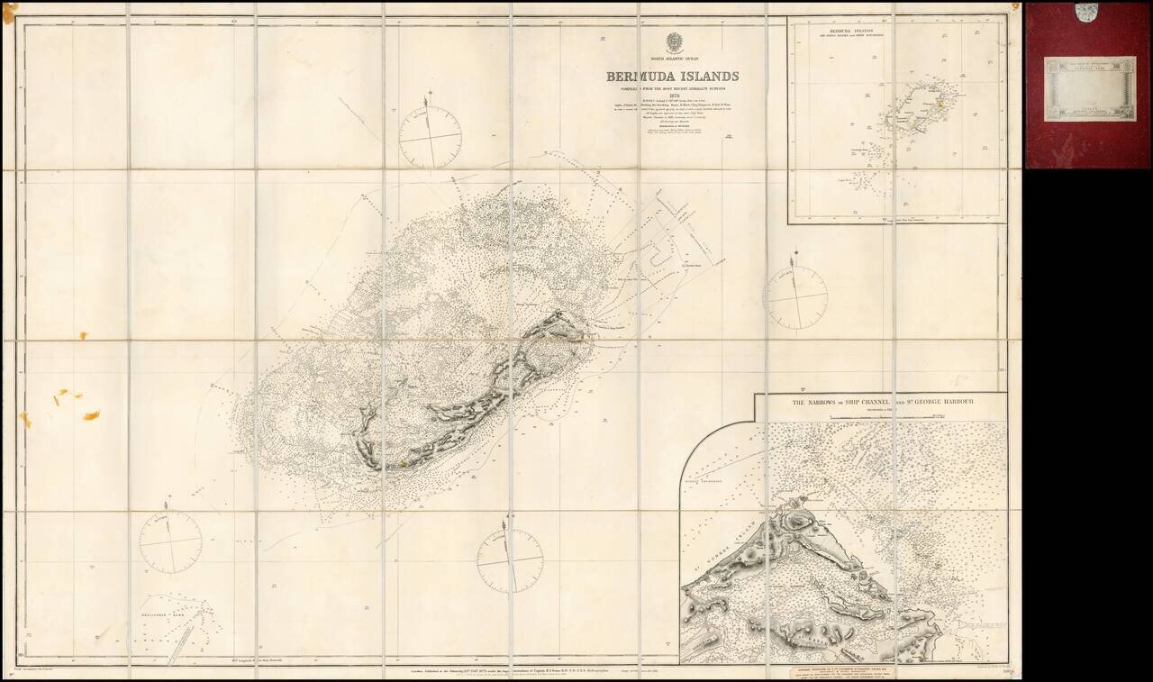
Finely detailed separately issued sea chart of Bermuda, with a large inset plan of St. George Harbour, first published by the British Admiralty in London in 1877. The inset of St. George's Harbour is of particular note, one of the largest and most...