The British Admiralty has produced nautical charts since 1795 under the auspices of the United Kingdom Hydrographic Office (HO). Its main task was to provide the Royal Navy with navigational products and service, but since 1821 it has also sold charts to the public.
In 1795, King George III appointed Alexander Dalrymple, a pedantic geographer, to consolidate, catalogue, and improve the Royal Navy’s charts. He produced the first chart as the Hydrographer to the Admiralty in 1802. Dalrymple, known for his sticky personality, served until his death in 1808, when he was succeeded by Captain Thomas Hurd. The HO has been run by naval officers ever since.
Hurd professionalized the office and increased its efficiency. He was succeeded by the Arctic explorer Captain William Parry in 1823. By 1825, the HO was offering over seven hundred charts and views for sale. Under Parry, the HO also began to participate in exploratory expeditions. The first was a joint French-Spanish-British trip to the South Atlantic, a voyage organized in part by the Royal Society of London.
In 1829, Rear-Admiral Sir Francis Beaufort was appointed Hydrographer Royal. Under his management, the HO introduced the wind force scale named for him, as well as began issuing official tide tables (1833). It was under Beaufort that HMS Beagle completed several surveying missions, including its most famous voyage commanded by Captain FitzRoy with Charles Darwin onboard. When Beaufort retired in 1855, the HO had nearly two thousand charts in its catalog.
Later in the nineteenth century, the HO supported the Challenger expedition, which is credited with helping to found the discipline of oceanography. The HO participated in the International Meridian Conference which decided on the Greenwich Meridian as the Prime Meridian. Regulation and standardization of oceanic and navigational measures continued into the twentieth century, with the HO participating at the first International Hydrographic Organization meeting in 1921.
During World War II, the HO chart making facility moved to Taunton, the first purpose-built building it ever inhabited. In 1953, the first purpose-built survey ship went to sea, the HMS Vidal. Today, there is an entire class of survey vessels that make up the Royal Navy’s Hydrographic Squadron. The HO began to computerize their charts in the late 1960s and early 1970s. In 1968, the compilation staff also came to Taunton, and the HO continues to work from there today.
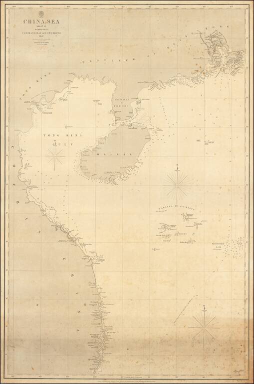
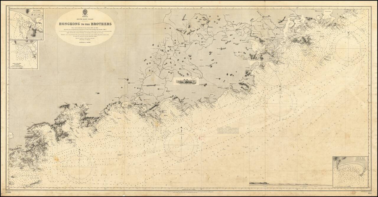
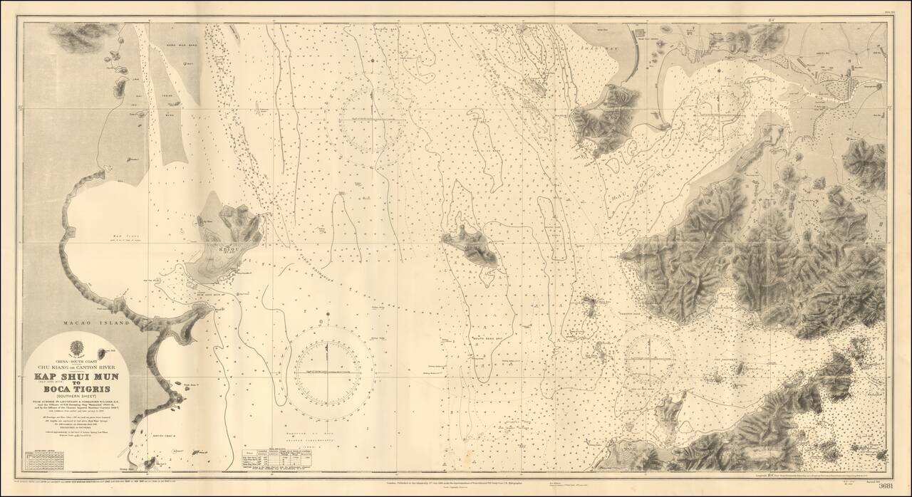
The authoritative sea chart of the southwestern coasts of China and northern Vietnam showing the main shipping route into Hong Kong during the era of the Second Opium War. This important work was part of a series of charts of the South China Sea first...
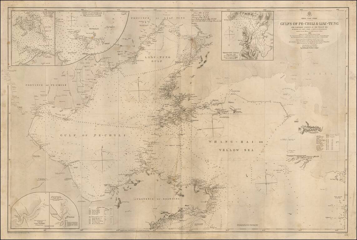
Detailed sea chart of the Coast of Northerneastern China and part of Korea, published by the British Admiralty. The map extends from the Shantung Province and Pechili Province in the west, including the river extending from Tianjin to Beijing in the...
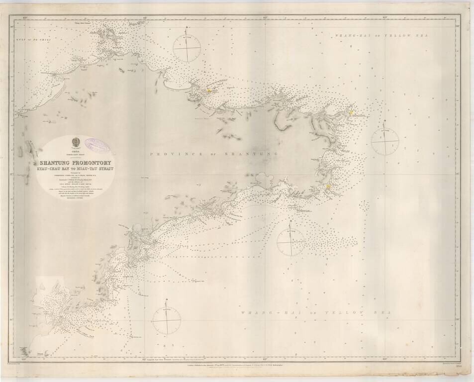
Highly detailed sea chart of the Shantung (Shandong) Province, published by the British Admiralty. The chart provides a highly detailed treatment of the region, from Kyau-Chau Bay (Jiaozhuo Bay) and the Qingdao area to Miaodoa Strait in the North and...
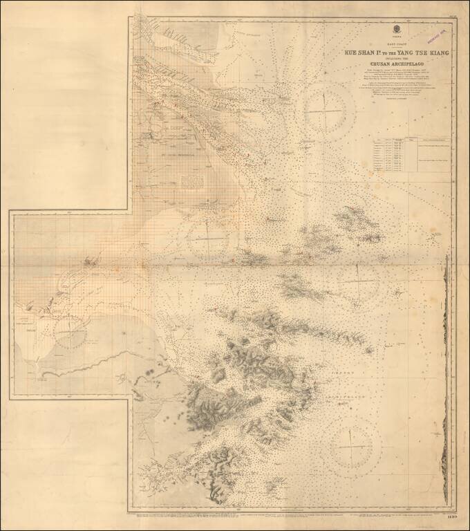
Redlined For Contemporary Use Detailed sea chart of the mouth of the Yangtze River in the north to the Zhousan Island, published by the British Admiralty. The chart includes thousands of soundings, islands, sailing directions and lighthouses,...
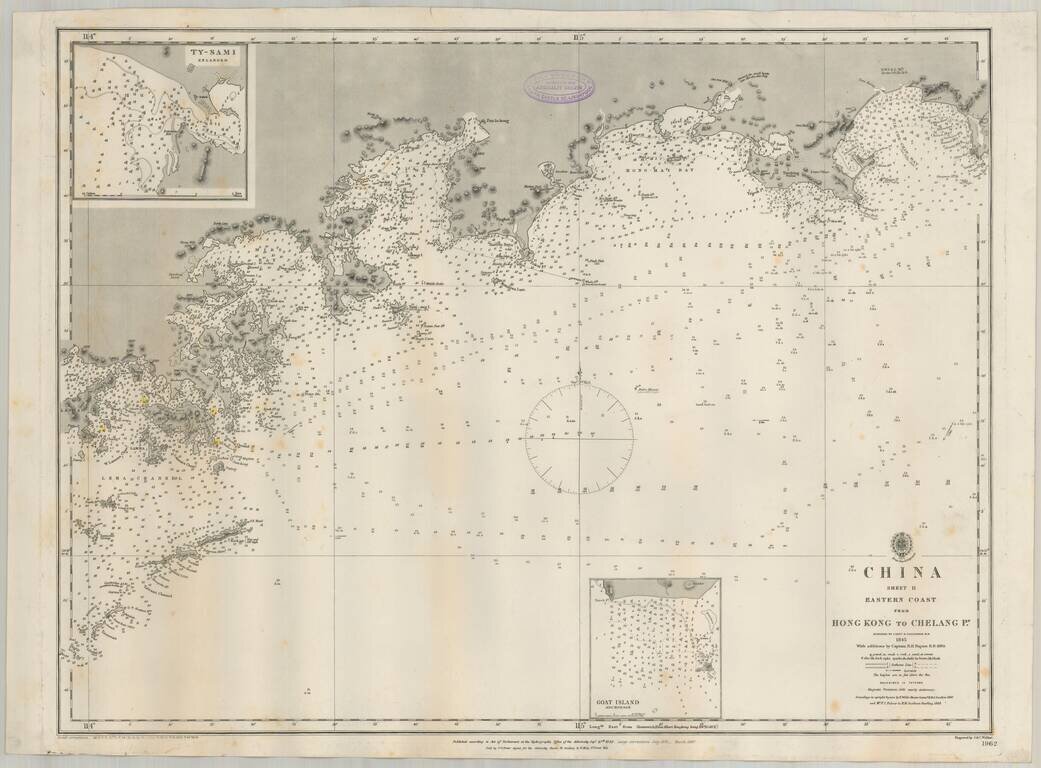
Detailed British Admiralty sea chart of China, extending from Hong Kong and the Lena Islands in the south to Hie Che Chin Bay in the north. Victoria is named on Hong Kong. The map includes extensive soundings and other sailing information. Includes...
19th Century British Navigational Chart Scarce early sea chart of the coast of China, from Hong Kong and Lantao to Nan'ao Island and Dongshan. Engraved chart, including tidal information, compass roses, soundings, seabed notations, currents,...
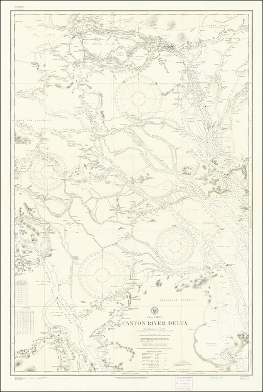
Detailed chart of the Pearl River (Zhujiang) Delta, published by the U.S. Navy Hydrographical Office based on a British Admiralty Chart published in 1909 and here updated to 1930s. The map provides significant detail of the area between Canton...
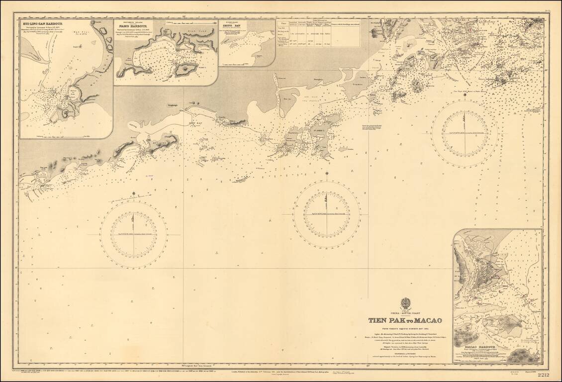
Scarce map of the the region from Macau to the west, published by the Hydrgraphic Office of the British Admiralty. Shows the South China Sea from Dianbai to Macau, centered on Hailing Island (then St. John Island). Includes insets of Macau Harbor,...
An Early Look At Shenzen Bay & Hong Kong Gold Coast Fine large format sea chart of the region between the western most part of Hong Kong, Shenzen, Macao and Lantao Island, published by the British Admiralty. The areas shown in Shenzen and Hong...
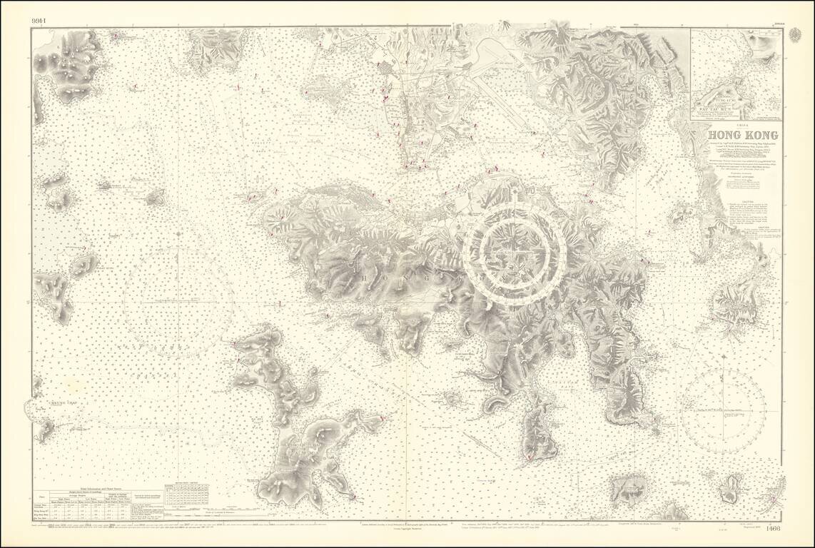
An Exceptional Post-World War II Chart of Hong Kong and Environs -- The First British survey of Hong Kong Harbor, updated to 1953 / 1964 Remarkably detailed British Admiralty Sea Chart of Hong Kong, first published in 1843, based upon the surveys of...
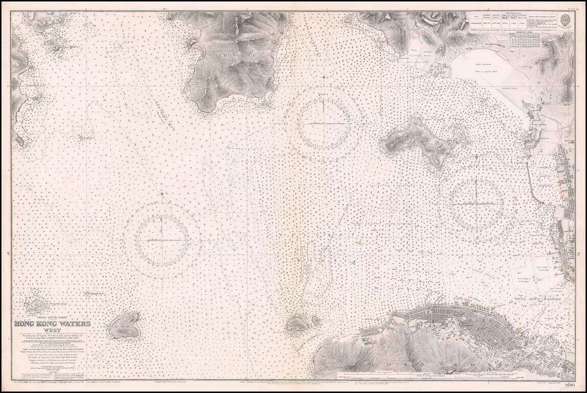
Western Approaches To Hong Kong Harbor A large-scale and detailed sea chart of the western approaches to Hong Kong Harbor, issued by the British Admiralty, including all of Victoria (Central), western Kowloon and extending westwards to Lantau...
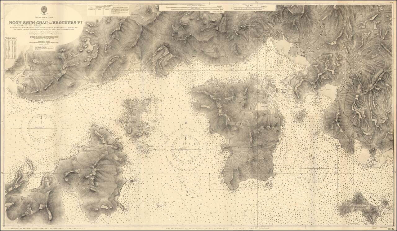
Impressive Chart of Park Island, Tsing Yi, and western Hong Kong Harbor. A very detailed chart of the section of water west of Hong Kong Harbor. The chart was first published in 1908, based on the surveys of Commander C.E. Monro of H.M.S. Rambler,...

Western Approaches To Hong Kong Harbor (Red Lined By An Early Harbor Planner) A large-scale and detailed sea chart of the western approaches to Hong Kong Harbor, issued by the British Admiralty, including all of Victoria (Central), western Kowloon...
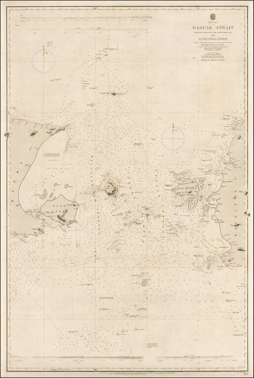
Rare example of this authoritative sea chart of the Gaspar Strait, Indonesia, a critical point of passage for navigation en route from Singapore to the Sunda Strait. This fine sea chart details the Gaspar Strait that runs between the islands of Bangka...
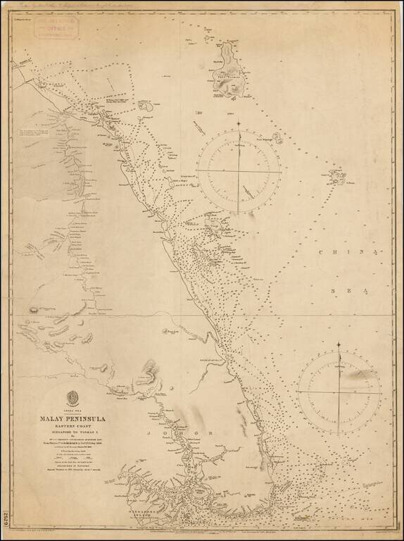
A rare British Admiralty sea, depicting southeastern Malaysia and the eastern part of the island of Singapore. This fine chart details the eastern parts of what is now the mainland Malayisian State of Johor, from the site of Jahor Bahru eastwards,...
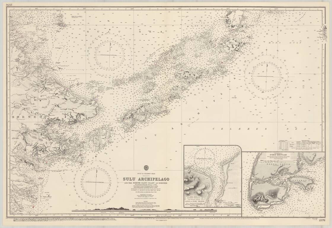
Detailed map of the Sulu Archipelago, with insets of Port Bongao, and the Tapul Group Entrance between Lapak and Siasi Islands,