The British Admiralty has produced nautical charts since 1795 under the auspices of the United Kingdom Hydrographic Office (HO). Its main task was to provide the Royal Navy with navigational products and service, but since 1821 it has also sold charts to the public.
In 1795, King George III appointed Alexander Dalrymple, a pedantic geographer, to consolidate, catalogue, and improve the Royal Navy’s charts. He produced the first chart as the Hydrographer to the Admiralty in 1802. Dalrymple, known for his sticky personality, served until his death in 1808, when he was succeeded by Captain Thomas Hurd. The HO has been run by naval officers ever since.
Hurd professionalized the office and increased its efficiency. He was succeeded by the Arctic explorer Captain William Parry in 1823. By 1825, the HO was offering over seven hundred charts and views for sale. Under Parry, the HO also began to participate in exploratory expeditions. The first was a joint French-Spanish-British trip to the South Atlantic, a voyage organized in part by the Royal Society of London.
In 1829, Rear-Admiral Sir Francis Beaufort was appointed Hydrographer Royal. Under his management, the HO introduced the wind force scale named for him, as well as began issuing official tide tables (1833). It was under Beaufort that HMS Beagle completed several surveying missions, including its most famous voyage commanded by Captain FitzRoy with Charles Darwin onboard. When Beaufort retired in 1855, the HO had nearly two thousand charts in its catalog.
Later in the nineteenth century, the HO supported the Challenger expedition, which is credited with helping to found the discipline of oceanography. The HO participated in the International Meridian Conference which decided on the Greenwich Meridian as the Prime Meridian. Regulation and standardization of oceanic and navigational measures continued into the twentieth century, with the HO participating at the first International Hydrographic Organization meeting in 1921.
During World War II, the HO chart making facility moved to Taunton, the first purpose-built building it ever inhabited. In 1953, the first purpose-built survey ship went to sea, the HMS Vidal. Today, there is an entire class of survey vessels that make up the Royal Navy’s Hydrographic Squadron. The HO began to computerize their charts in the late 1960s and early 1970s. In 1968, the compilation staff also came to Taunton, and the HO continues to work from there today.
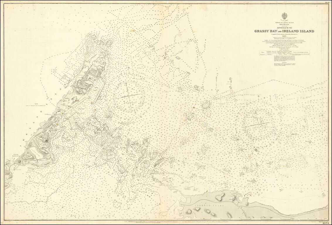
Detailed sea chart showing the approaches to Grassy Bay, Spanish Point, and Ireland Island in the Great Sound of Bermuda. The chart covers what is essentially the entrance to the "hook" of Bermuda, the Great Sound. Considerable detail is shown around...
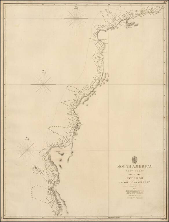
Rare coastal chart of the northern part of the Coast of Ecuador, published by the British Admiralty. The map extends from the Valdivia Region in the south to just north of Esmeraldas. Henry Kellett Henry Kellett (1806-1875), joined the Royal Navy in...
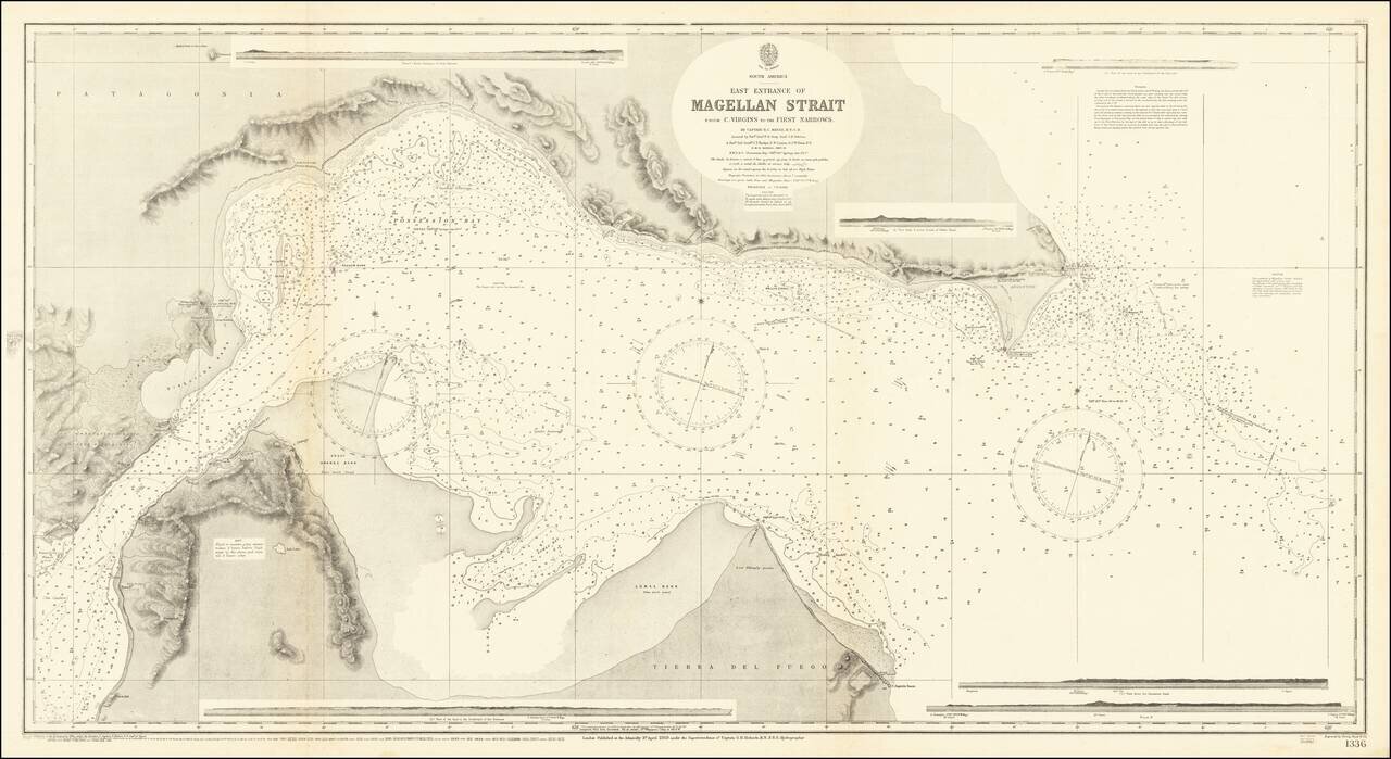
Detailed British Admiralty chart of the easternmost entrance to the Strait of Magellan. "The Light house was not visible to us before we saw it in a bearing of N 25° W true." An exceptionally detailed chart. Rarity This is the first time we have...
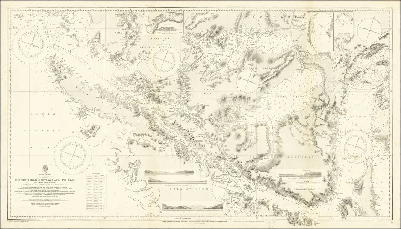
Finely executed Sea Chart of a large portion of the Straits Magellan, published by the British Admiralty. The chart is based upon a series of 19th Century surveys, with major corrections in 1885, 1898, 1903, 1910 and 1920. The map incorporates the...
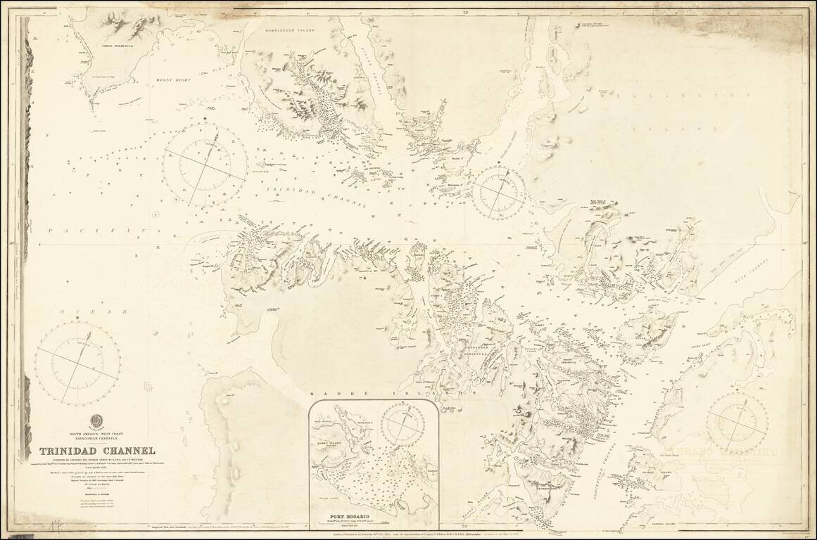
Detailed British Admiralty chart of a western section of the Strait of Magellan, illustrating the Trinidad Channel. The following report appeared in surveys of the Admiralty for 1879: On the western coast of South America, H.M.S. Alert, with an...
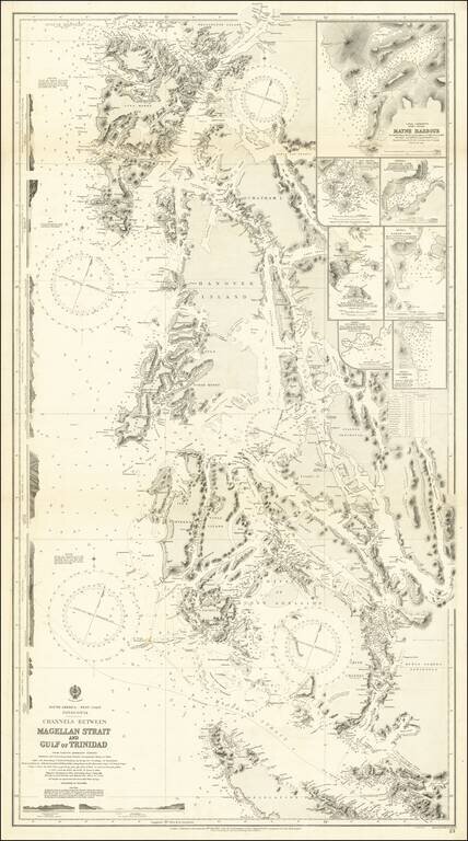
An Important Modern Charting of Southwestern Patagonia Fine chart of the western part of the Straits of Magellan and the southern part of Chile, extending north to the Reserva Nacional Alcalufes and Desolation Island. The sea chart was first issued...
![[Peruvian Coast] Sheet XII Peru Cape Lobos to Pescadores Point By Captn. Robert Fitz Roy R.N. The Officers of H.M.S. Beagle 1836](/map/small/58399.jpg)
Detailed chart of a portion of the Coast of Peru, with contemporary annotations showing use at sea in 1872. Includes four profile views. The present chart is based upon surveys on the coast of South America aboard the H.M.S. Beagle in 1836, during...
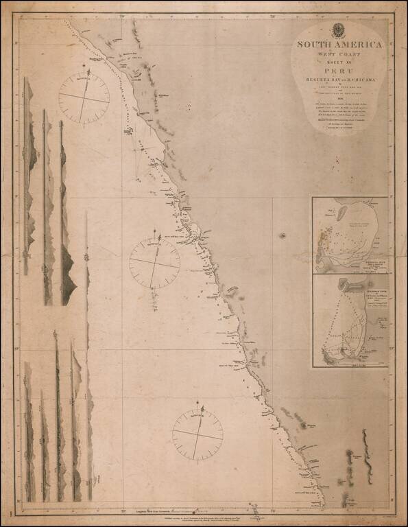
Detailed chart of a portion of the Coast of Peru, with contemporary annotations showing use at sea in 1872. Includes seven profile views. The present chart is based upon surveys on the coast of South America aboard the H.M.S. Beagle in 1836, during...
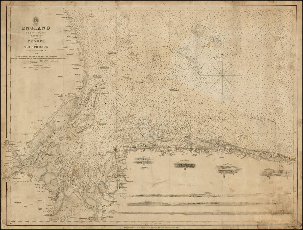
Detailed chart of the Northeastern English Coastline, from Mablethorpe and Trusthorpe to Cromer LIght House, first published by the British Admiralty in 1828 and revised by Captain I. Washington in the H.M.S. Blazer in 1843. The chart provides a...
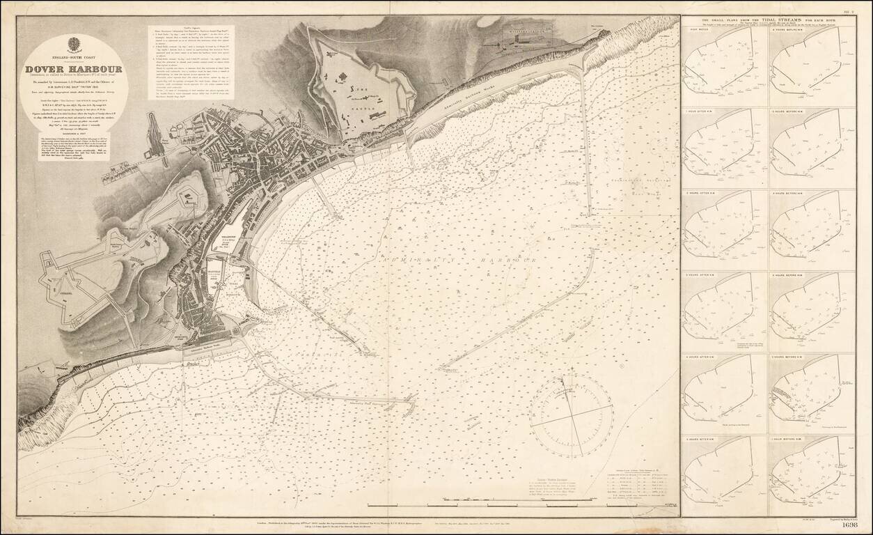
Highly detailed map of the Port of Dover, published in 1910. The finely detailed chart reflects the revisions of the Admiralty over a number of years. The Military Prison, Castle, Harbor Works, Citadel and docks are plainly illustrated, along with a...
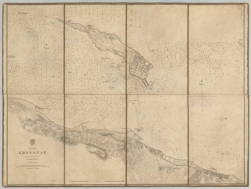
Scarce chart of the Island of Kronstat, the primary defensive position for the Russian Navy in defense of Russia's Czarist Capital of St. Petersburg. Published on the eve of the Crimean war in anticipation of the conflict with Russia, the Allied Navy...
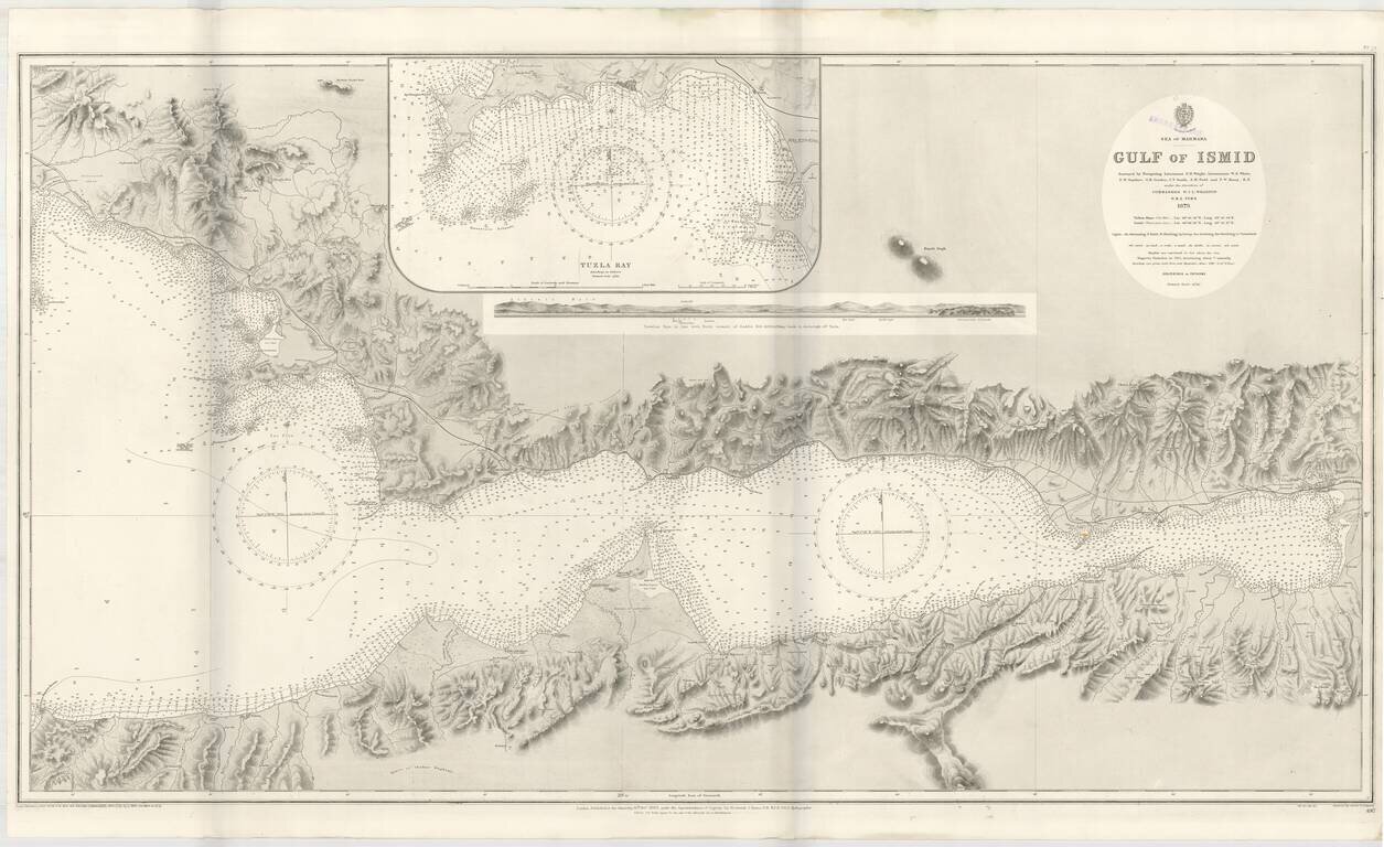
Detailed sea chart of the Gulf of Ismit, the easternmost part of the Sea of Marmara. This elaborate and highly detailed chart extends from Ismit in the east to Sedef Island (Prince Islands), Kartal and the southeastern suburbs of Istanbul in the North,...
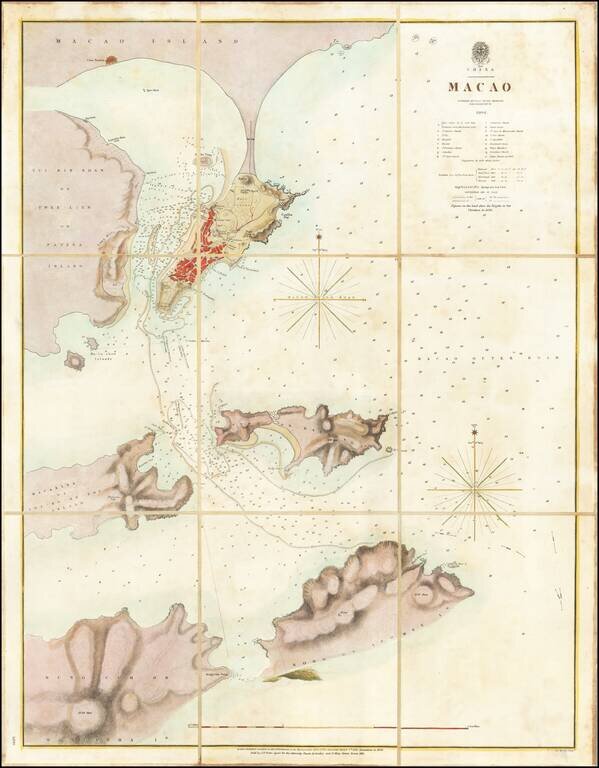
A Surreptitious Survey of Macau By A Famed British Officer Rare separately published sea chart of Macau, published by the British Admiralty, based upon the work of Peter Heywood, of Mutiny on the Bounty fame. The chart shows the town of Macau,...
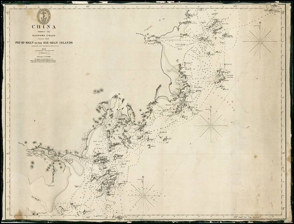
Rare early sea chart of the coast of China, from Taizhou to Wenzhou. Detailed chart, with extensive soundings and other sailing information. Includes pencil notes showing contemporary charting.
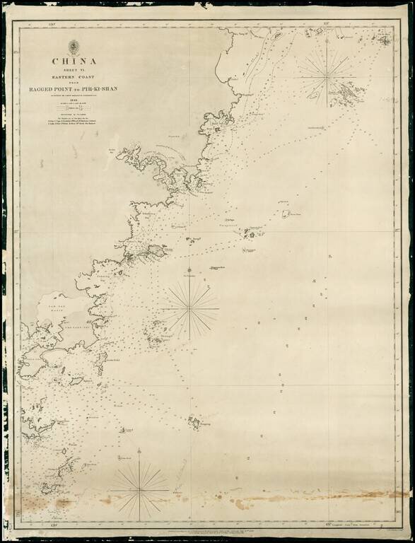
Rare early sea chart of China, showing the coast from Pingyang to Huangqiwan. Detailed chart, with extensive soundings and other sailing information. Includes pencil notes showing contemporary charting.
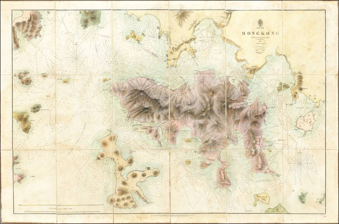
The First Printed Map of Hong Kong Early edition of the first printed map of Hong Kong, first published in 1843 by the British Admiralty Chart of Hong Kong, based upon the surveys of Sir Edward Belcher. Belcher's survey is the first large format map...