Gilles Robert de Vaugondy (1688-1766) was the head of a leading family of geographers in eighteenth century France. Gilles got his start when he jointly inherited the shop of Pierre-Moullart Sanson, grandson of the famous geographer Nicholas Sanson. The inheritance included the business, its stock of plates, and a roller press. In 1760 Gilles became geographer to King Louis XV. His son, Didier Robert de Vaugondy (ca. 1723-1786), was also a geographer and the two worked together. They were known for their exactitude and depth of research. In 1757, they produced the Atlas Universel, considered an authority for many years.
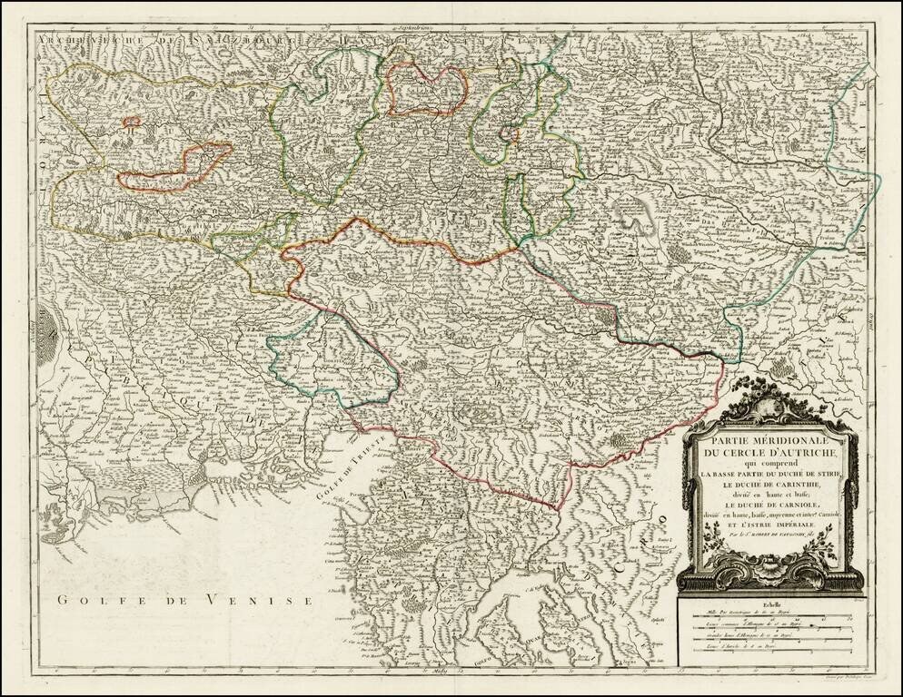
Detailed regional map of the region north of the Gulf of Venice, Istria, etc.. Shows the Southern portion of the Austrian Empire, from the Republic of Venice and the Gulf of Venice in the west to the Croatian Border. Shows Salzburg, Graz, Rijeka,...
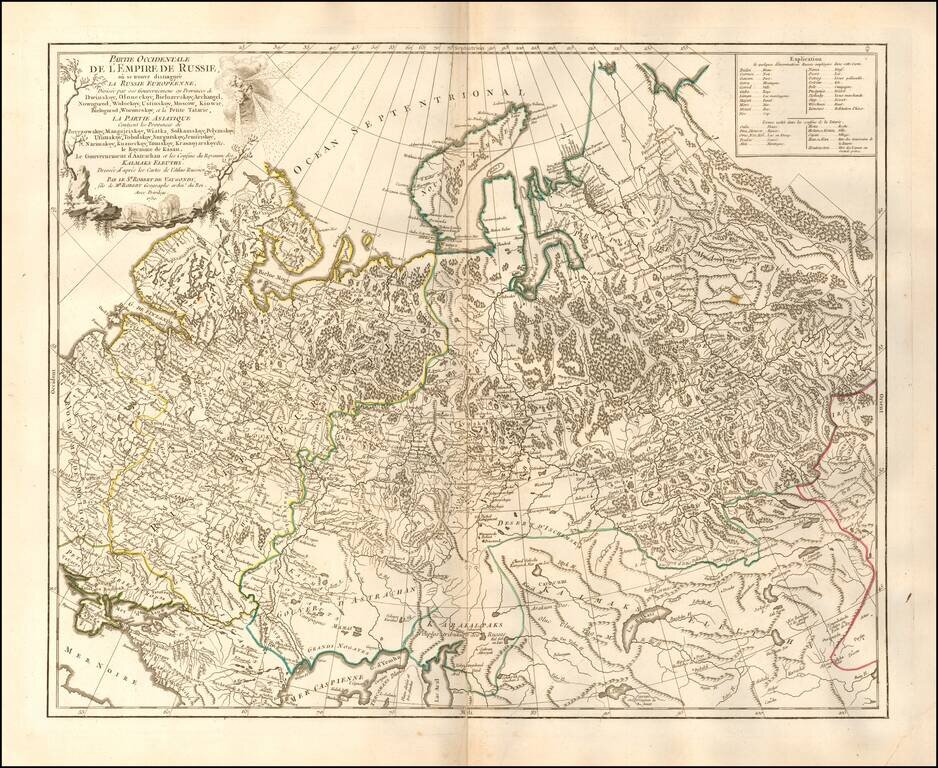
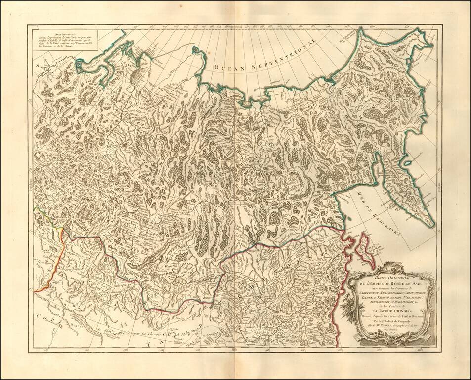
Highly detailed map of the Western Part of Russia, extending South to the Caspian and East to Irkurkoy and Ilimskoy.
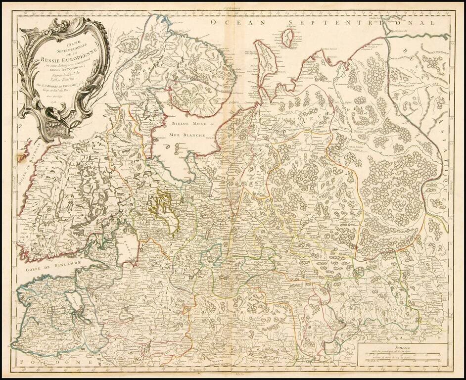
Highly detailed map of the Northwestern part of Russia, from the Gulf of Finland and Poland, to the western part of Asian Russia. Decorative cartouche.
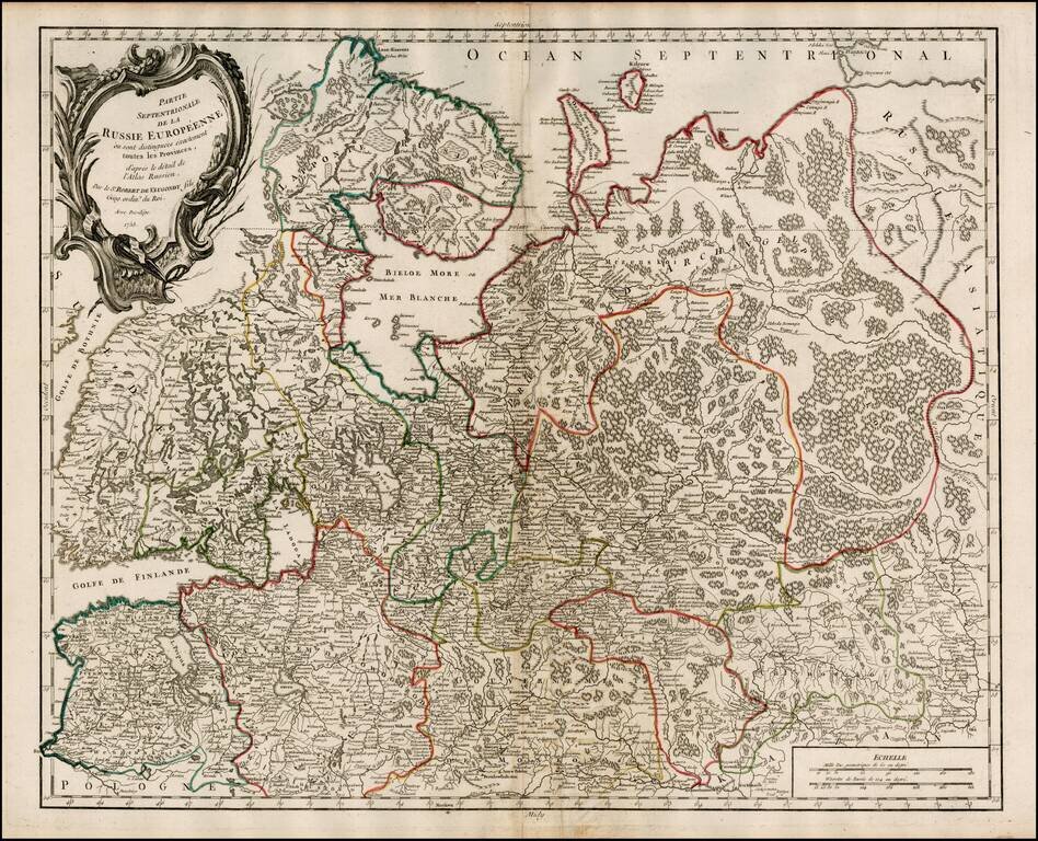
Highly detailed map of the Northwestern part of Russia, from the Gulf of Finland and Poland, to the western part of Asian Russia. Decorative cartouche.
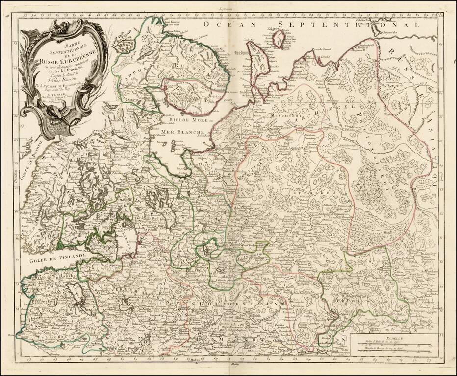
Highly detailed map of the Northwestern part of Russia, from the Gulf of Finland and Poland, to the western part of Asian Russia. Decorative cartouche.
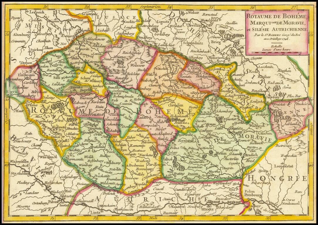
Detailed map of the Bohemia, Moravia and Austrian Silesia, published in De Vaugondy's first atlas.
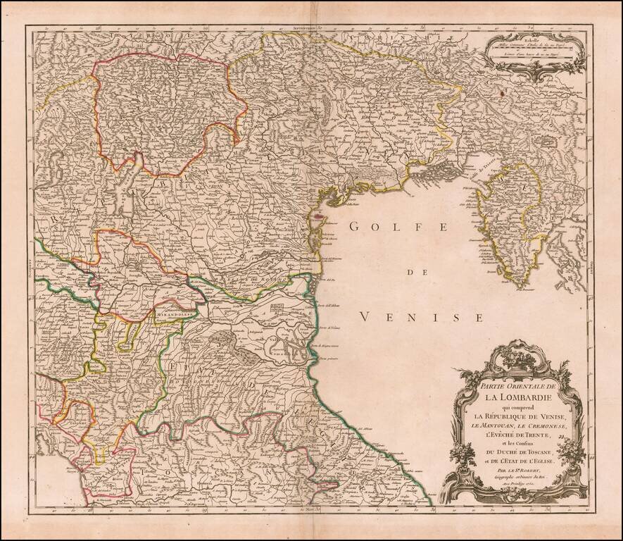
Highly detailed map of the Eastern part of the Lombardy region, from DeVaugondy's Atlas Universel. Includes towns, mountains, rivers, lakes and a host of other details. Decorative Cartouche. De Vaugondy's atlas was one of the most successful and...
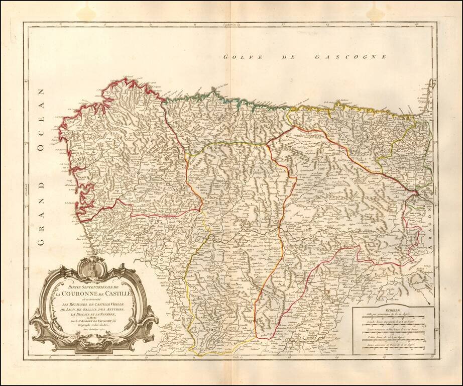
Decorative and highly detailed map of Northwestern Spain, including Biscaya, Gallicia, Leon, Asturias, Old Castille, and New Castille. A finely detailed map, with decorative cartouche.
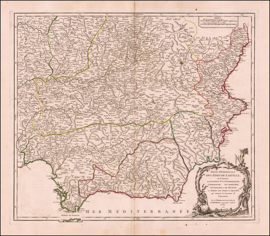
Decorative and highly detailed map of Southwestern Spain and including a decorative cartouche.
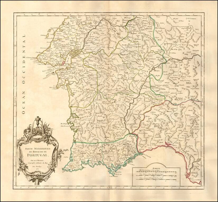
Nice example of the first edition of De Vaugondy's map of the southern part of Portugal. Lisbon and the Barra da Lisboa are prominently featured. Several hundred towns are shown. Decorative cartouche. An excellent large format map from the middle of...
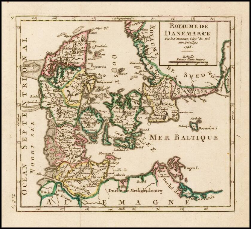
Detailed map of Denmark, colored by Dioceses, and showing towns, rivers, mountains, ports, islands, etc. From De Vaugondy's Atlas Portatif.
Fascinating and attractive map of the Northeastern portion of Asia, including Russia, China, the Gobi Desert, etc. Includes cities, villages, rivers, mountain ranges and various coastal islands.
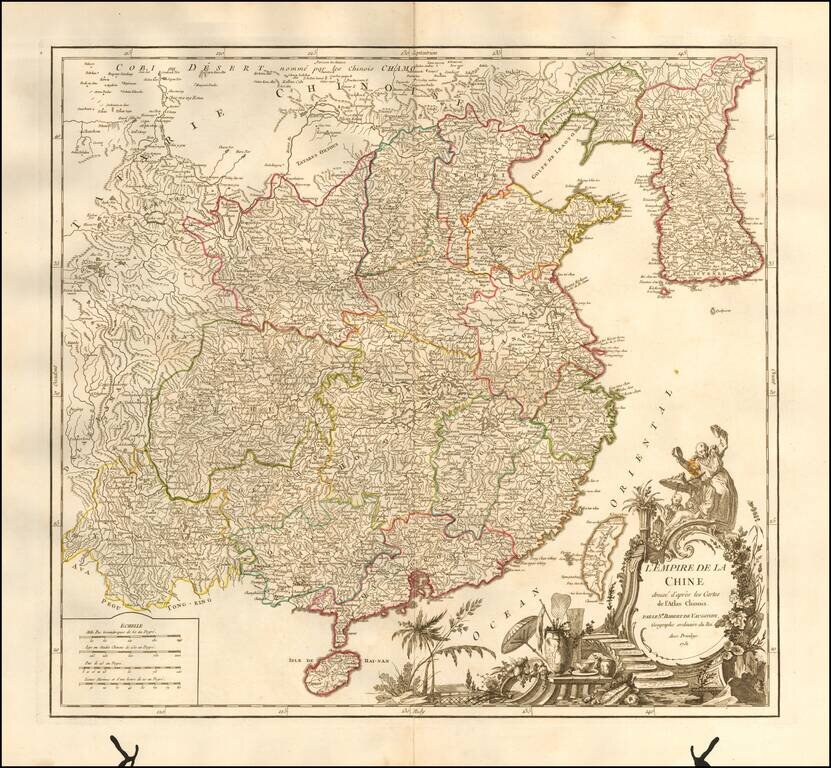
Striking large format map of China & Korea, from De Vaugondy's Atlas Universel. Includes a large and detailed Formosa. Beautifully colored by province, with a striking full-color cartouche. Includes the Island of Taiwan or Formosa.
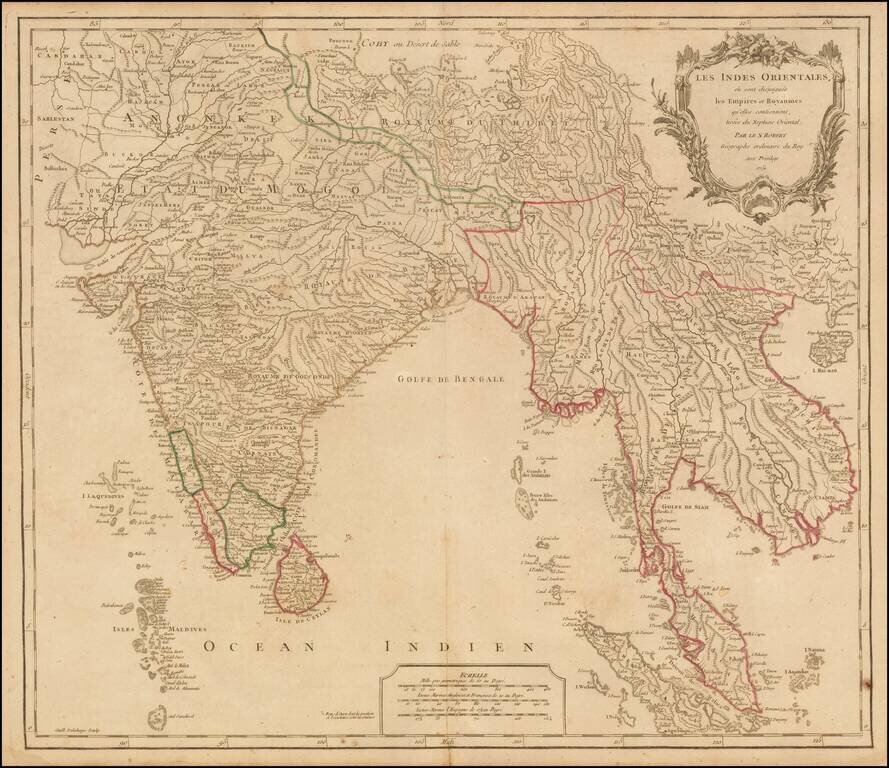
Nice example of Robert De Vaugondy's map of India & Southeast Asia, from his Atlas Universel. Publisher's outline hand-color.
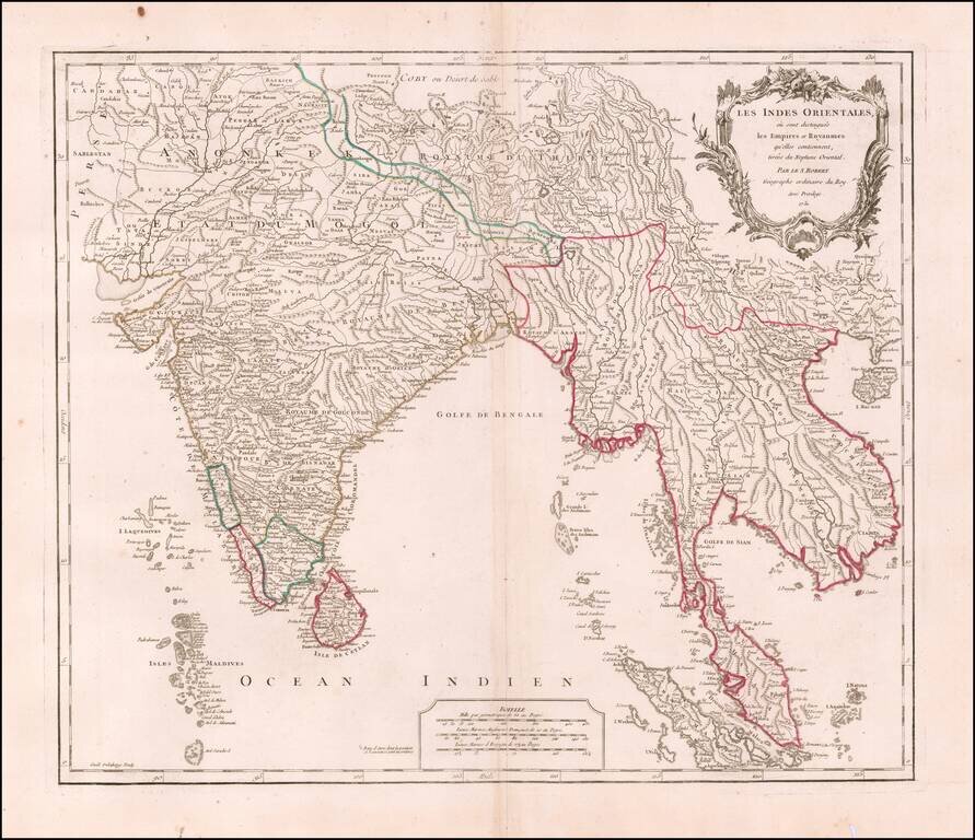
Interesting regional map extending from India, the Ganges and the Maldive Islands to Hai-nan, Cochinchina, the Straits of Malacca and Sumatra, from DeVaugondy's Atlas Universel. Includes islands, towns, mountains, rivers, lakes and a host of other...
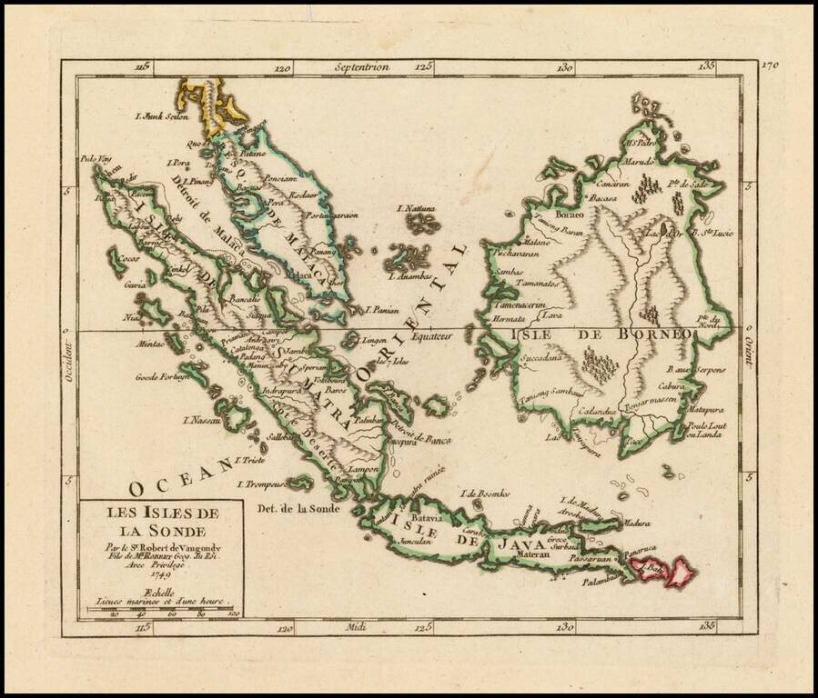
Attractive map of the Straits of Singapore, Sumatra, Java, Malaca, Borneo and neighboring islands, showing towns, harbours, bays, and other details. The map appeared in De Vaugondy's Atlas Portatif.