Gilles Robert de Vaugondy (1688-1766) was the head of a leading family of geographers in eighteenth century France. Gilles got his start when he jointly inherited the shop of Pierre-Moullart Sanson, grandson of the famous geographer Nicholas Sanson. The inheritance included the business, its stock of plates, and a roller press. In 1760 Gilles became geographer to King Louis XV. His son, Didier Robert de Vaugondy (ca. 1723-1786), was also a geographer and the two worked together. They were known for their exactitude and depth of research. In 1757, they produced the Atlas Universel, considered an authority for many years.
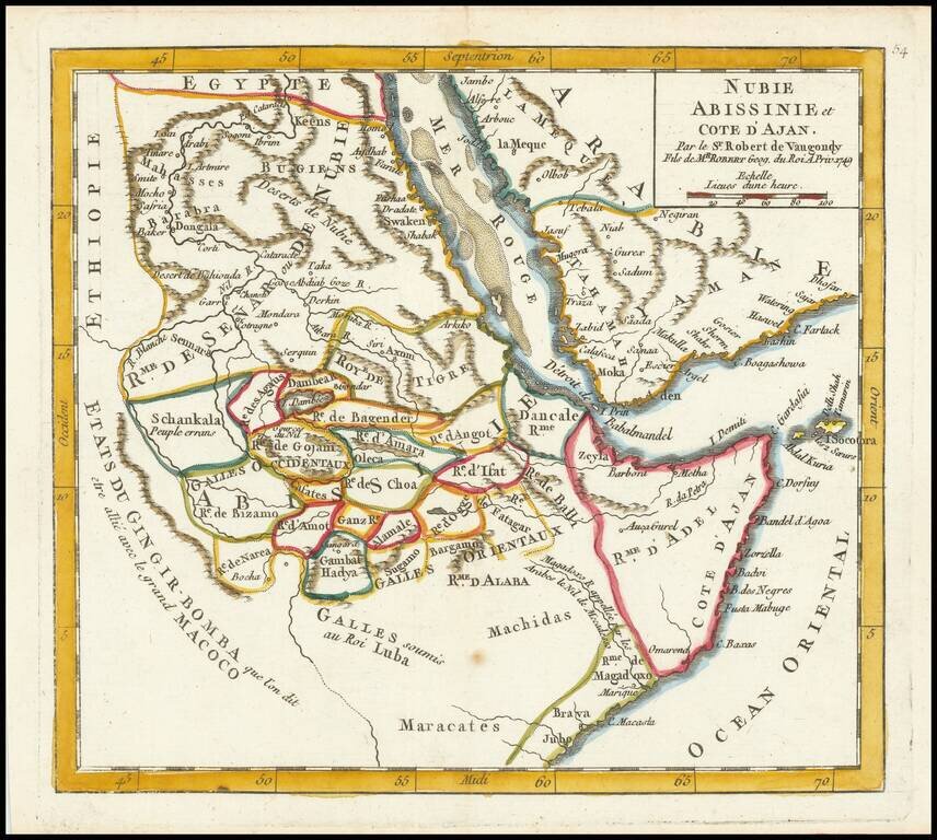
Detailed map of part of the area centered on the Red Sea and the Horn of Africa, featuring modern-day Somalia and Ethiopia. The map features numerous small kingdoms, including the "Rme. de Magadoxo" in Somalia, presumably related etymologically to...
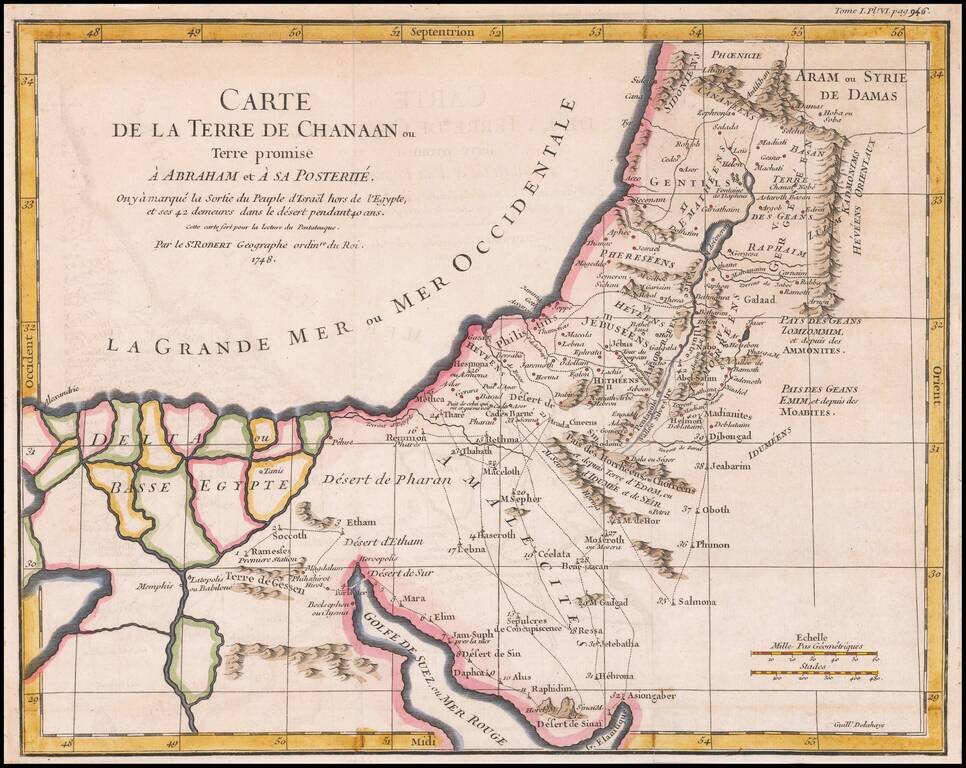
Detailed map of Ancient Canaan and the Nile River Delta. Includes the route of Moses and the Israelites as they wandered the Desert for 40 years.
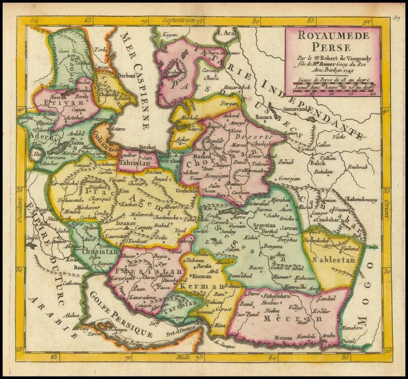
Detailed map of Persia, showing the extent of its territory from the border with the Mogol Empire to the Caucasus and the eastern side of the Caspian Sea. Internal regions are named and colored individually.
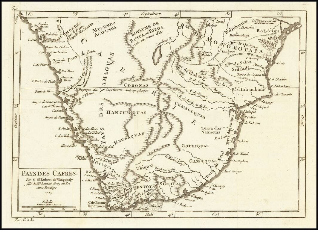
Attractive map of South Africa, from this popular atlas of the mid-18th Century.
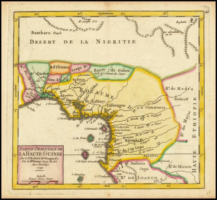
Detailed map of the Gulf of Guinea, published in Paris in 1749 Includes all or part of the modern countries of Ghana, Togo, Benin, Nigeria, Cameroon, Equatorial Ginea and Gabon, which at the time was primarily the "Kingdom of Benin."
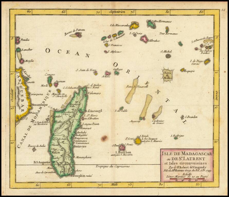
Detailed engraved map of Madagascar, the Mascarene Islands, and other nearby Indian Ocean African islands, published in De Vaugondy's first atlas. The map extends as far east as Chagos and as far west as Zanzibar.