John Tallis (1817-1876) was a British map publisher. Born in the Midlands, Tallis came to London in the 1840s. Tallis began his London career with a series of remarkable London street views. He began a partnership with a Frederick Tallis, possibly his brother, but their collaboration ended in 1849. For the Great Exhibition of 1851, Tallis published the Illustrated World Atlas, one of the last series of decorative world maps ever produced. The maps were engraved by John Rapkin, a skilled artisan. The maps were later reissued by the London Printing & Publishing Company, who left the Tallis imprint intact, thus ensuring his enduring fame. In 1858, he began publication of the popular Illustrated News of the World and National Portrait Gallery of Eminent Personages, selling it in 1861 (it ceased publication in 1863).
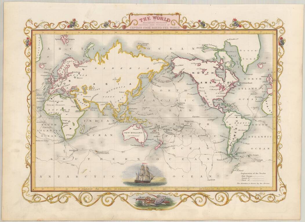
Full color example of this marvelous map with a beautiful decorative border, based upon the 3 voyages of of Captain James Cook. An amazing depiction of a sailing vessel of the time, likely intended to represent Cook's Endeavour. Engraved for R....
![Western Hemisphere [and] Eastern Hemisphere](/map/small/46484.jpg)
Nice full color example of these highly decorative maps of the Western Hemisphere and Eastern Hemisphere, each with 12 decorative vignettes. Perhaps the most decorative mid 19th Century Atlas map of its type. Engraved for R. Montgomery Martin's...
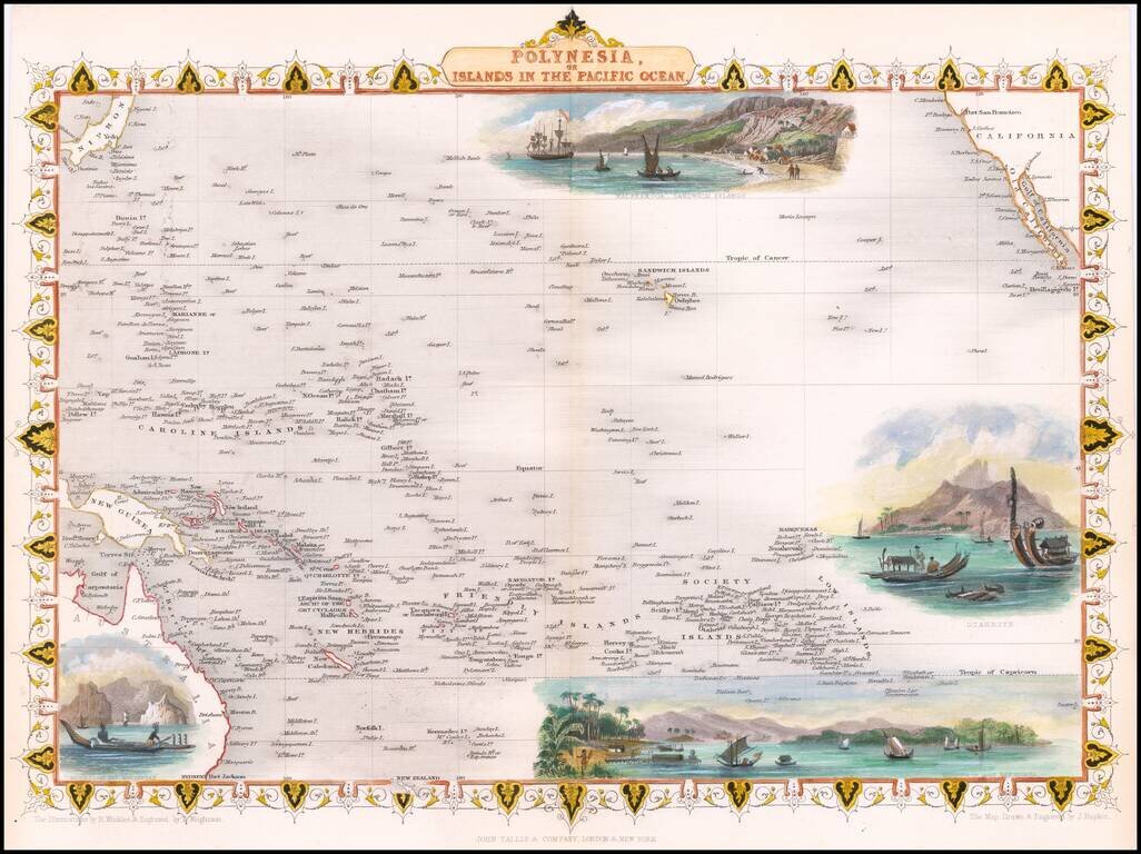
Nice full color example of John Tallis' map of the South Pacific. The map includes large vignettes of Kalakakooa Sandwich Islands, Otaheite, the Harbour of Dory in New Guinea and Resolution Bay, Marquesas. Engraved for R. Montgomery Martin's...
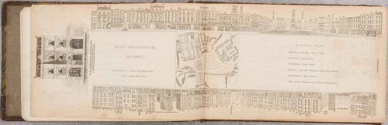
A Nice Set of Tallis's London Views That We Can Find Having Come to the Market. An impressive run of 47 parts (of 88) of John Tallis's fantastic project to provide a view of every major street in London during the late 1830s. This set includes views...
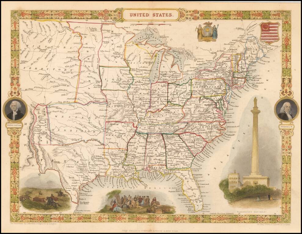
Attractive full color example of Tallis' map of the United States. The map shows an oddly configured Texas and New Mexico, pre-Indian Territory region called Western Territory, massive Missouri Territory, odd elongated Nebraska Territory extending to...
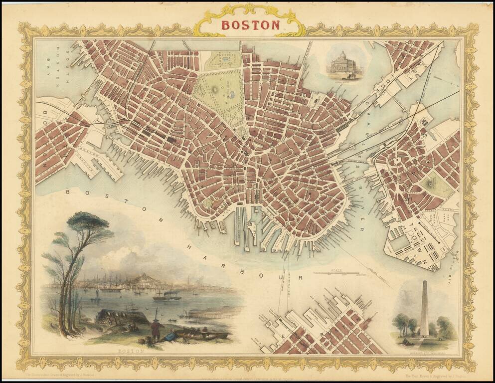
Striking full color example of Tallis's town plan of Boston, with a massive view and vignettes of Bunker Hill Monument and the State House. One of the most decorative and sought after town plans of the City to appear in an atlas in the mid-19th...
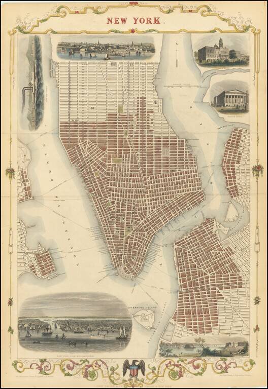
Striking full-hand-color example of Tallis's town plan of New York City, one of the few double-page plans published by Tallis. Includes vignettes of City Hall, the Custom's House, the Narrow's from Fort Hamilton, a New York Steamer, and two larger...
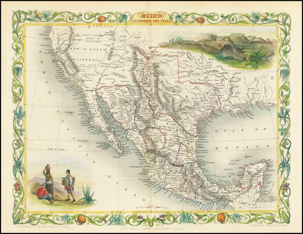
Rare variant edition of this decorative regional map of the Texas, California and the Southwest, featuring Texas in its Republic configuration, with Stovepipe reaching to Wyoming and Colorado. Upper California is shown with the Gold Regions...
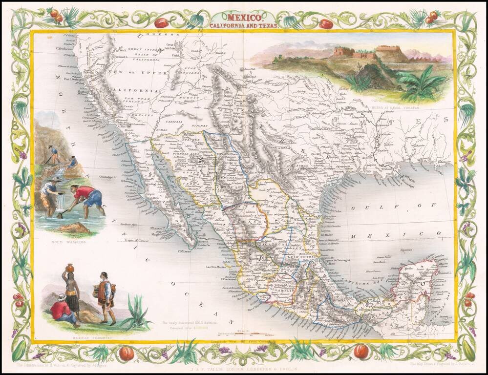
Decorative regional map of the Texas, California and the Southwest, featuring Texas in its Republic configuration, with Stovepipe reaching to Wyoming and Colorado. This is the second edition of the map, which includes the Gold Washing vignette not...
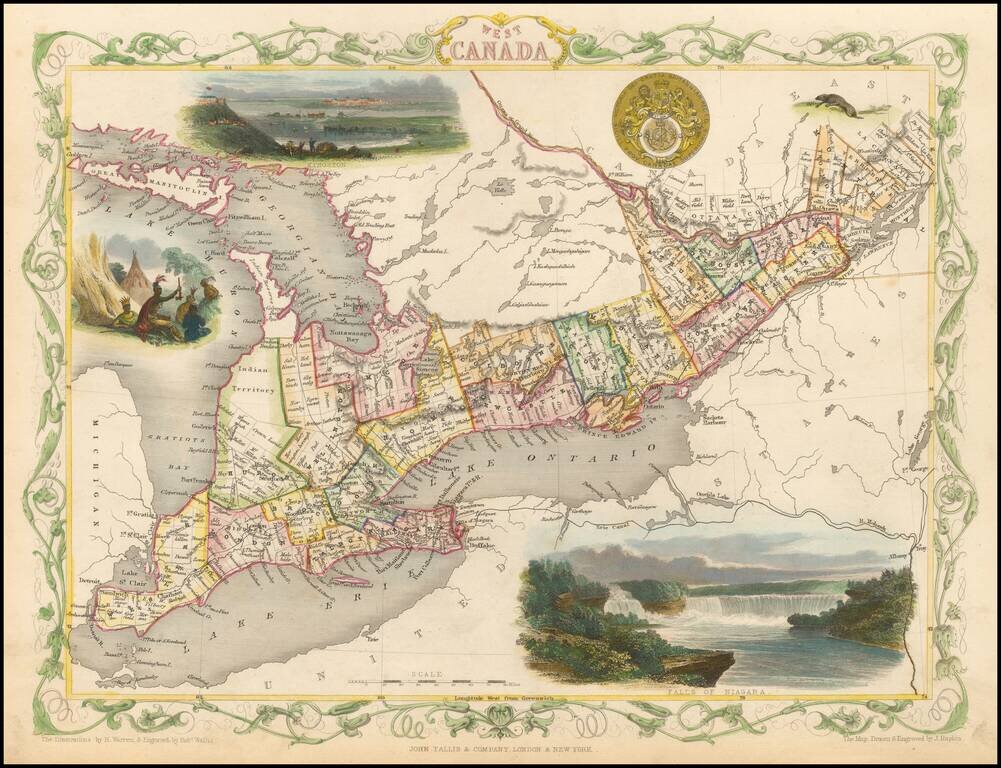
Interesting and highly detailed map of the Great Lakes region, showing counties and townships, Lake Huron, Lake Ontario and Lake Erie, as well as the Erie Canal and Mohawk River. Vignettes of Kingston, Niagara Falls and Indians in an encampment, along...
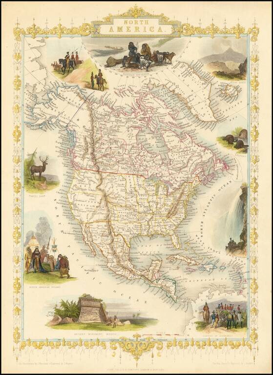
Nice full color example of Tallis's map of North America. Includes decorative vignettes of Esquimaux's Mount Hekla, Beavers, Niagara Falls, a Convoy of Diamonds, Ancient Monument in Mexico, North American Indians, Wapiti Deer, and Russian Cossacks!...
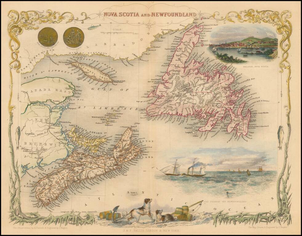
Striking full color example of this marvelous map of Nova Scotia, Newfoundland and the Gulf of St. Lawrence. Decorative Vignettes of Halifax, Cod Fishery Off Newfoundland, and several others. Engraved for R. Montgomery Martin's Illustrated Atlas....
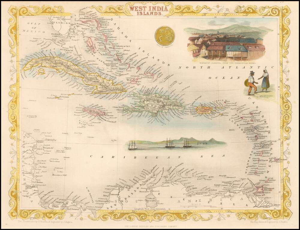
Striking full color example of this marvelous map. Showing vignettes of Kingston, Jamaica, from the commercial rooms. Also showing the harbors and people trading. The Seal of Jamaica is shown in its splendor. Engraved for R. Montgomery Martin's...
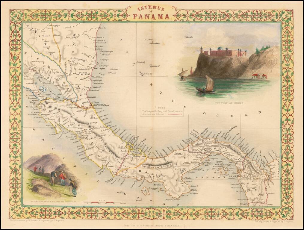
Striking full color example of this marvelous map. Showing vignettes of the Fort at Chagres and Gold seekers on their way over the cordilleras, also showing proposed railways. Engraved for R. Montgomery Martin's Illustrated Atlas of the World. Tallis...
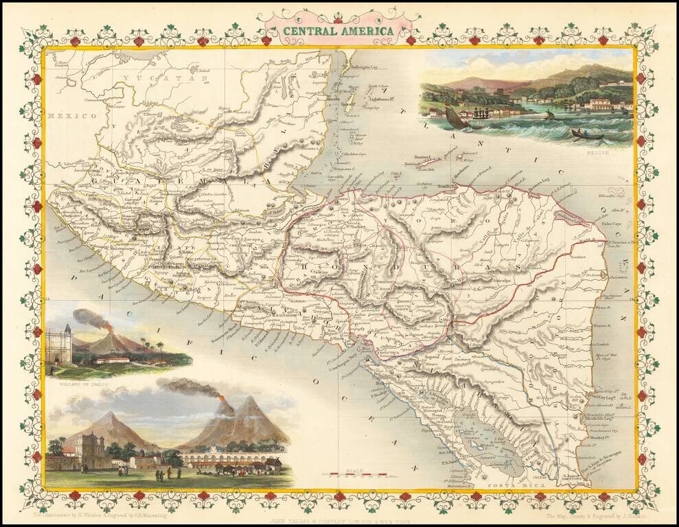
Striking full color example of this wonderful decorative map of Central America, including Guatemala, Honduras, El Salvador, Nicaragua and "Mosquito Territory." In the body of the map is outline color by country. The map features vignettes of Volcano...
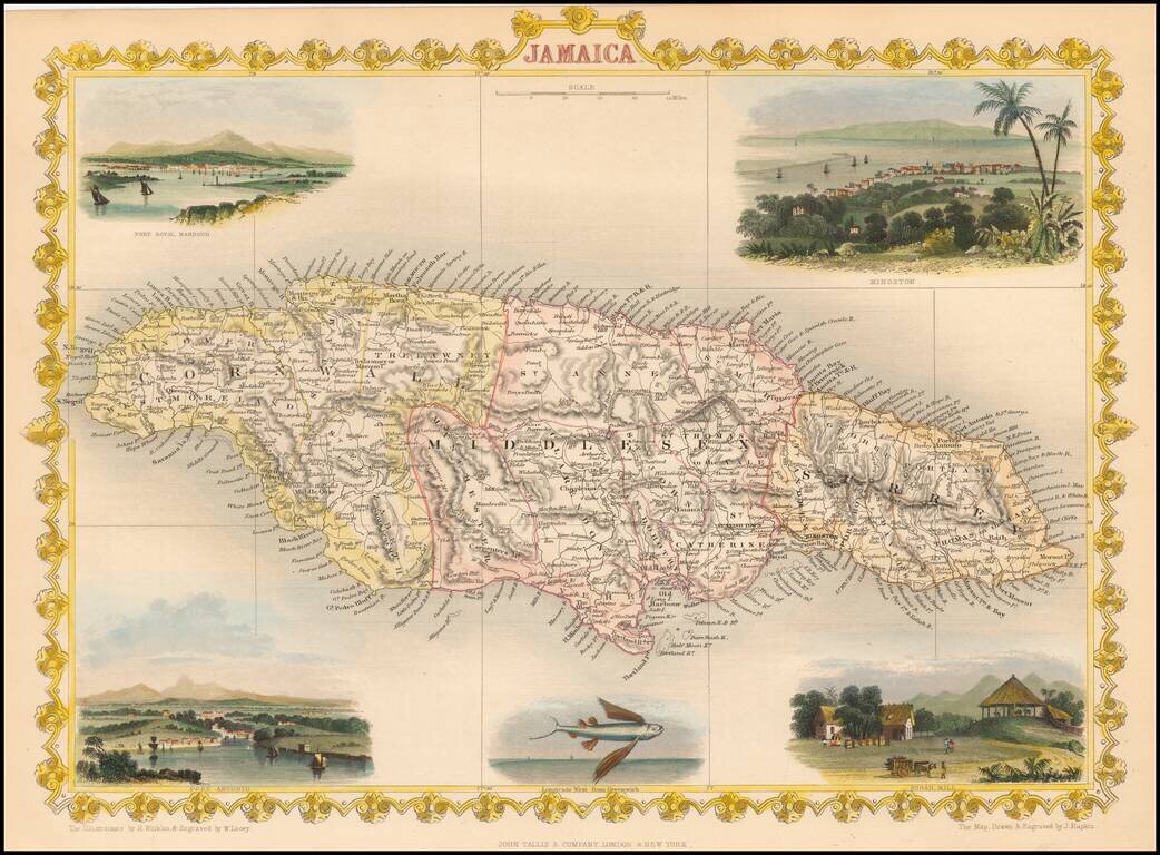
Nice full color example of Tallis' map of Jamaica, with decorative vignettes of Kingston, Port Antonio, Fort Royal Harbour and Sugar Mill. Engraved for R. Montgomery Martin's Illustrated Atlas. Tallis was one of the last great decorative map makers....