John Tallis (1817-1876) was a British map publisher. Born in the Midlands, Tallis came to London in the 1840s. Tallis began his London career with a series of remarkable London street views. He began a partnership with a Frederick Tallis, possibly his brother, but their collaboration ended in 1849. For the Great Exhibition of 1851, Tallis published the Illustrated World Atlas, one of the last series of decorative world maps ever produced. The maps were engraved by John Rapkin, a skilled artisan. The maps were later reissued by the London Printing & Publishing Company, who left the Tallis imprint intact, thus ensuring his enduring fame. In 1858, he began publication of the popular Illustrated News of the World and National Portrait Gallery of Eminent Personages, selling it in 1861 (it ceased publication in 1863).
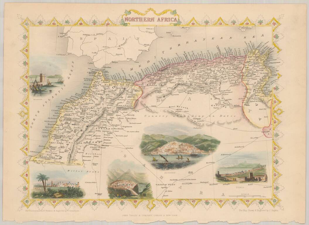
Decorative full color example of Tallis' map of Northern Africa, with vignettes showing Morocco, Constantine, Tunis, Algiers and Mogador. The map was engraved for R. Montgomery Martin's Illustrated Atlas. Tallis was one of the last great decorative...
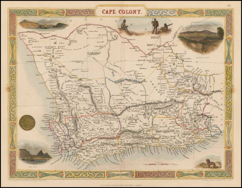
Striking full color example of Tallis' decorative map of Cape Colony, South Africa. Decorative vignettes of Entrance to the Knysna, Graham Town anand Cape Town. Engraved for R. Montgomery Martin's Illustrated Atlas. Tallis was one of the last great...
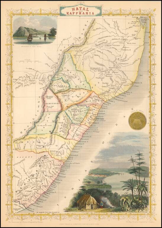
Striking full color example of this marvelous map. Decorative vignettes of Entrance to Port Natal. Engraved for R. Montgomery Martin's Illustrated Atlas. Tallis was one of the last great decorative map makers. His maps are prized for the wonderful...
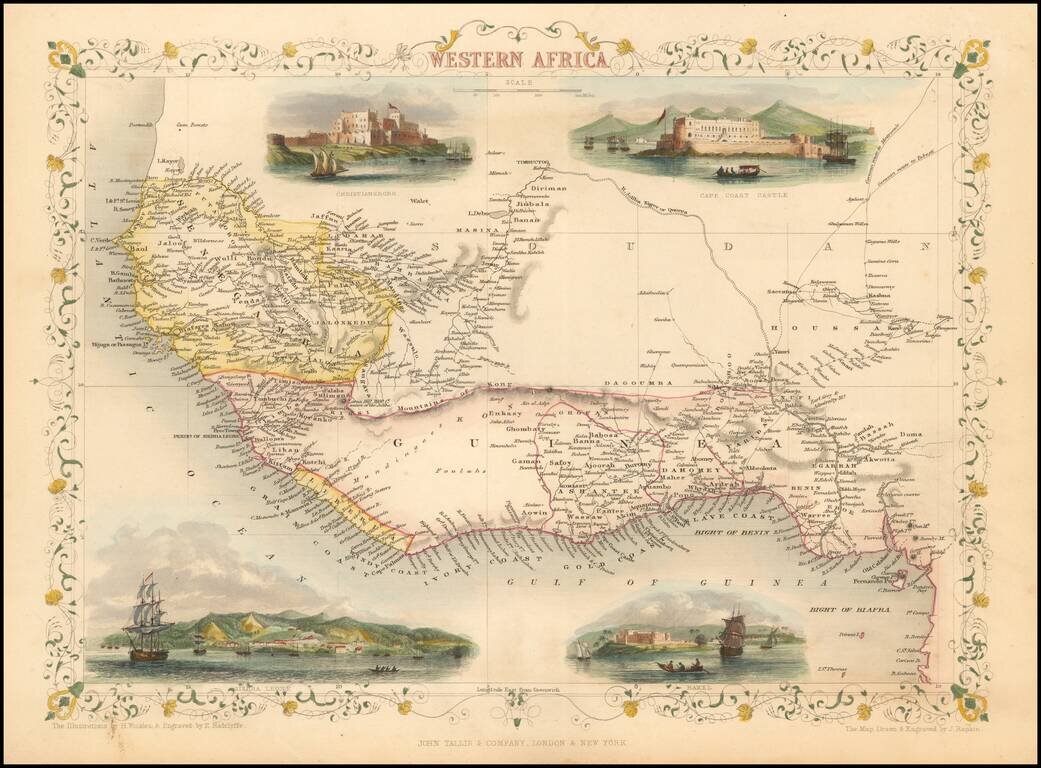
Decorative map of Western Africa, showing towns, roads, rivers, lakes, mountains, etc. Vignettes show Chirstianborg, Cape Coast Castle, Bakel and Sierra Leone. Engraved for R. Montgomery Martin's Illustrated Atlas. Tallis was one of the last great...
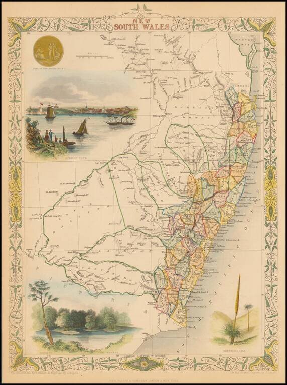
Striking full color example of this marvelous map. Includes vignettes of Sydney, The Murray and Xanthorrhea, plus a seal. Engraved for R. Montgomery Martin's Illustrated Atlas. Tallis was one of the last great decorative map makers. His maps are...
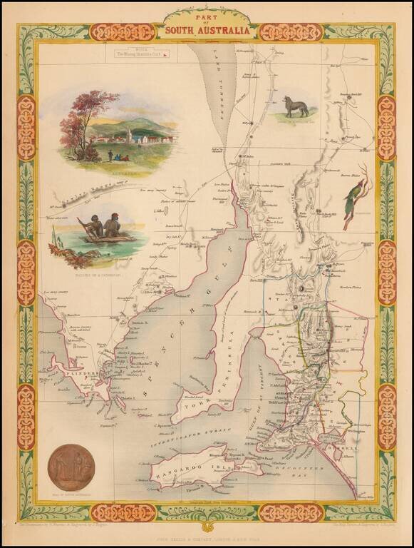
Interesting and detailed map of South Australia, centered on Spencer Gulf and York Peninsula and extending to Encounter Bay and Port Drummond. Vignettes show Adelaide, Aborigines on a raft, a Dingo, a Nymphicus and the seal of South Australia. Colored...
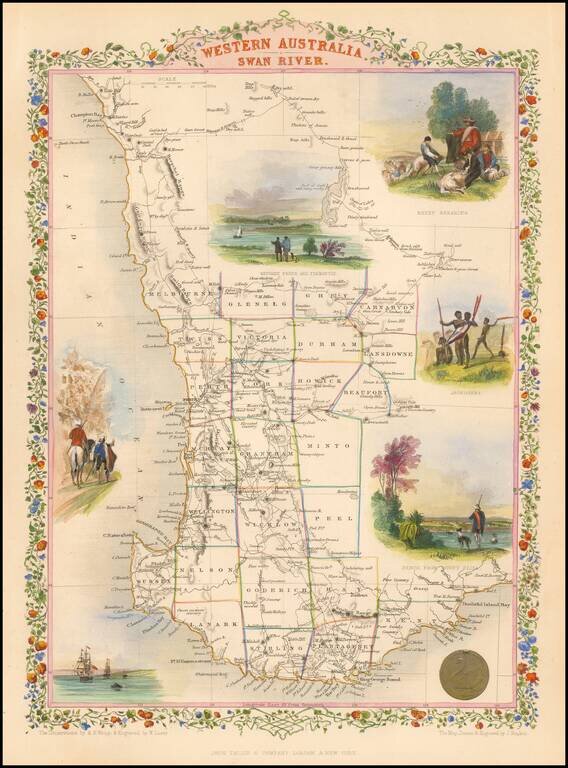
Gorgeous full color example of this decorative map, extending from Champion Bay to Doubtful Island Bay and colored by counties. Shows vignettes of Sheep Shearing, Aborigines, Perth From Mount Eliza and three other vignettes. Engraved for R. Montgomery...
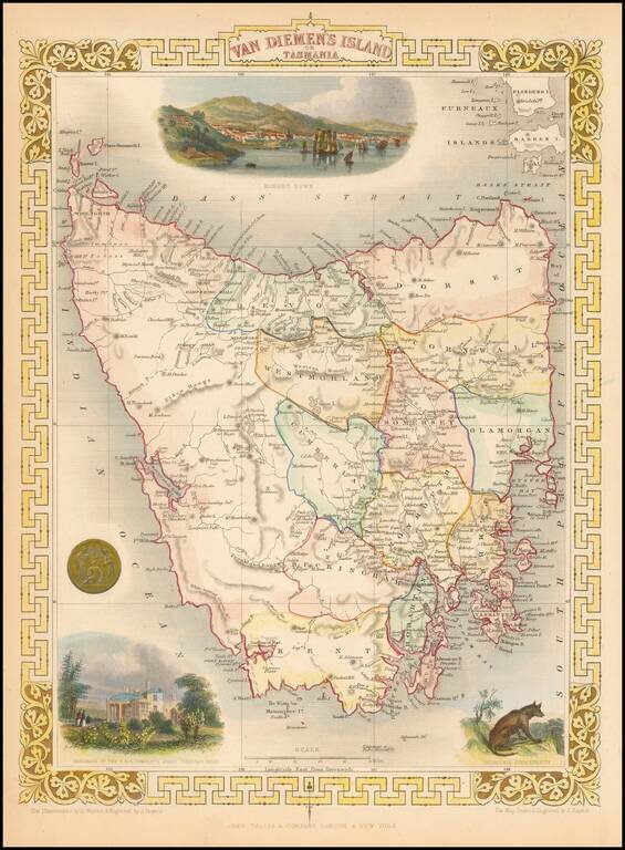
Stunning full color example of this marvelous map. Decorative Vignettes of Hobart Town, the Residence of the V.D.L Company's agent, Circular Head and two other vignettes. Engraved for R. Montgomery Martin's Illustrated Atlas. Tallis was one of the...
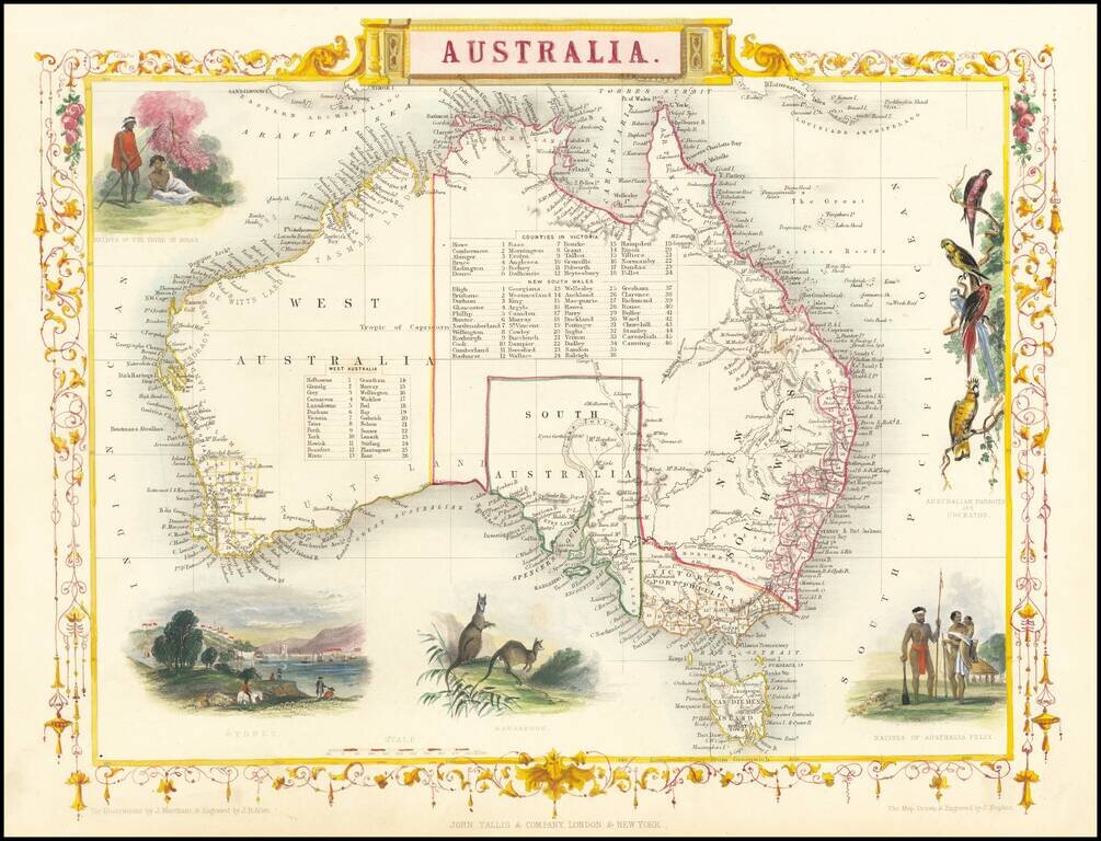
Gorgeous full color example of this wonderful map of Australia, with vignettes of Parrots, two sets of Aborigines, Kangaroos, and Sydney. Two sets of tables of counties in Victoria and NSW. Engraved for R. Montgomery Martin's Illustrated Atlas. Tallis...
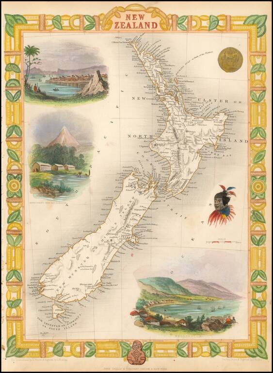
Nice full color example of Tallis' map of New Zealand. Includes decorative vignettes of Auckland, Wellington, Mount Egmont from New Plymouth, a Maori Warrior and seal. Engraved for R. Montgomery Martin's Illustrated Atlas. Tallis was one of the last...
![[Title Page] The Illustrated Atlas and Modern History of the World](/map/small/45335.jpg)
Nice full color example of the Title page from this famous British Atlas. Tallis was one of the last great decorative map makers. His maps are prized for the wonderful vignettes of indigenous scenes, people, etc.
![[Title Page] The Illustrated Atlas and Modern History of the World](/map/small/56568.jpg)
Nice example of the Title page from this famous British Atlas. John Tallis was one of the last great decorative map makers before the complete dominance of purely utilitarian, unadorned maps. His maps are prized for the wonderful vignettes of exotic...