John Tallis (1817-1876) was a British map publisher. Born in the Midlands, Tallis came to London in the 1840s. Tallis began his London career with a series of remarkable London street views. He began a partnership with a Frederick Tallis, possibly his brother, but their collaboration ended in 1849. For the Great Exhibition of 1851, Tallis published the Illustrated World Atlas, one of the last series of decorative world maps ever produced. The maps were engraved by John Rapkin, a skilled artisan. The maps were later reissued by the London Printing & Publishing Company, who left the Tallis imprint intact, thus ensuring his enduring fame. In 1858, he began publication of the popular Illustrated News of the World and National Portrait Gallery of Eminent Personages, selling it in 1861 (it ceased publication in 1863).
![Turkey in Asia [with Cyprus]](/map/small/54309.jpg)
Decorative full color example of Tallis's map of Turkey in Asia. Includes large vignettes of castles in Europe and Asia, local costumes, Jerusalem and an Ostrich. Engraved for R. Montgomery Martin's Illustrated Atlas. Tallis was one of the last great...
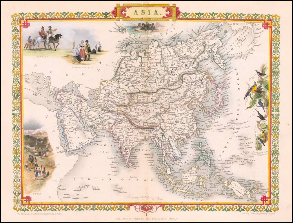
Striking full color example of this marvelous map of the Asian Continent. Decorative vignettes of Tartars, Russian Peasants, Petra and the Sun Birds of India and the Philippines. Engraved for R. Montgomery Martin's Illustrated Atlas. Tallis was one...
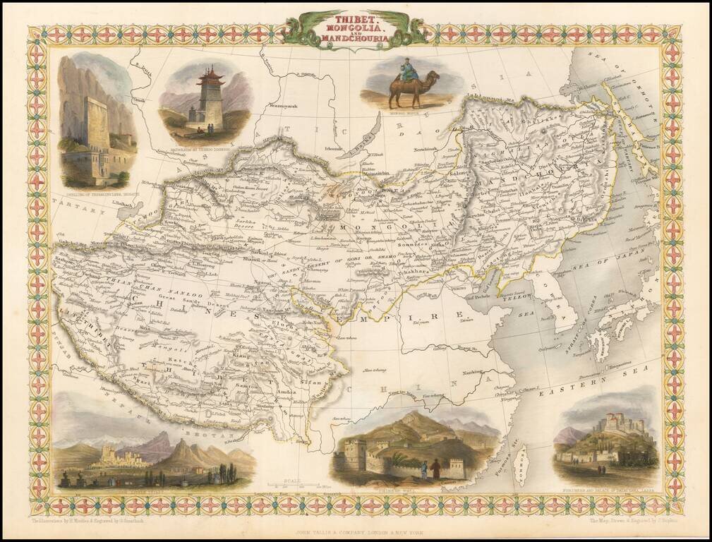
Striking full color example of this marvelous regional map. Extends to Nepal and Lake Balkach. Decorative vignettes of Dwelling of Tessaling Lama, Shigatei, Mausoleum At Teshoo Loom Boo, a Mongol Noble riding a camel, Fortress and Palace of the Dalai...
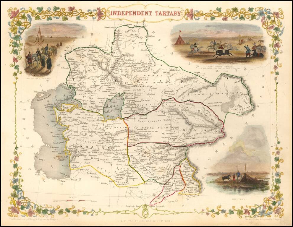
Striking full color map of Tartary, with vignettes of the Bride Chase, Tartars on the journey, and the Tent of those days. Engraved for R. Montgomery Martin's Illustrated Atlas. Tallis was one of the last great decorative map makers. His maps are...
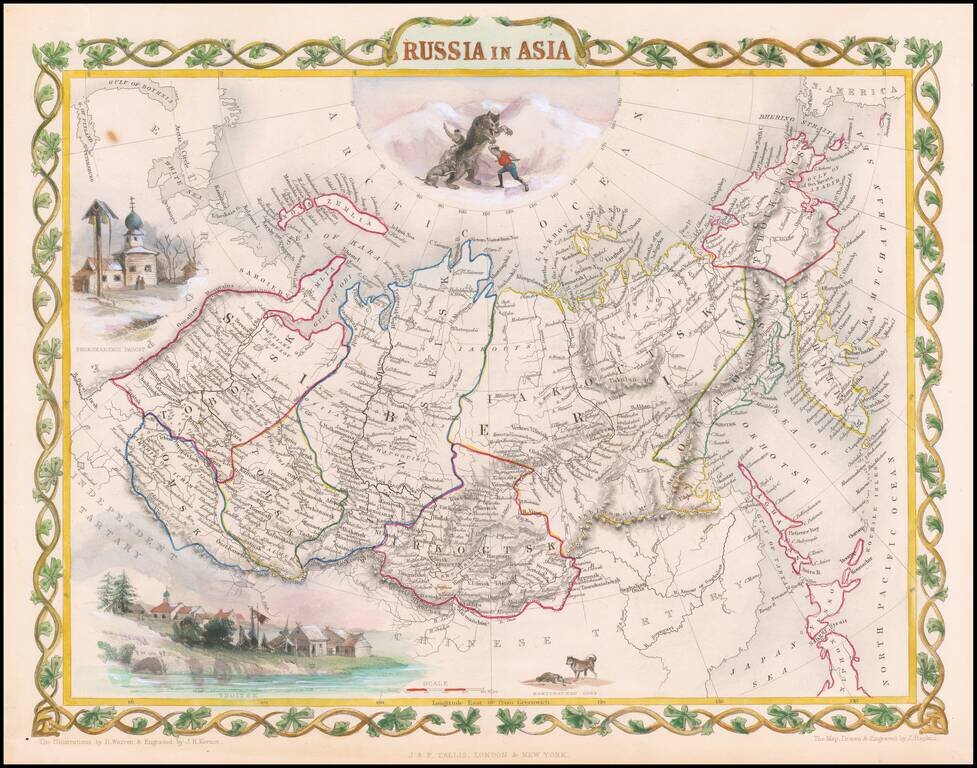
Decorative full color example of Tallis' decorative map of Russian Asia, with large vignettes of a polar hunting scene, Skorskarskoi Pagost, Troitsk and Kamchatkan Dogs. Engraved for R. Montgomery Martin's Illustrated Atlas. Tallis was one of the last...
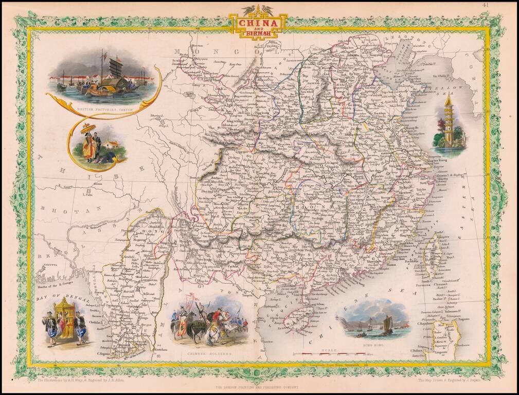
Gorgeous full color example of Tallis' map of China & Birmah, with decorative vignettes showing British factories in Canton, a birdseye view of Hong Kong, Chinese soldiers, and two other decorative vignettes. Engraved for R. Montgomery Martin's...
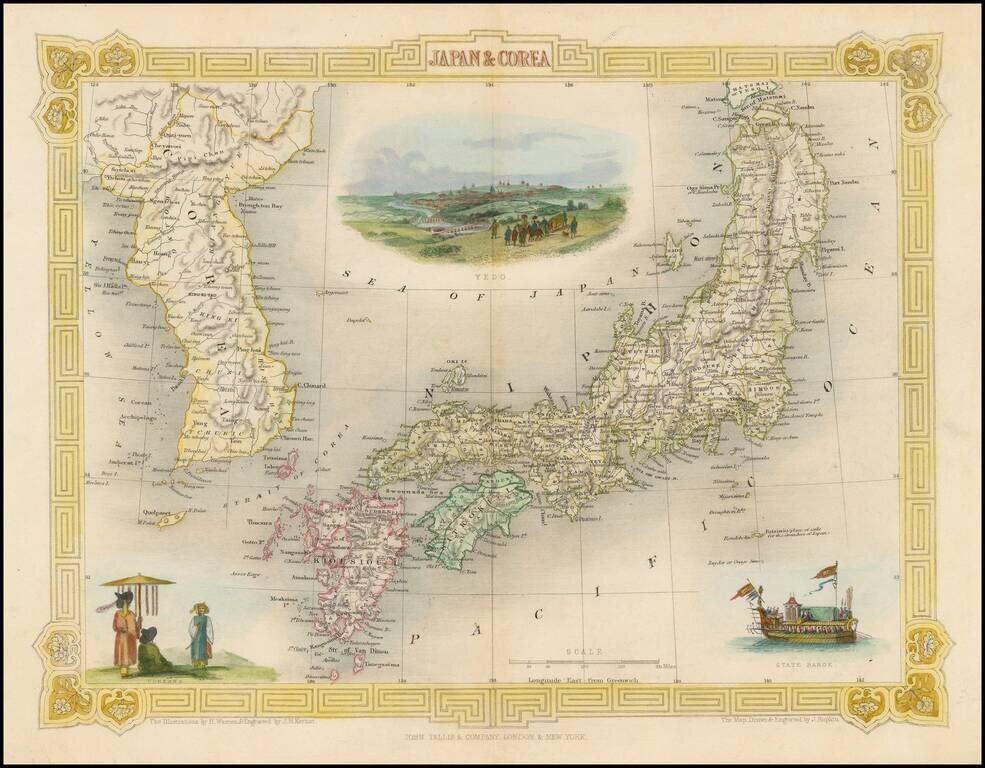
Striking full color map of this decorative map of Japan and Korea, with vignettes of Yedo, a State Barge and Coreans. Engraved for R. Montgomery Martin's Illustrated Atlas. Tallis was one of the last great decorative map makers. His maps are prized...
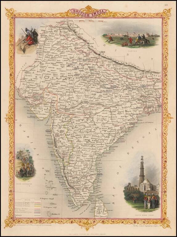
Gorgeous full color example of this decorative map of India. Vignettes show Lahore, Cootub Minar in Dehli, an Indian Procession and Beloochees, all in striking color. From R. Montgomery Martin's Illustrated Atlas, one of the last great decorative...
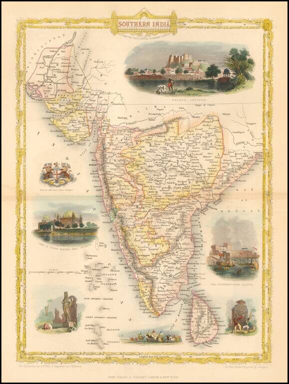
Striking full color example of this decorative map of India, including decorative vignettes. The map extends to the Indus and the Bay of Bengal. Decorative vignettes of the Government House in Calcutta, Tomb of Sultan Mahomed Shah, Bejapoor, Seal of...
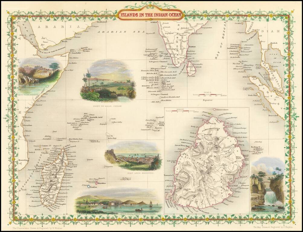
Striking full color example of this marvelous map of the Indian Ocean, including Madagascar, Ceylon and a large inset of Mauritius. Showing vignettes of Point De Gall, Ceylon, Port Louis Mauritius with Inset of Island of Mauritius. Engraved for R....
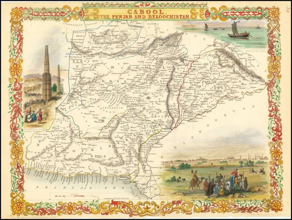
Nice example of this decorative regional map, covering Afghanistan and part of Pakistan. Decorative Vignettes of Boats on the Indus, Lahore and Sulton Mahmoud's Minars and Fortress, Ghuznee. Engraved for R. Montgomery Martin's Illustrated Atlas....
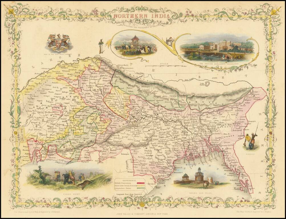
A striking full-color example of this marvelous map of the northern part of India. The area shown encompasses present-day northeastern India, Bangladesh, Bhutan, and Nepal. The map includes vignettes of life during the Company Raj as well as other...
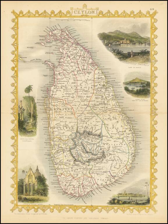
Striking full color example of the John Tallis map of Ceylon. Decorative vignettes of Lake of Kandy, Adams Peak from the Lake of Colorado, Temple of Buddha Kalany and the Ruins of the Dagora at Toopharamaya. Engraved for R. Montgomery Martin's...
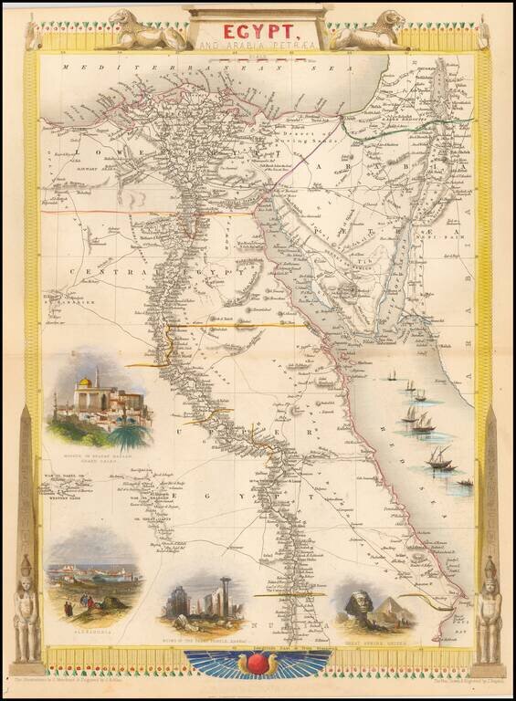
Gorgeous full color example, with large vignettes showing the Mosque of the Sultan Hassan, Alexandria, Ruins of the Great Temple Karnac, Great Sphinx, Ghizeh and sail boats in the Red Sea. Engraved for R. Montgomery Martin's Illustrated Atlas. Tallis...
![Syria [shows Cyprus]](/map/small/51574.jpg)
Striking full color example of this marvelous map of Syria. Highly detailed with decorative vignettes of Jerusalem, Arabs and the Baggage Camels. From R. Montgomery Martin's Illustrated Atlas, one of the last great decorative atlases of the 19th century.
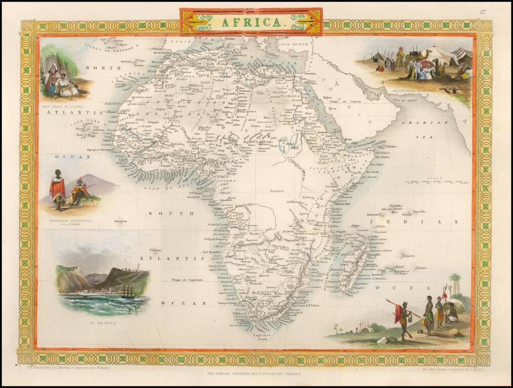
Fine full color example of this marvelous map of Africa. Decorative vignettes show a Bedouin Arabs Encampment, Korranna Hottentots, St. Helena, Bosjesman Hottentots Wild Bushmen, and an Arab Family of Algeria. Engraved for R. Montgomery Martin's...