John Tallis (1817-1876) was a British map publisher. Born in the Midlands, Tallis came to London in the 1840s. Tallis began his London career with a series of remarkable London street views. He began a partnership with a Frederick Tallis, possibly his brother, but their collaboration ended in 1849. For the Great Exhibition of 1851, Tallis published the Illustrated World Atlas, one of the last series of decorative world maps ever produced. The maps were engraved by John Rapkin, a skilled artisan. The maps were later reissued by the London Printing & Publishing Company, who left the Tallis imprint intact, thus ensuring his enduring fame. In 1858, he began publication of the popular Illustrated News of the World and National Portrait Gallery of Eminent Personages, selling it in 1861 (it ceased publication in 1863).
![Islands in the Atlantic [Bermuda, Madeira, Canaries, Azores and Cape Verde Islands]](/map/small/48484.jpg)
Terrific map of the various islands in the Atlantic, including Bermuda, the Azores, Madeira, the Canaries and Cape Verde Islands, with 5 large profile views. Engraved for R. Montgomery Martin's Illustrated Atlas. Tallis was one of the last great...
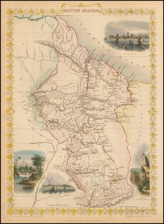
Decorative and detailed map of the Britsh Guayana, showing mountains, rivers, towns, islands, etc. Vignettes of Christmas Cataract on the River Berbice, New Amsterdam, Ataraipu and Georgetown. Engraved for R. Montgomery Martin's Illustrated Atlas....
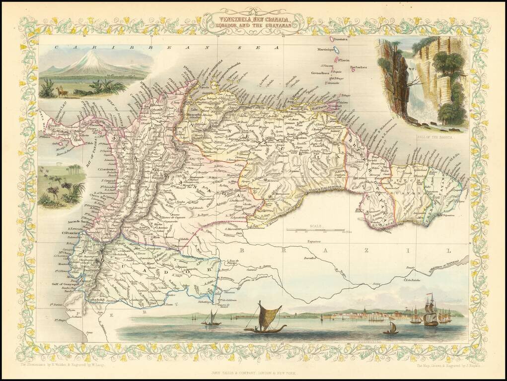
Striking full color example of this marvelous map of the Northeastern part of South America. Showing vignettes of Paramaribo, Chimborazo, the Falls of Bagota and animals of that time. Engraved for R. Montgomery Martin's Illustrated Atlas. Tallis was...
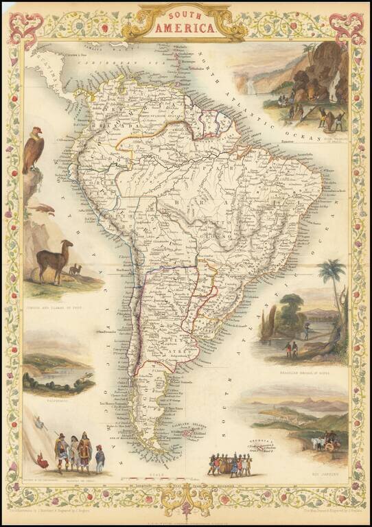
Gorgeous full-color example of Tallis' map of South America, with vignettes showing the cities of Rio Janeiro and colorful vignettes of Gold Washing in Brazil, Natives of Chili, Condor and Llamas of Peru. Beautiful decorative border. Engraved for R....
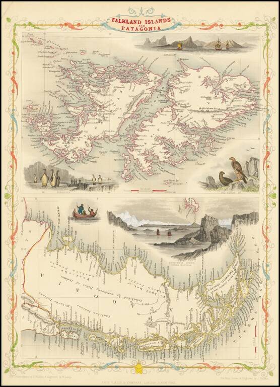
Decorative and detailed map of Patagonia and the Falkland Islands, showing mountains, rivers, towns, islands, etc. Vignettes of the Jason Islands, Sea Eagles, Penguins, Fugians, and Christmas Sound. Engraved for R. Montgomery Martin's Illustrated...
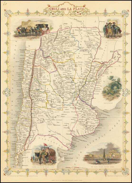
Decorative and detailed map of the region, showing mountains, rivers, towns, islands, etc. Vignettes of a Travelling Post, the Gobernador, the Grand Square in Buenos Ayres, and a Water Seller in Buenos Ayres. Tallis was one of the last great...
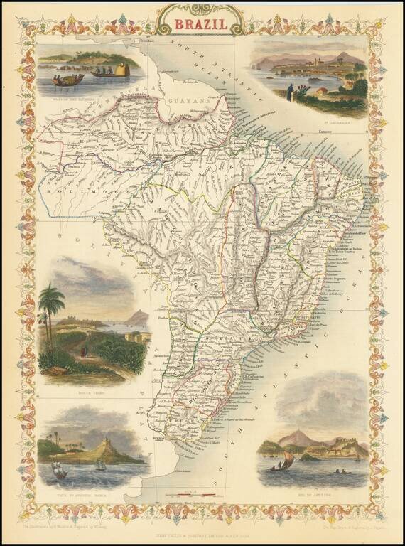
Gorgeous full color example of this decorative map of Brazil, with colorful vignettes showing Monte Video, Cape St. Antonio Bahia, Rio De Janeiro and St. Catharina. Engraved for R. Montgomery Martin's Illustrated Atlas. Tallis was one of the last...
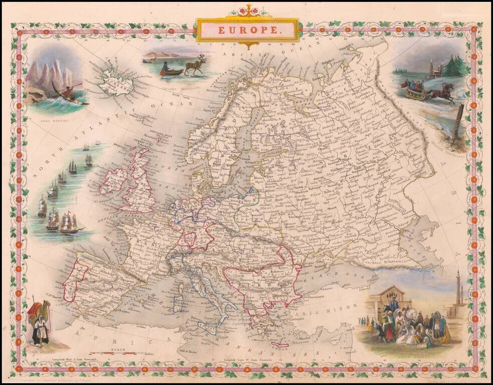
Gorgeous full color example, with vignettes showing Slave Market, Seal Hunting, Lapland Travellers, Arabs and Camels. Beautiful decorative border with remarkable color. Engraved for R. Montgomery Martin's Illustrated Atlas. Tallis was one of the last...
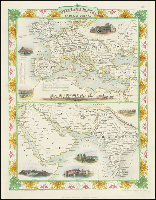
Striking full color example of this fascinating map, showing the various trade routes to Europe, with a larger map of Europe and the Mediterranean at the top, and a detailed regional map of the Middle East and Western India at the bottom. Decorative...
![Channel Islands [Guernsey and Jersey]](/map/small/46638.jpg)
Decorative full color example of Tallis' map of the Channel Islands. Includes decorative vignettes showing St. Peter's Port, Castle Cornet, Druidical Alter near Lancresse, Mont Orgueil Castle and Jersey. Tallis was one of the last great decorative map...
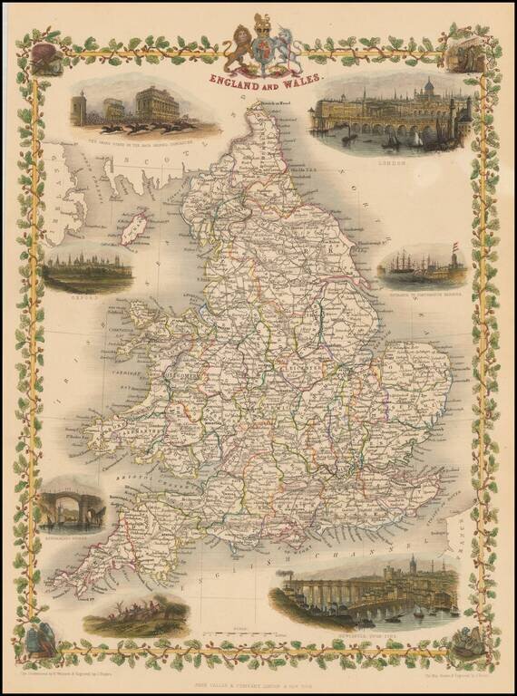
Attractive full color example of Tallis' map of England & Wales. Includes decorative vignettes of London, Entrance to Portsmouth Harbour, Newcastle upon Tyne, a Fox Hunt, Sunderland Bridge, Oxford, and the Grand Stand on the Race Ground,...
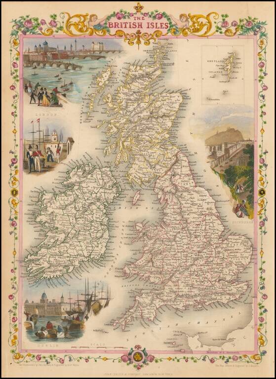
Striking full color example of this marvelous map, showing vignettes of London, Edinburgh, Dublin and inset of Shetland Islands. Engraved for R. Montgomery Martin's Illustrated Atlas. Tallis was one of the last great decorative map makers. His maps...
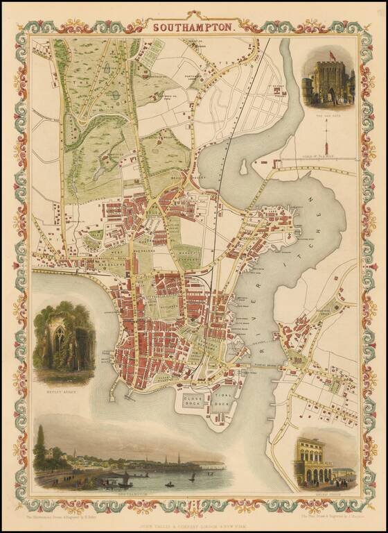
Striking full color example of Tallis's town plan of Southampton. Shows roads, buildings, railway stations, churches etc. Also includes landscape insets of the Bar Gate, Netley Abbey, the Railway Station and a small panorama of Southampton. Tallis...
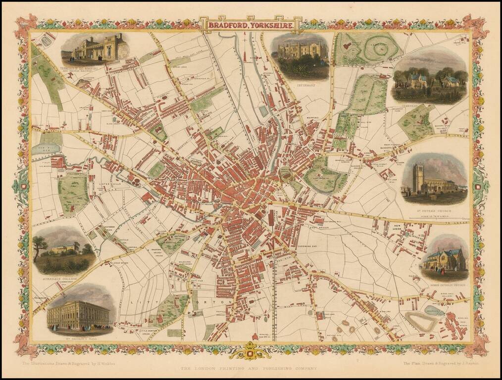
Striking and detailed town plan of Bradford, with vignettes of Terminus of the Bradford and Halifax Railway, Airedale Colelge, St. George's Hall, Infirmary, Cemetery,St. Peter's Church and the Roman Catholic Church. Decorative full color example.
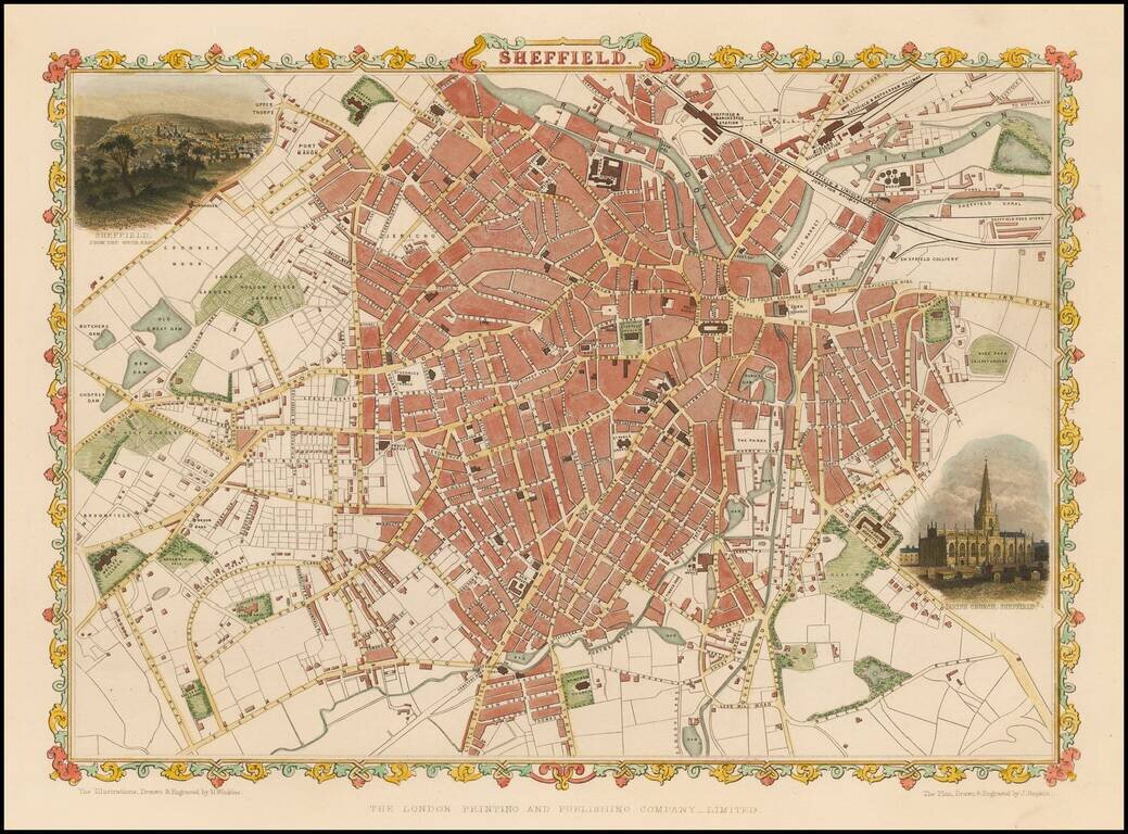
Striking full color example of Tallis's town plan of Sheffield. Showing roads, buildings, railway stations, etc. Also includes landscape insets of Sheffield from the south east and the Parish Church Sheffield. Tallis was one of the last great...
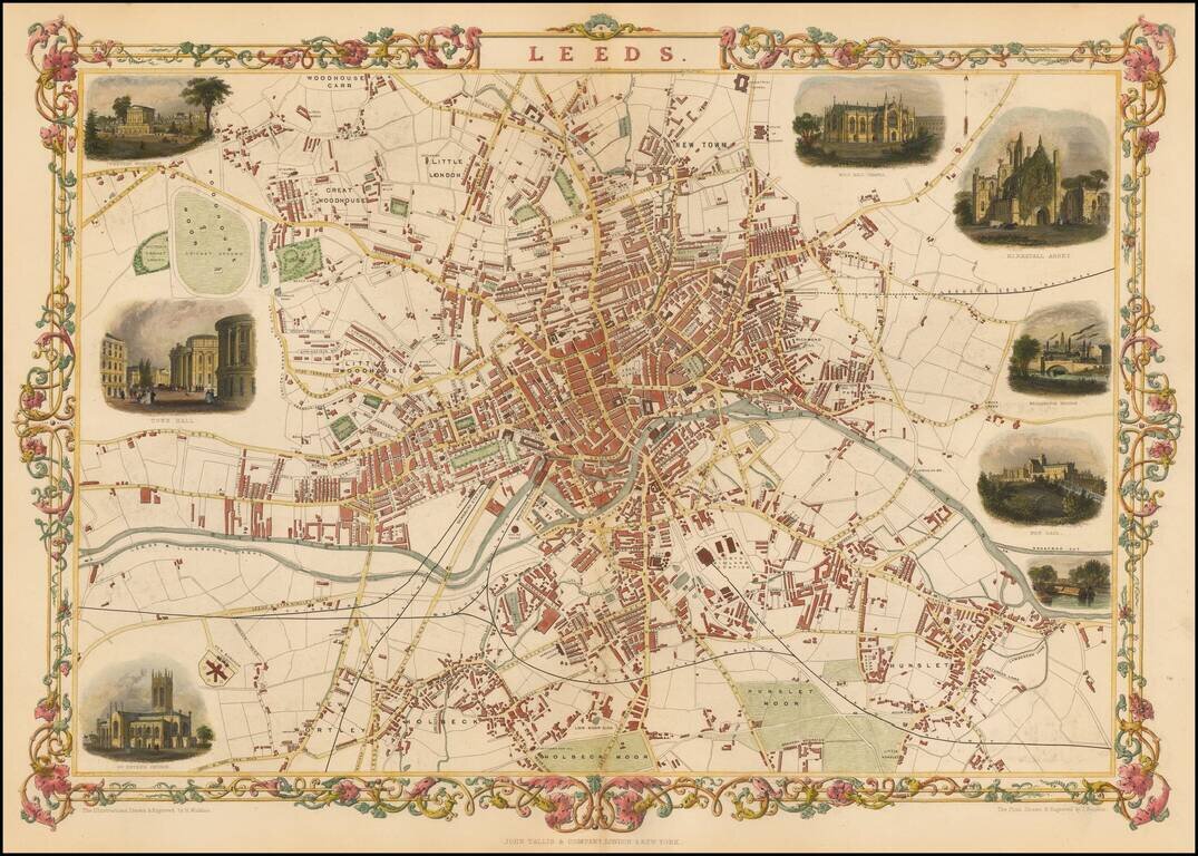
Striking and highly detailed map of Leeds. Includes decorative vignettes of the Cemetery Woodhouse, Town Hall, St. Peter's Church, Mill Hill Chapel, Kirkstall Abbey, Wellington Bridge, New Gaol, and boats on the river.