
A nice early American atlas in the Malte-Brun vein, containing 40 engaged maps in original hand-color. 14 of the maps relate to the Americas, 4 to Africa, 9 to Asia, and the rest to Europe and the World.
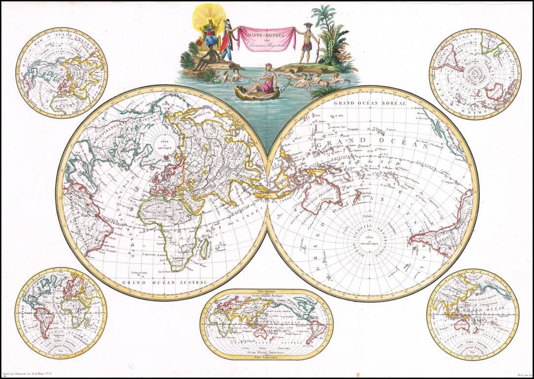
Decorative double hemisphere map of the World, published in Paris by Conrad Malte-Brun. The map includes a double hemisphere world map, with an additional smaller world maps centered on Australia and 4 other hemispheric projections. Malte-Brun's...
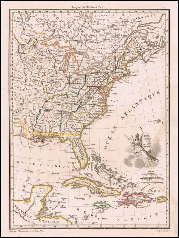
Finely engraved map, embellished with a winged America with shield and javelin. Shows Mississippi Territory including Alabama, Indiana to the Mississippi River, plus nice western Indian information. Malte Brun's Atlas Complet Du Precis De La...
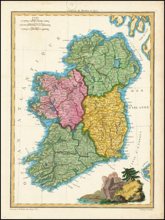
Engraved antique map of Ireland, engraved by J.B. Tardieu, and published by Conrad Malte-Brun in Paris, 1812. In the map, Ireland is divided into Connaught, Ulster, Linster, and Munster. The cartouche in the bottom-right features the columnar basalt...
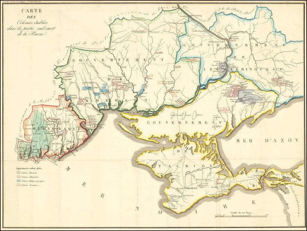
Detailed map of the Crimea and northern part of the Black Sea and Sea of Azof, locating colonial settlement in the region. The map is divided by Governments as created by the Imperial Russian Government in 1802 (and abolished in 1925). The...
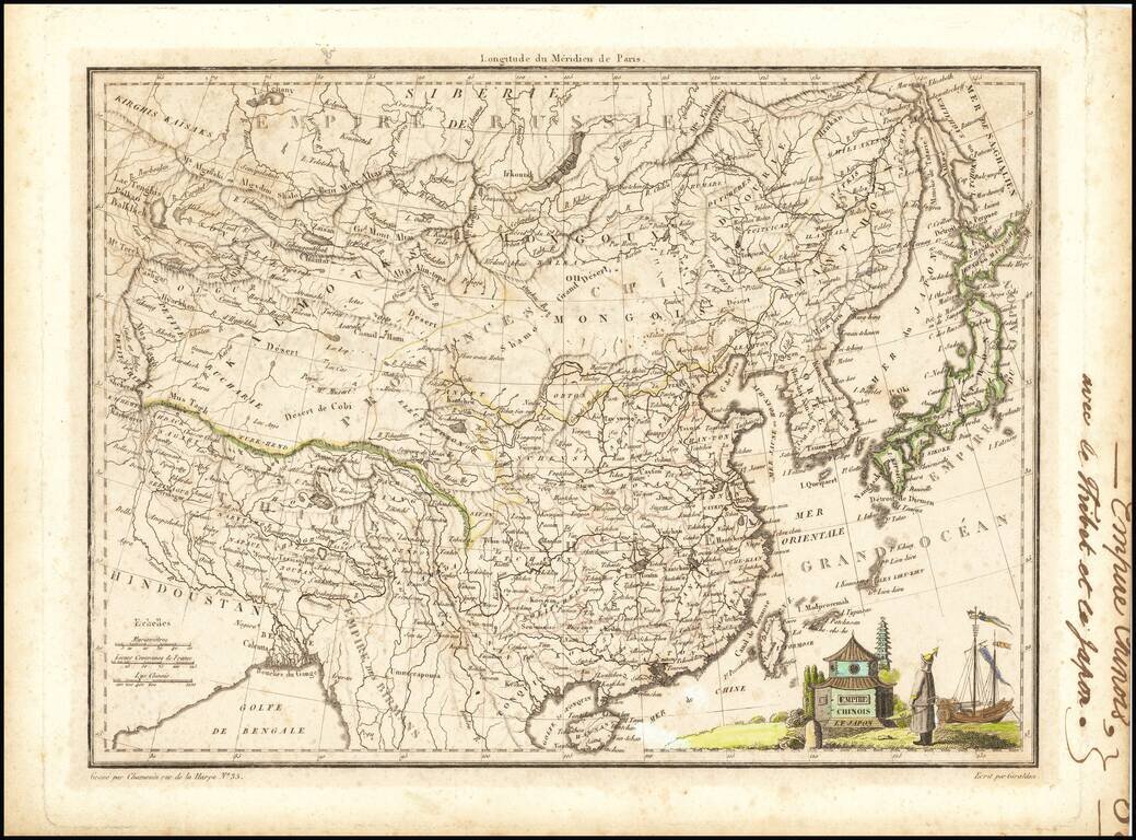
Detailed map of China, Korea and Japan, showing provinces, towns, rivers ports, islands, etc. Includes Formosa and Hainan Islands. Decorative vignette.
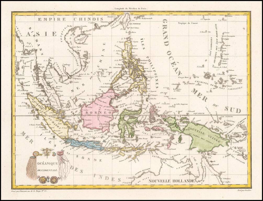
Decorative map of the region bounded by Taiwan, Pegu and Northern Australia, centered on the Philippines and Borneo. Malte Brun's maps were very up to date and well researched, meaning that this map includes the most recent discoveries in the Pacific.
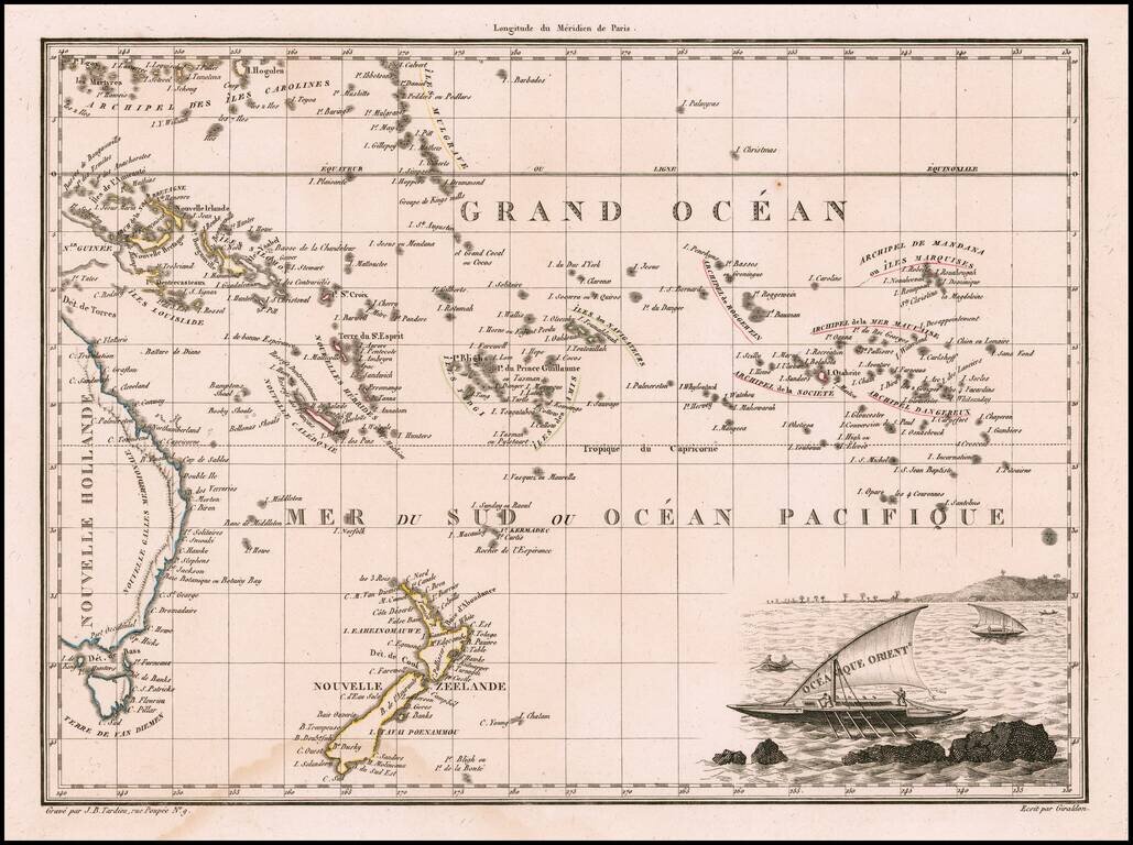
Decorative antique engraved map of the Eastern Pacific, from the Carolines, Eastern Australia, and Tasmania to the Marquesas, including all of New Zealand. Malte Brun's maps were extremely well researched, utilizing the most up to date information....