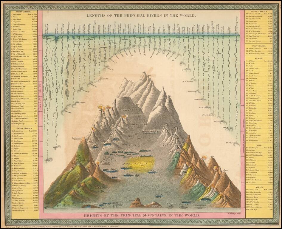
Interesting chart of the principal mountains and rivers of the World, with a key on either side identifying the mountains and rivers shown, including a number of active volcanoes.
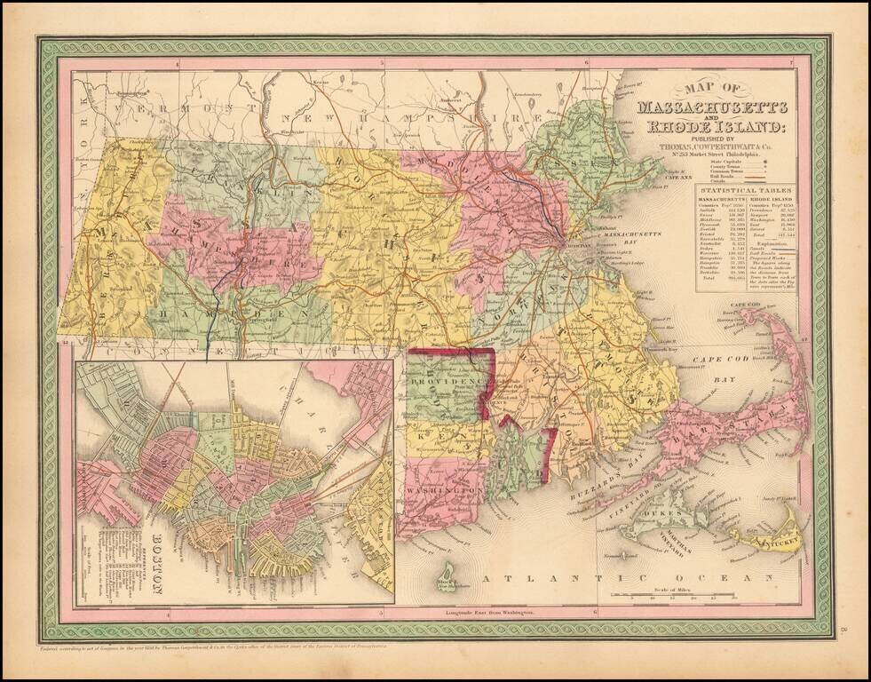
Striking map of Massachusetts and Rhode Island, hand colored by counties, from Thomas Cowperthwait & Co.'s New Universal Atlas. The map names towns, rivers, lakes, islands, etc. and shows roads with distances, railroads and other details. Large...
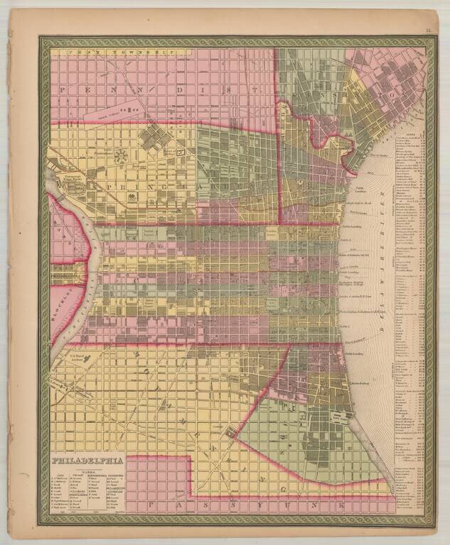
Detailed and interesting map of Philadelphia, includes an index of public buildings, hotels, churches (including a "Jews Synagogue") and banks. The map has been updated from the pre-1850 edition of the map, to include several new townships, etc.

Cowperthwait's map of Arkansas, hand colored by counties, with a chart showing the Steamboat routes and illustrating canals, railroads, and other details.
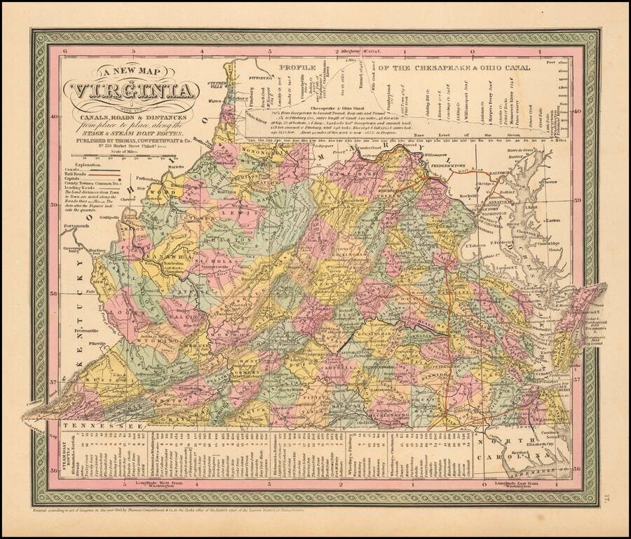
Nice example of Cowperthwait's early map of the State of Virgina, showing counties, towns, rivers, roads, mountains, lakes, Canals, etc. Profile of the Chesapeake and Ohio Canal at the top of the map and a schedule of steamboat routes and distances at...
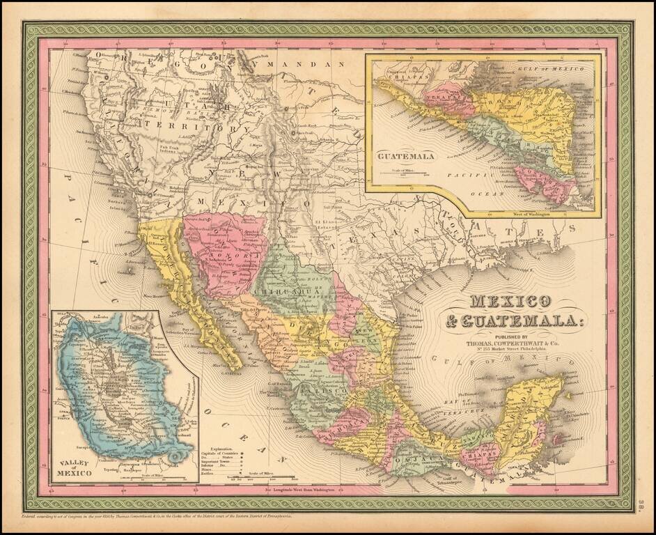
Detailed map of Mexico and the Southwest. Many of the early place names in Texas still appear. Pre-Gadsden Purchase border with Mexico. Large insets of the Valley of Mexico, Isthmus of Tehuantepec, Isthmus of Nicaragua and Guatemala.
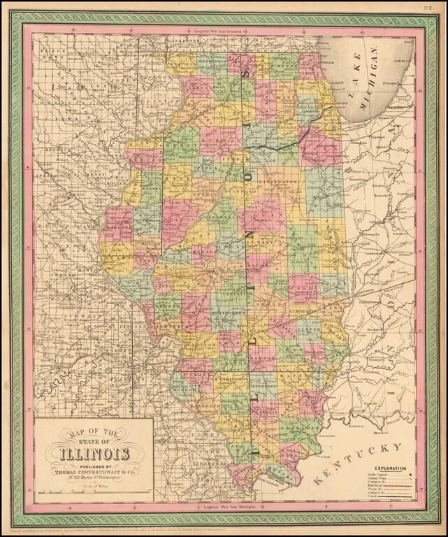
Detailed and interesting map, hand colored by county and showing towns, rivers, lakes, railroads, roads, distances, forts, etc. An exceptional example.
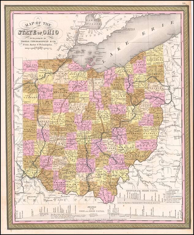
Rare first state of the Thomas Cowperthwait & Co. map of Ohio. Detailed and interesting map, hand colored by county and showing towns, rivers, lakes, railroads, roads, distances, forts, etc. Profile of Miami, Ohio and Erie Canals shown.
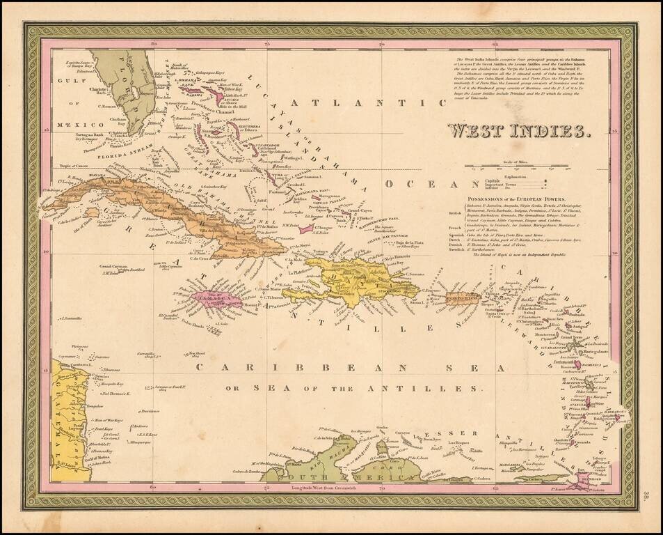
Detailed and attactive map of the southern portion of Florida and the Caribbean, from the Universal Atlas. The map shows the various European Powers possessions, including Spanish, British, French, Dutch, Danish and Swedish, along with substantial...
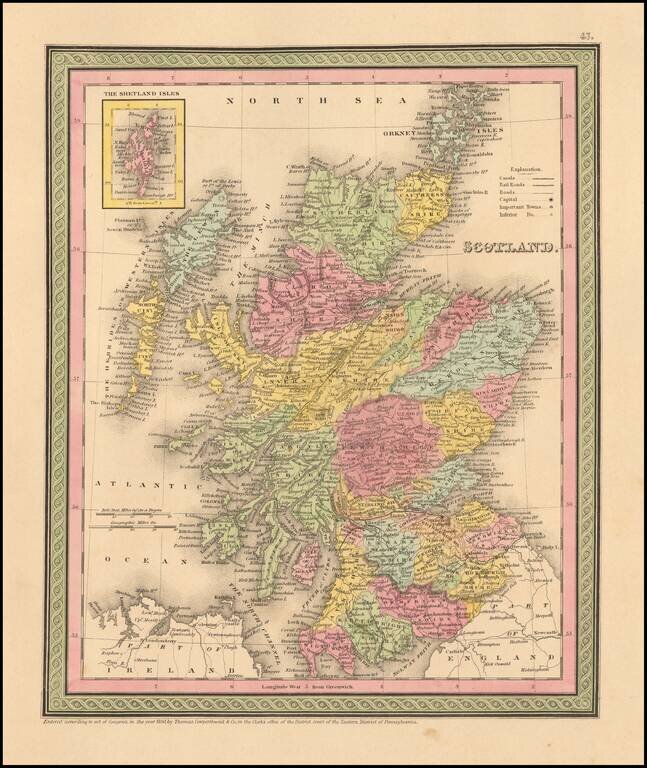
Detailed and interesting map of Scotland, hand colored by county and showing towns, rivers, lakes, railroads, roads, etc. Inset of the Shetland Islands. A decorative interesting map.