Samuel Augustus Mitchell Jr. inherited the Mitchell Company from his father in 1860. For over thirty years, the company had specialized in the production of school atlases and wall maps of America. They were one of the pioneers on engraving on steel plates. In 1860, Samuel Jr. released the New General Atlas, which had been compiled in house and replaced a previous atlas by Tanner. The elder Mitchell died in 1868 and Samuel Jr. continued the business until the 1890s. At its height, the Mitchell Company employed 250 people and sold 400,000 publications annually.
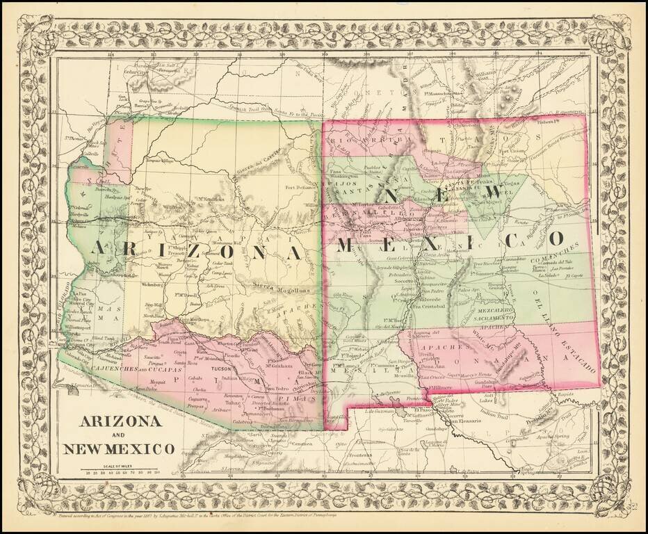
Attractive regional map of New Mexico and Arizona, colored by counties with beautiful decorative border. Shows towns, roads, railroads and rivers. This is a period when western county and state borders were rapidly evolving, such that each year holds...
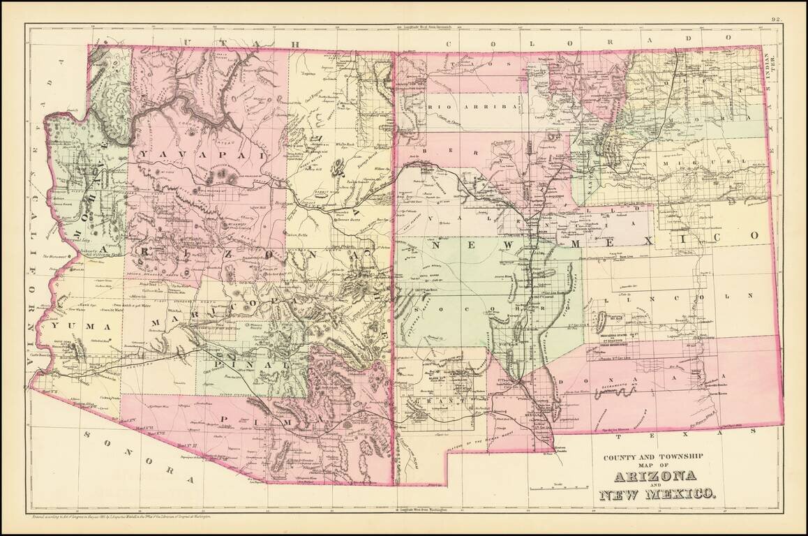
Detailed map of Arizona and New Mexico, colored by counties and showing towns, roads, railroads, rivers, lakes and a host of other information. The map predates the formation of Sierra County, New Mexico in 1884. One of the most detailed maps of the...
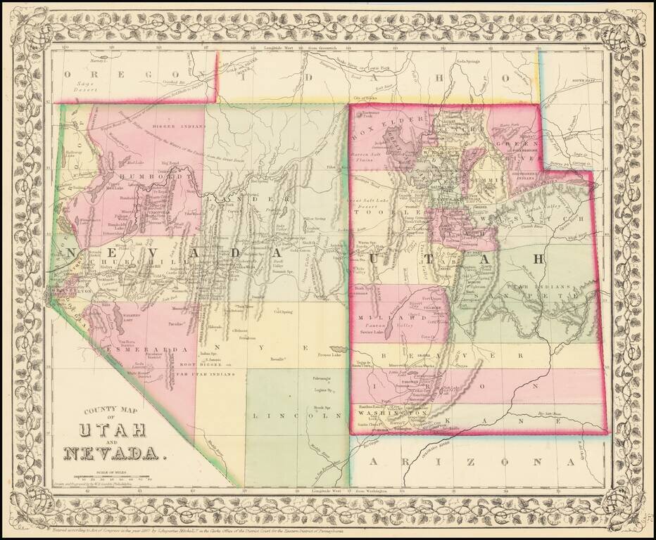
Detailed map of Nevada and Utah, colored by counties and showing towns, mountains, rivers, railroad lines, Indian Tribes, mining districts, etc. The first map of the region to appear in a commercial atlas. Decorative floral border.
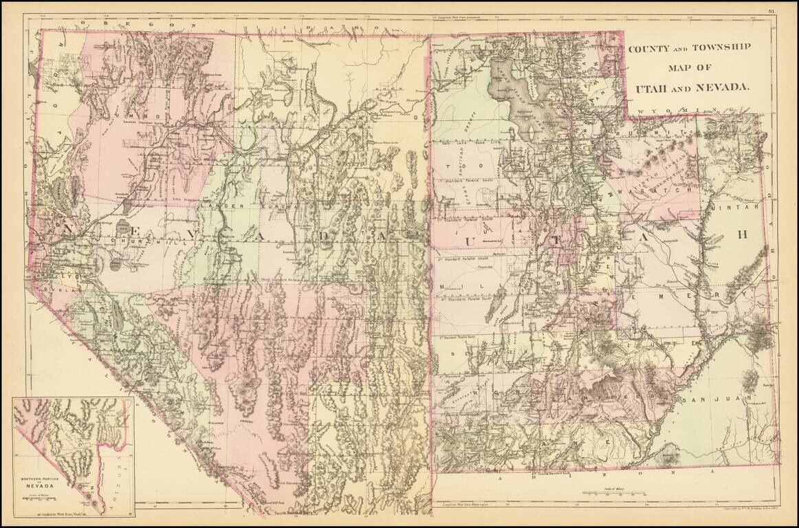
A detailed map of Utah and Nevada, colored by counties and showing towns, roads, railroads, rivers, lakes, and a host of other details. While earlier editions of the map include all of Utah but lack the southern tip of Nevada, this 1884 edition adds...

Excellent early map of Idaho, Montana and Wyoming Territories, published by SA Mitchell Jr. Includes early county configurations for each: Wyoming has only 7 counties; Montana has 11 counties; Idaho has 13 counties. The map shows Indian...
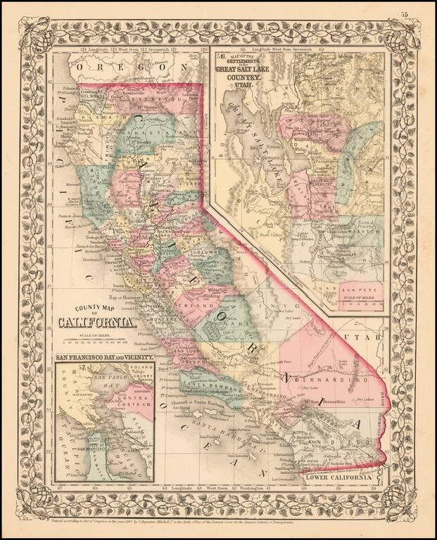
Attractive map of California, colored by county. Predates a number of Southern California Counties. Includes a detailed inset plan of San Francisco, colored by wards. Shows towns, roads, railroads, rivers, lakes, mountains, missions, etc. Decorative...
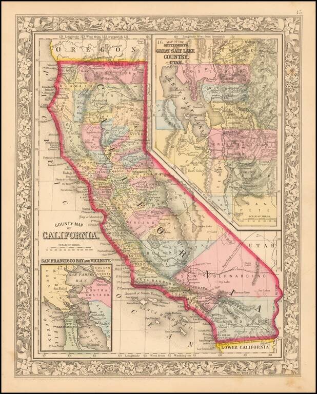
Fine early example of Mitchell's map of California, colored by county. Shows towns, railroads, roads, mountains, lakes, dry lakes, rivers, forts, etc. Insets of San Francisco Bay and the area around Salt Lake, with counties. Decorative border....
Attractive map of California, colored by county. Predates a number of Southern California Counties. Includes a detailed inset plan of San Francisco, colored by wards. Shows towns, roads, railroads, rivers, lakes, mountains, missions, etc. Decorative...
![Map of Oregon, Washington, Idaho and part of Montana [Early appearance of Montana]](/map/small/70803.jpg)
Interesting early map of the Northwest, hand-colored by counties or territories. The map is copyright-dated 1860, and has counties in eastern Oregon but not in Idaho or Montana. The existence of Montana dates the publication to 1864 or later. A fine...
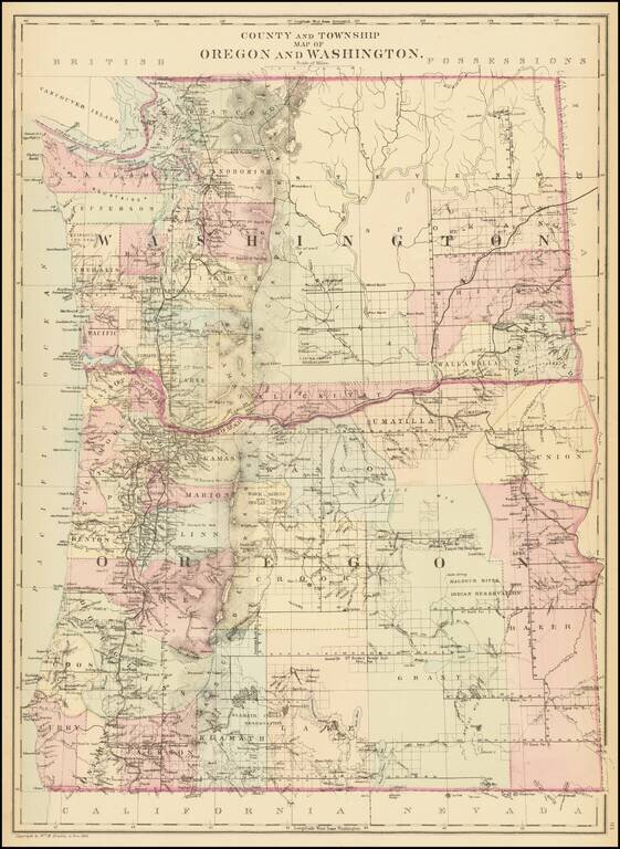
Detailed map of Washington and Oregon, which appeared in a late edition of Mitchell's General Atlas, pubished by William Bradley. The map is colored by counties and showing towns, roads, railroads, rivers, lakes, and a host of other details. SA...
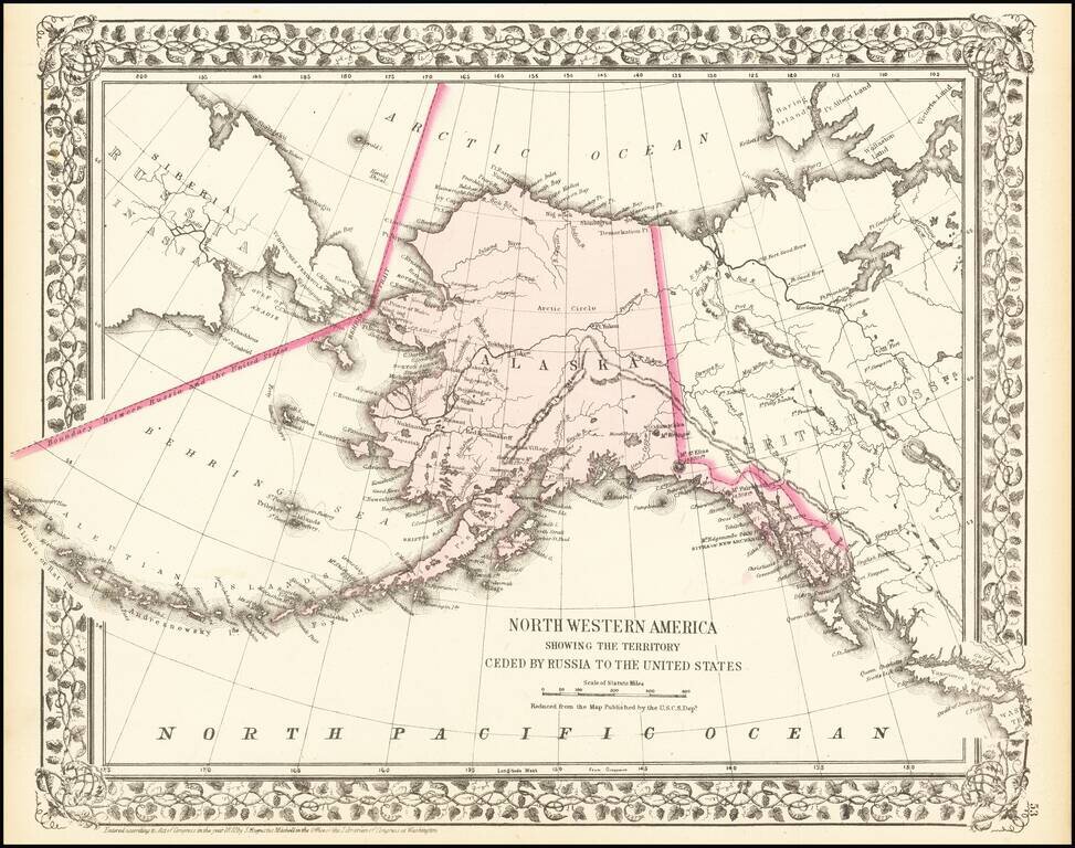
A detailed map of Alaska, showing the territory shortly after it was sold by Russia to America for $7.2 Million in 1867. The map locates towns, mountains (with elevations), rivers, bays, and other details. Cities named include Sitka and Sheshalik. The...
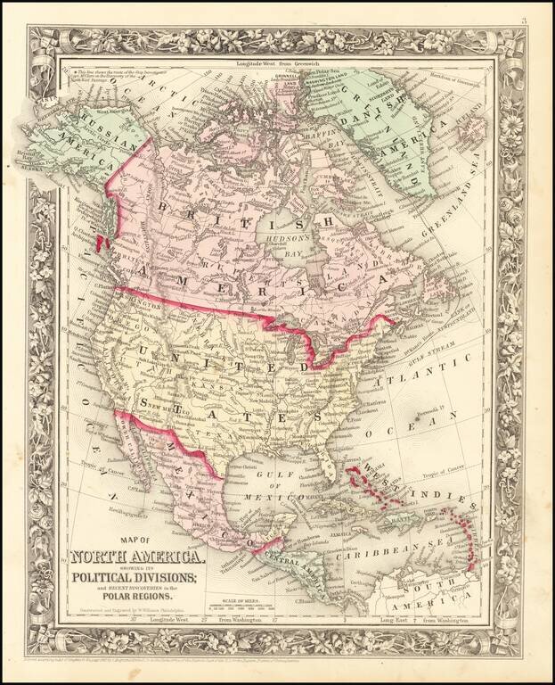
Decorative map of North America, colored by country. Shows recent discoveries in Russian America, including McClure's northwest passage aboard the Investigator. Locates cities, rivers, mountains, forts, lakes, etc. Decorative border.
![Ireland in Provinces and Counties [with] County Map of Scotland](/map/small/69266.jpg)
A decorative map with Ireland and Scotland side by side, colored by counties. Includes a decorative border. Nice detail in both maps, including early roads, towns, railroads, rivers, lakes, islands, etc. Inset of the Shetland Islands. Mitchell makes...
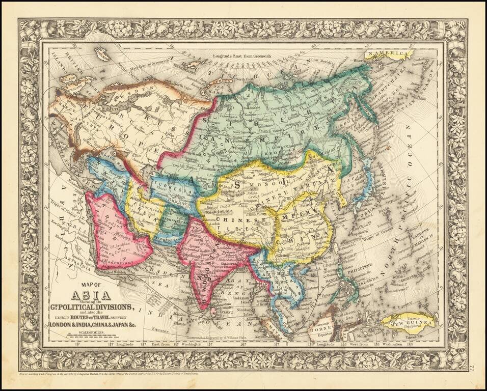
Detailed map of Asia, colored by country. Includes the classical SA Mitchell decorative border of the period.
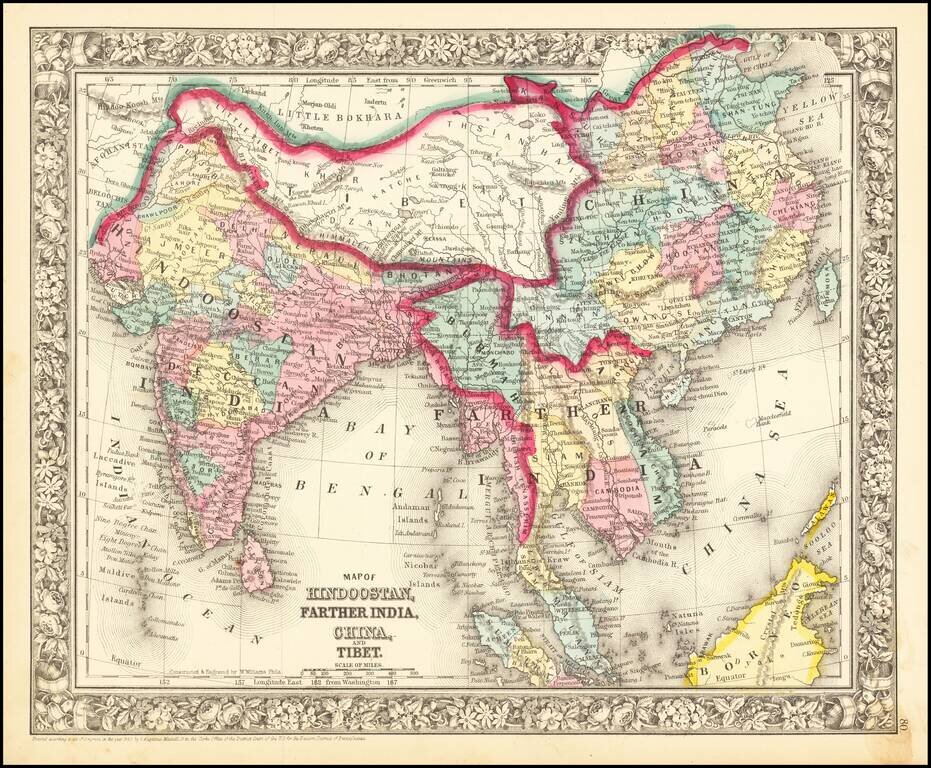
Nice mid-19th century map of India and Southeast Asia, including Cambodia, Siam, Burmah, Tonquin, Cochin China, and British Tenasserim. Shows roads, towns, rivers, mountains, etc. Decorative border.
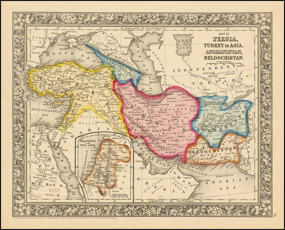
Attractive map centered on Persia and extending from Turkey and the Black Sea to Afghanistan and Beloochistan. Colored by countries Shows towns, tribes, roads, rivers, mountains, lakes, etc.