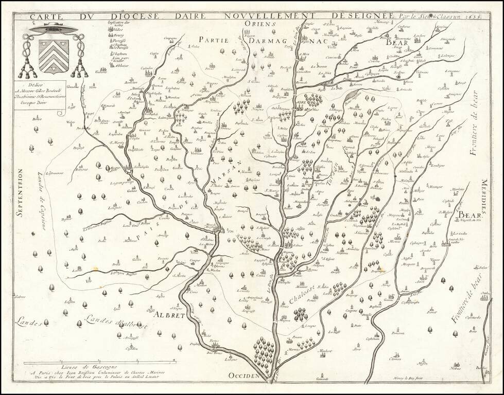
Jean Boisseau's First Map! Rare map of the Diocese of Aire, printed in Paris in 1635. The map is oriented with east at the top, breaking the course of the Leie River and its tributaries. All of Boisseau's maps are rare. As noted in Mapforum.com...
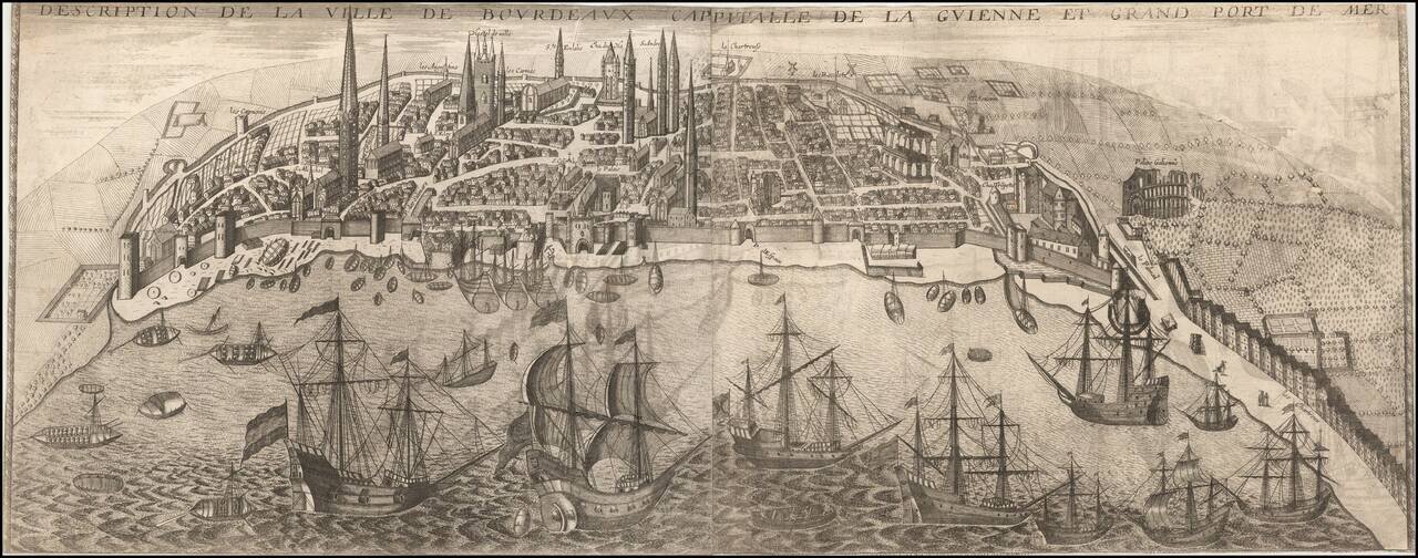
Rare early view of Bordeaux, published in Paris by Jean Boisseau. A fine early panoramic view of the city of Bordeaux from the east, with the Garonne River in the foreground. Bourdeaux's Roman amphitheater, Le Palais Galien, is shown at far right,...
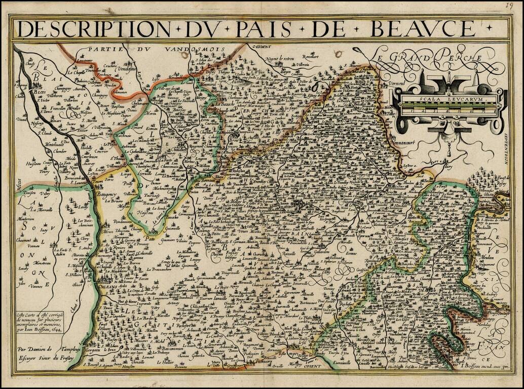
Rare map of Beauce, from Jean Boisseau's Theatre Des Gaules, first published in 1642. The map extends from Paris and the Seine River in the north to the Loire River in the south, centered on Chartes. All of Boisseau's maps are rare. As noted in...
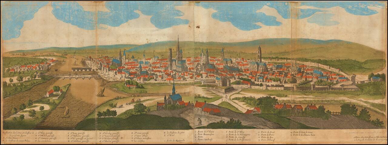
Rare old color example of this early view of Rouen, published in Paris by Jean Boisseau. A fine early panoramic view of the city of Rouen from the south, with the Seine River and St. Paul Church in the foreground and the Notre Dame Cathedral in the...

Rare map of the forest of Fontainebleau, published in Paris by Boisseau. The map shows the castle of Fontainebleau in the center of the map, with two small views of Melun and Moret. Text in the bottom right notes: "This map represents the forest of...
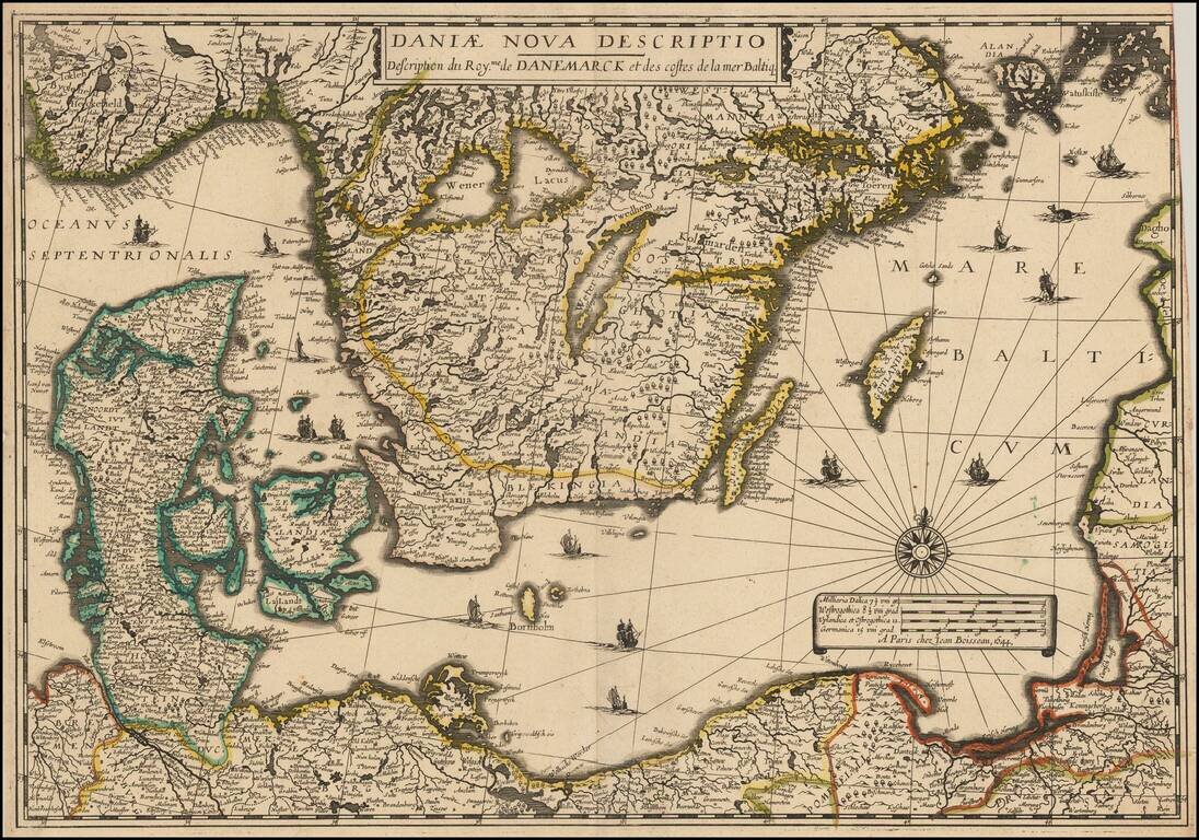
Rare separately issued map of Scandinavia and the Baltic Regions, published by Jean Boisseau. The map would later be issued by Langlois in Paris, circa 1660, with name "Mare Balticum" revised to "Mer Balticque." Not in Pastereau or Nordenskiold. We...
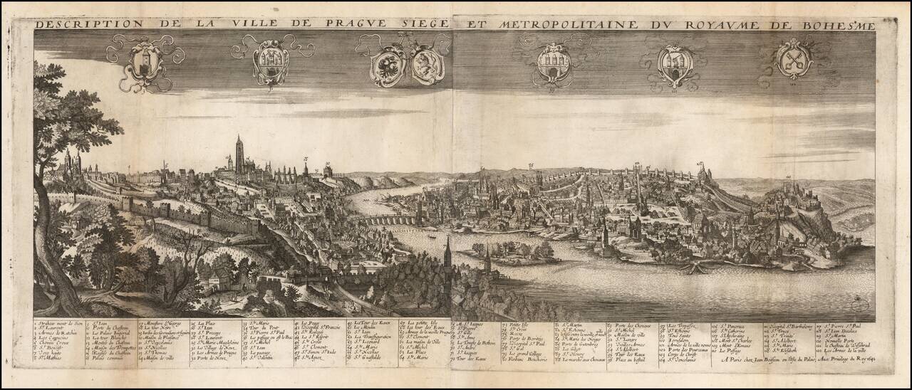
Rare early view of Prague, published in Paris by Jean Boisseau. Fine large perspective view centered on the Charles Bridge with 122 key locations identified in French in the lower margin. The view was published in Jean Boisseau's extremely rare...
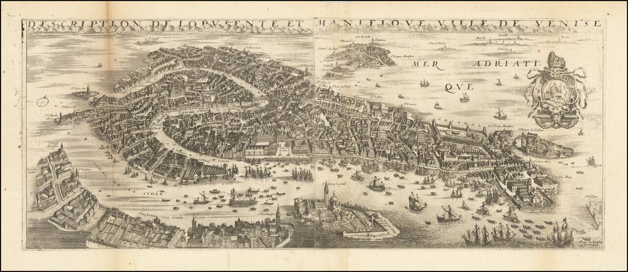
This a rare view of Venice from the French atlas maker and royal cartographer Jean Boisseau. The stunning view presented shows the city of the Doges in a magnificent bird's eye format, focusing on the main island and surrounding islets, but with the...
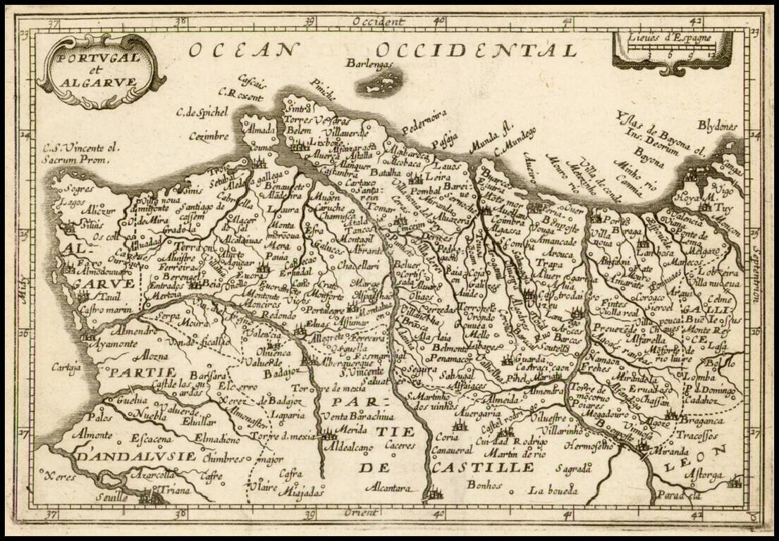
Rare map of the Portugal, which appeared in Boisseau's Tresor des carte Geographiques, published in Paris. Boisseau's map is based upon Jansson's map, published in his Atlas Minor in 1628. The map was later copied by Jean Picart. The map is...
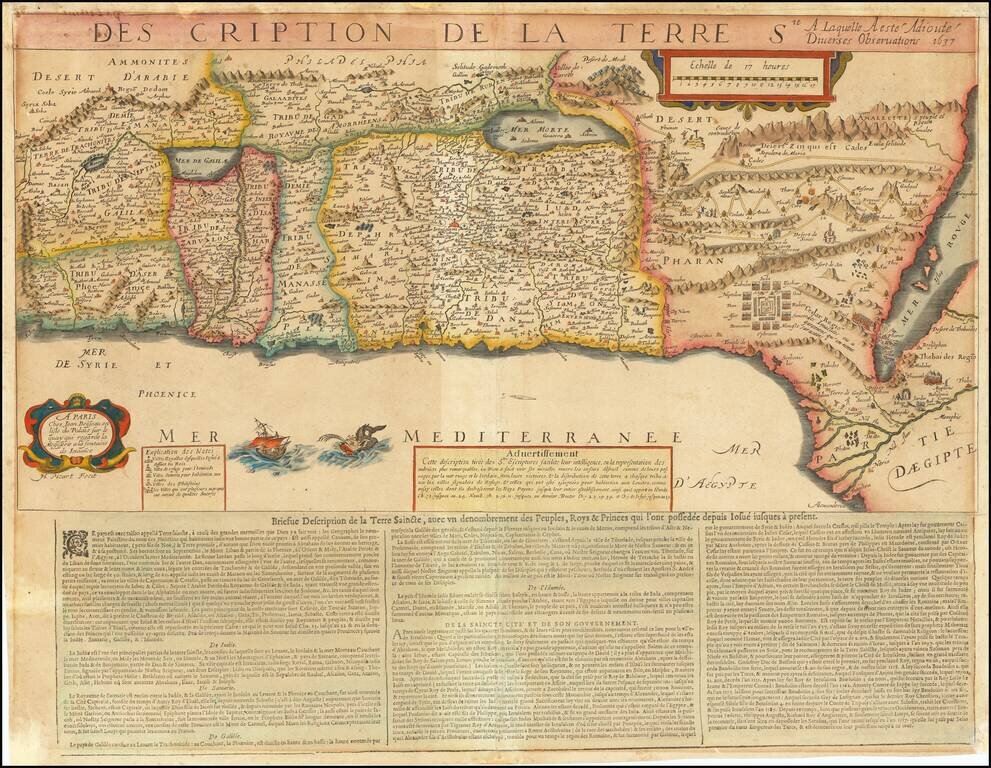
Extremely rare map of the Holy Land based upon the writings in the Old Testament, published by Jean Boisseau and engraved by Jean Picart in Paris. The map includes descriptive text at the bottom entitled: Briefue Description de la Terre Saincte. The...
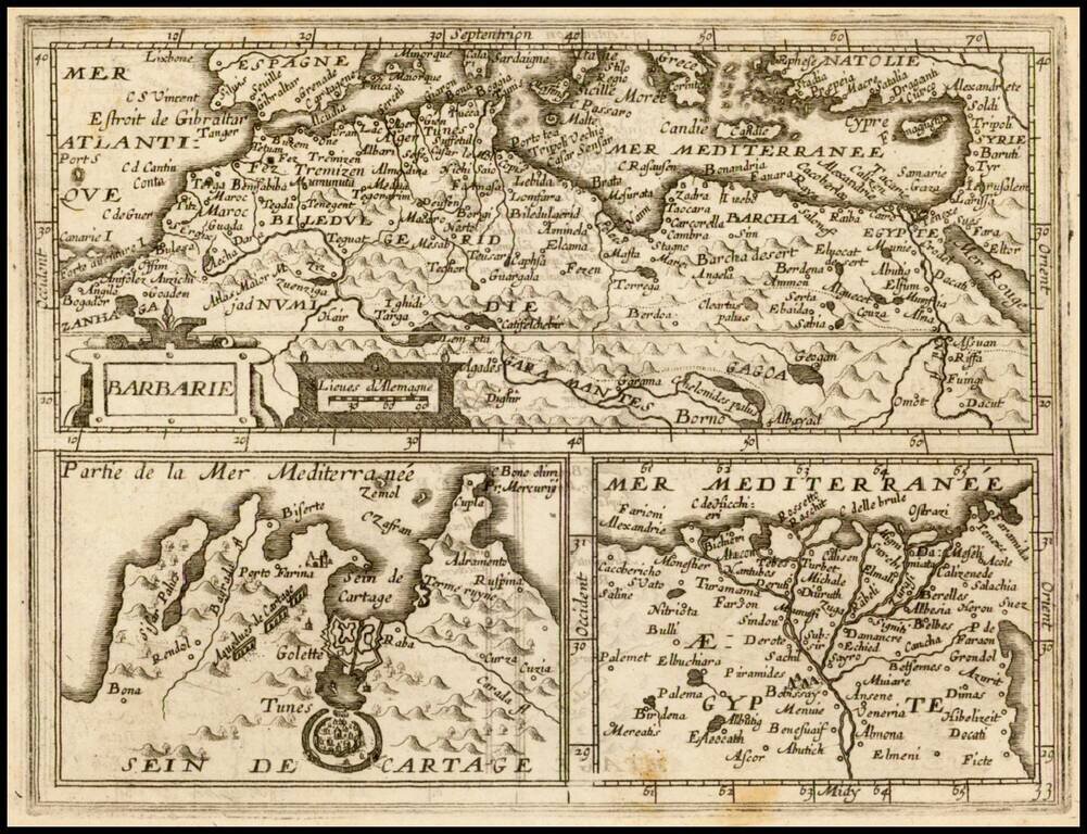
Rare map showing the African Coastline of the Mediterranean, with two inset maps Egypt and Carthage, which appeared in Boisseau's Tresor des carte Geographiques, published in Paris. The map is based upon Jansson's map, published in his Atlas Minor in...