G. W. & C. B. Colton was a prominent family firm of mapmakers who were leaders in the American map trade in the nineteenth century. The business was founded by Joseph Hutchins Colton (1800-1893) who bought copyrights to existing maps and oversaw their production. By the 1850s, their output had expanded to include original maps, guidebooks, atlases, and railroad maps. Joseph was succeeded by his sons, George Woolworth (1827-1901) and Charles B. Colton (1831-1916). The firm was renamed G. W. & C. B. Colton as a result. George is thought responsible for their best-known work, the General Atlas, originally published under that title in 1857. In 1898, the brothers merged their business and the firm became Colton, Ohman, & Co., which operated until 1901, when August R. Ohman took on the business alone and dropped the Colton name.
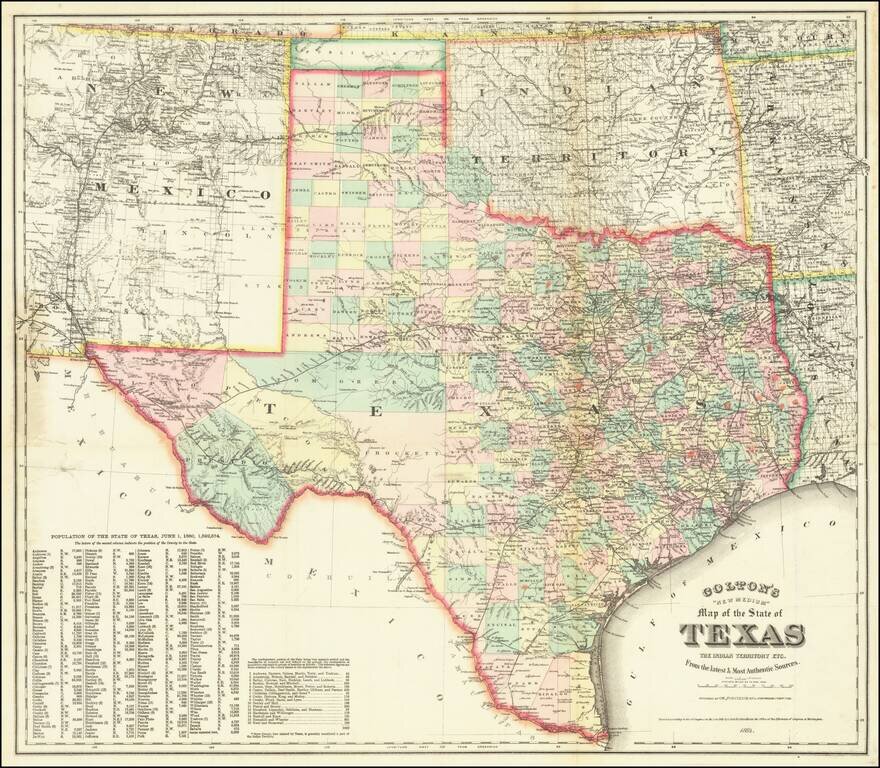
A Texas Rarity Fine large separately published map of Texas, published by GW & CB Colton in 1884. The map provides a detailed treatment of Texas, Indian Territory, and New Mexico, the latter two of which have now been extensively surveyed and...
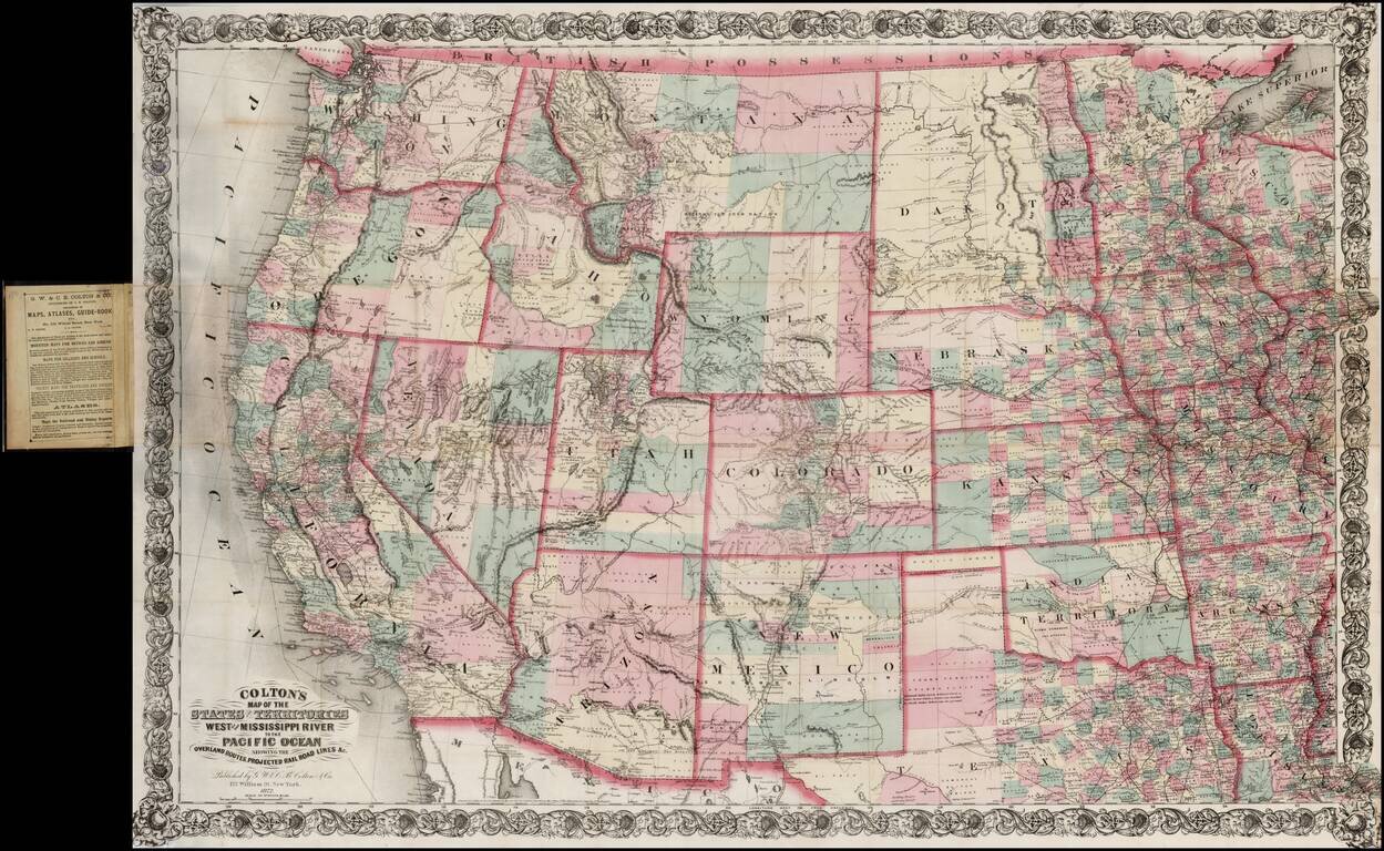
Large scale pocket map of the Transmississippi West. Fine example of Colton's large format map of the West, colored by Counties and focusing on the projected railroad lines west of the Mississippi River, shortly before the first appearance of...
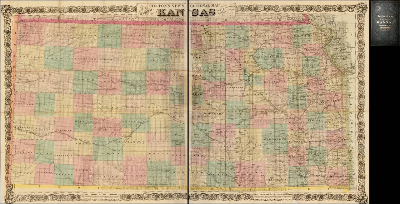
Nice example of Colton's 1878 edition of the New Sectional Map of Kansas. This is a later issue of a beautiful large scale map of Kansas, first issued in 1867. The map locates cities, towns, rivers, roads and railroad lines. While the rectangular...
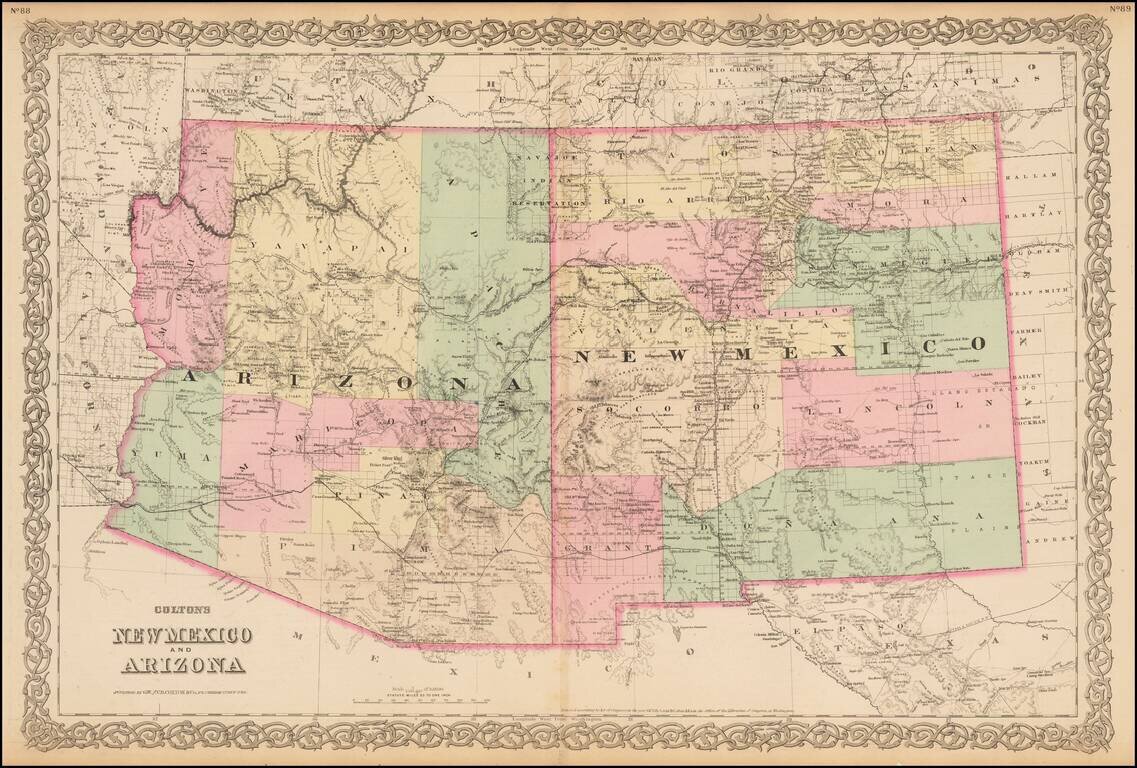
Gorgeous large format map of Arizona and New Mexico. Shows the proposed routes of a number of early railroads through the region, including the Southern Pacific, Atchison Topeka & Santa Fe, etc., along with the route of the Denver & Rio...
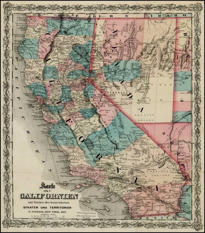
Rare separately issued map of California, published in New York City by Colton. Includes excellent detail throughout the map, including counties, roads, rivers, lakes, mountains, railroads, stations, gold mines, dry lakes, extinct volcano craters,...
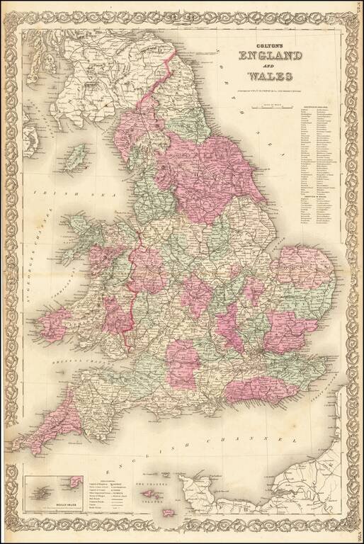
Nice large format map of England & Wales, hand colored by counties.
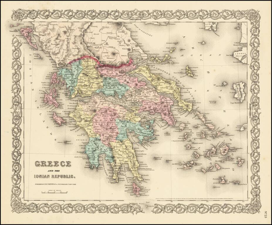
Detailed map of the Greek Islands, showing towns, mountains, rivers, roads, lakes, gulfs, bays, etc. Decorative border. A terrific regional map, from JH Colton, one of the most prolific American mapmakers of the mid-19th Century.
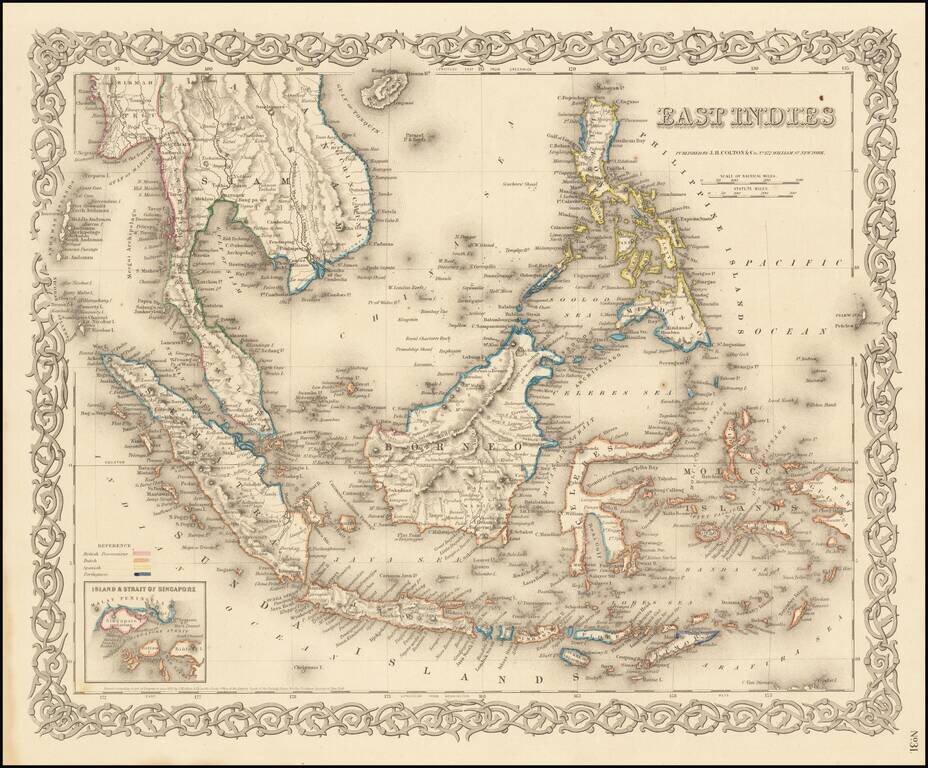
Very detailed map of Indonesia, Malaysia and the Philippines, with inset map of the Strait of Singapore. Color key shows the Dutch, British, Spanish and Portuguese Possession. A marvelously detailed map. Decorative border. A terrific regional map...
![Africa [Southern Sheet]](/map/small/70118.jpg)
Interesting map of Southern Africa and Madagascar, covering the region from Zanzibar and Lower Guinea to Cape Colony. A large Unrecorded Area appears in the interior, with several annotations and early information for the region. Many placenames,...
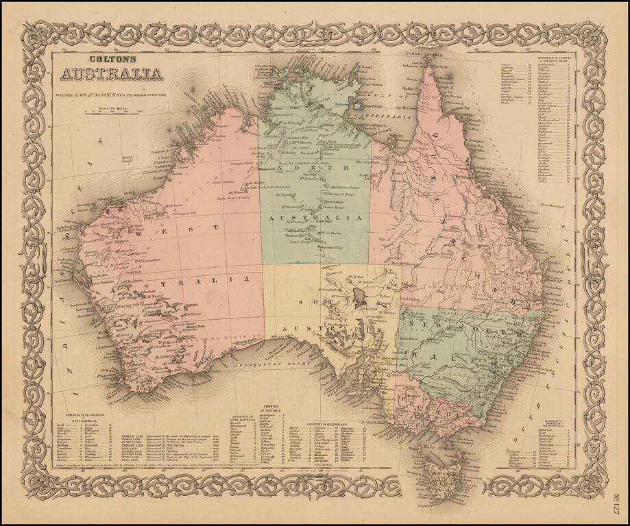
Highly detailed map of Australia, colored by provinces. Includes a key showing the various counties in each of the provinces. Shows towns, rivers, lakes, mountains, islands, etc. The interior is still highly primitive and unknown. Decorative border....
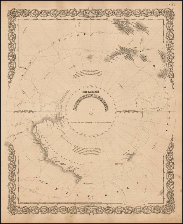
Detailed map of the South Polar Region, published by GW & CB Colton. The map shows in detail the land masses discovered to date, along with the Tracts of the Wilkes, Bellinghausen, Kemp, Ross and Cook Voyages, landfalls, etc.
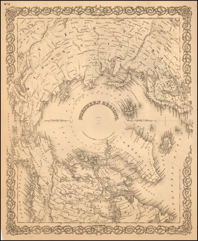
Detailed map of the regions around the North Pole. The Northwest and Northeast Passages are delineated and most of the coastlines of North America, Europe and Asia are shown with relative accuracy.