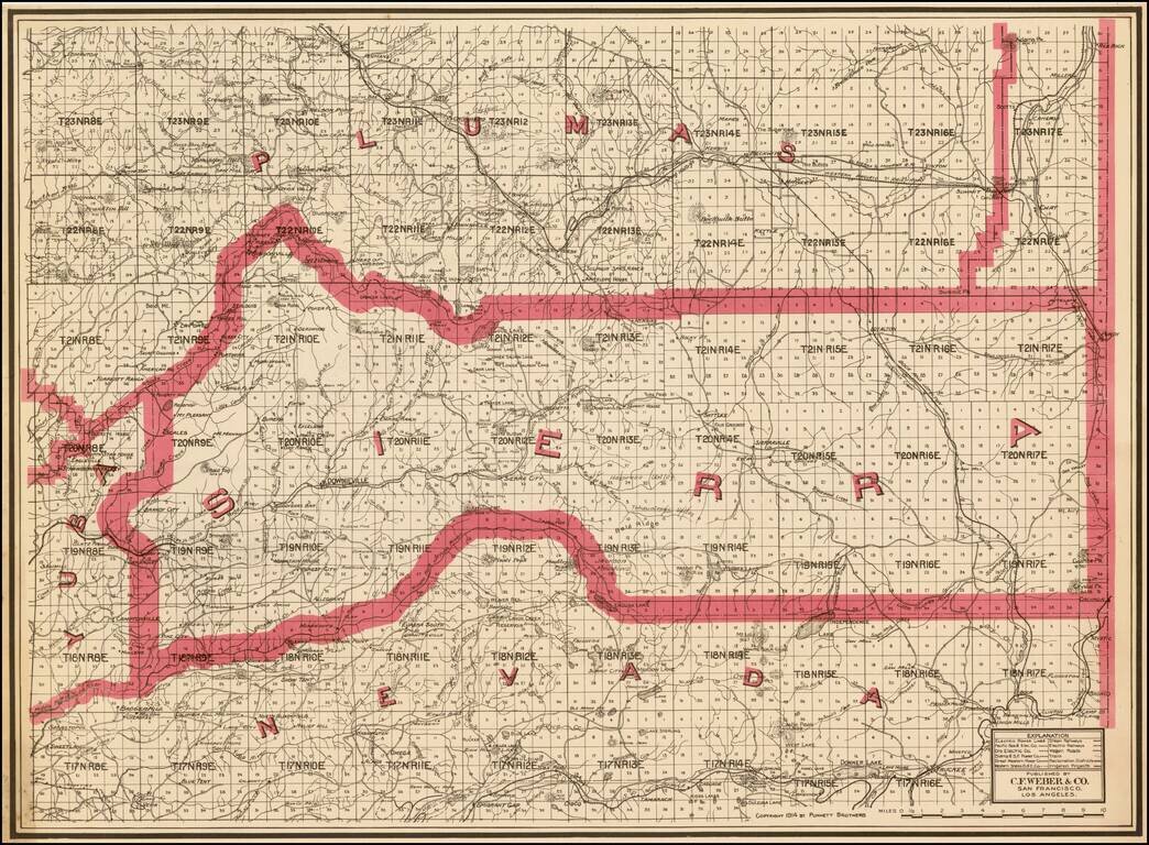
Highly detailed pocket map of Calaveras County, published by C.F. Weber. The map shows early railroads, roads, wagon roads, mines, lakes, mills, and many other details. Calaveras County was one of the original counties of the state of California,...
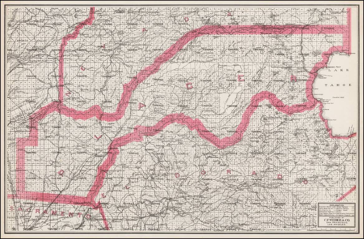
Separately issued unfolded map of Lake Tahoe, El Dorado County, Placer County, etc., published by C.F. Weber. The map shows early railroads, roads, wagon roads, mines, lakes, mills, and many other details.
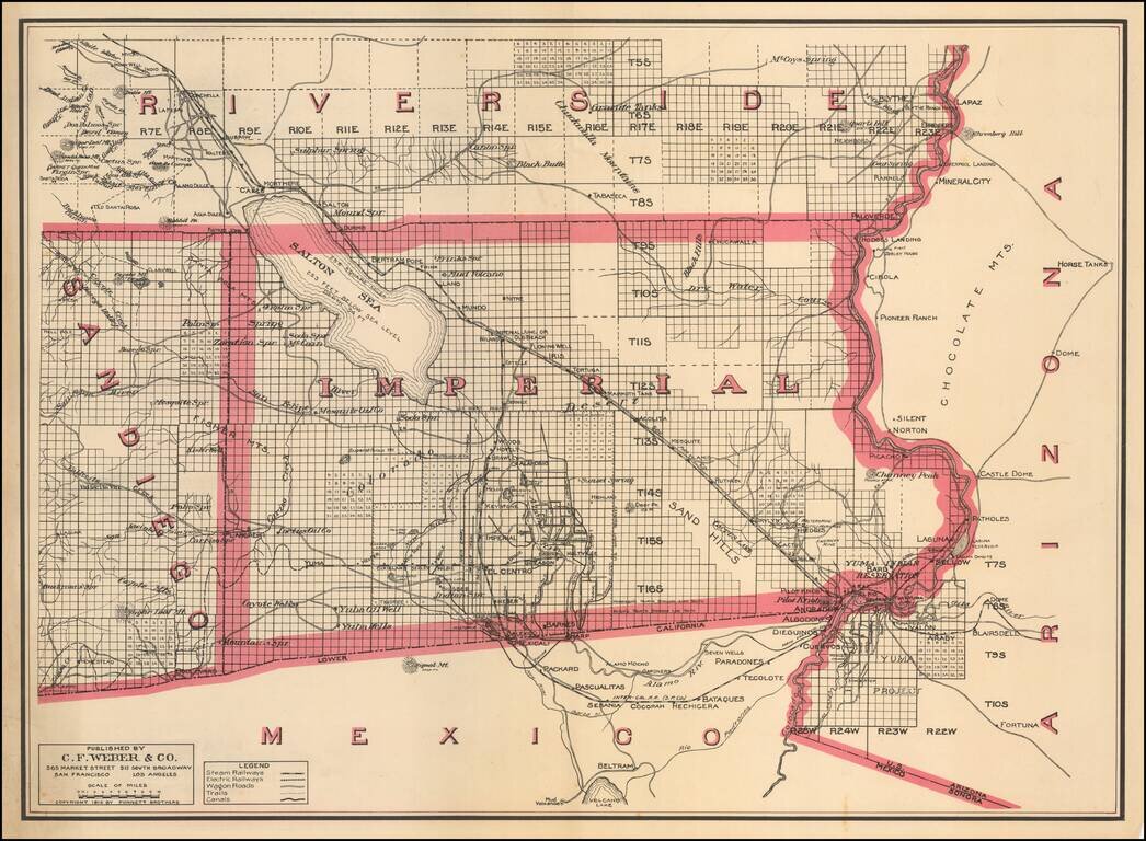
One of the Earliest Separate Maps of Imperial County Scarce separately issued map of Imperial County, published by C.F. Weber & Co. The map was issued just 7 years after the formation of the county and 9 years after the Salton Sea was created by...
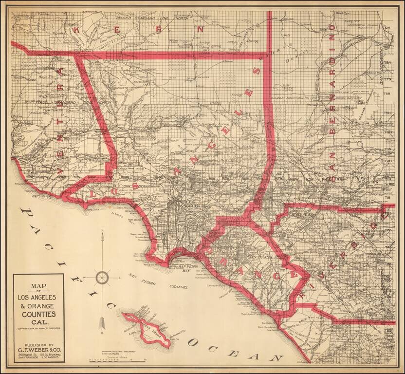
Highly detailed map of Los Angeles and Orange Counties, published by C.F. Weber. The map shows early railroads, roads, wagon roads, mines, lakes, mills, and many other details. A number of early ranchos are shown. There is additional detail of...