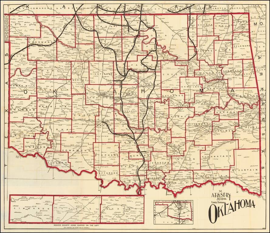
Fine map of Oklahoma, shortly after it obtained statehood on September 17, 1907, and published by the Atchison Topeka & Santa Fe Railroad. Fine map of the state, with the lines of the Santa Fe Railroad running up the center and a number of other...
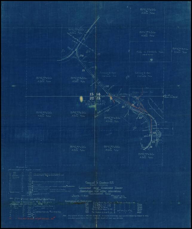
Internal working Sketch map showing the existing and proposed routes of the Prescott & Eastern Railroad in the vicinity of Humboldt, Arizona, prepared on October 18, 1905. Most of the land in the areas is showns as being owned by E.W. Wells and...
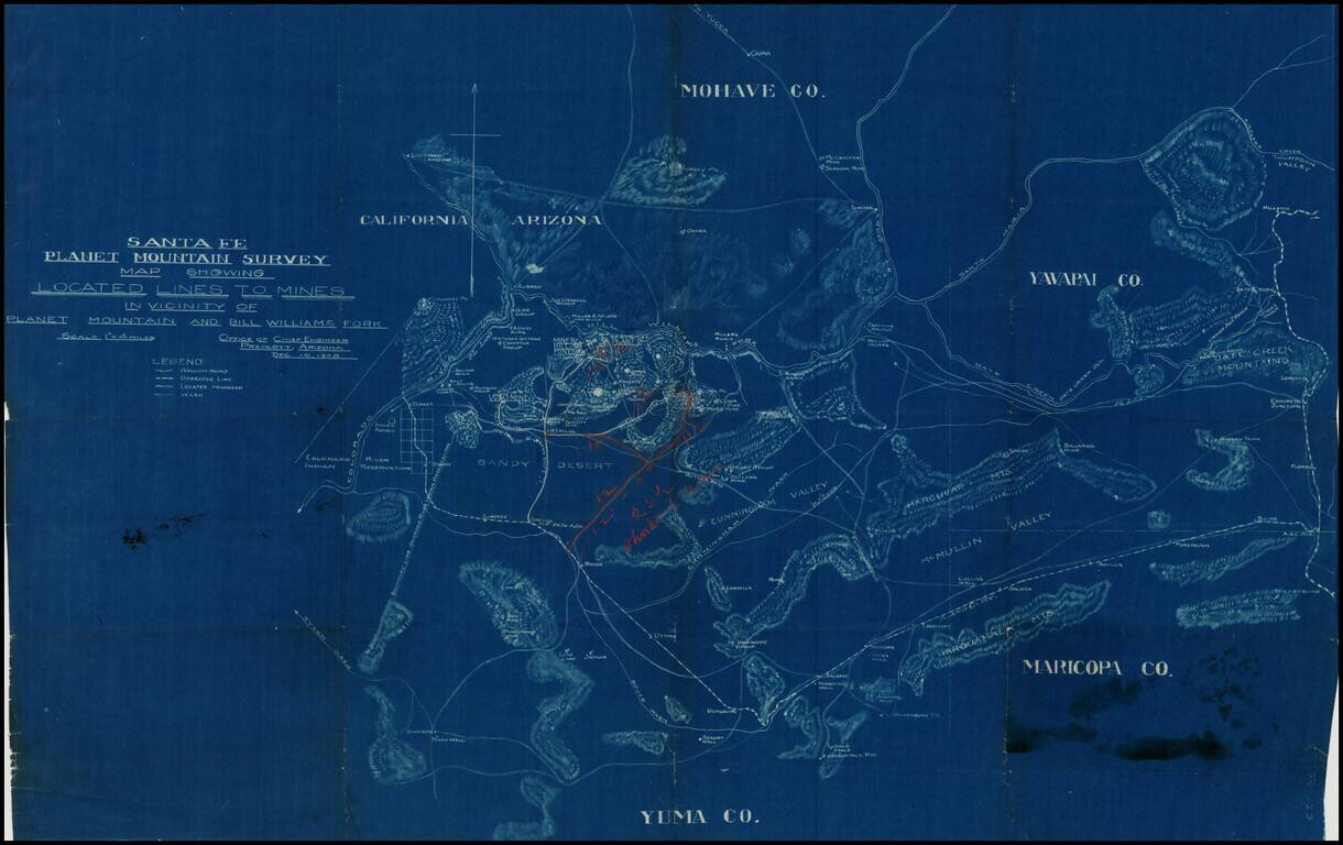
Detailed blue print map of southwestern Arizona, focusing in on the lines of transportation to the mining regions around Planet Mountain and Bill Williams Fork, prepared by the Atchison Topeka & Santa Fe Railroad in 1908. The map includes parts of...
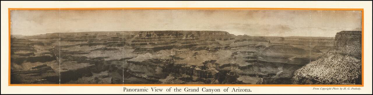
The Grand Canyon of Arizona -- Most Sublime Scenic Panorama in the World Fine photographic view of the Grand Canyon, published in conjunction with the Pan American Exposition. Includes a promotional tract on the verso. Title on verso: The Grand...
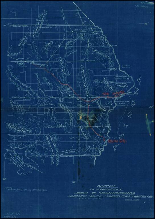
Detailed map of part of Southeastern California (Eastern Imperial and San Bernardino Counties), showing the projected railroad lines connecting Blythe City, Parker, Arizona, and Bengal, on the main line of the Santa Fe Railroad between San Bernardino...