Paolo Santini (1729-1793) was an Venetian engraver known especially for his religious prints and fine cartographic engravings. He published in Venice and may have a been a member of the clergy. In his maps, he largely adopted and adapted the work of his French counterparts, especially the brothers de Vaugondy.
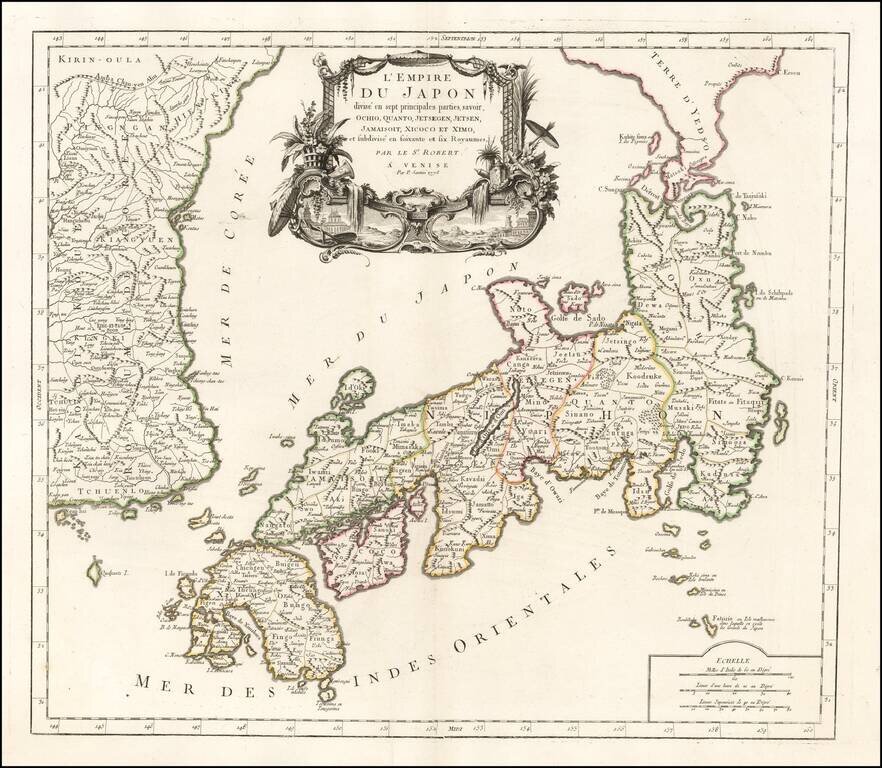
Fine early map of Japan and Korea published in Venice by Francois Santini. The sea between Japan and Korea is prominently labeled Mer de Coree. The map is one of the best large format maps of Japan and Korea to appear in a commercial atlas. One of...
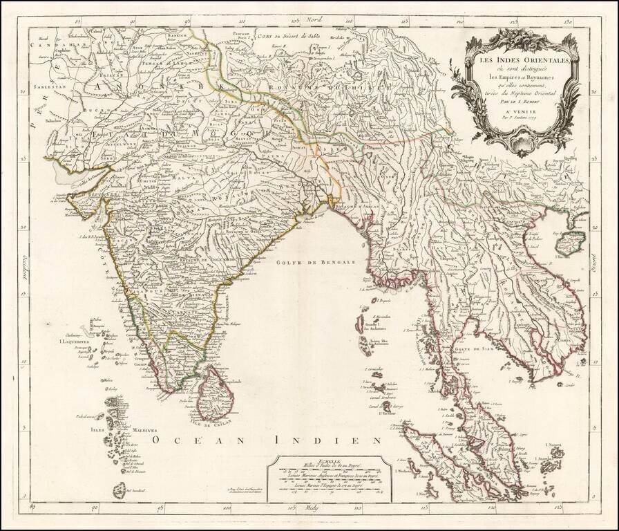
Detrailed map of India and Southeast Asia, published in Venice by Paolo Santini. The map extends from the Kingdom of Tibet and northern India to the Maldives and the Straits of Malacca. Includes islands, towns, mountains, rivers, lakes and a host of...
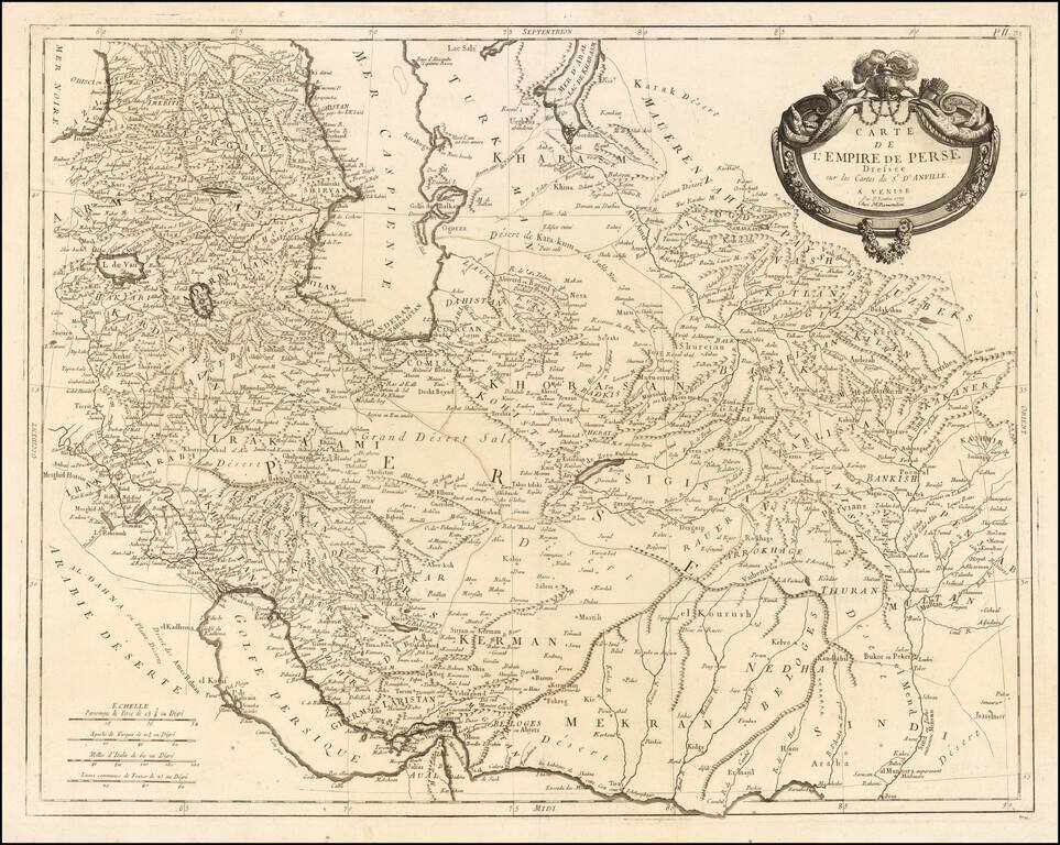
Remondini's edition of the Santini map of the Persian Empire Detailed map of the Persian Empire extending north to the Caspian Sea and Uzbekistan, and from Armenia and the Persian Gulf in the west to the Indus River and the Karachi area in the east....
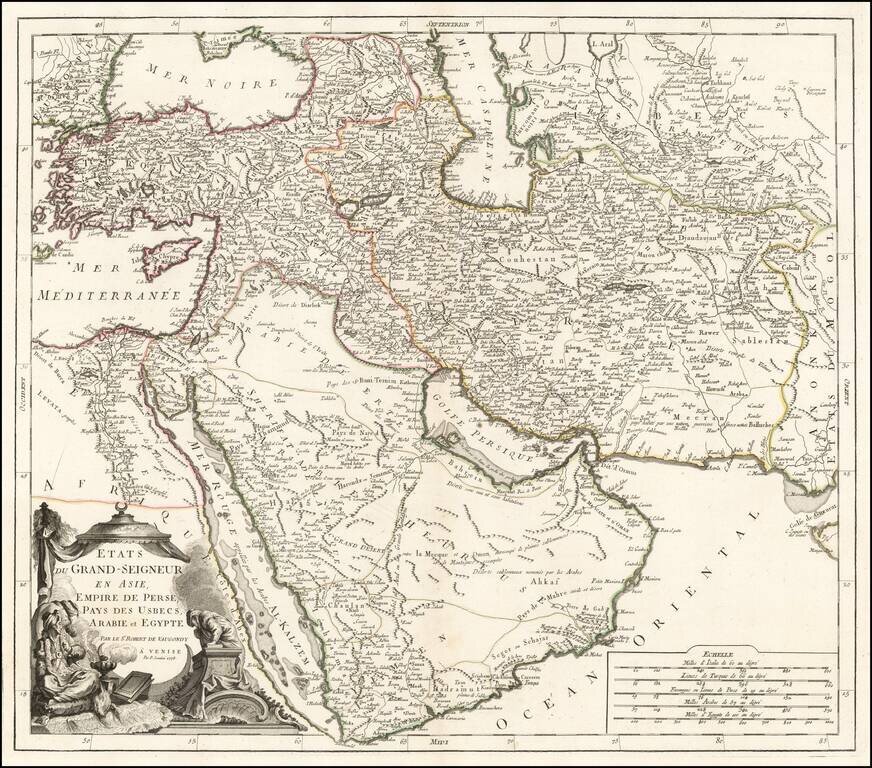
Detailed map of the Turkish Empire, extending to the Black Sea, Georgia, the Caspian, Usbekistan, the Indian Ocean, Saudi Arabia, Egypt and the Red Sea, published in Venice by Santini. Large decorative cartouche. The map is based upon an earlier map...
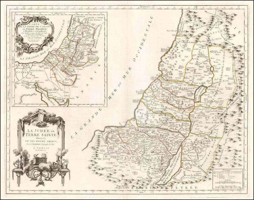
Fine large format map of the Holy Land, published in Venice, in 1779, by Santini and engraved by Remondini. The map presents a fine detailed depiction of Judea or the Holy Land, divided into the regions controlled by the 12 Tribes of Israel. A large...