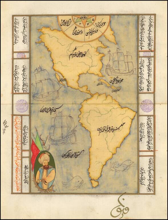
Decorative manuscript map of America, showing California as an island, with decorative embellishments. Maps of this type are typically hand drawn for tourists in Istanbul, using old paper which frequently includes earlier manuscript writing in...
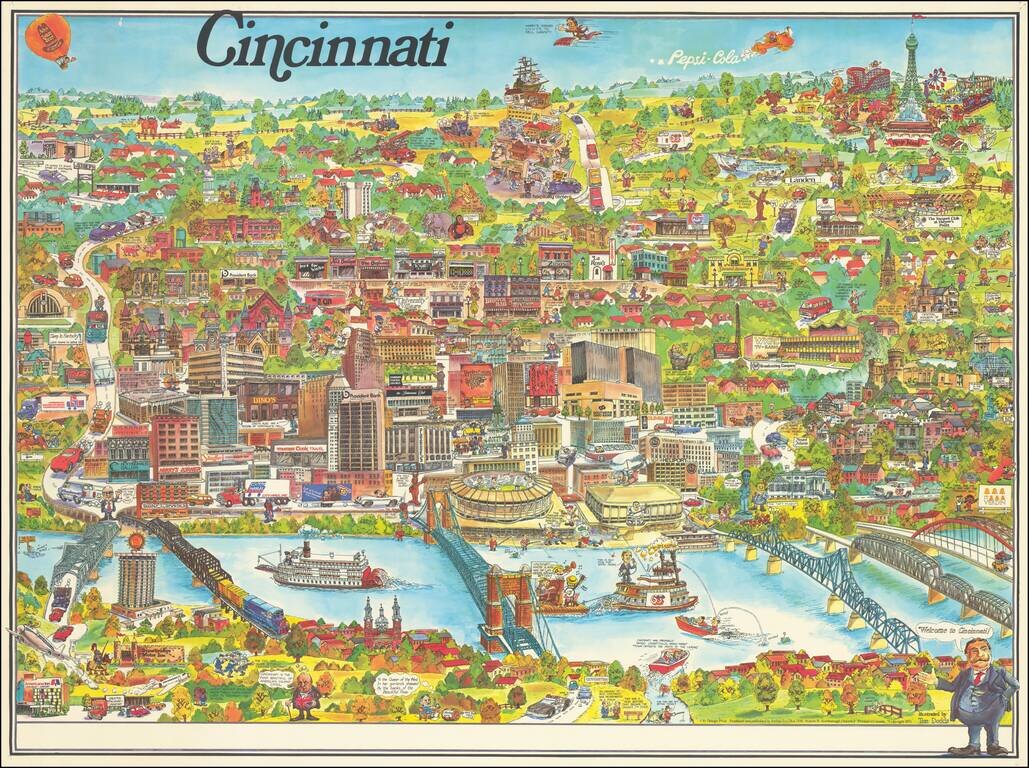
Lively pictorial map of Cincinnati, published by City Design Print and illustrated by Tom Dodds. The map includes advertising for dozens of Cincinnati's local businesses, including a number of local landmarks, providing an entertaining an informative...
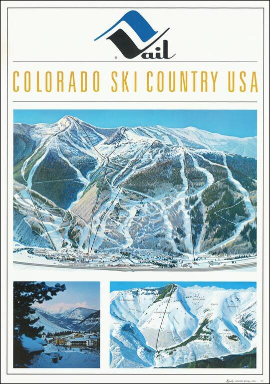
Fine early Hal Shelton Poster, promoting Vail, Colorado. Iconic promotional poster of Vail, published shortly after the addition of Gondola #2. The top image is a large traditional trail map, identifying ski lifts, trails, bowls, etc. with the...
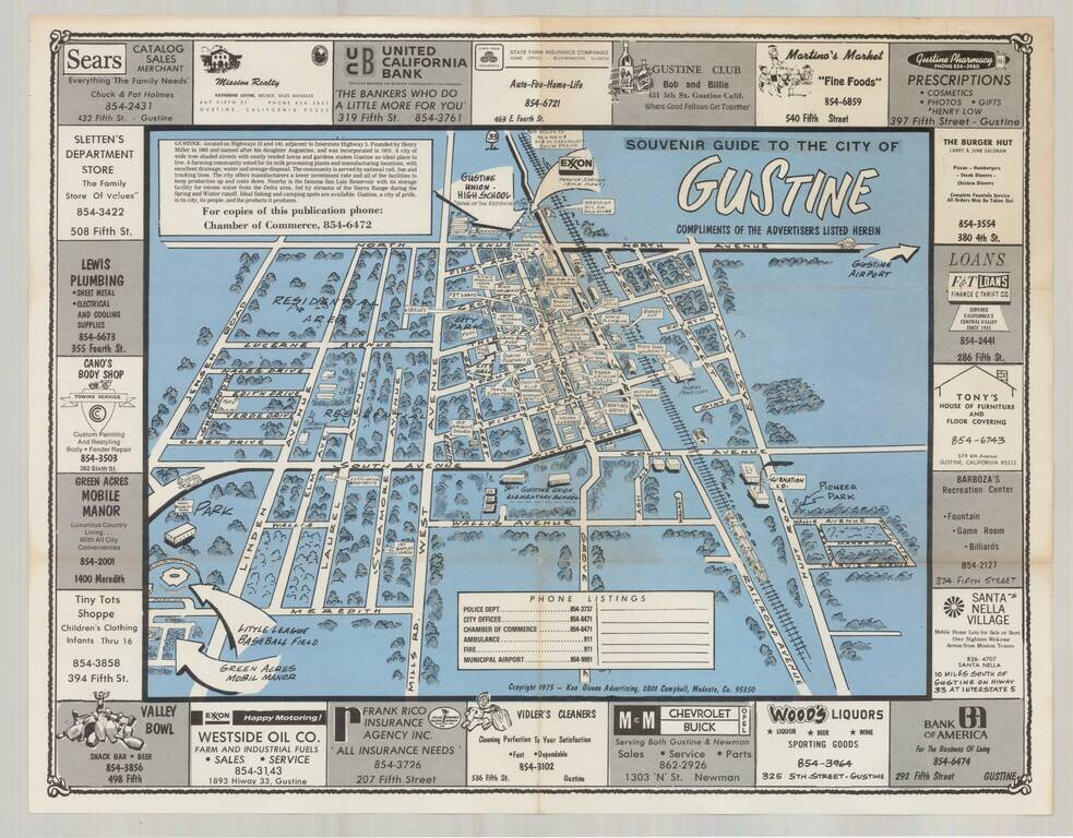
Interesting pictorial map of the Gustine, California, surrounded by local advertising, published by the Gustine Chamber of Commerce. While published in 1975, the map is a stylistic throwback to the pictorial maps of earlier times. The map was...
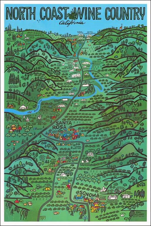
Fine pictorial map of the North Coast Wineries (Napa Valley, Sonoma Valley, etc.), published by Earl Thollander. The map shows many of California's top wineries from the mid-1970s. The reverse side features a map of the area, including a winery and...
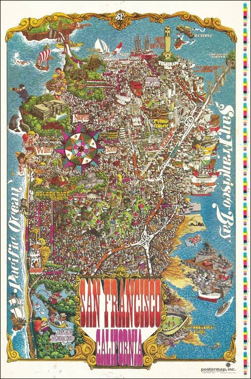
Decorative vintage pictorial map of San Francisco, published by Funny Funny World. The map shows the city in an absolute hustle and bustle; a game is being plaid at Candlestick Park, ships are lined up all along the waterfront, certain important...
![[Placerville, California]](/map/small/63008.jpg)
Lively pictorial advertising map for Placerville, California, issued in the mid-1970s. We dated the map based upon the Master Charge logo (1969-1979). The map provides a whimsical look at Placerville, in the foothills of the Sierra Mountains, with...
![Wailuku [Maui]](/map/small/61147.jpg)
Interesting pictorial advertising map of Wailuku, Hawaii, which seems to have been published by Uncle Harold's Lunch Wagon. The map is a fun mix of cultural and promotional material, with an image of pre-WWII Wailuku at the top (with Ox Cart),...
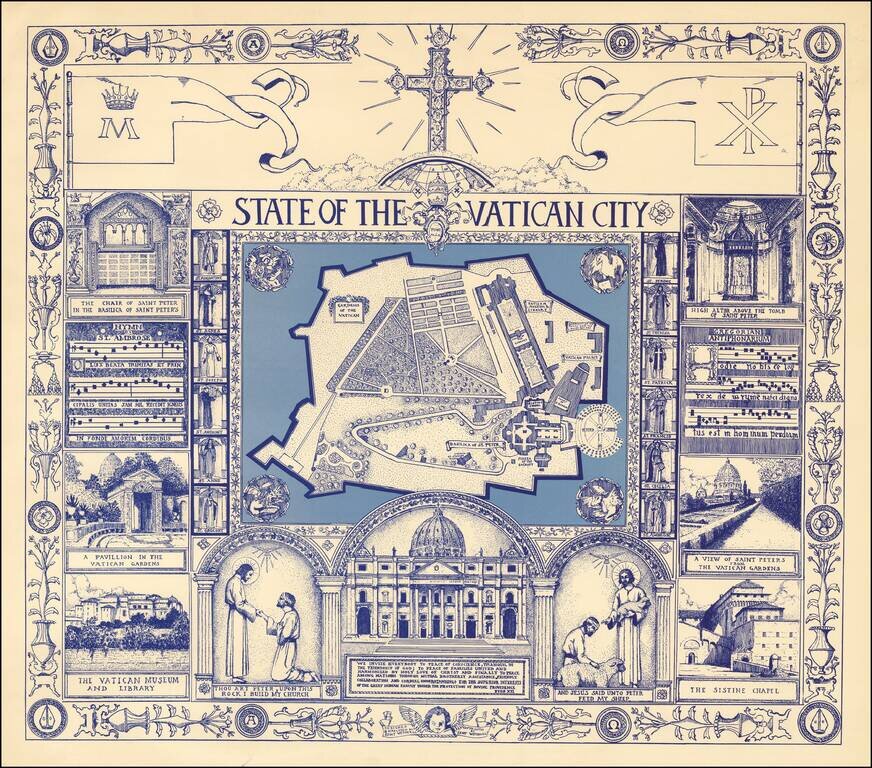
Fine large format pictorial view of the Vatican, surrounded by religious themed vignettes. We were not able to locate information on the artist, other than credits for other illustrations done in the mid-1970s.
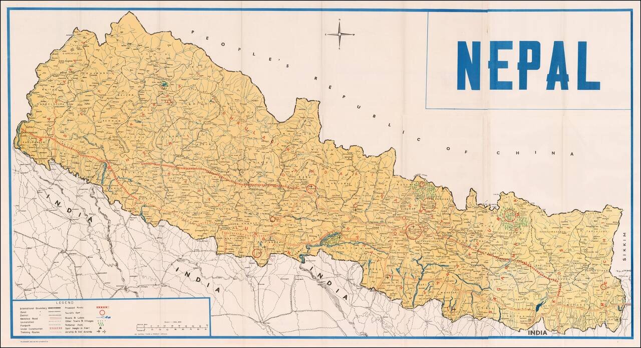
Fine large map of Nepal, published by Natraj Tours & Travels, in Katmandu. Legend notes: International Boundaries Zonal Boundaries District Boundaries Metalled Road Unmetalled Road Foot Path Trekking Routes Proposed Roads Roads Under...