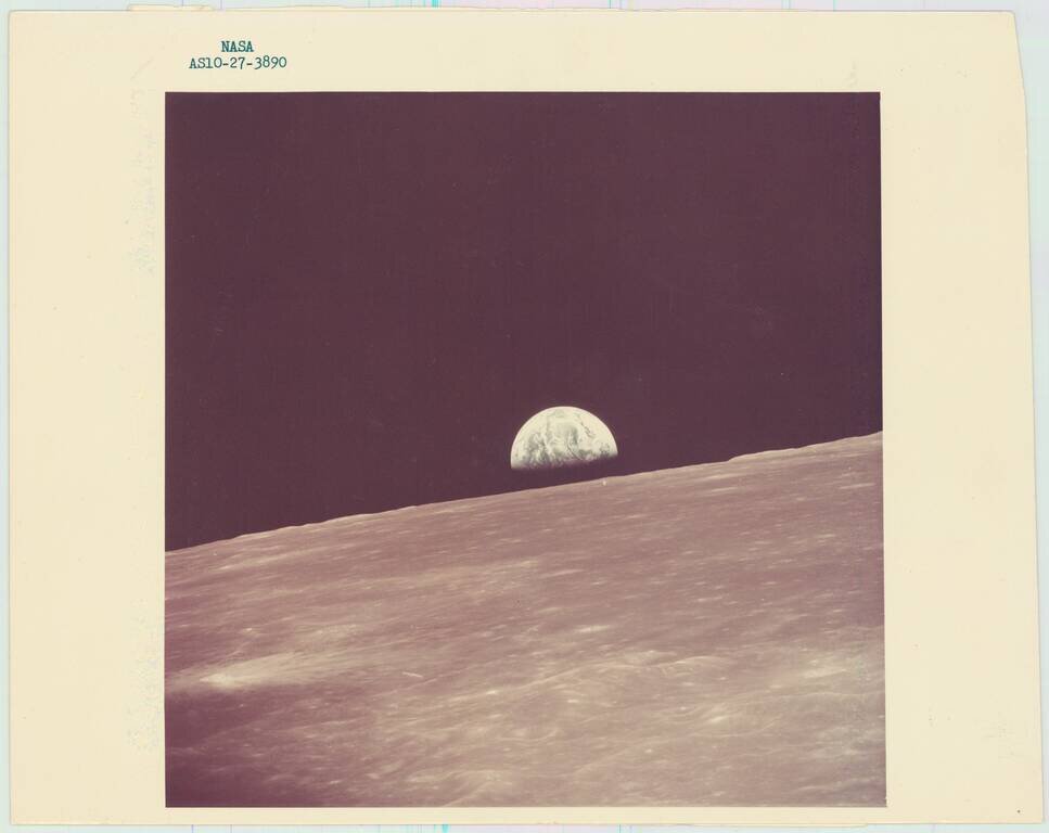
An iconic "earthrise" photo taken by the Apollo 10 Lunar Module, looking west in the direction of travel. The photo was taken in May of 1969, and this original NASA print was made in the same month. At the time the picture was taken, the Lunar Module...
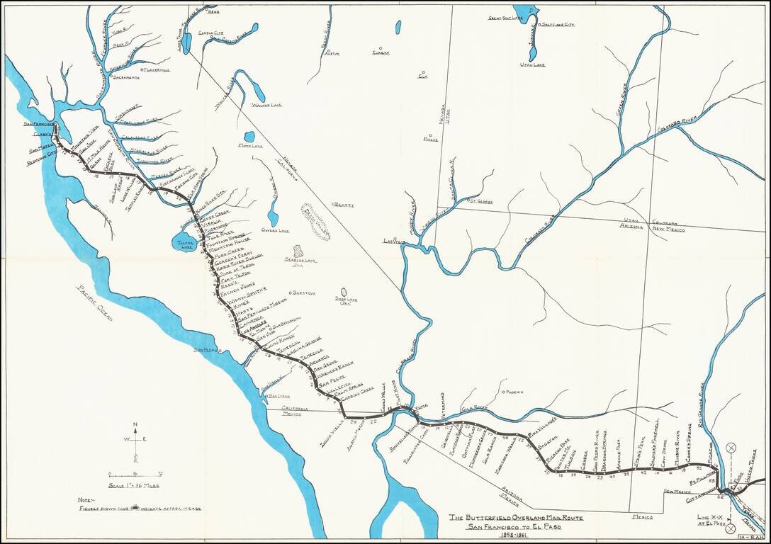
Rare historical / pictorial map of Western portion of the Butterfield Mail Route, drawn by Robert A. Hanson. The map was likely published by the Western Cover Society, a California based society which published the Western Express. Hanson's maps were...
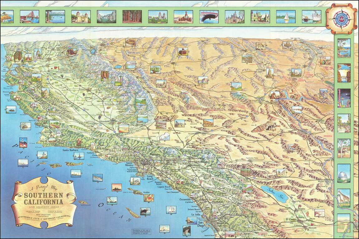
Decorative pictorial map of Southern California, produced by Harry F. Pflum for the Automobile Club of Southern California. Includes over 30 inset views.
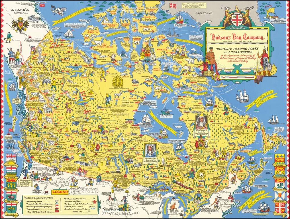
"Third Revision" of this marvelous pictorial map celebrating the history of the Hudson's Bay Company, published in Toronto. Fine large format map drawn by Toronto Artist Stanley Turner, one of the best known WWII map illustrators. The map is filled...
![[Moscow. Motorist's companion. Schematic plan of the main streets and highways of the capital] Москва Схематический План Основных улиц и Магистралей Столицы](/map/small/70244.jpg)
Vintage map of Moscow focusing on automobile infrastructure at the end of the 1960s. The map shows some of the development of the city's automobile infrastructure: 105 gas stations, 32 official parking spots, a dozen of car repairs, and a small number...
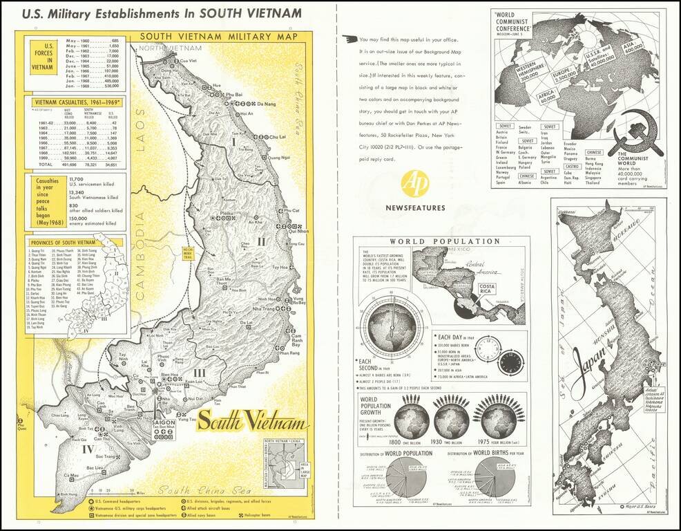
A fascinating image of South Vietnam, a decade into American involvement in the region. The main portion of the map focuses on the US military establishments in the country. Command headquarters, helicopter bases, navy bases, and other points of...
![[Pictorial Map of the United Arab Republic] Kharitat Musawwarat al-Jumhuriya al-'Arabiya al-Muttahida / خريطة مصورة الجمهورية العربية المتحدة](/map/small/55146.jpg)
Fine Pictorial Map of the United Arab Republic Tourist map of the United Arab Republic, published by the Ministry of Tourism in Egypt in 1969. The map shows what is now Egypt during its short time as the United Arab Republic, as well as the boundaries...