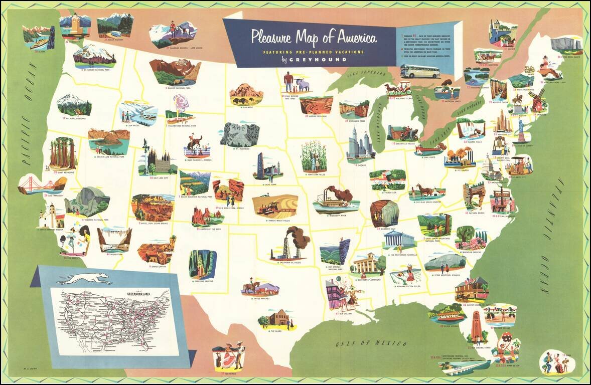
Scarce pictorial map of the United States, promoting pre-planned vacation packages offered by Greyhound. The map is illustrated with regional tourist attraction vignettes, with numbers keyed to Greyhound's vacation tour packages described on the...
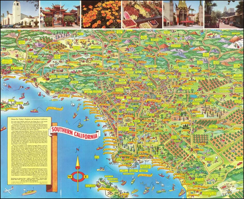
Pictorial Southern California -- A Pic-Tour Map of Southern California Scarce pictorial map of Southern California, published by A Mirro-Krome Production and Drawn by famed pictorial artist Don Bloodgood. Bloodgood's pictorial map of Southern...
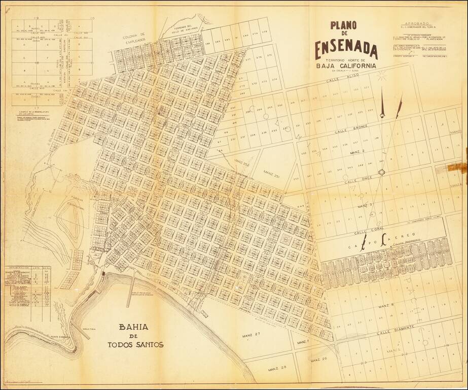
A mid-century map of Ensenada, Baja California del Norte. It shows the port of Todos Santos, the layout of the city and its neighborhoods, and plots of land not yet developed. The margins contain notes and tables showing how new plots should be labeled...
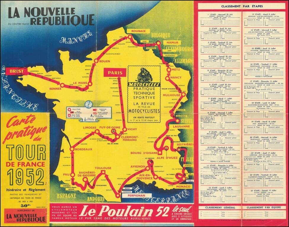
A great antique map made for the 1953 Tour de France, showing the many cities and towns the race would pass through. The route starts in Strasbourg and then passes through Liege, Lille, Caen, Nantes, Bordeaux, Marseille, and Lyon before arriving in...
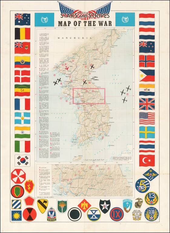
Decorative map of Korea, intended for distribution to soldiers stationed in Korea in the 1950s. Shaded relief with key military features locations marked and described. Includes a decorative border of flags of allies and insignia of military units.
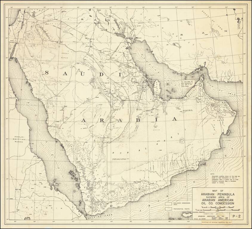
One of the earliest printed maps of Saudi Arabia to include the name Arabian American Oil Company (Aramco) Highly detailed map of Saudi Arabia, published by the Arabian American Oil Company in August 1951 and Revised in 1953. The map is one of the...