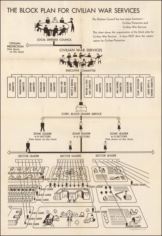
World War II Civilian War Services Organizational Chart Unusual organizational chart showing the means for organizing civilians during World War II. As the chart notes, this is the Civilian War Services chart, NOT the chart for Civilian Protection....
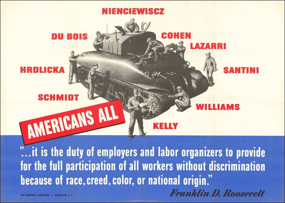
Fighting Labor Discrimination During World War II Large World War II broadside published by the American Government, stressing the importance of utilizing "All Americans" in the workplace and its importance in aiding the war effort. As noted by...
![[WWII Propaganda Map] Newsmap -- Monday, September 14, 1942](/map/small/66662.jpg)
American Occupation of Galapagos -- Nazis Closing on Stalingrad -- 234 US Vessels Launched Labor Day (1942) Fine large format WWII "Newsmap", providing up to date coverage of World War II to the American public. The base map is surrounded by news...
![[WWII Propaganda Map] Newsmap -- Monday, October 26, 1942](/map/small/66710.jpg)
More Than 530 Enemy Subs Reported Sunk or Damaged Fine large format WWII "Newsmap", providing up to date coverage of World War II to the American public. The base map is surrounded by news style articles, images, photographs and other information...
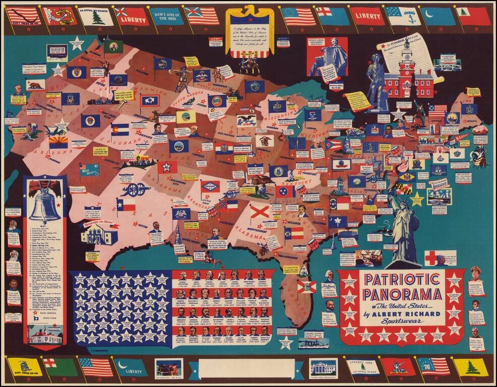
The Albert Richmond Patriotic Panorama Map Detailed patriotic map of the United States drawn by F. E. Cheeseman, published for Albert Richard. The map was issued by Albert Richard, a manufacturer of mens and boys coats. The posters were promotional...
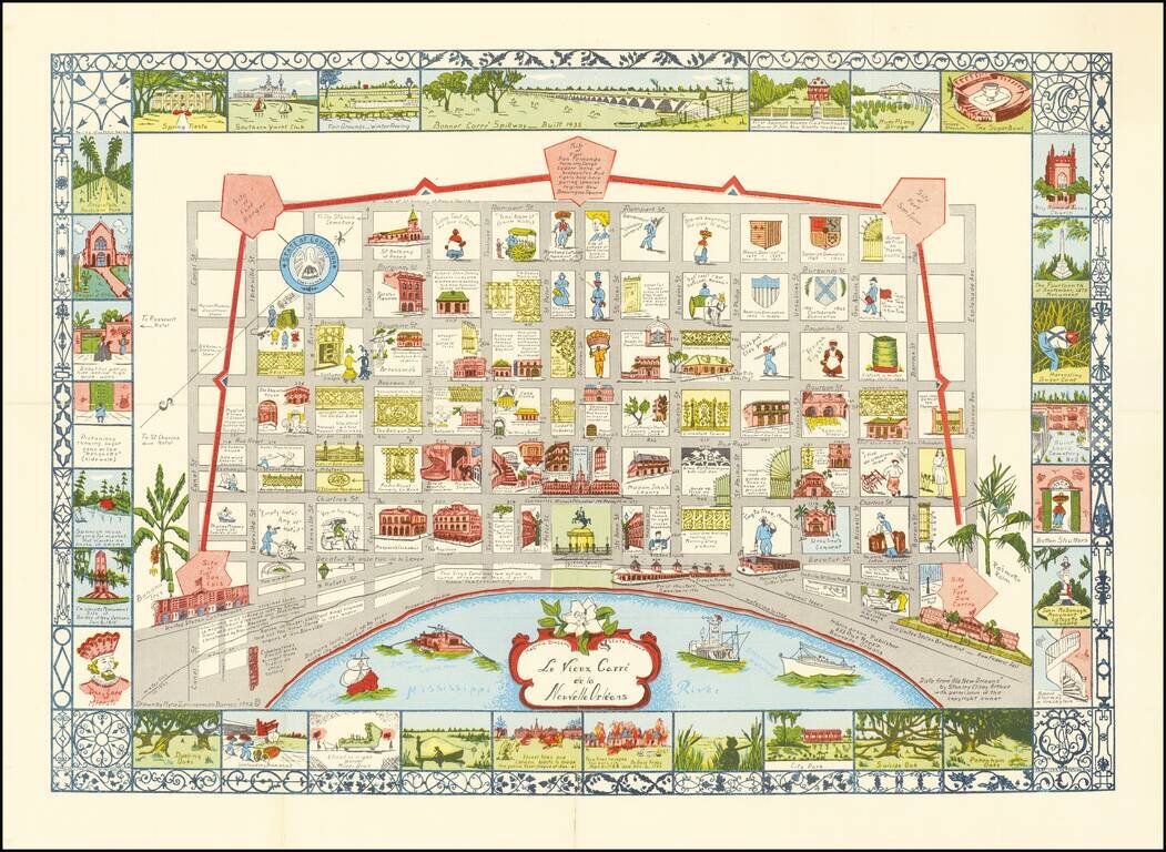
Scarce map of New Orleans, drawn by Myro Zimmerman Barnes in New Orleans in 1942. Includes a fabulous whimsical look at the city, with block by block vignettes of history, costumes and other clever caricatures.
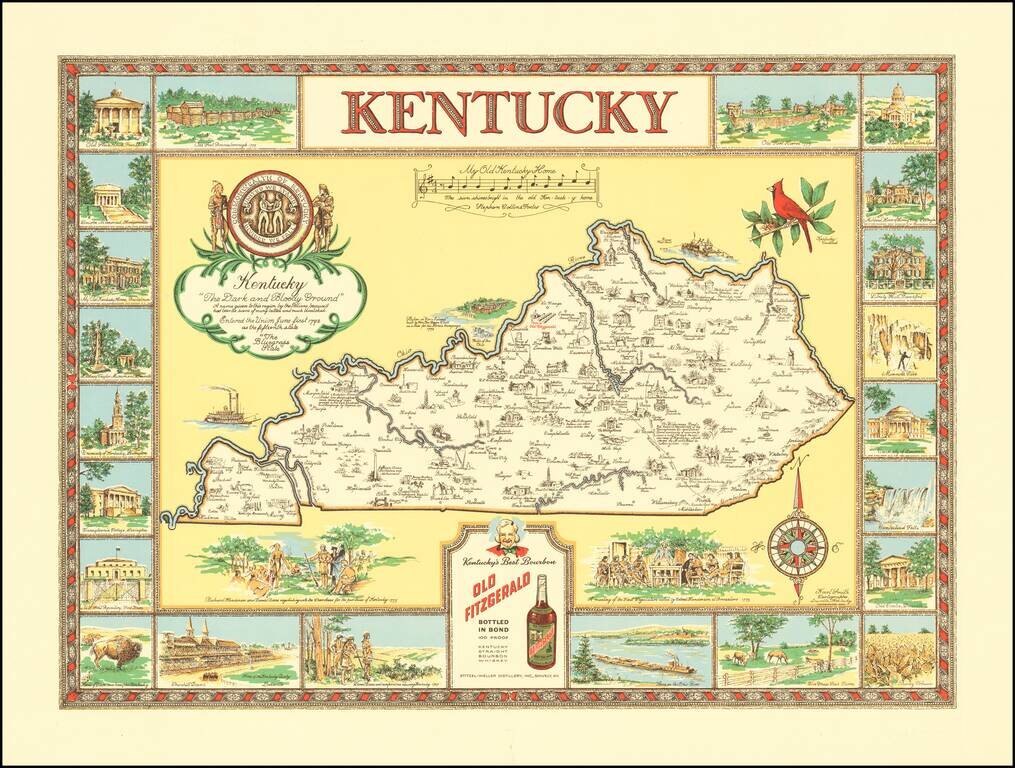
"The Dark and Bloody Ground" Rare pictorial map of the Kentucky, one of a number of different pictorial maps of Kentucky by the prolific illustrator Karl Smith. The map illustraes landmarks and historical events in the decorative panels which make up...
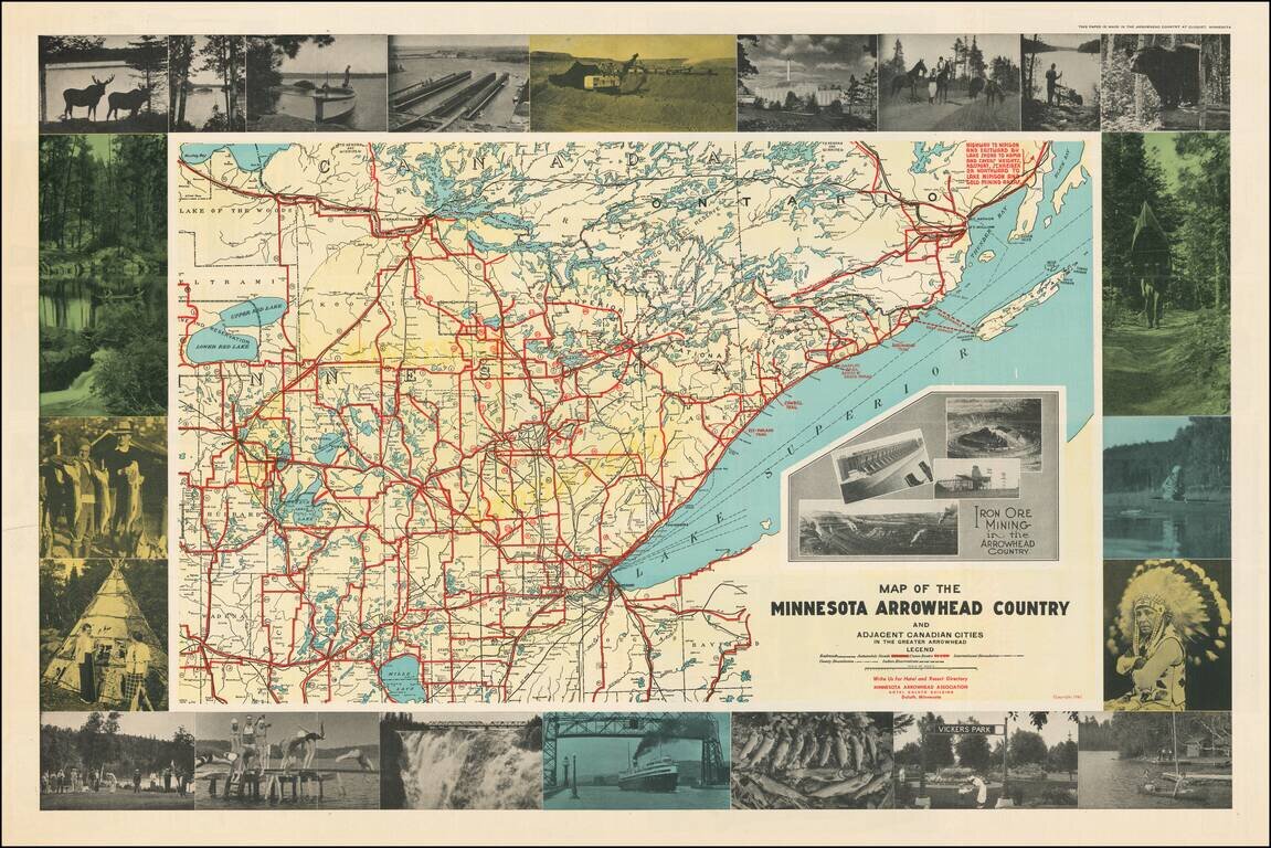
Attractive pictorial map of Minnesota's Arrowhead Region with numerous carte-a-figure photographs of local tourist attractions, wildlife, Native Americans, etc. The map includes inset photos of Iron Ore mining operations in northeast Minnesota. The...
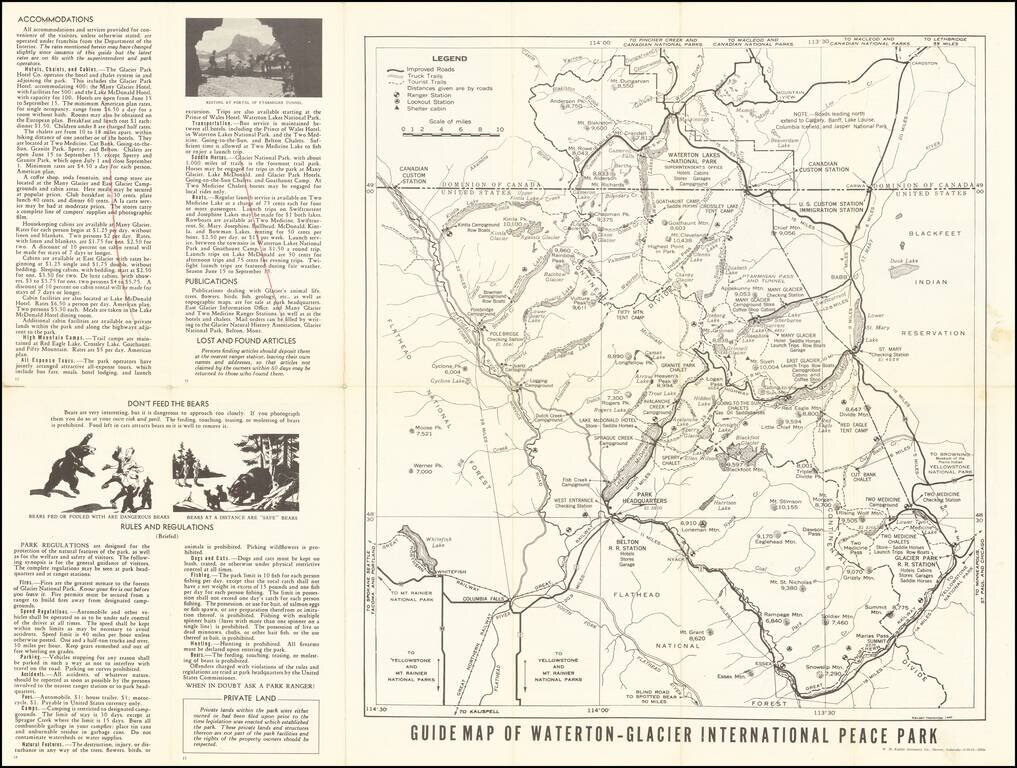
Rare early state of this road map of Glacier Park area, published for the United States National Park Service. The map includes roads through the park, distances, important points of interest, elevations, etc., including a delineation of the...
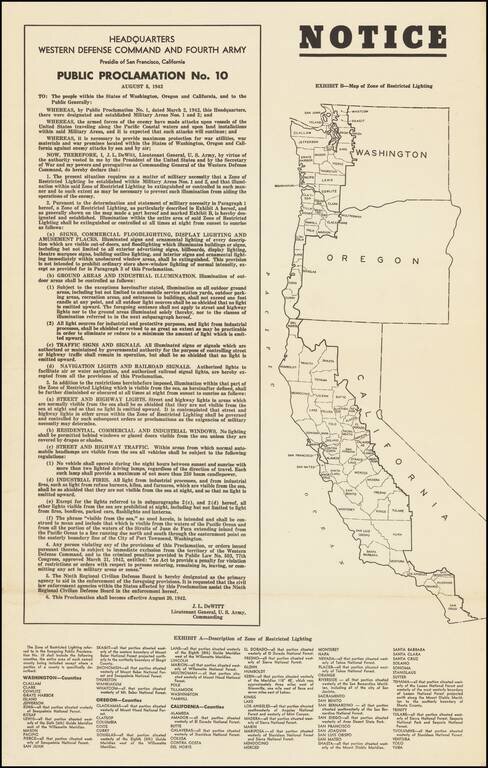
Lights Out Across the Pacific Coast. World War II broadside declaring the institution of Public Proclamation No. 10, which heavily controlled the use of artificial lighting on the West Coast, so as to inhibit nighttime attacks by Japanese warships and...
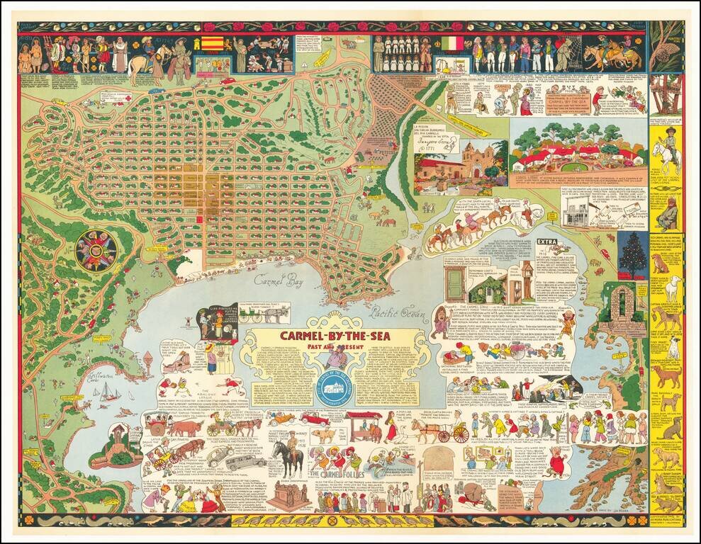
Fine example of Jo Mora's marvelous map of Carmel and the location of Mora's art studio. The map includes a detailed and whimsical look at the area around Carmel, with marvelous vignettes of the major landmarks, past and present, a town plan and a...
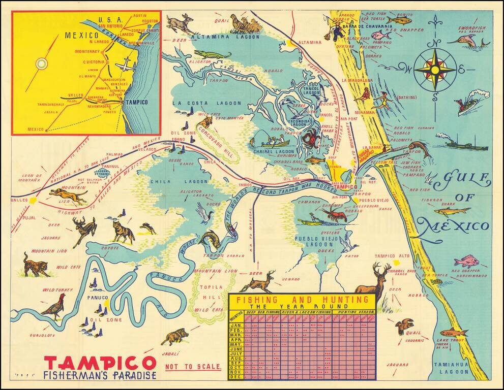
Decorative pictorial map of the Tampico area, promoting the local fishing and tourism area.

Map of the Russian Front Published in the British Empire Fascinating WWII broadside propaganda map, published in India, in order to keep the local populous informed about the War. The map illustrates the Russian Front, from the Caucus Mountains and...
![[Fall of Berlin - Operation Clausewitz] Umgebung von Berlin](/map/small/60025.jpg)
Extraordinary Defensive Plan of Berlin, Prepared by Nazi Forces on the Eve of the Soviet Capture of the City and the End of World War II in Europe. This Map was Captured by Soviet Soldiers and Bears an Inscription in Russian in the Upper Left Corner....