![[Europe: Air Mail Routes] Carte des lignes postales aeriennes internes et internationales Europe pubilee par le Bureau International de l'Union postale universelle Berne, Avril 1937](/map/small/41144.jpg)
Postal map of Europe, showing the various domestic and international air postal routes. Includes German, Belgian, British, French, Dutch and Polish postal lines.
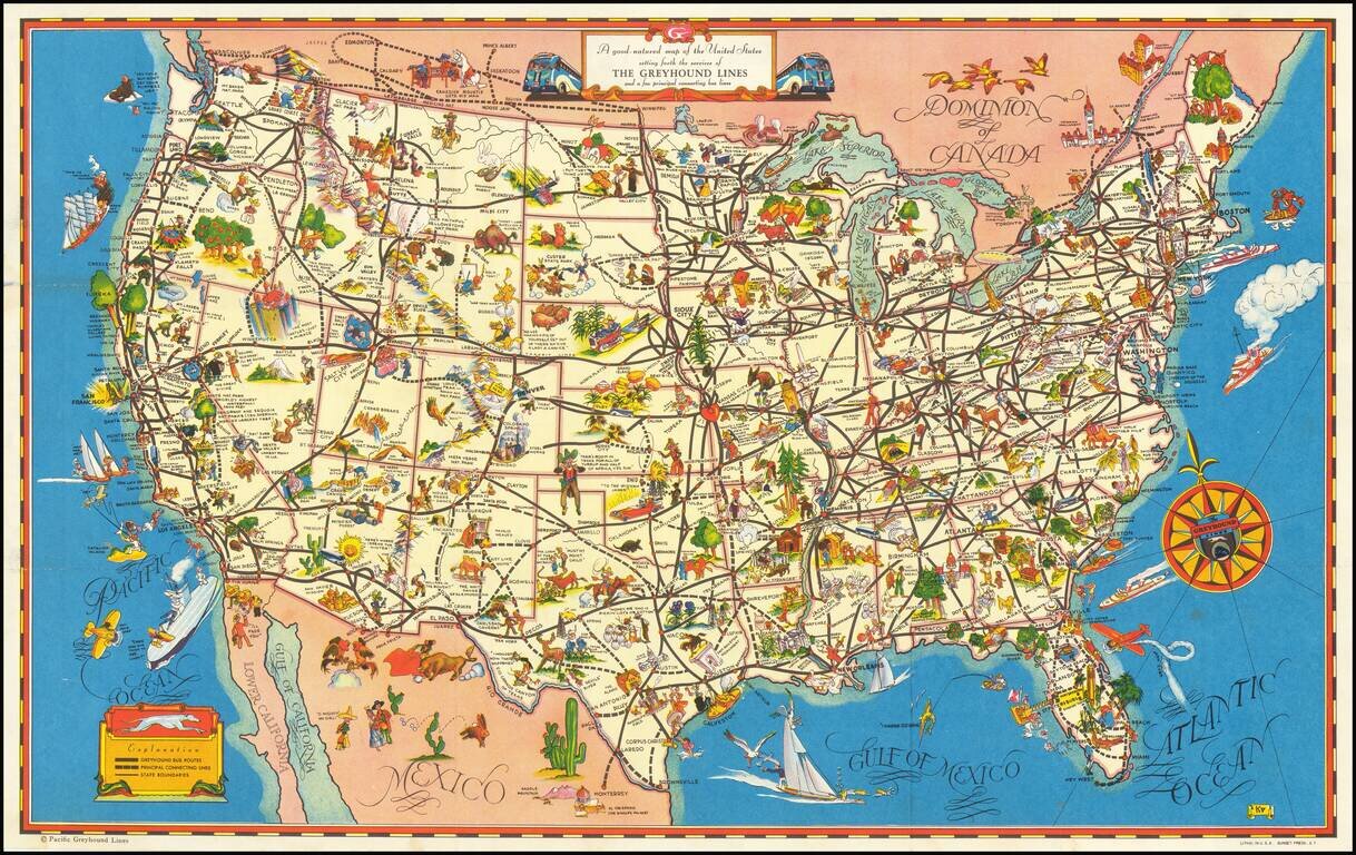
A fine example of this decorative pictorial map of the United States, promoting Greyhound bus lines. The caricatures of the various regions run from charming to very politically incorrect and provide a marvelous look at American's ethnic and regional...
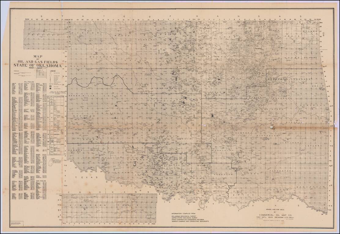
First published in January 1937, the map is revised to February 1938. A rare and detailed map of oil and gas development in Oklahoma, by the Commercial Oil Map Co. of Oklahoma City. The map was compiled from information collected by the Oklahoma...
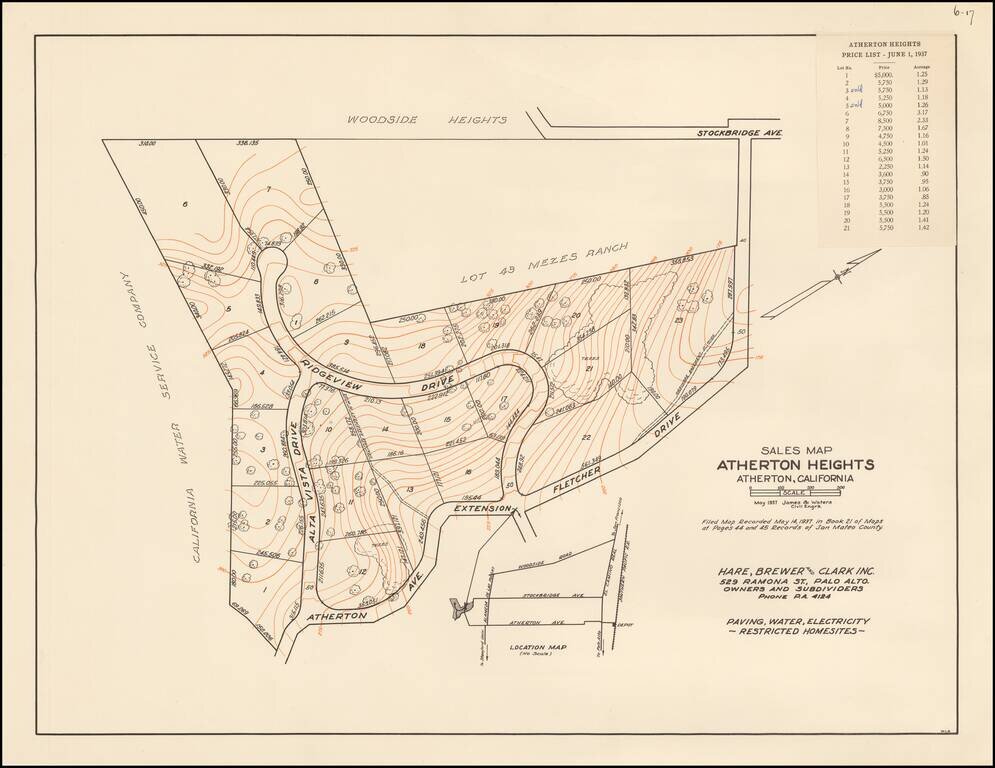
The First Subdivision Map of Atherton Heights - With Price List! Rare Subdivision Sales map for Atherton Heights, in Atherton, California, dated May 1937, prepared for Hare, Brewer and Clark, Inc., the owners and subdividers of Atherton Heights. The...
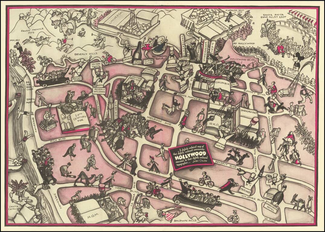
Hollywood in the 1930s Pictorial map of Hollywood section of Los Angeles, also incorporating surrounding areas. Shows streets, locations of film producers and directors, studios, and other points of interest with cartoon illustrations. Landmarks...
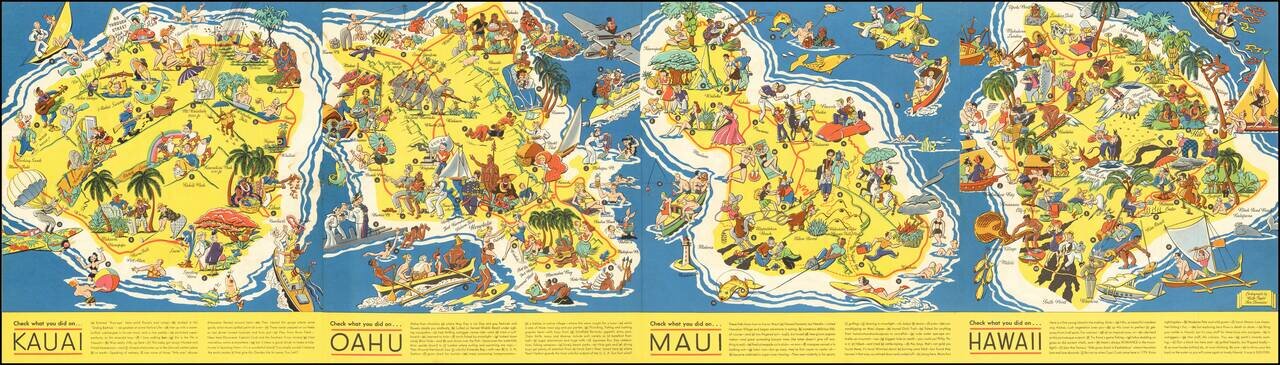
Very rare Ruth Taylor White pictorial map of Hawaii, really four separate maps of Kauai, Oahu, Maui, and Hawaii all on one sheet. This set is far rarer than her other Hawaiian maps. The maps were completed two years after she made "The Story of...
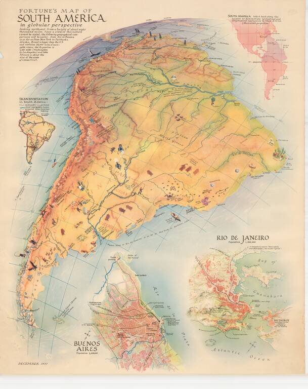
Scarce map of South America, published by Fortune Magazine. The map includes vignettes, showing natural resources, recreational activities and other vignettes highlighting the features of the various regions. Includes a second map showing a detailed...
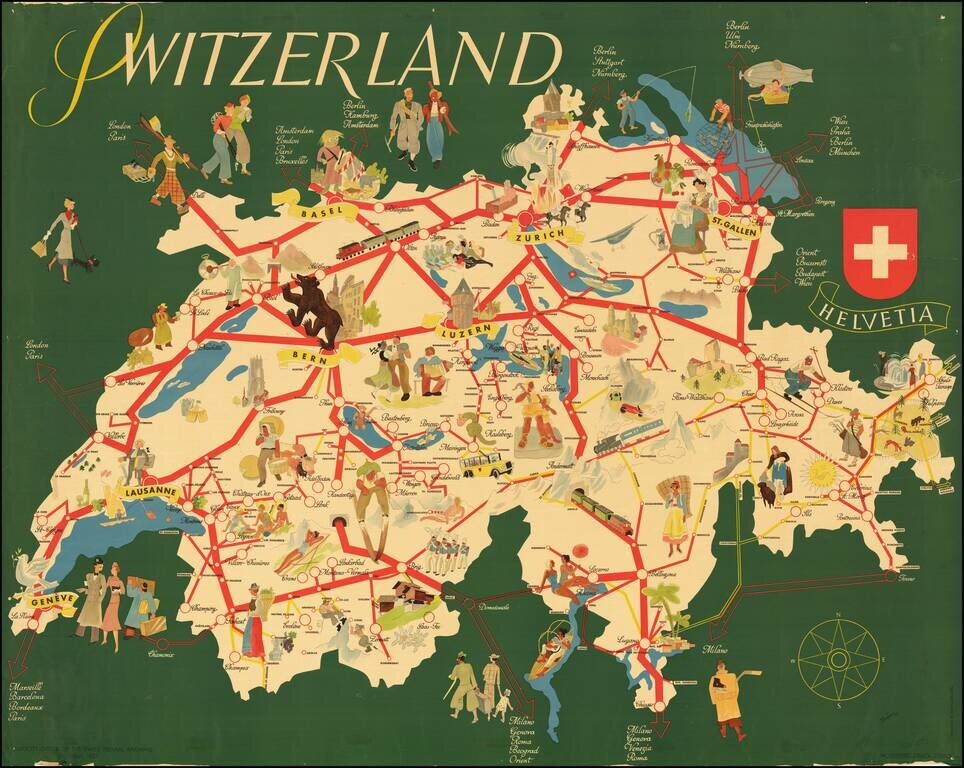
Rare separately published tourist map of Switzerland, published in Berne. The map focuses on the major rail lines, cities and tourist attractions within the country, with lively pictorial vignettes throughout.
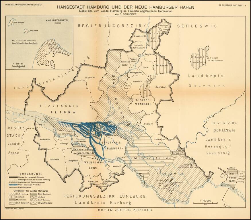
Detailed map of the area around the city of Hamburg. The map illustrates the growth of the various regions of this Hanseatic port, on the eve of World War II. The map translates as follows: Hanseatic City of Hamburg and the New Hamburg Harbor...
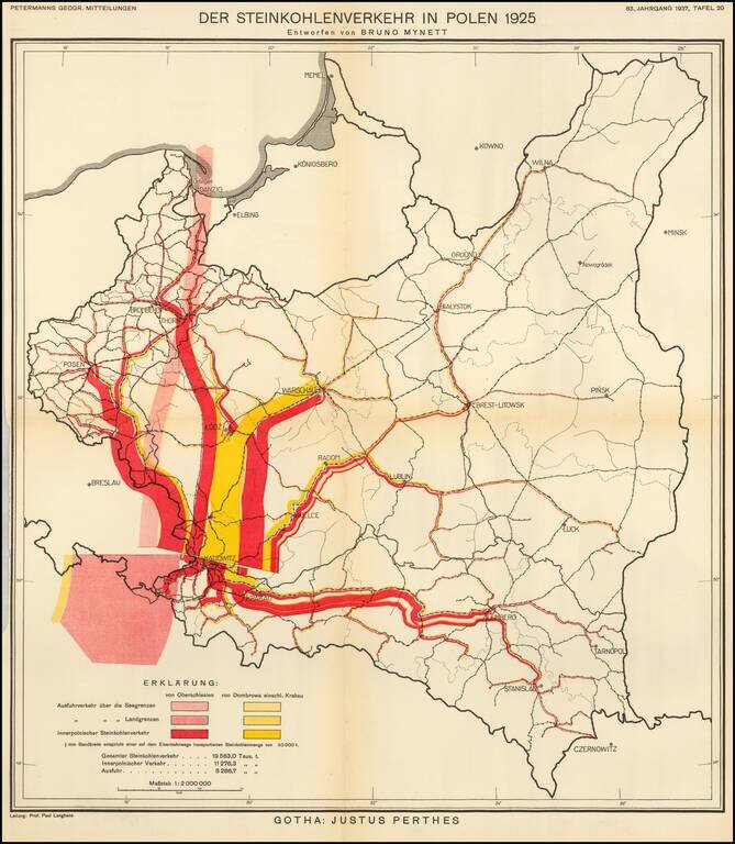
Thematic map of Poland, showing the Coal Industry in 1925, based upon the work of Bruno Mynett, Der Steinkohlenverkehr innerhalb Polens. The map was published by Augustus Petermann in 1937, based upon Bruno Mynett's book
![Rīgas Plāns Izdevusi 1937. gadā Rīgas pilsētas nekustamu īpašumu valde. [Riga Plan issued in 1937 by the Riga City Real Estate Board]](/map/small/63953.jpg)
Impressive four-sheet Latvian-language wall map of Riga, issued just before the Second World War, in 1937, by the Riga City Real Estate Board. The lower-left corner has a map of Riga in 1400, including fortress walls, castles, churches, etc. In the...
![[China invasion detailed map]](/map/small/57053.jpg)
A detailed map of eastern China, showing parts of the densely populated Jiangsu, Zhejiang, and Anhui provinces. Includes an inset map of both Nanjing and Shanghai. The map shows topography, roads, major cities, and more around this area. Printed...
![[Shahai senkyoku zenzu] War Situation Map of Shanghai](/map/small/65558.jpg)
Detailed map of the international concessions area of Shanghai Settlement, published as a supplement to Osaka Asahi Shinbu on August 23, 1937. The map was published weeks after the Marco Polo Bridge incident on July 7, 1937 and 10days after the Battle...