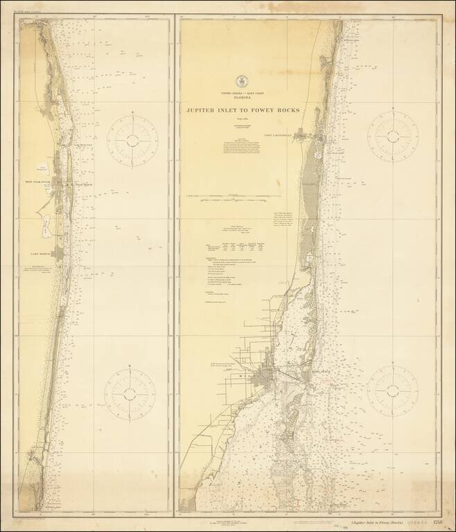
Detailed pair of Sea Charts, extending from Biscayne Bay and Miami in the South to the area of Jupiter. A highly detailed and accurate sea chart of the region, with some interior details.
This is a fantastic pamphlet detailing Los Angeles during the 1920s. The booklet, replete with many photographs and descriptions, painting a marvelous picture of the region as it lay a century ago. This is the thirty-second edition of this work...
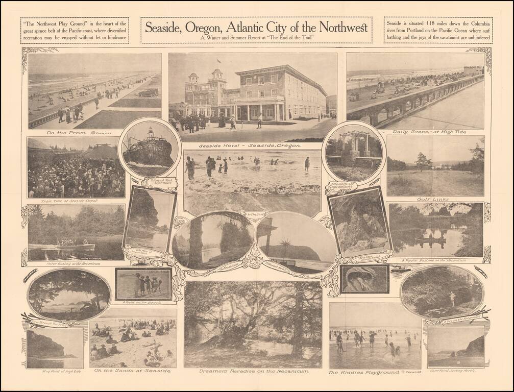
A Winter and Summer Resort at "The End of the Trail" Rare promotional pamphlet for Seaside, Oregon, including approximately 20 black and white photos of the town, beach and tourist features. Promotional text on the verso. Rarity OCLC locates 2...
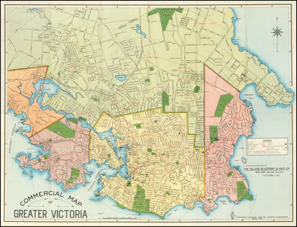
Detailed separately published map of Victoria, British Columbia, published by the Island Blueprint & Map Company. Shows railways, streetcar and bus lines, schools, fire halls, post offices and selected holdings. This is the second edition of the...
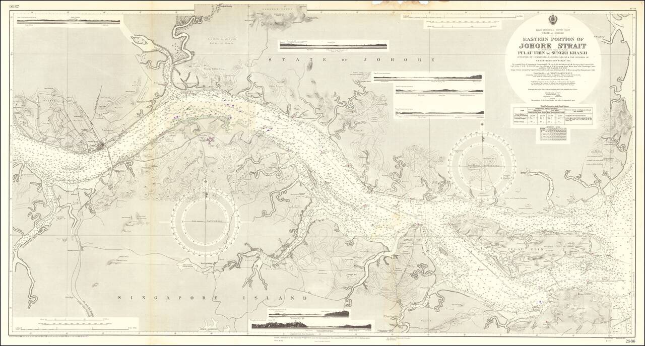
Fine large sea chart centered on the Johor Strait, published in London by the British Admiralty. Drafted from surveys by the H.M.S. Merlin conducted in 1921, the map includes hundreds of soundings and an exceptionally detailed treatment of the...
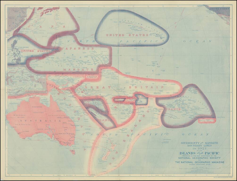
Fine map of the Pacific Ocean subsequent to the settlements agreed on territorial claims at the Peace Treaties after World War I. The best contemporary Pacific map of its era with the Island groups reflecting the loss of the German possessions of...