![[Early Texas Aeronautical Navigation Map] Aeronautical Map For Cross Country . . Drawn by Cpl. V.G. Smylie Aero Squadron, Ellington Field](/map/small/59678.jpg)
Rare Early Aeronautical Map of Texas - 252nd Aero Squadron - Ellington Field Rare aviation map prepared by Vernon Guy Smylie of the 252nd Aero Squadron, Ellington Field, in Houston, Texas. The map covers an approximately 9500 square mile area of...
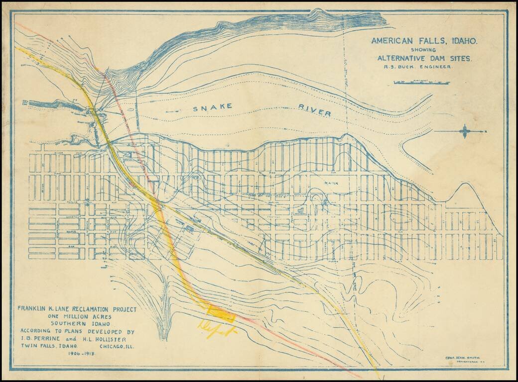
Relocating A Town To Construct the American Falls Dam Topographical plan of the area around American Falls, Idaho and the American Falls, Dam on the Snake River, drawn by Edna Dean Smith. The map was prepared in connection with the "Franklin K. Lane...
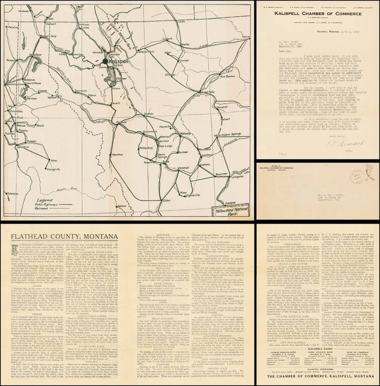
Fascinating map, brochure and letter, promoting the town of Kalispell, Montana, to a prospective Homesteader, H. Edward Moore of Janesville, Wisconsin. The map and brochure were published by the Kalispell Chamber of Commerce. The letter, written by...
![[Victoria, B.C.] Vancouver Island -- Victoria Harbour Surveyed By Captn. G. H. Richards & The Officers of H.M.S. Plumper. 1859. The Entrance from a Survey by Lieut. B.M. Chambers. R.N. 1895. Amendments by Capt. J.F. Parry, H.M. Surveying Ship Egeria](/map/small/69236.jpg)
Finely executed British Admiralty Sea Chart, illustrating Victoria, British Columbia and environs. The chart shows a well developed waterfront around James Bay and the Harbor, with an outline of the streets shown in great detail in interior. At the...
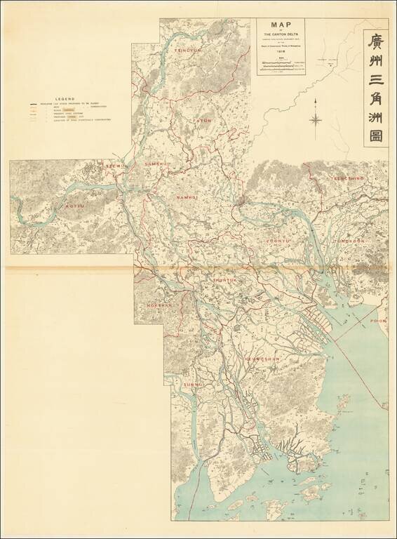
Controlling the Rivers Feeding the Canton Delta and Zhujiang Estuary Large detailed bilingual wall map tracking the course of the Canton Delta, and the Xi River and Bei River, Zhujiang River and Estuary and the area around Guangzhou and Foshan. The...
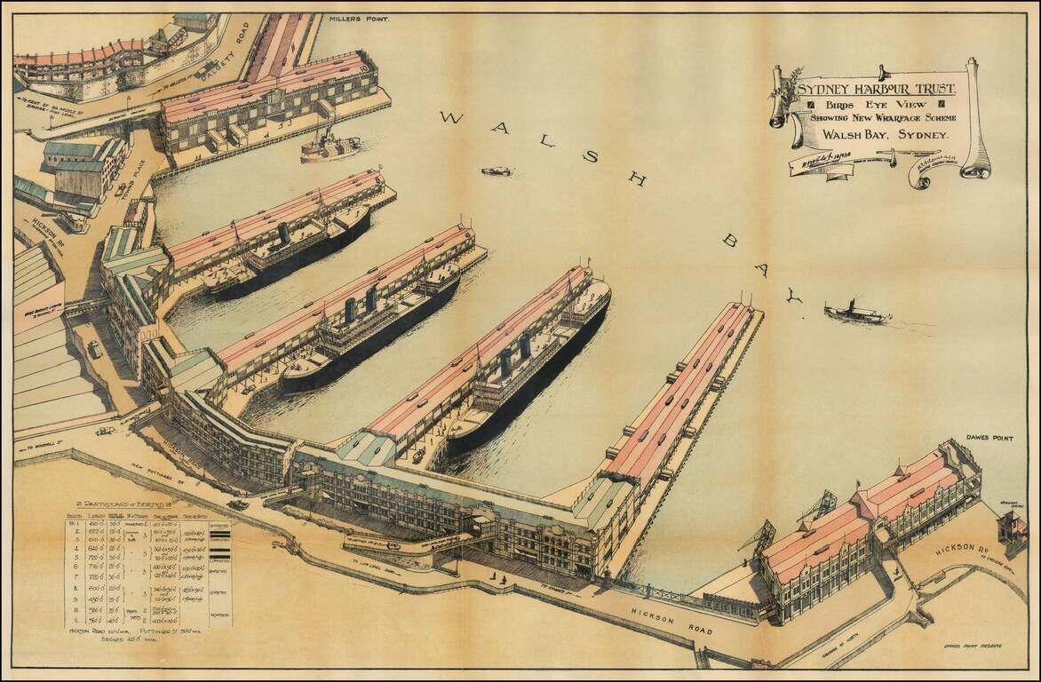
Detailed Plan of the Walsh Bay area of Sydney Harbor, published by the Syndey Harbour Trust. The Wharf at Walsh Bay was constructed between 1912 and 1921, making this one of the earliest obtainable views of the Wharf. Sydney Harbour Trust The Sydney...
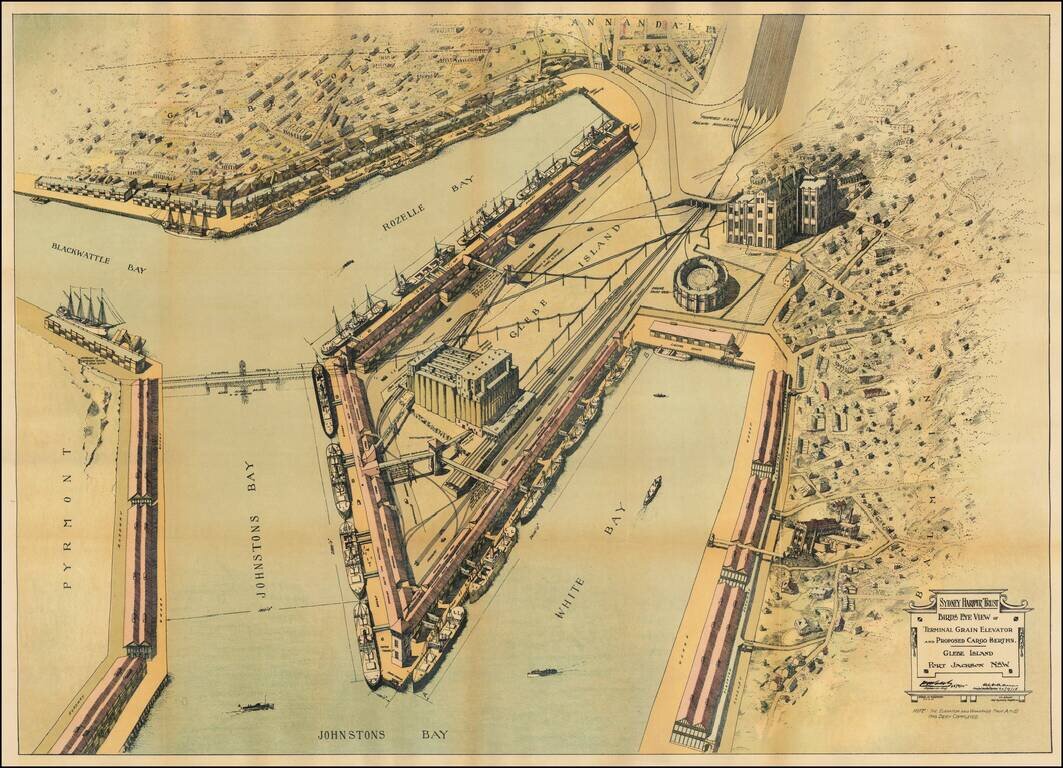
Detailed Plan of the Walsh Bay area of Sydney Harbor, published by the Syndey Harbour Trust. Detailed plan of the area around Glebe Island, illustrating plans for the improvement of the facilities on the water front at Johnston's Bay, Rozelle Bay and...