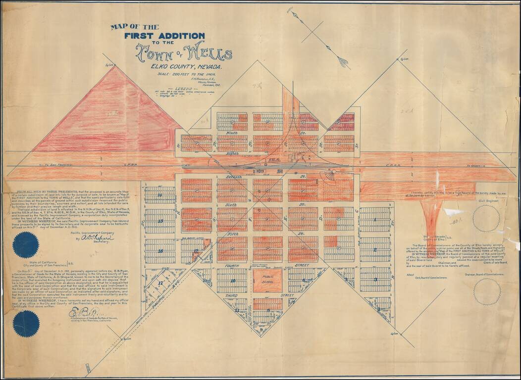
Early certified copy of the detailed map of an early addition to the town of Wells, Nevada, surveyed by F.H. Russell, Civil Engineer. The map shows the newly planned subsdivision on either side of the Central Pacific Railroad Depot and Warehouse. A...
![[Fruit Crate Label Advertising Map] Star of California Brand](/map/small/41396.jpg)
Decorative Fruit Crate Label map of California, promoting Exeter Orange Growers.
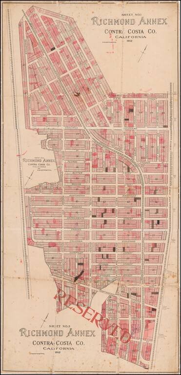
Early Richmond Annex / El Cerrito Real Estate Promotional Map Large separately published map of Richmond Annex, issued in 1912. The map would seem to have been used by a local real estate promoter, with pencil annotations and color shading, neither...
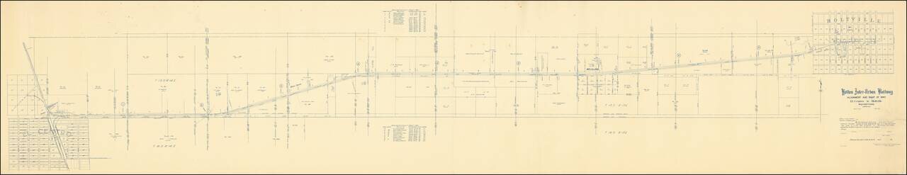
The Holton Inter-Urban Railway Company was incorporated W. F. Holt in December, 1903. The line connects El Centro with Holtville (a distance of about eleven miles) using standard gauge construction. The company carried both freight and passenger...
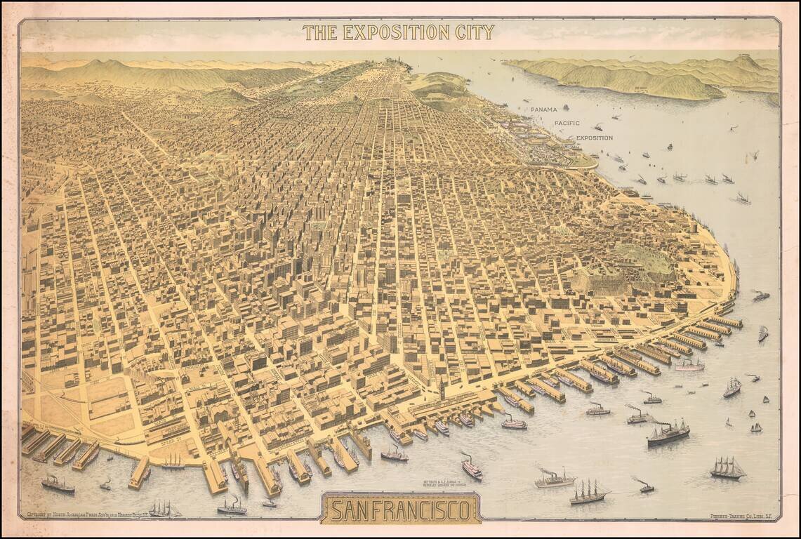
Important Early 20th Century View of San Francisco -- Antique Map Promoting the Site of the Future Panama Pacific Exposition Rare Birdseye View of San Francisco, "The Exposition City," copyrighted by North American Press Ass'n 1912 Hearst Bldg. S.F.,...
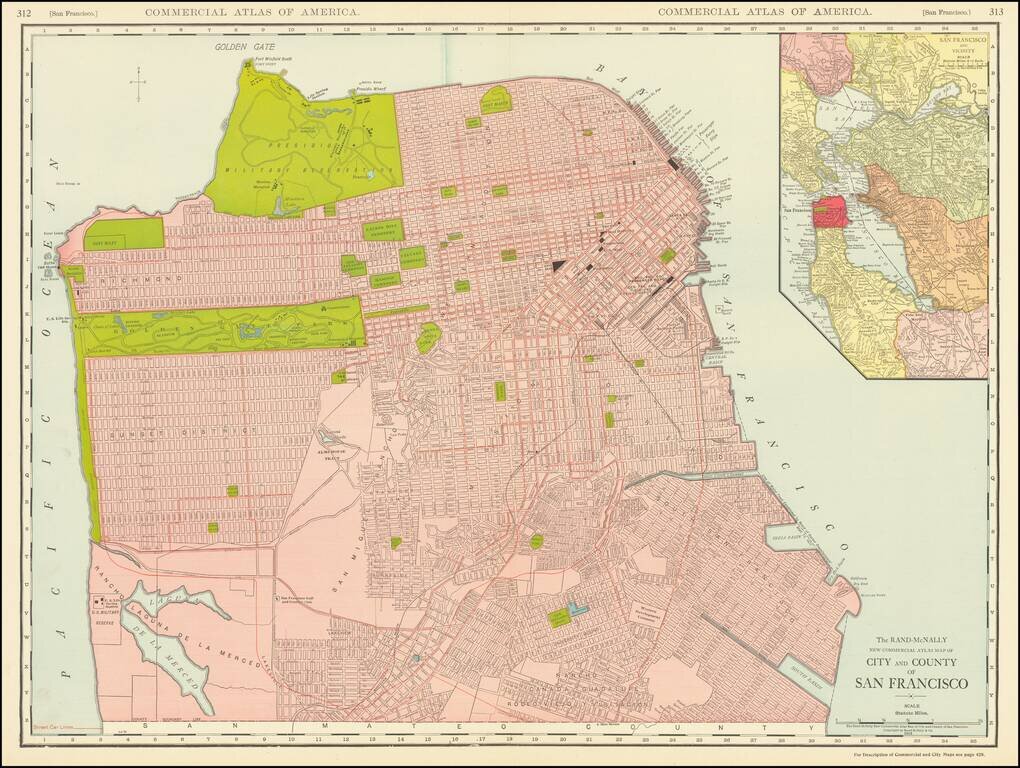
This is a great large-format, highly detailed map of San Francisco, showing towns, wharfs, rail lines, street car lines, roads, buildings, and more. The map includes a large inset of San Francisco Bay, attractively colored according to the county....
![[Fruit Crate Label Advertising Map] Panama Brand (North America & Panama Canal)](/map/small/48860.jpg)
Decorative Fruit Crate Label, showing various routes through the Panama Canal, published for the Johnson Fruit Company of Santa Barbara, California.
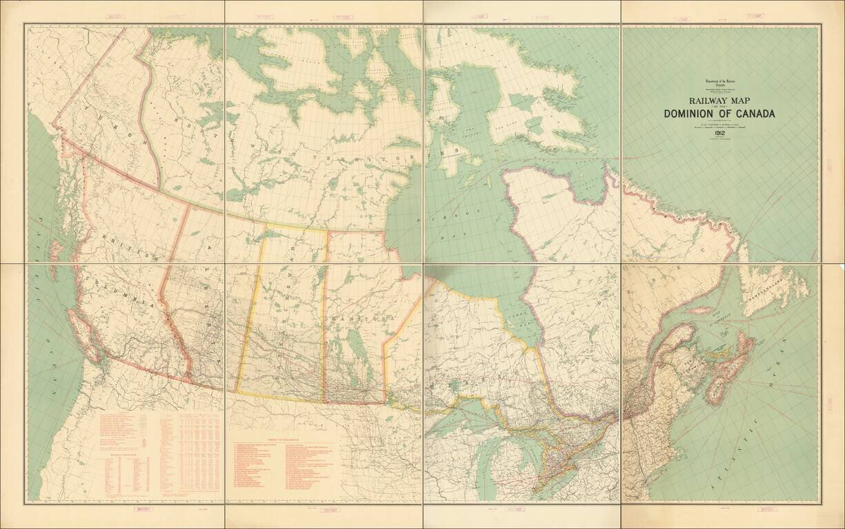
Fine example of this exceptional map of Canada, published by the Department of the Interior. The map focuses on the Railway system in Canada and related statistical information. Tables include: Legend showing Grand Trunk Railway, Canadian Pacific...
![[Expanding Rome To the Sea] Progetto per l'espansione di Roma al Mare dell'architetto Dario Carbone](/map/small/63570.jpg)
A fascinating set of maps and profiles, showing a proposal for developing the areas surrounding the Tiber River and for the expansion of Rome toward the sea, 1912, by Dario Carbone. As noted by Lina Malfona in Between Rome and the Sea: Ancient &...
![[Arabia] Kort over Ost og Centralarabien hovedsagelig omfattende de topograifske Resultater af Barclay Raunkiaer's Rejse 1912](/map/small/62032.jpg)
Raunkiaer’s Detailed Map of Central Arabia—An Early Traveler’s Map Finely-detailed map illustrating the travel route of Danish explorer Barclay Raunkiaer, whose early twentieth-century expedition proved to be a valuable primary source of...