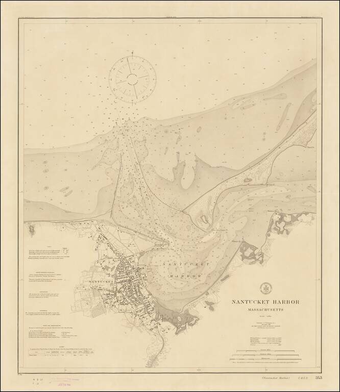
Rare Separately Published Harbor Chart of Nantucket -- Early Appearance of The Completed Jetties Fine example of rare first state of this early 20th Century Chart of Nantucket, published by the United States Coast & Geodetic Survey. Perhaps the...
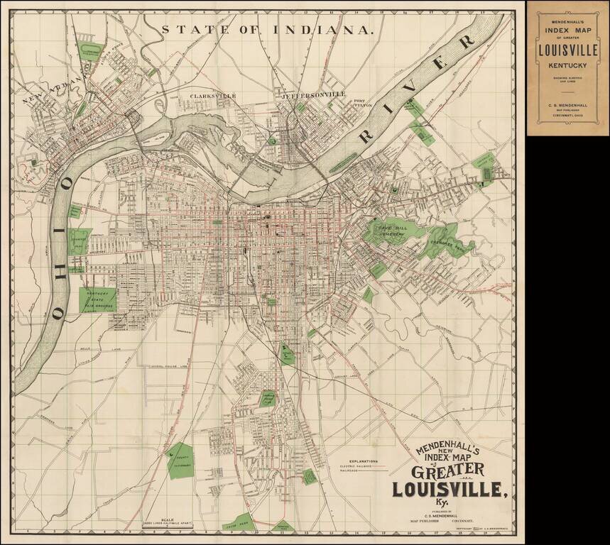
Scarce early map of the city of Louisville, published by C.S. Mendenhall. The map extends north to include Clarkesville, Jeffersonville and New Albany. The map identifies streets, major buildings, wharfs, and a number of land owners on the outskirts...
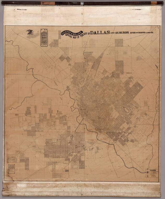
A Colossal, Virtually Unknown Wall Map of Dallas, Published After Publication of George Kessler's Plan For Modernizing Dallas The present map measuring approximately 7.5 feet x 7.5 feet, is the only other large format map of Dallas published before...
![[Heavily Annotated] Great Shoshone and Twin Falls Water Power Company Map Showing Location of Power houses, Substations and Transmission Lines](/map/small/62919.jpg)
Heavily Annotated Blue Print Copy of One of the Earliest Large Scale Hydro-Electric Power Companies in Idaho Wall map of a portion of the Northwestern United States, centered on Twin Falls and Shoshone Falls, illustrating the area proposed to be...
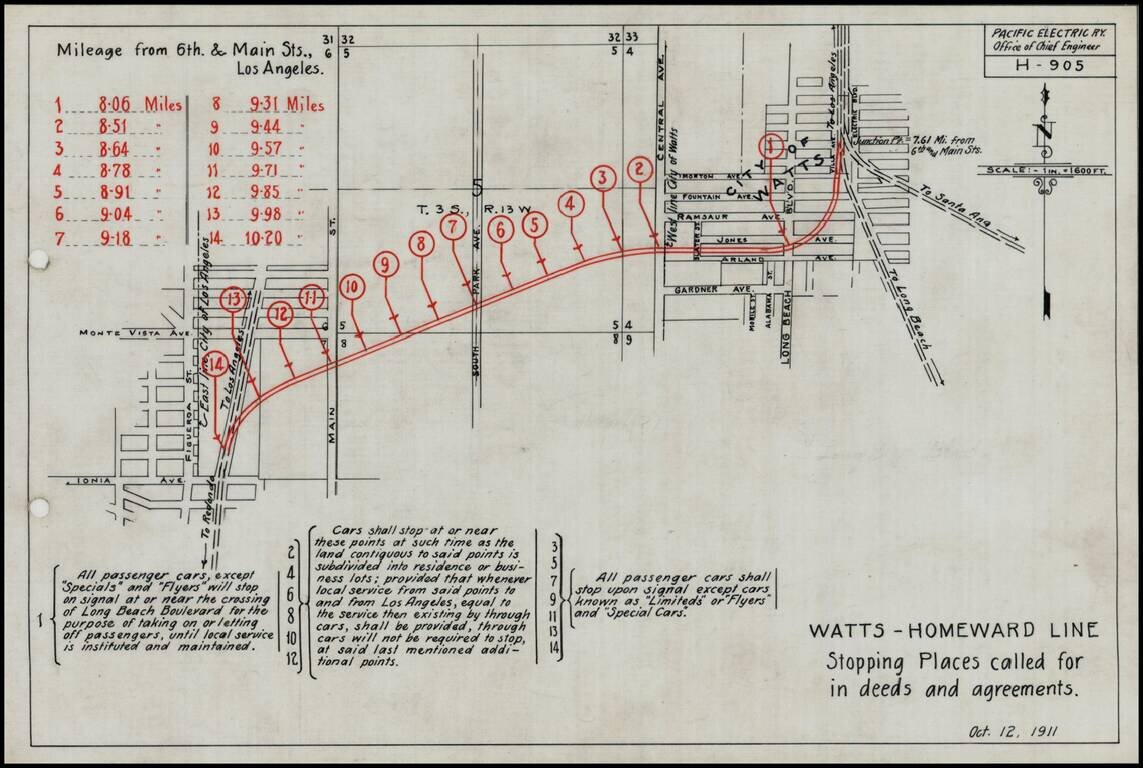
Detailed engineering map showing the various proposed stops on the Pacific Electric Railway line on the Watts-Homeward line, as prepared by the Pacific Electric Railway Company engineers. Includes a lengthy explanation of the various grant and deed...
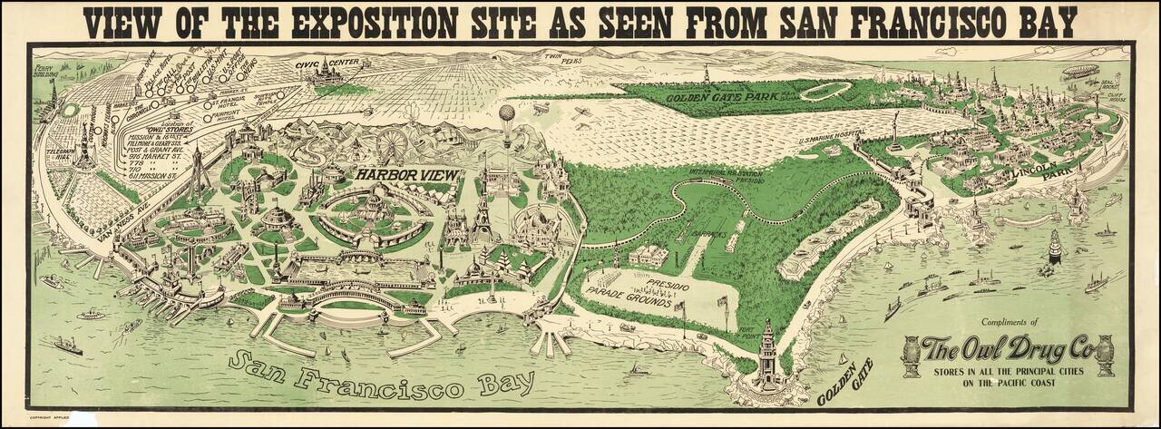
With Early Airplanes and Hot Air Balloon and Early Dirigible Rare panoramic view of the proposed site of the Panama Pacific International Exposition, published by The Owl Drug Company. The image provides an interesting Bird's-eye view of site of...
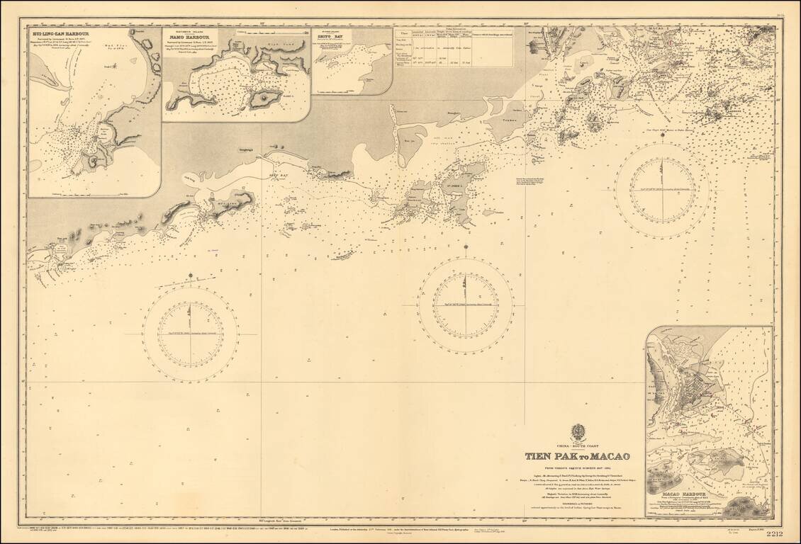
Scarce map of the the region from Macau to the west, published by the Hydrgraphic Office of the British Admiralty. Shows the South China Sea from Dianbai to Macau, centered on Hailing Island (then St. John Island). Includes insets of Macau Harbor,...
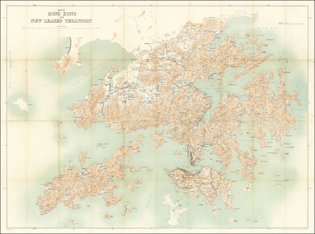
For Official Use Only. A Large Map of Hong Kong During the 1911 Revolution. Large antique map of Hong Kong Island and the region north to the Sham Chun River. The map was prepared by the Royal School of Military Engineering in concert with the...