Map size in jpg-format: 48.909MiB
Click to open in high resolution (open in new tab).
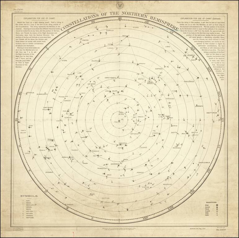
Rare Working Celestial Navigation Chart!
Rare working navigational celestial chart of the northern skies, published by the United States Hydrographic Office.
Updated to August 5, 1916, the chart was actually utilized by mariner's at sea to take readings and navigate at night.
Includes an explanation on how to use the chart (mount on light drawing board, affix pivot string, etc.) a table showing the magnitude of stars in six sizes, Symbols for the planets,
Rarity
OCLC locates only a photo copy of these charts -- no other recorded examples.
These charts are very rare on the market.
If you are a student, write to us in telegram: @antiquemaps and indicate what material you need and for what work you need a map in high detail. We are ready to provide material on special terms. For students only!