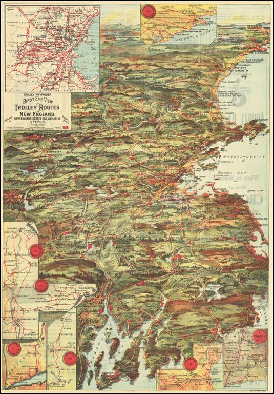
Attractive color-lithographed bird's-eye view of the eastern part of New England, showing the trolley routes in the area roughly bounded by New Bedford, Providence, Worcester, Concord, and Portland. The map is an impressive work of popular color...
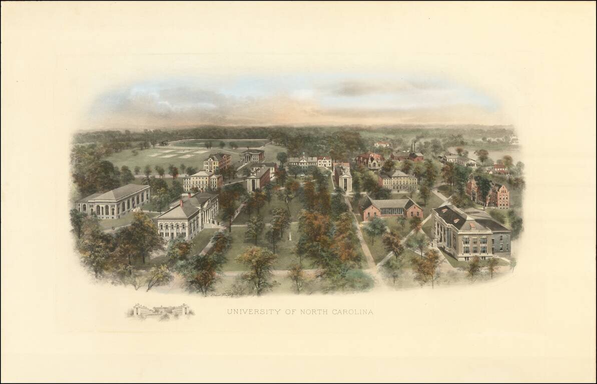
Fine example of this marvelous early birdseye view of the University of North Carolina, Chapel Hill. At the turn of the century, Littig & Company commissioned a number of artists, including the accomplished artist Richard Rummell (1848-1924), to...
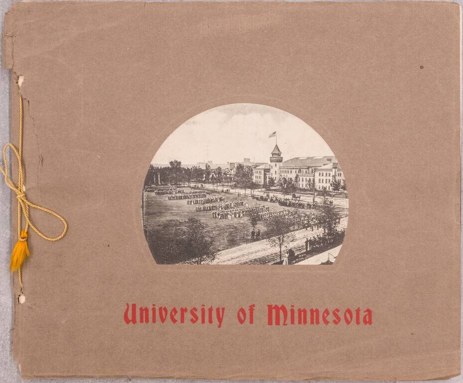
Rare book of 24 black and white photographs of the University of Minnesota. OCLC gives a date of 1907 - this example with ink annotations to after 1913 (one image notes that a building was burned down that year). The best image is probably that of an...
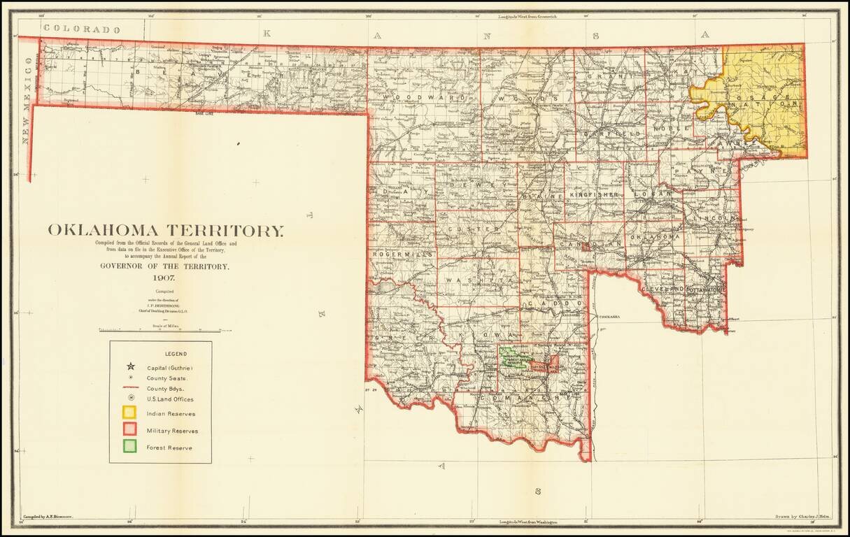
The Final Year of Oklahoma Territory Map -- Pre-Dating Merger with Indian Territory To Form The State of Oklahoma Rare map of Oklahoma Territory, issued by the Territorial Governor, during the brief period when Oklahoma and Indian Territory were...
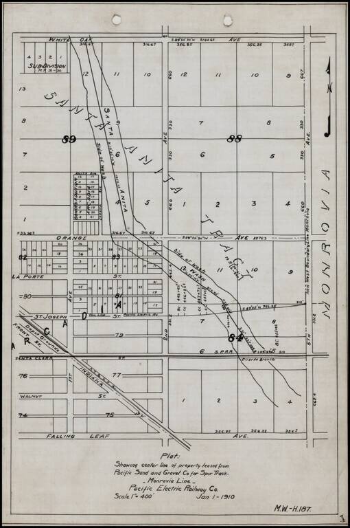
Detailed internal sketch map of the Pacific Electric Railway lines in Arcadia, California. Shows Depot Grounds of the ATS&F, Southern Pacific Railroad's Duarte Branch, a portion of the Santa Anita River and a street plan, centered on 2nd Avenue...
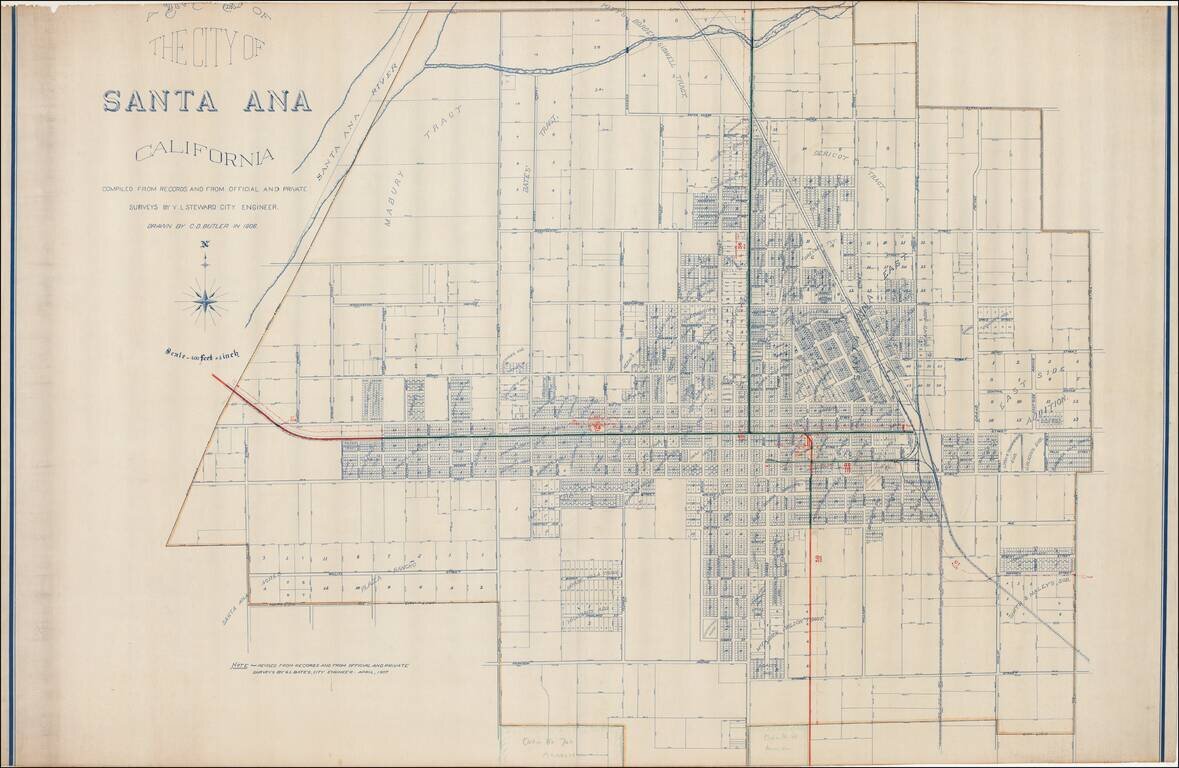
Excellent early map of Santa Ana, compiled by its City Engineer, W.L. Steward in 1906 and drawn by C.D. Butler, and later updated by G.L. Bates, the City Engineer in 1907. A reduced size edition of the map was printed by George L. Bates in Santa Ana,...
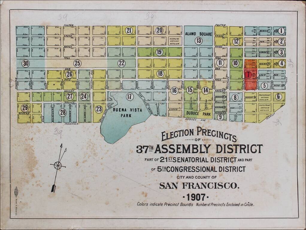
Rare Election Precinct Map for San Francisco, centered on Buena Vista Park. The map is bounded by Stanyan at the west, Fulton at the north, Octavia Street on the east and Frederick and Dubose Avenues in the south. Places shown include: Panhandle...
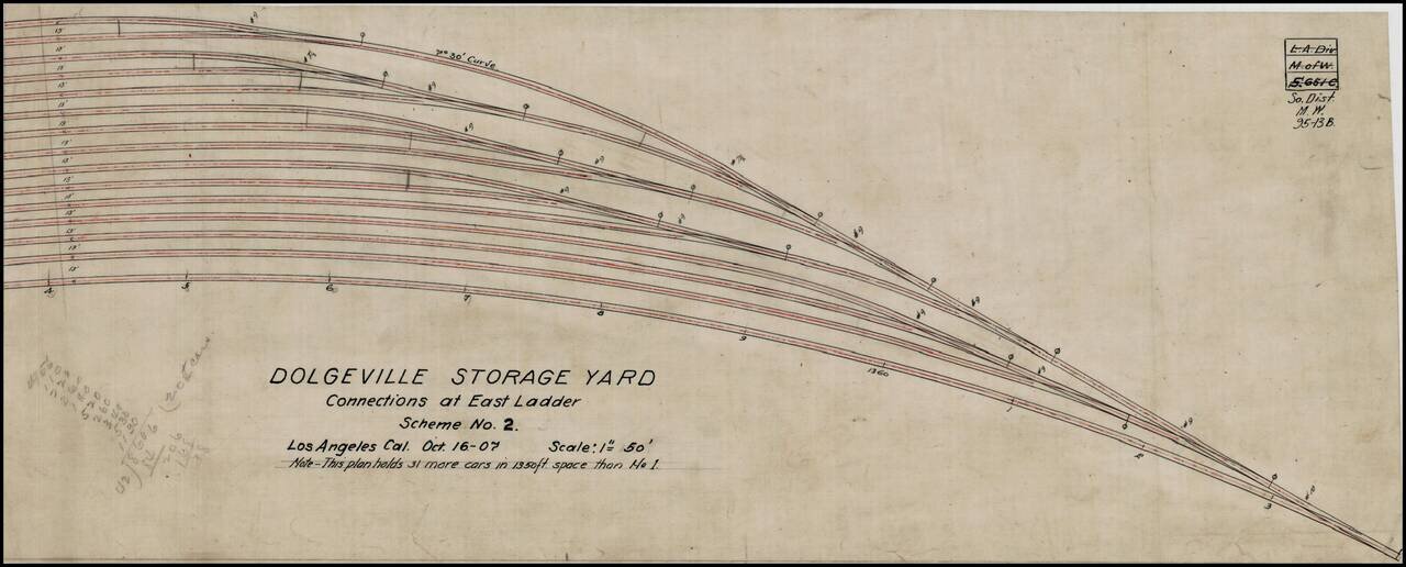
Manuscript plan for a proposed rail yard in Los Angeles, California, composed in 1907. The rail yard was probably located in the Dolgeville Subdivision of Alhambra, California. Dolgeville was named after the Alfred Dolge Manufacturing Company. This...
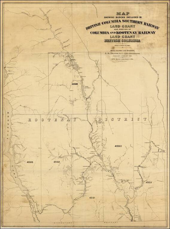
A very rare map with great importance to the historical development of the Kootenay Region of British Columbia. This map embraces the southeastern portion of British Columbia as far westward as Kootenay Lake, and charts the route of the British...
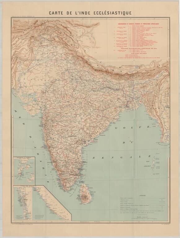
Rare map showing the Catholic Missions in India. The map includes topographical details, locations of Missionaries, Archdioces, Diocese, Vicariats and Prefectures. The Société des Missions Étrangères de Paris (Society of Foreign Missions of Paris)...