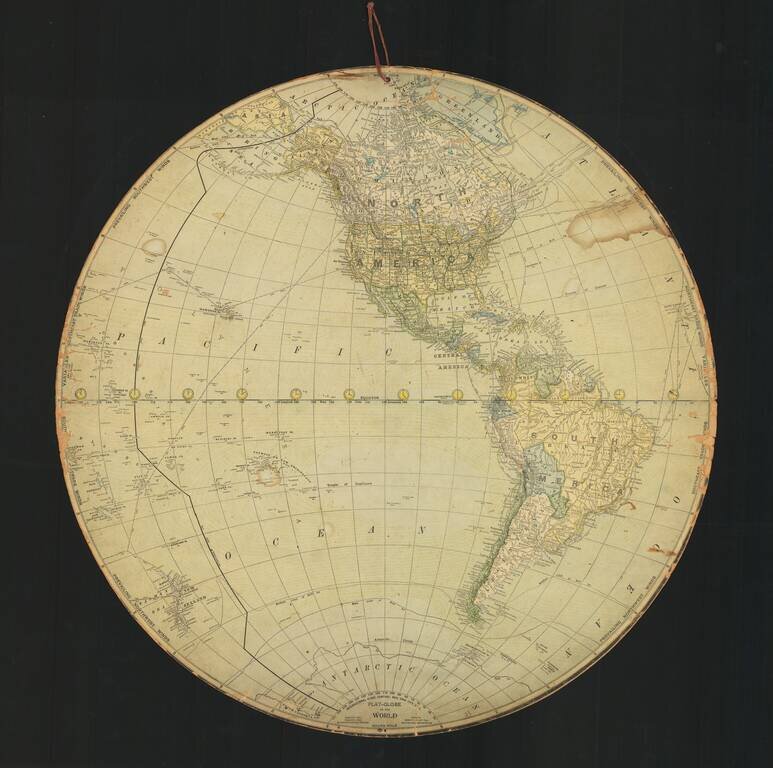
A Two-Sided Flat Earth Globe? Fascinating "Flat-Globe" of the World, published in New York by the International Globe Company. Includes a note that it was edited by Robert Peary, the American explorer and United States Navy officer who made several...
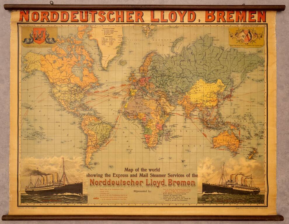
Fine promotional wall map of the world, promoting the Norddeutscher Lloyd line of Bremen. The map focuses on the routes of the Norddeutchser Lloyd Line, an important global steamship line in the 19th and 20th centuries. The routes of the line are...
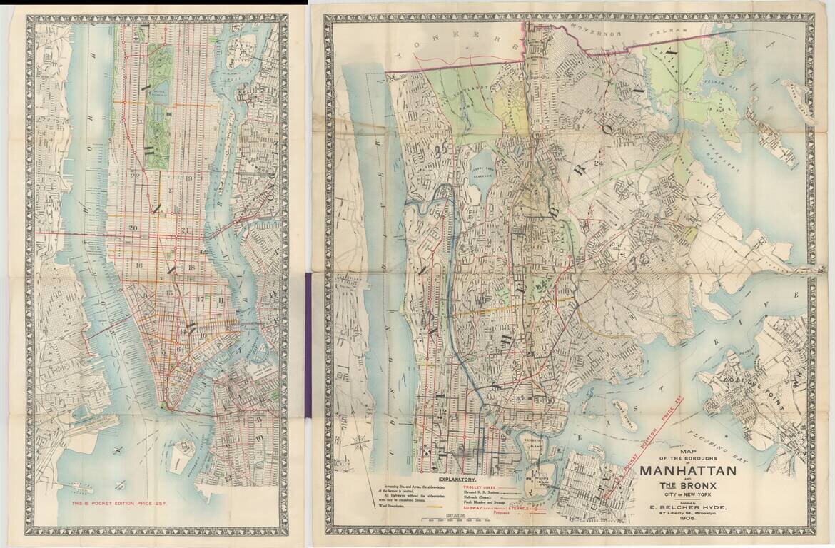
Pocket map edition of Hyde's map of Manhattan and the Bronx, published in Brooklyn in 1905. The map depicts subways (proposed and completed), trolley lines, elevated railroads, and railroad stations, ward boundaries, etc. The earliest edition of the...
![[Manuscript Map of Oil Development at High Island, Texas]](/map/small/66465.jpg)
An interesting manuscript map of High Island, Texas, one of the first big oil strikes after Spindletop. Showing drilling blocks in the process of being developed. The map includes notes about a spring and "foot ridge" (?) The map offers an...
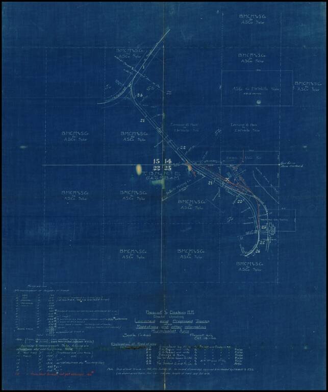
Internal working Sketch map showing the existing and proposed routes of the Prescott & Eastern Railroad in the vicinity of Humboldt, Arizona, prepared on October 18, 1905. Most of the land in the areas is showns as being owned by E.W. Wells and...
![[Cochise County, Arizona Territory - Northern Sonora] Ranches of the California and Mexico Land and Cattle Co. Arizpe District, State of Sonoma Mexico](/map/small/47308.jpg)
Hand Drawn Southern Pacific Railroad Company Map Locating The Cattle Ranches of the California and Mexico Land and Cattle Company -- Mexican Revolution -- Cananea Strike & Massacre Detailed manuscript map of part of Southern Arizona and Northern...
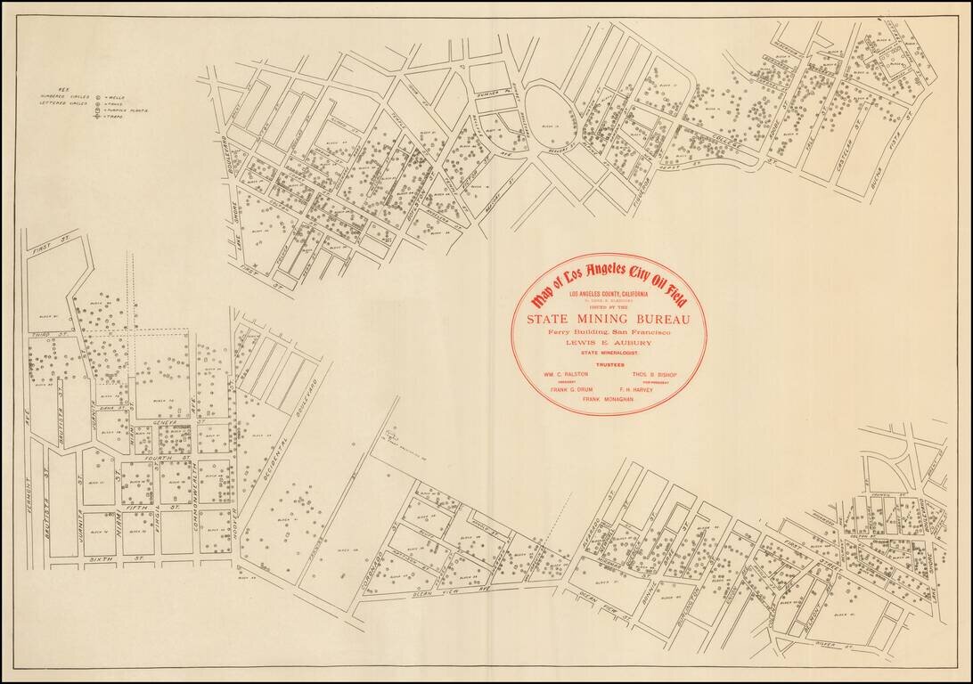
Rare early map of the Los Angeles Oil fields. The map shows many oil wells in the heart of Los Angeles, along with the tanks, pumping plants, and traps.
Includes Early Annotations Detailed map of Canada, illustrating the route of the Grand Trunk Railway and Projected lines. The map illustrates the lines of the railway in red and the projected lines in a broken red line, extending to the Vancouver...
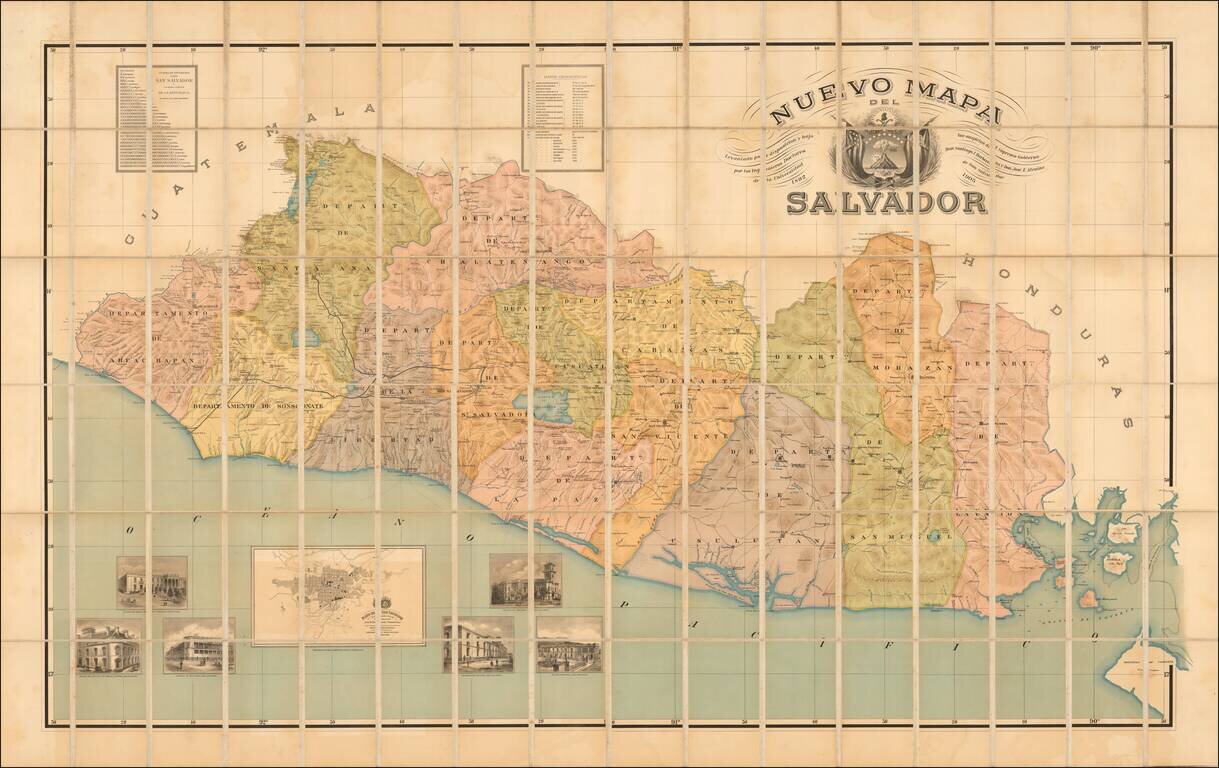
"Published under the auspices of the Supreme Government." Rare early map of El Salvador, published in 1905, based upon work undertaken by Santiago I Barberena and Jose E. Alcaine, between 1892 and 1905. This is apparently the first edition of the...
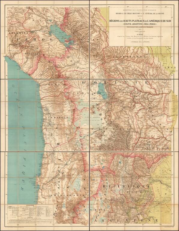
The First Comprehensive Scientific Mapping of the Andes Rare large scale map of the South American Highlands of Bolivia, Argentina, Chile and Peru, compiled by Victor Huot as part of a comprehensive study of the region by the Scientific Mission of G....
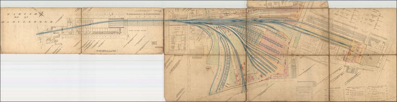
An Early Map of the Marylebone Station, with Lord's Cricket Ground and Public Bar! Rare large format map of the Marlyebone Train Station and surrounding part of St. Marylebone Parish, immediately west of Regent's Park in London. The map locates...
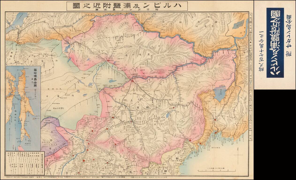
Highly detailed large format map of the Harbin and Vladivostok areas, with a large inset map of Sanghalien Island. The map is dated year of Meiji era 38th and locates roads, railroads and other features.