Map size in jpg-format: 32.1946MiB
Click to open in high resolution (open in new tab).
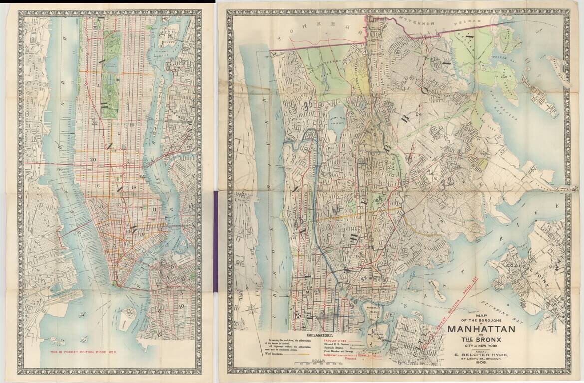
Pocket map edition of Hyde's map of Manhattan and the Bronx, published in Brooklyn in 1905.
The map depicts subways (proposed and completed), trolley lines, elevated railroads, and railroad stations, ward boundaries, etc.
The earliest edition of the map we locate was published in 1899.
The map is exceedingly rare. OCLC locates only 1 example of the right half of the map.
If you are a student, write to us in telegram: @antiquemaps and indicate what material you need and for what work you need a map in high detail. We are ready to provide material on special terms. For students only!

![[Charles Lindbergh] Spirit of St. Louis](/map/small/69234.jpg)
![[Charles Lindbergh / New York to Paris View] Spirit of St. Louis](/map/small/69235.jpg)