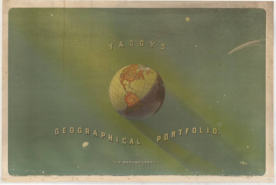
Fine color chromolithograph title page for Yaggy's Geographical Portfolio. Originally issued as an educational aid, Yaggy's charts are among the most distinctive and stunning comparative charts ever published. Unlike the smaller, simpler and more...
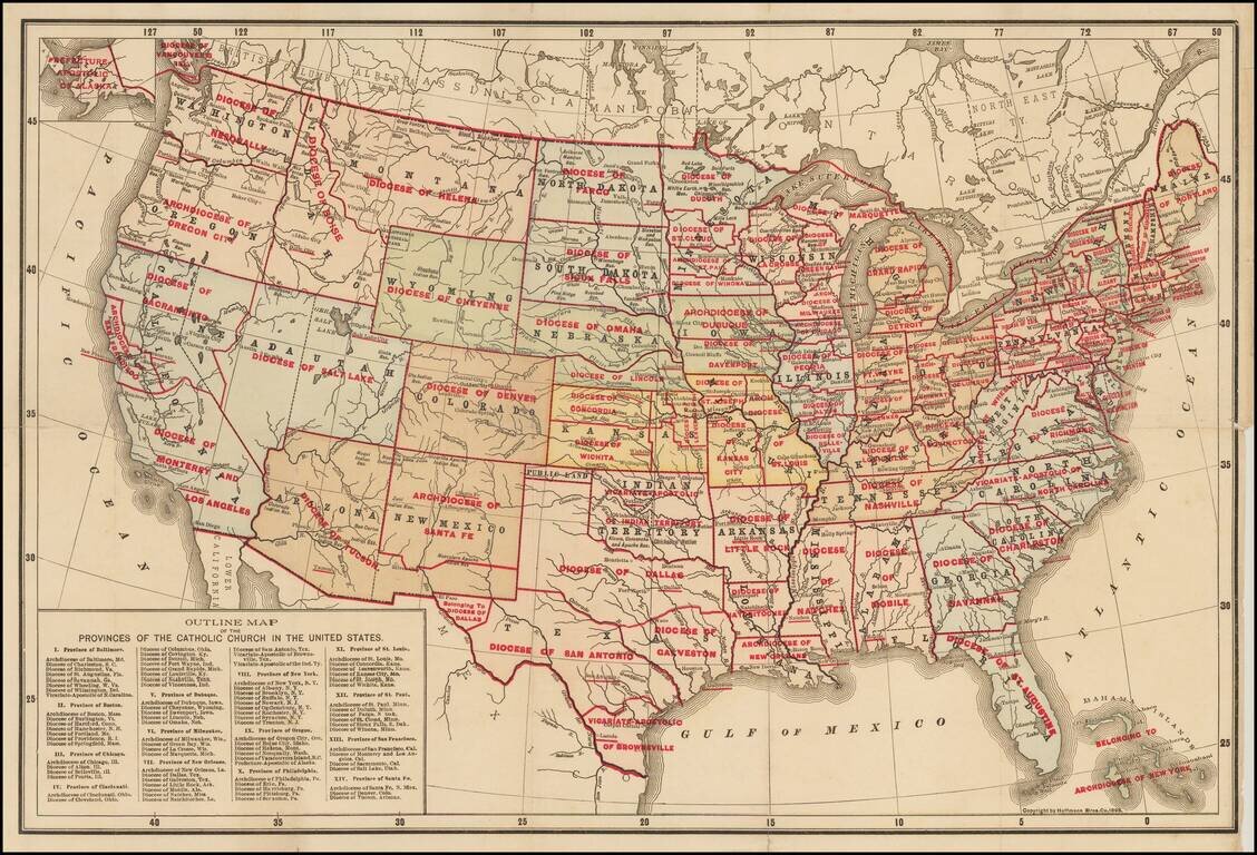
Rare separately issued map of the United States, apparently the earliest printed map to identify the various Catholic Church Provinces and Dioceses within the United States. Each of the Provinces are divided by Dioceses. Nearly 100 Dioceses are shown....
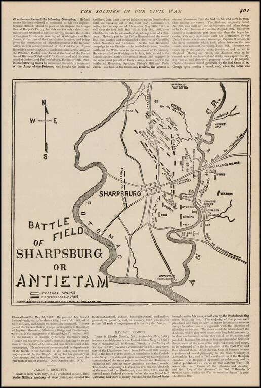
Fine sketch map of the Battlefield at Antietem, which appeared in The Soldier In Our Civil War, published by Frank Leslie. The map shows Confederate and Federal Works, various positions naming commanding officers, Roads and other important battle...
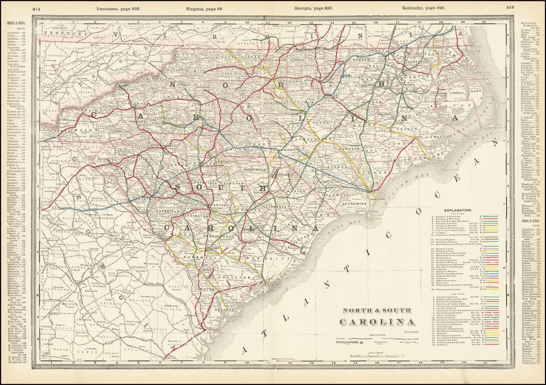
A fabulously detailed railroad map of the Carolinas, from Cram's scarce Standard American Railway Atlas. Shows over 60 different railroads, stations, and numerous other details. The best atlas railroad map of the time period.
![Western Part of North and South Carolina [and] Eastern Part of North and South Carolina](/map/small/69547.jpg)
A fabulously detailed railroad map of the Carolinas, from Cram's scarce Standard American Railway Atlas. Shows over 60 different railroads, stations, and numerous other details. The best atlas railroad map of the time period.
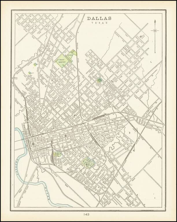
A detailed plan of the city of Dallas highlighting major parks and cemeteries and showing a portion of the Trinity river as well as local creeks. The first separate map of Dallas to appear in a Commercial Atlas and one of the few maps of Dallas...
![Illinois Northern Half [and] Illinois Southern Half](/map/small/69643.jpg)
Fine large Railroad map of Illinois, published in Chicago by George Cram. Includes a list of over 60 railroads operating in the state, with color coding.
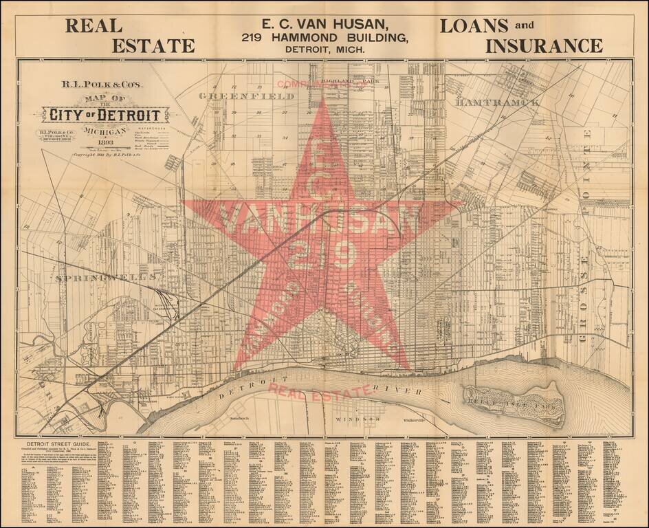
Scarce promotional map of the City of Detroit, advertising for EC Van Husan Real Estate (219 Hammond Building). This is apparently the first state of the map--F.B. Streeter also notes an edition of 1894. Oriented with north toward the upper right....
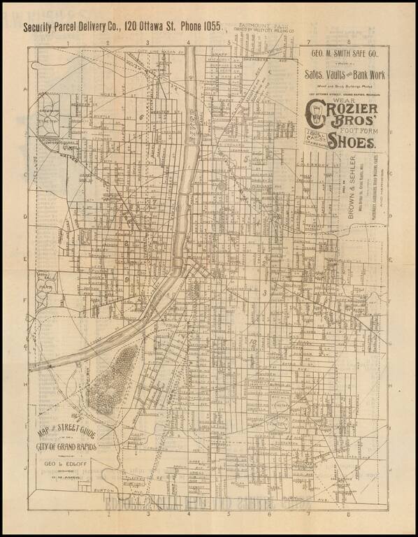
Advertising city map promoting Nelson Matter & Co. Furniture and The Reed Engraving Company on the outside and George M. Smith Safe Co and Crozier Bros' Shoes on the map. This is the first map of Grand Rapids we have handled.
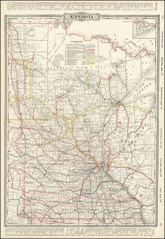
Detailed railroad map of Minnesota, published in Chicago by George Cram. The map shows counties, railroad lines, towns, rivers, lakes, post offices, railroad depots, Indian Reservations, and a host of other information. The map shows nearly 30...
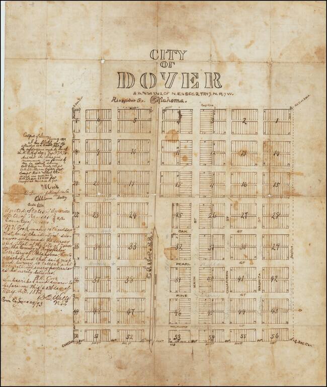
The First Map of Dover, Oklahoma Territory -- Primary Stopover on the Chisholm Trail -- Final Robbery By The Wild Bunch / Doolin Dalton Gang Drawn only 2 years after the establishment of the Dover Post Office, the present map is almost certainly the...
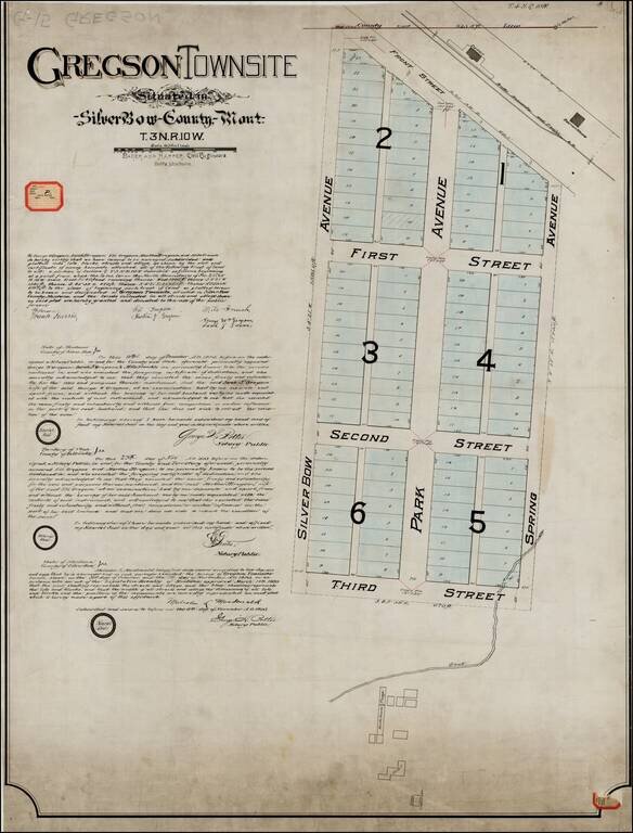
Original Plan For Gregson Townsite -- Locating The Original Hotel and Bathhouses for Upper Deer Lodge Hot Springs Resort ( aka Gregson Hot Springs Resort), One of the Earliest Resorts in Montana Territory. Unique example of the original...
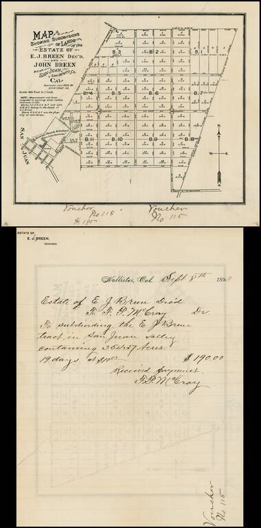
Map of the lands owned by the Breen family in San Juan Valley, San Benito, California. The lands shown were owned by Edward Breen and John Breen, two of the sons of Patrick Breen and Margaret Breen, survivors of the Donner Party. It was Patrick Breen...
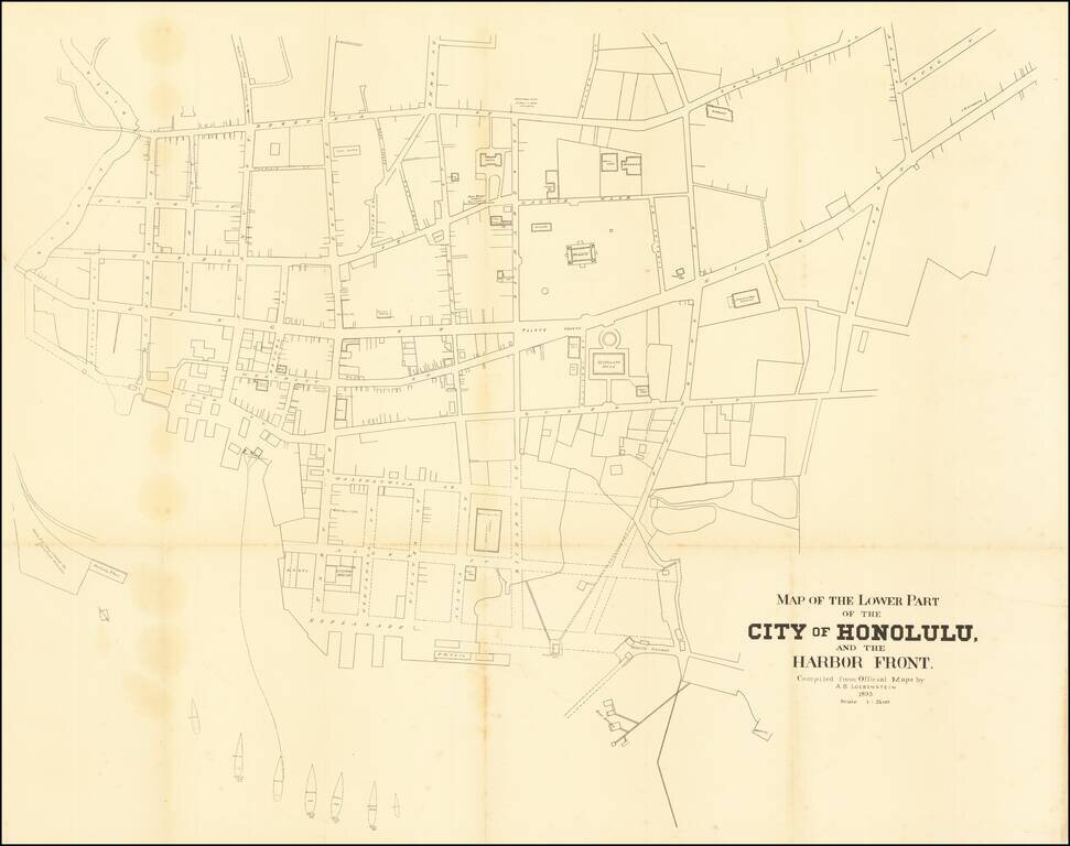
A highly detailed map of downtown Honolulu, one of the finest plans of the city made in the twilight years of the independent Hawaiian Kingdom. This fine map is a detailed engineer's plan of downtown Honolulu, done to very precise standards of...
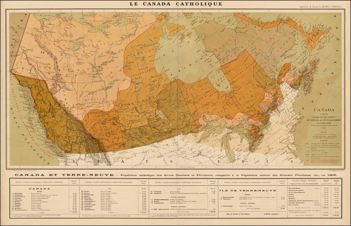
Rare separately issued map of Canada depicting the nature and organization of the Roman Catholic population, published as a supplement to the Journal les Missions Catholiques, in Paris. The map focuses on the various Roman Catholic Dioceses in Canada,...
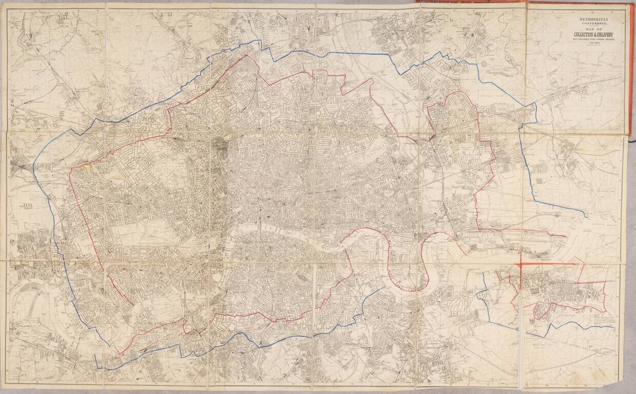
An expansive and detailed map of London, produced for the transportation of goods at the turn of the century. Detail on the map is very extensive, with thousands of streets, parks, railways, buildings, and more all labeled. The map accompanies a...