![[Texas and Western Louisiana]](/map/small/66617.jpg)
Highly detailed map of a large part of Texas and Louisiana, prepared as part of the US Government's monumental work Atlas to accompany the official records of the Union and Confederate armies, published between 1891 and 1895. The map extends west to...
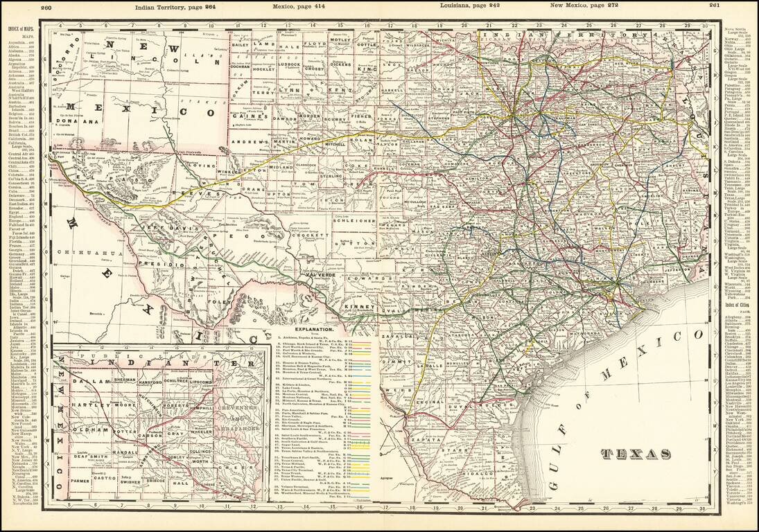
Detailed and interesting railroad map of Texas, which appeared in Cram's Standard American Railway Atlas. Includes the routes of approximately 40 different railroads (with each identified by name and color key), towns, counties, post offices, rivers,...
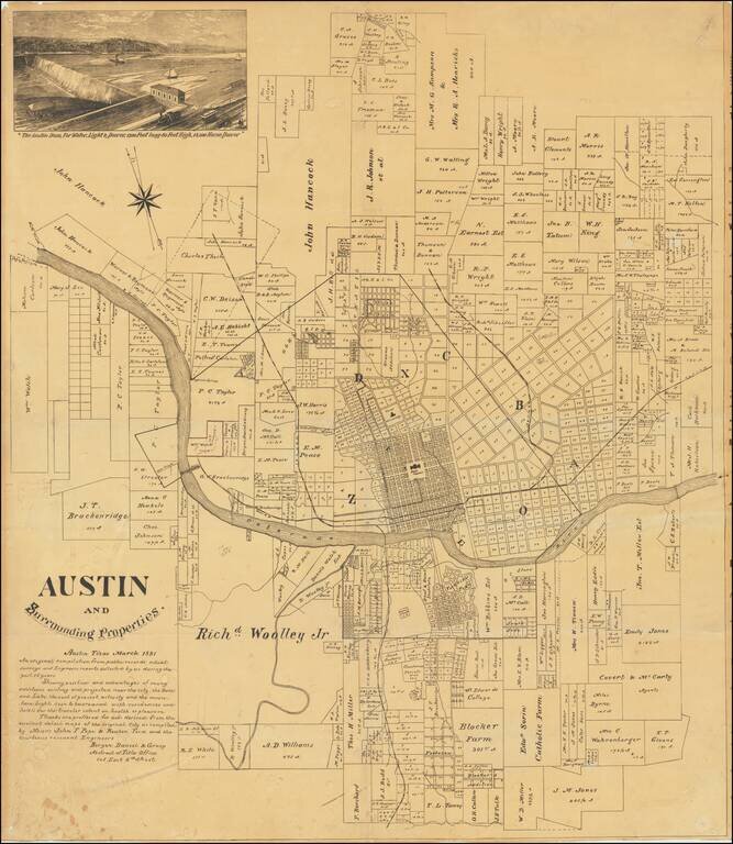
An Early Wall Map of Austin, Texas -- Includes Contemporary Developer's Annotations Rare promotional plat map of Austin, Texas, published by the Bergen, Daniel & Gracy Abstract Title Company. Fine cadastral map identifying dozens of land owners...
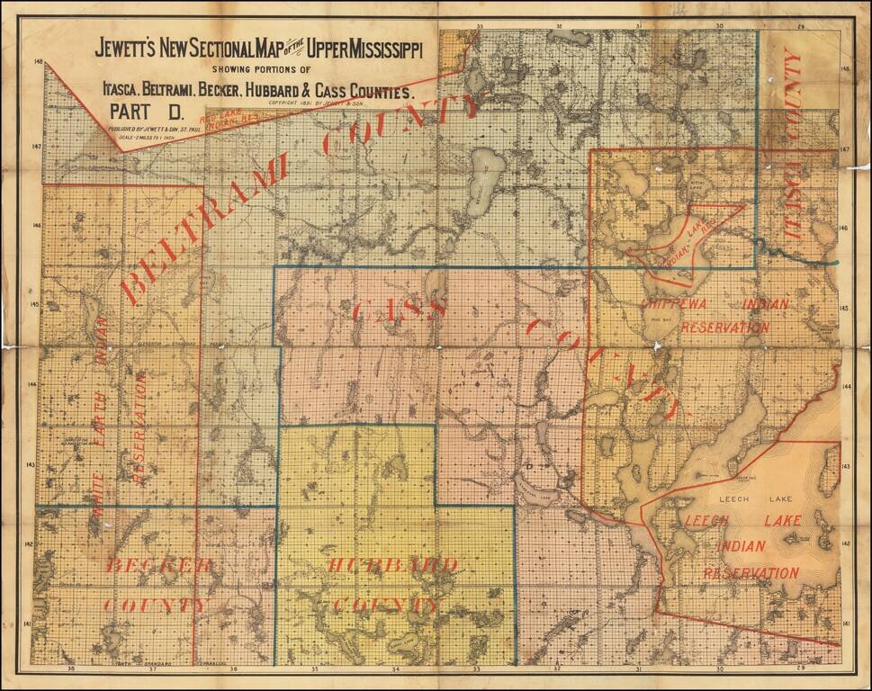
The Headwaters of the Mississippi. Interesting and very scarce Minnesota-published map of the headwaters of the Mississippi River (Lake Itasca) and the surrounding region. The map shows the White Earth Indian Reservation, Chippewa Indian Reservation,...
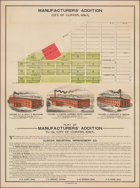
Rare illustrated promotional map broadside, promoting the Plat of Manufacturers' Addition To The City of Clinton, Iowa. In addition to the Plat of the Manufacturers Addition, the map illustrates 3 factories, each of which was scheduled for completion...
![[Wounded Knee] Scene of the Fight with Big Foots Band, Dec. 29th 1890. showing Positions of Troops when first shot was fired. From Sketches made by Lt. S.A. Cloman Act'g Eng'r Officer Division of the Missouri](/map/small/65742.jpg)
Interesting battle plan depicting the Battle of Wounded Knee / Wounded Knee Massacre Wounded Knee resulted in the killing of several hundred Lakota Indians, almost half of whom were women and children, by soldiers of the United States Army, on...
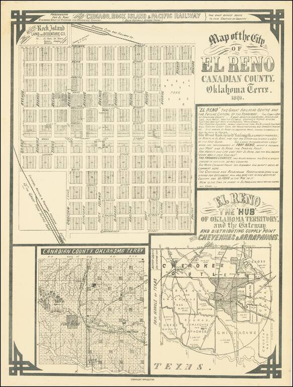
El Reno The 'Hub' of Oklahoma Territory and the Gateway and Distributing Supply Point for the Cheyennes & Arrapahoes Rare early map of the city of El Reno, Indian Territory, published in 1891, on the eve of the Third Oklahoma Land Rush (April 19,...
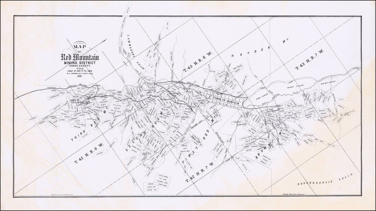
Nice example of W.A. Sherman's extremely rare promotional map showing the Red Mountain Mining District, in Ouray County, Colorado. Oriented with Northwest at the top. The map follows the course of the Silverton Railroad, from the Summit Depot Grounds,...
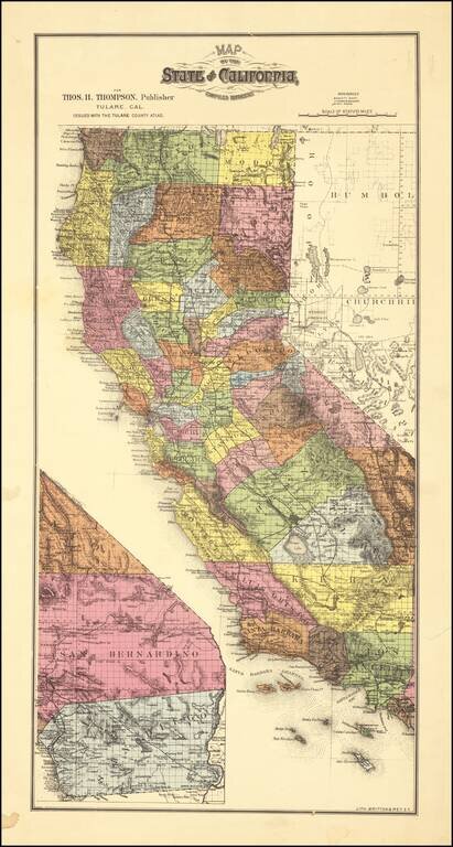
Scarce map of California, colored by counties. which appeared in Thompson's Atlas of Tulare County. The map shows California with completed township surveys. Orange County is present, but Riverside and Imperial Counties are still not yet formed....
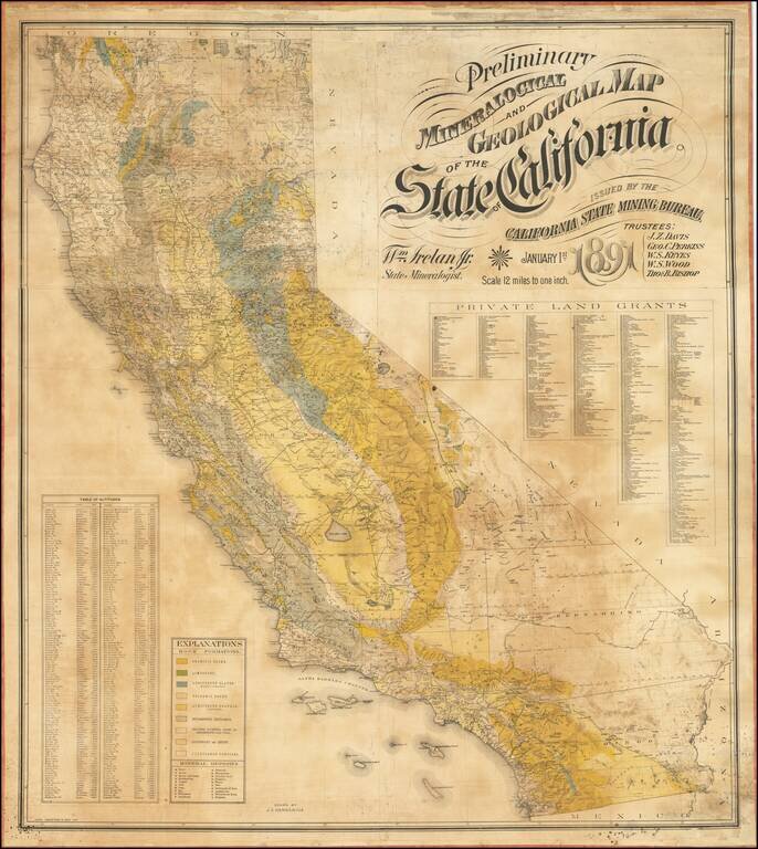
The First Comprehensive Geological Map of California Fine large mineralogical map of California, published by the California State Mining Bureau. The map was the result of an effort by the Trustees of the Mining Bureau, Harry I. Willey, as the former...
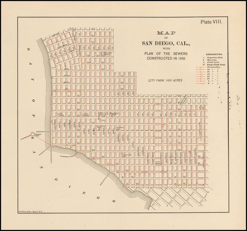
Rare map of San Diego. Shows the Downtown area from Juniper and Curlew Street to 30th Street and N Street. A number of early structures are showing, including: Florence Hotel California Southern Depot Court House Horton House Brunswick Hotel...
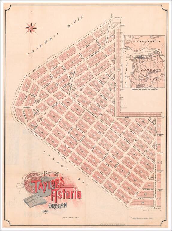
Rare promotional plan of Taylors Astoria subdivision, published in Portland in 1891. Taylors Astoria is situated on the Columbia River at Young's Bay, just east of Fort Stevens and the Astoria Lighthouse. The map inset shows that a proposed rail...
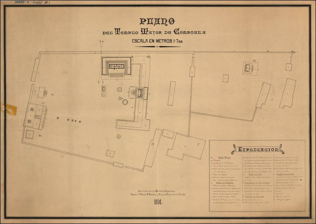
Striking Plan of the Templo Mayor de Cempoala (Zempoala) in the state of Veracruz This late-nineteenth century plan shows the larger temple of Cempoala, also known as Zempoala. It is an important archaeological site for Mesoamerican history, but also...
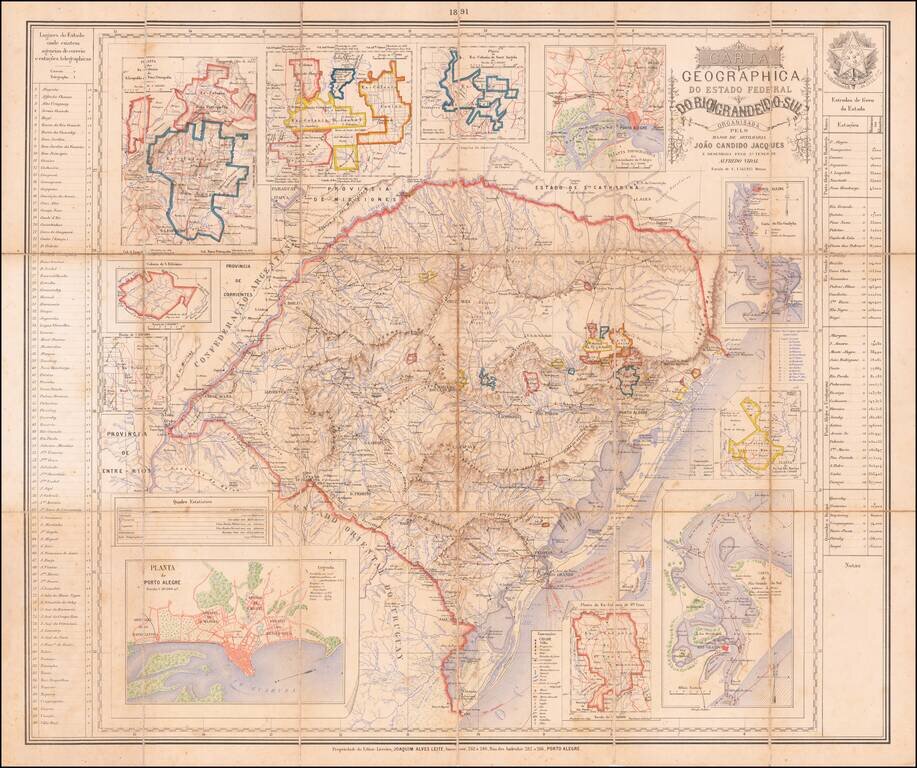
The German Colonies of Rio Grande Do Sul Rare separately published map of the Brazilian State of Rio Grande do Sul, published in Porto Alegre by the firm of Joaquim Alves Leite. The map includes inset maps of the following regions, primarily early...