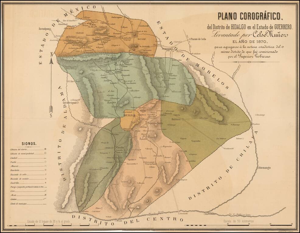
Rare map of the Hidalgo District in the State of Guerrero. showing its divisions and highlighting the cities of Iguala, Cocula, Huitzuco, Taxco and Tetipac. The map shows topographical details, roads, routes, towns, ranches and haciendas.
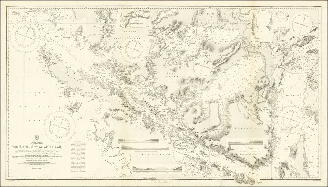
Finely executed Sea Chart of a large portion of the Straits Magellan, published by the British Admiralty. The chart is based upon a series of 19th Century surveys, with major corrections in 1885, 1898, 1903, 1910 and 1920. The map incorporates the...
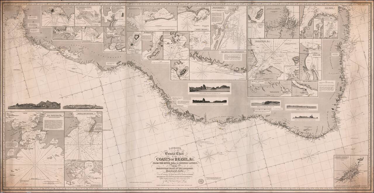
Fine large format sea chart of the coast of Brazil and Paraguay, published by Richard Laurie in London. The map includes inset plans of a number of Brazilian and other harbors, including: Rio de Janeiro Bahia San Salvador Montevideo Rio Grande...
![[Manuscript map of the Mantaro River Valley, Peru]](/map/small/30411.jpg)
Interesting manuscript map of part of the central highlands of Peru, from Jauja in the north to Huancayo and Chupaca in the south. The map covers a little more than 50 miles north-to-south and east-to-west. Many smaller villages and hamlets are...
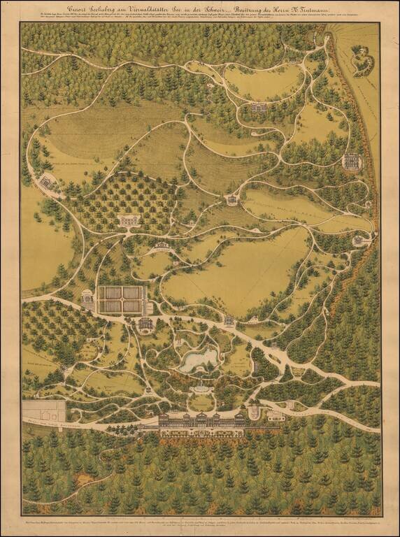
Detailed Landscape Architecture Plan for a Resort in Seelisberg, on Lake Lucerne in Switzerland. Color-lithographed plan, finished by hand, of beautiful Gilded Age grounds, featuring numerous pavilions, gardens, fountains, and villas. The project was...
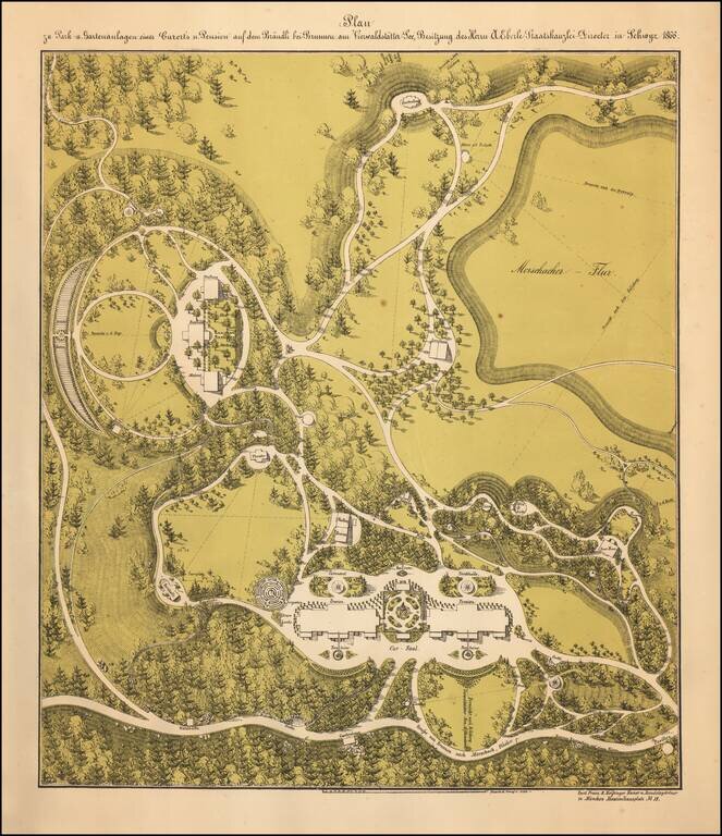
Color-lithographed landscape architecture plan for a resort on Lake Lucerne, in Switzerland. The plan shows design elements characteristic of Franz Xaver Heissinger, including winding paths, varied
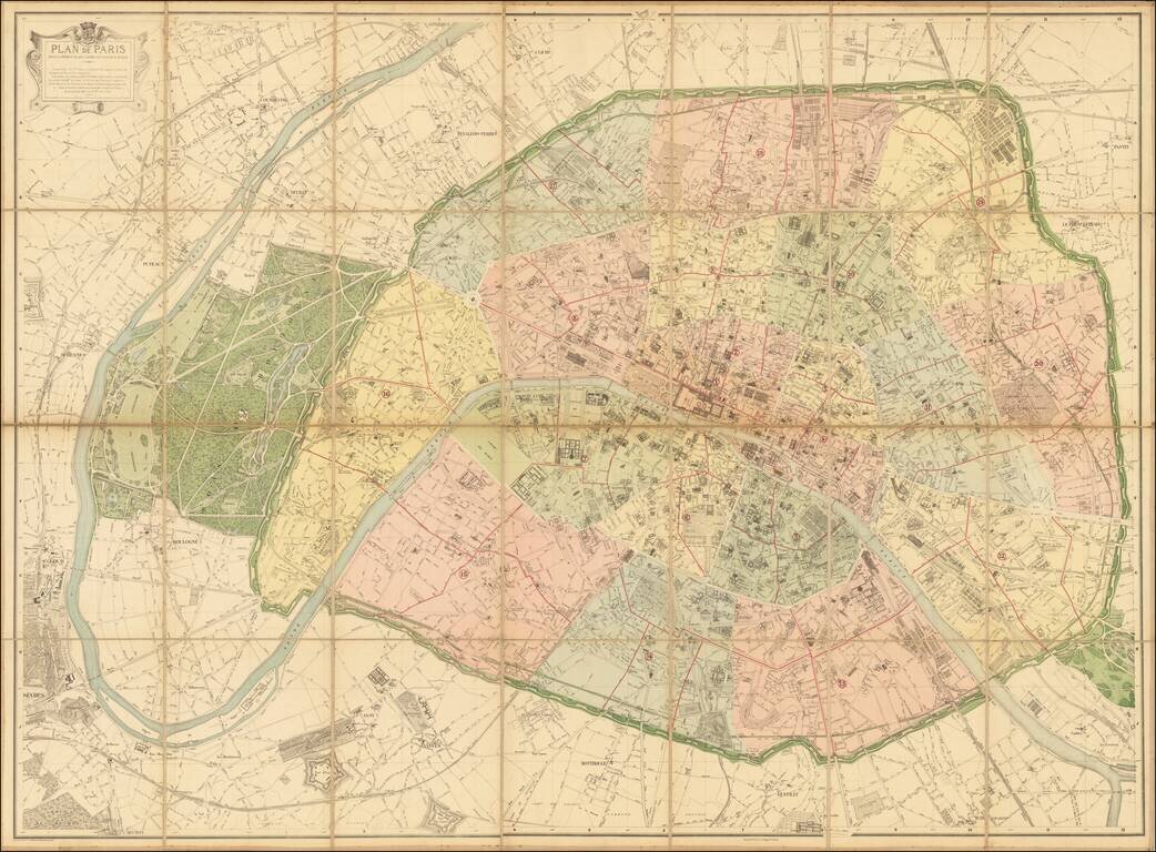
The Deschamps-Hausmann Plan of Paris Important Early Modern Plan of Paris, prepared under the direction of Eugene Deschamps. Divided into Arrondissements, the plan provides an exacting depiction of Paris at the conclusion of the multi-decade...
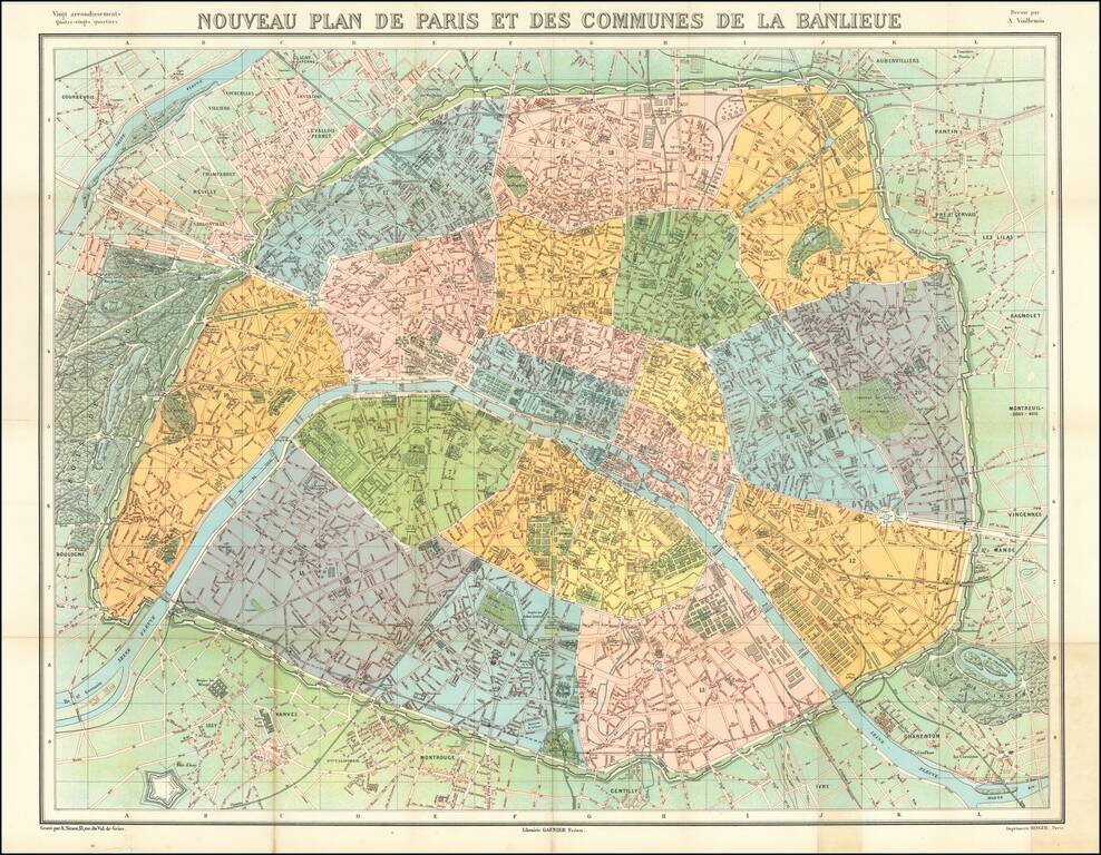
Striking map of metropolitan Paris, published by Garnier Freres. The map is colored by Arrondissements.
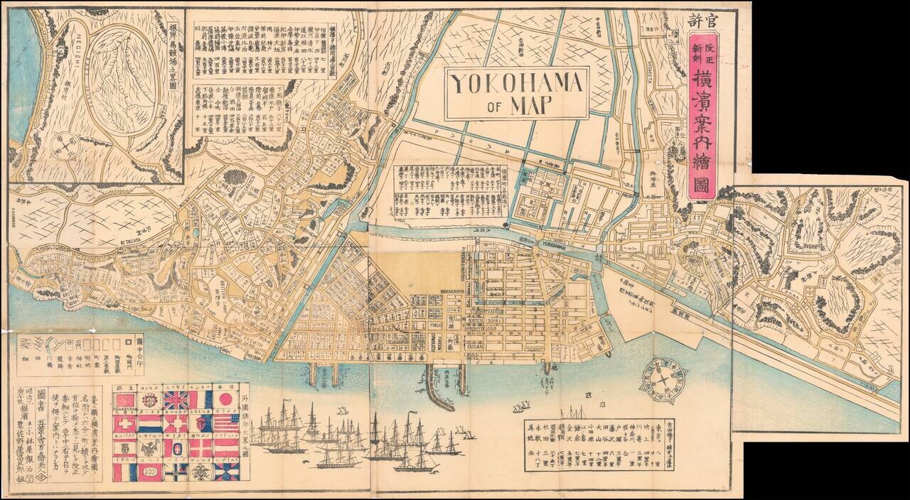
Wonderful Richly Illustrated Map of Yokohama, Featuring Flags of Foreign Nations and a Wonderful Malapropism "Yokohama of Map". Color woodblock map of the trading port of Yokohama, highlighting trade with foreign nations that flourished under the...
![[Straits of Malacca, Sumatra, Java and Western Borneo]](/map/small/51765.jpg)
Detailed sea chart of the Straits of Malacca, Sumatra, Java and Western Borneo, Banca Island, Billiton Island, etc. The chart identifies lighthouses in Yellow, with extensive sailing information, soundings, etc. Includes a large inset map of the...
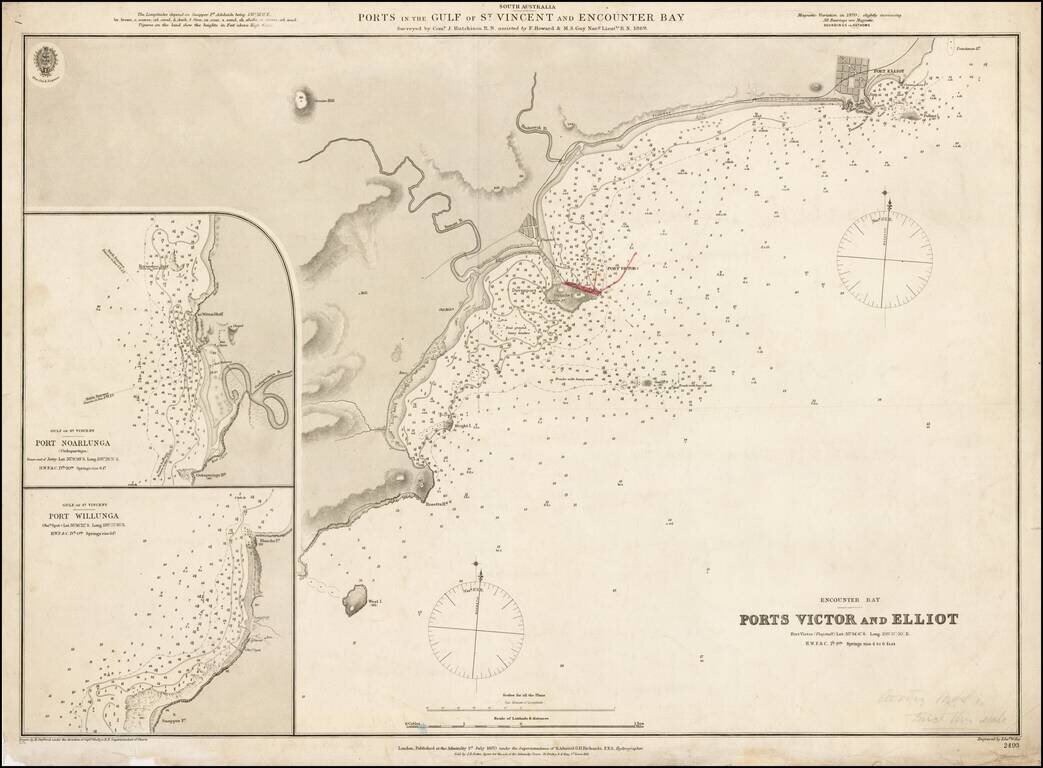
Fine example of the first edition of this early Admiralty Chart showing the ports in the Gulf of St. Vincent and Encounter Bay, published by the Admiralty in 1870. Detailed chart of the coastal region just south of Adelaide and east of Kangaroo...