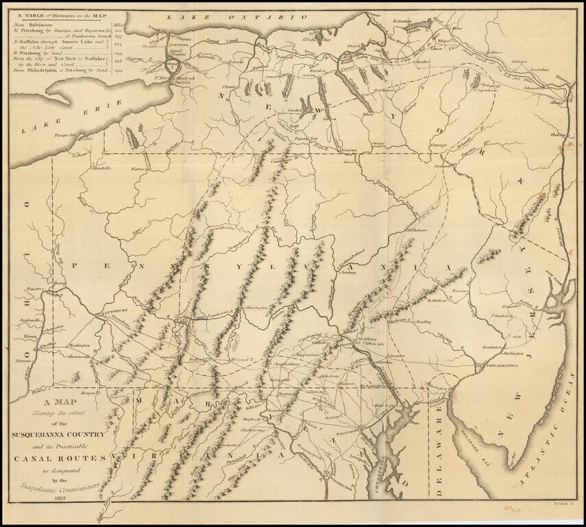
Fine large folding map, illustrating the work of the Commissioners appointed in December 1822 to survey the route of a Canal which would connect the Susquehanna River with the City of Baltimore. Published by Fielding Lucas Jr. in Baltimore, this rare...
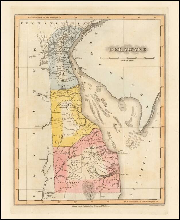
Rare map of Delaware, hand colored by counties and naming the various Hundreds. Shows towns, roads, political boundaries, and other features. Interesting depiction of shoals, flats and beds in the Delaware Bay. Striking example of Fielding Lucas'...
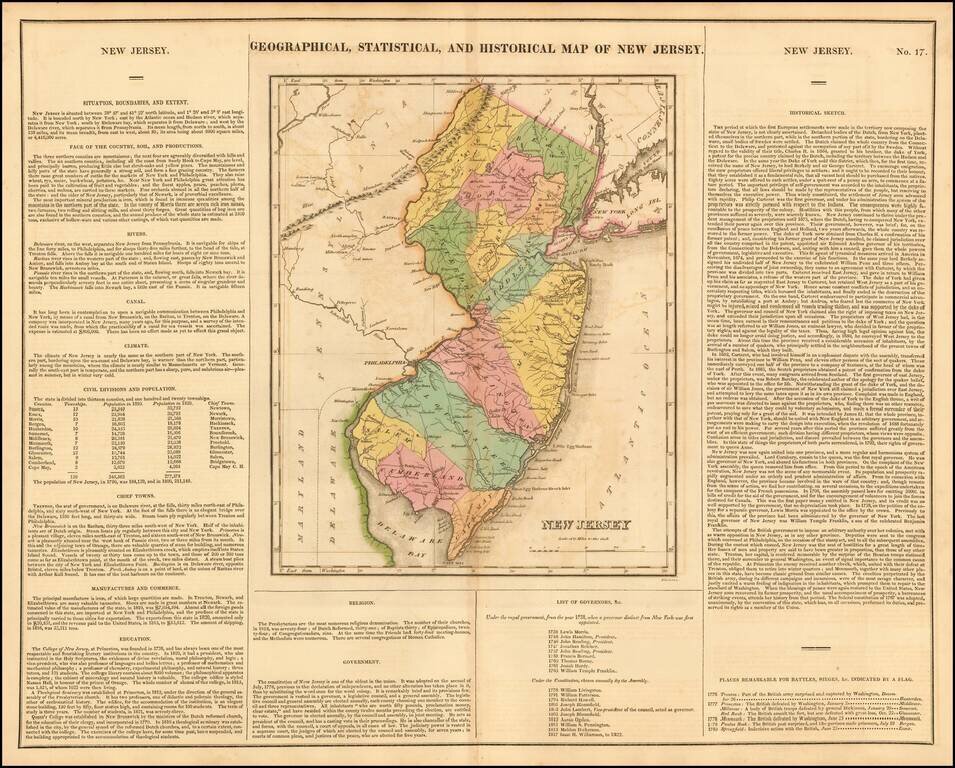
Fine old color map of this early map of New Jersey, from the first edition of Carey & Lea's Atlas. Size includes text surrounding map, which includes wonderful contemporary details concerning the topography, indigenous lands, rivers, climate,...
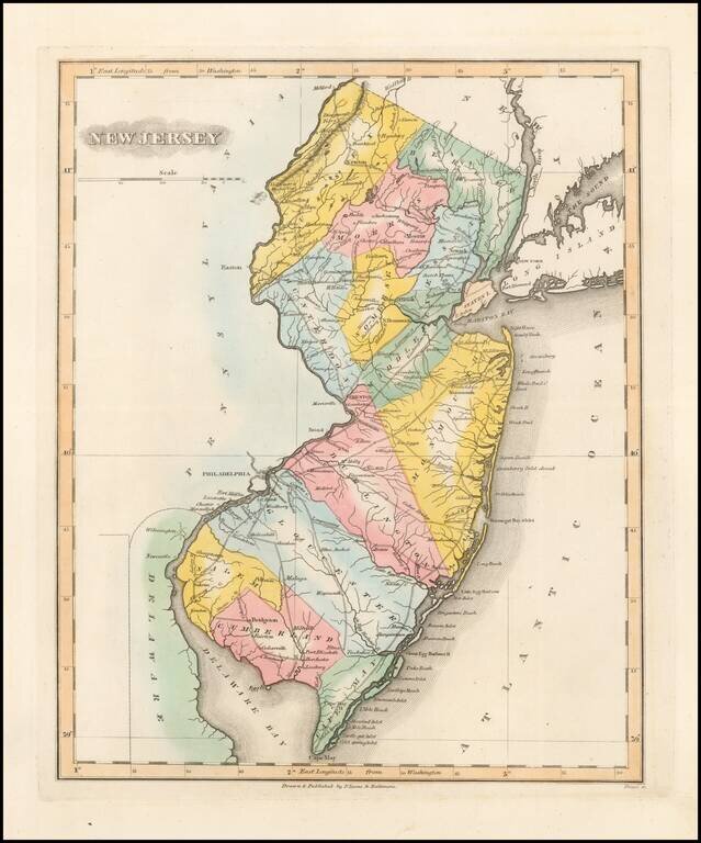
Nice example of Fielding Lucas' rare map of New Jersey, hand colored by counties. Shows towns, roads, rivers, lakes, islands, etc. One of the rarest atlas maps of the early 19th Century and one of the first finely engraved American printed maps of New...
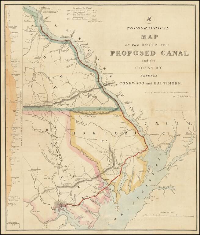
Rare map of the area between Baltimore, Harve de Grace and Middletown, Pennsylvania, drawn by Fielding Lucas Jr. for the Report of the Maryland Commissioners regarding the proposed canal from Baltimore to Conewago, Pennsylvania. The map illustrates...
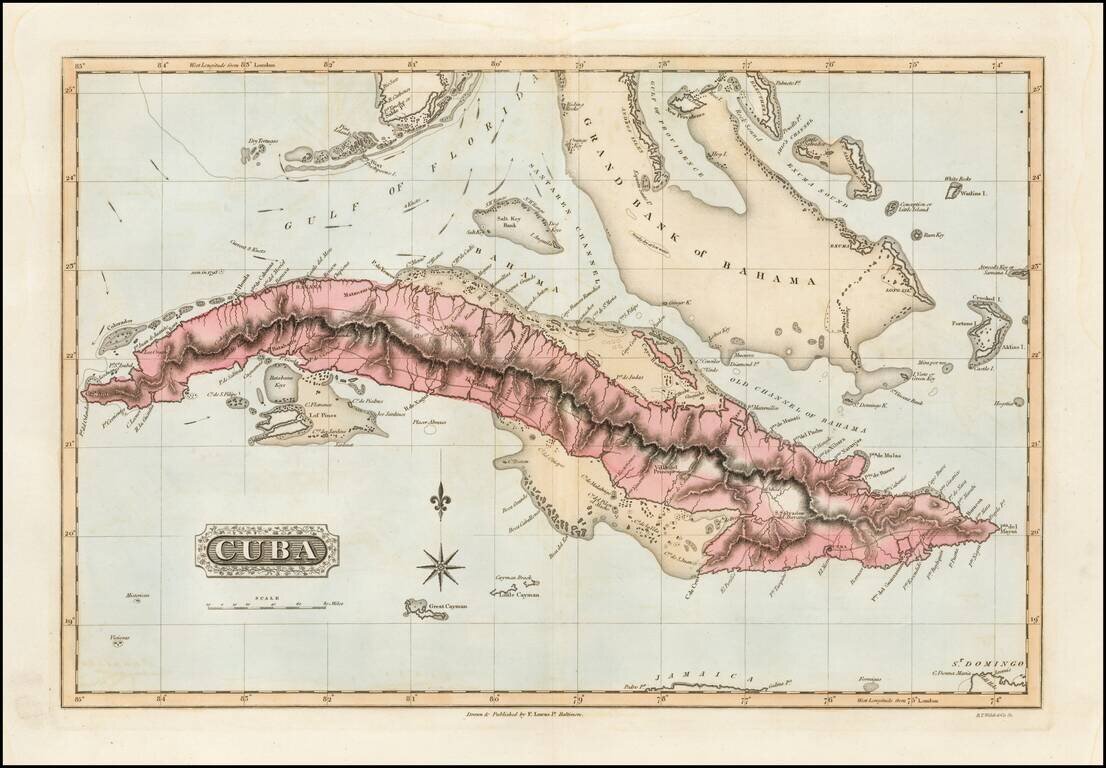
Detailed early American map of Cuba, the Bahamas and Florida Keys, published in Baltimore by Fielding Lucas Jr. The map includes topographical details, roads, and a host of other details. Fielding Lucas's New & Elegant General Atlas included a...
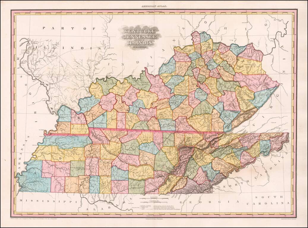
The Best Kentucky, Tennessee & Southern Illinois Regional Atlas Map of the First Half of the 19th Century -- Early Edition with 9 Unnamed Counties in Western Tennessee Gorgeous example of this rare early edition of Tanner's Map of Kentucky,...
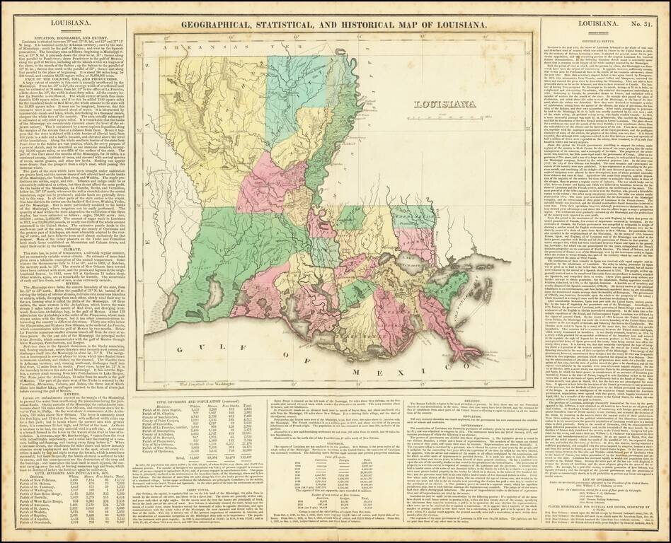
Fine early map of Louisiana, from Carey & Lea's Geographical, Statistical and Historical Atlas. Many parishes still not formed. Size includes text below the map, which includes wonderful contemporary details concerning the topography, indigenous...
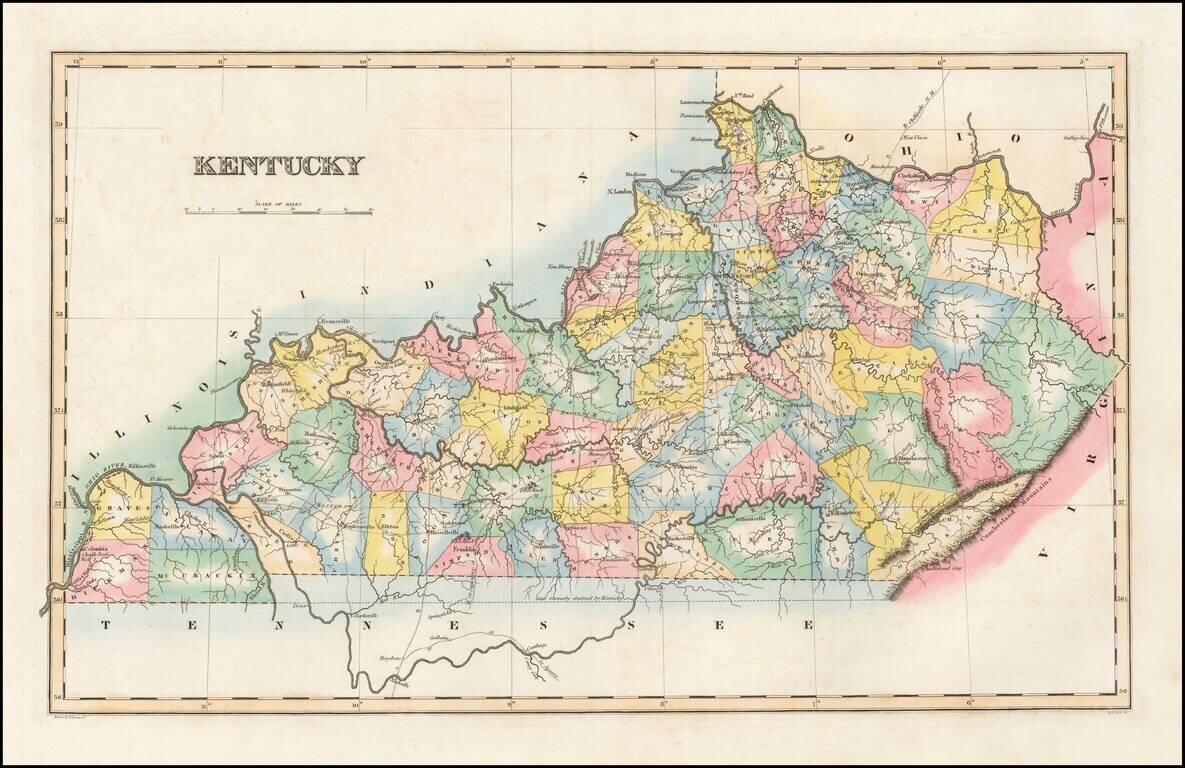
Striking map of Kentucky, colored by counties from Fielding Lucas' New Elegant General Atlas. A number of counties are still not shown, especially in the east. Undoubtedly one of the most attractive and sought after early 19th Century atlas maps of...
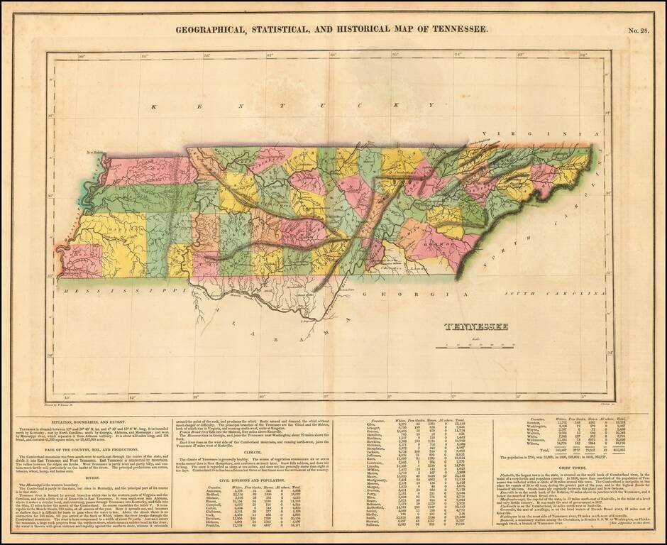
Old color example of one of the earliest obtainable maps of Tennessee, from the first edition of Carey & Lea's Atlas. Many counties still not formed. Size includes text below map, which includes wonderful contemporary details concerning the...
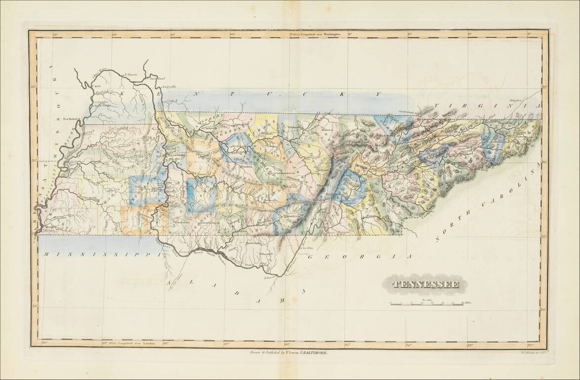
Striking map of Tennessee, colored by counties from Fielding Lucas' New Elegant General Atlas. A number of counties are still not shown, especially in the east. Undoubtedly one of the most attractive and sought after early 19th Century atlas maps of...
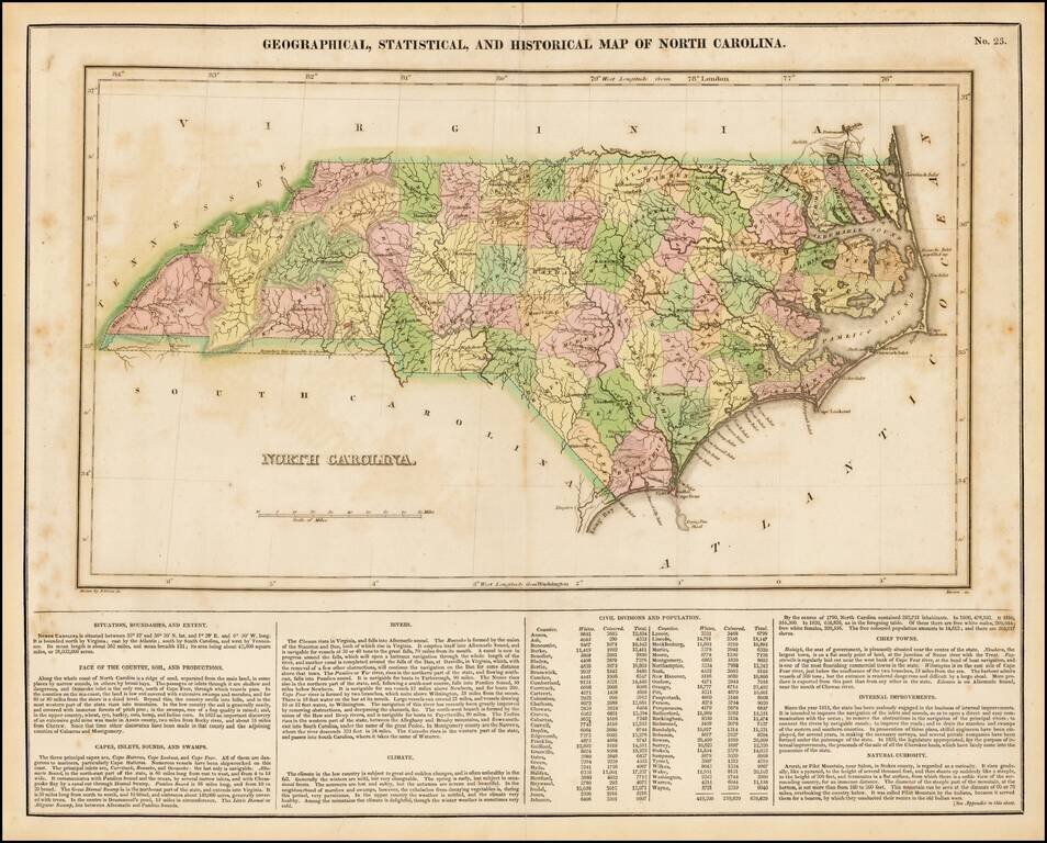
Detailed map of North Carolina, from the first edition of Carey & Lea's Atlas. Many counties still not formed. Size includes text below map, which includes wonderful contemporary details concerning the topography, indigenous lands, rivers,...
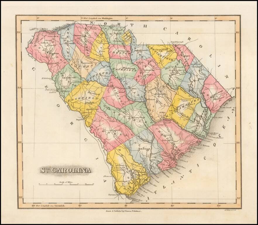
Striking example of Fielding Lucas' finely executed map of South Carolina. Lucas's maps were typcally printed on a higher quality paper than contemporary maps by Carey & Lea and demonstrate a superior engraving quality and more attractive coloring...
![Canada [with Great Lakes]](/map/small/53469.jpg)
Striking map of Canada, colored by territories. The map shows towns, rivers, lakes, mountains, etc. Fielding Lucas produced the best engraved an most attractive of all general atlases published in America (the 1823 Tanner and 1825 Finley being...
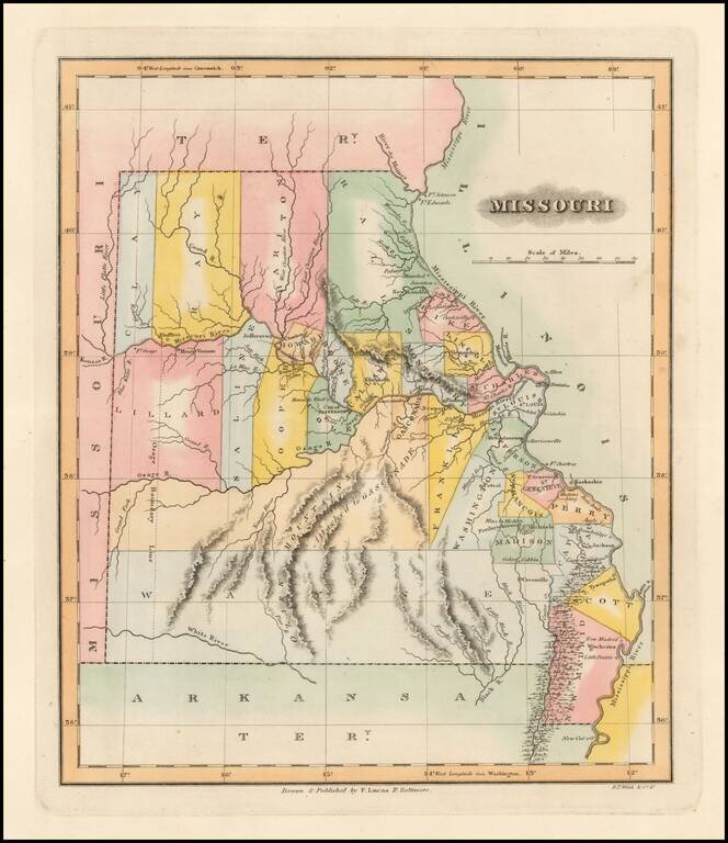
One of the Earliest Printed Maps of the State of Missouri Rare early map of Missouri just two years after statehood. Early state boundaries and most Western area are not yet partitioned into smaller counties. An Osage Boundary Line passes through...
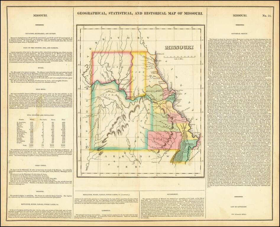
Nice example of the first printed map of Missouri as a state from the first edition of Carey & Lea's Atlas. Size includes text below map, which contains details concerning the topography, indigenous lands, rivers, chief towns, commerce,...