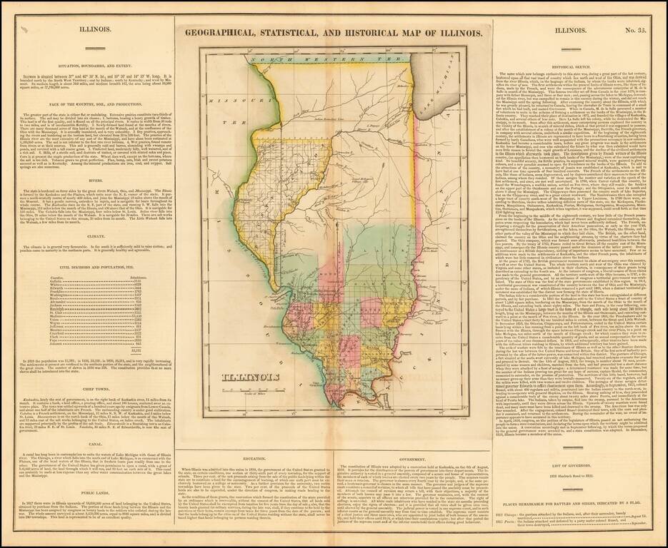
Nice example of this important early map of Illinois from Carey & Lea's Geographical, Statistical and Historical Atlas of North America. Carey & Lea's map of Illinois is one of the earliest obtainable maps of Illinois. This important and...
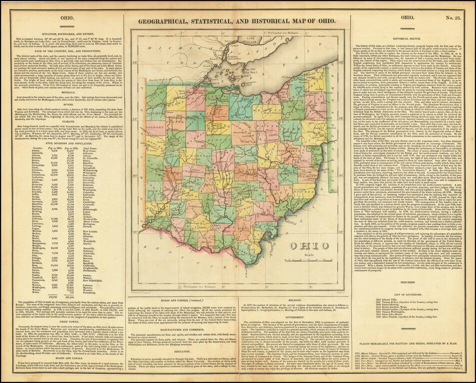
Striking old color example of the first edition of Carey & Lea's map of Ohio. Includes wonderful contemporary details concerning the topography, indigenous lands, rivers, climate, towns, manufacturing, commerce, education, history, population by...
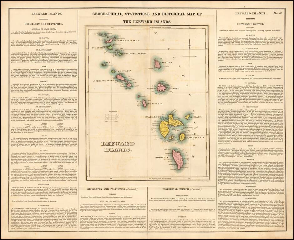
Nice example of this detailed map of the Leeward Islands, from the first edition of Carey & Lea's Atlas. One of the most detailed maps of the region to appear in an early American Atlas. Lengthy narrative text below includes details about the...
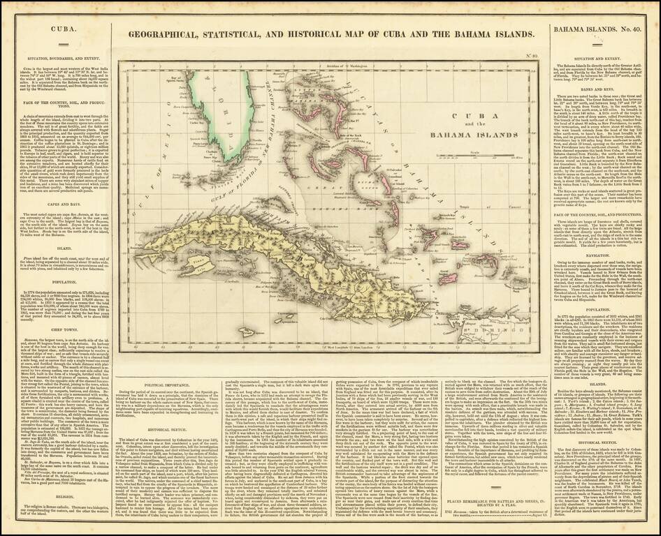
A nice detailed map of the Bahamas, South Florida, and Cuba, from the first edition of Carey & Lea's American Atlas. This is one of the most detailed maps of the Bahama Islands to appear in a commercial atlas. The lengthy narrative text below...
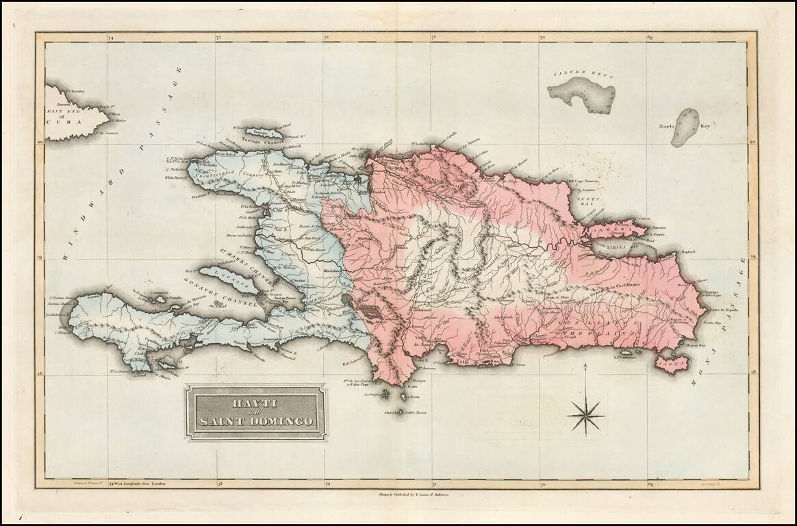
Fielding Lucas's 1823 engraved map of Hispaniola. The map shows the Republic of Spanish Haiti in the east and the Kingdom of Haiti in the west. Just as the map was published the two polities were joined as one. Fielding Lucas' fine work distinguished...
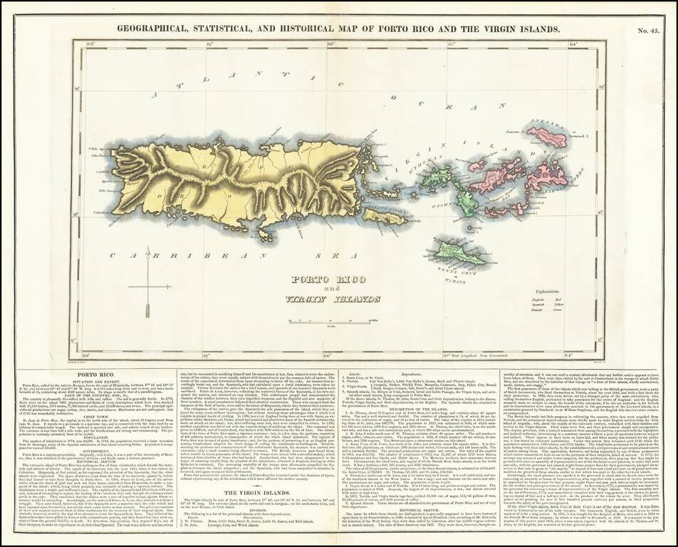
A nice detailed map of Puerto Rico and the Virgin Islands, from the first edition of Carey & Lea's American Atlas. This is one of the most detailed maps of the Virgin Islands to appear in a commercial atlas. The lengthy narrative text below...
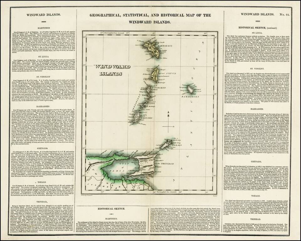
Detailed map of the Windward Islands, from Carey & Lea's rare American Atlas. The text surrounding the map is of particular note. Includes the region from Martinique to Trinidad & Tobago. Carey & Lea's Atlas is highly prized not only for...
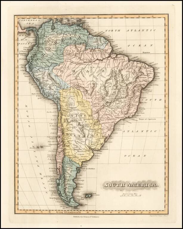
Nice example of Fielding Lucas's 1823 engraved map of South America. Fielding Lucas' fine work distinguished him as the best publisher of the era. His maps are printed on a higher quality paper than contemporary maps by Carey & Lea and demonstrate...
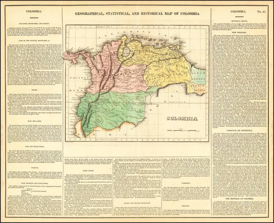
One of the first separate maps of the newly independent Colombia and Venezuela, which was still steeped in Revolution under the irrepressible work of Simon Bolivar. The map is surrounded by details on the country, its soil, climate, history,...
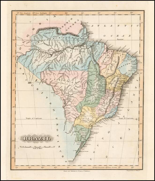
Fielding Lucas's 1823 engraved map of Brazil. Fielding Lucas' fine work distinguished him as the best publisher of the era. His maps are printed on a higher quality paper than contemporary maps by Carey & Lea and demonstrate a superior engraving...
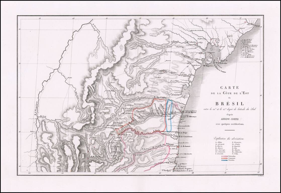
Fine map of a portion of Brazil, prepared to illustrate Prince Maximilian of Wied's expedition to Brazil in 1815-1817. Born at the end of the European Enlightenment, Maximilian of Wied was friends with two important explorers, Johann Friedrich...
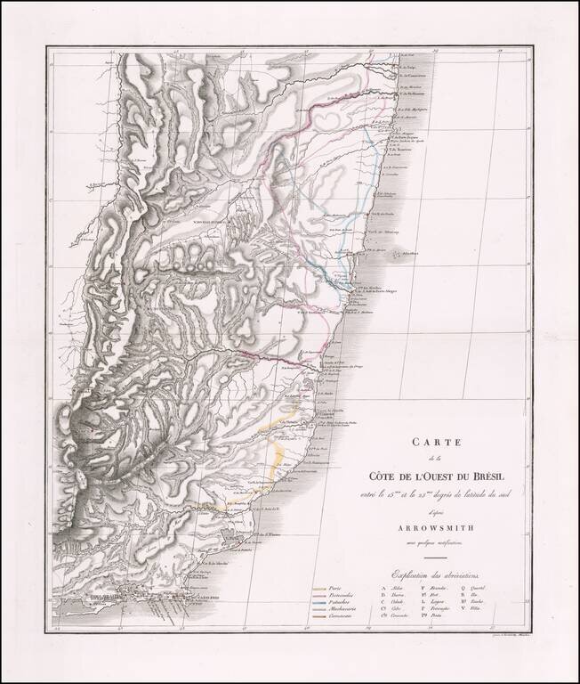
Fine map of a portion of Brazil, prepared to illustrate Prince Maximilian of Wied's expedition to Brazil in 1815-1817. Born at the end of the European Enlightenment, Maximilian of Wied was friends with two important explorers, Johann Friedrich...
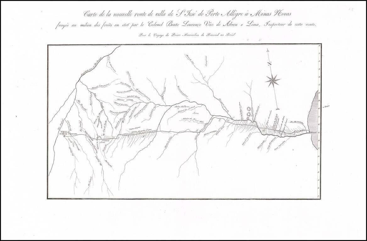
Fine map of a portion of Brazil, prepared to illustrate Prince Maximilian of Wied's expedition to Brazil in 1815-1817. Born at the end of the European Enlightenment, Maximilian of Wied was friends with two important explorers, Johann Friedrich...
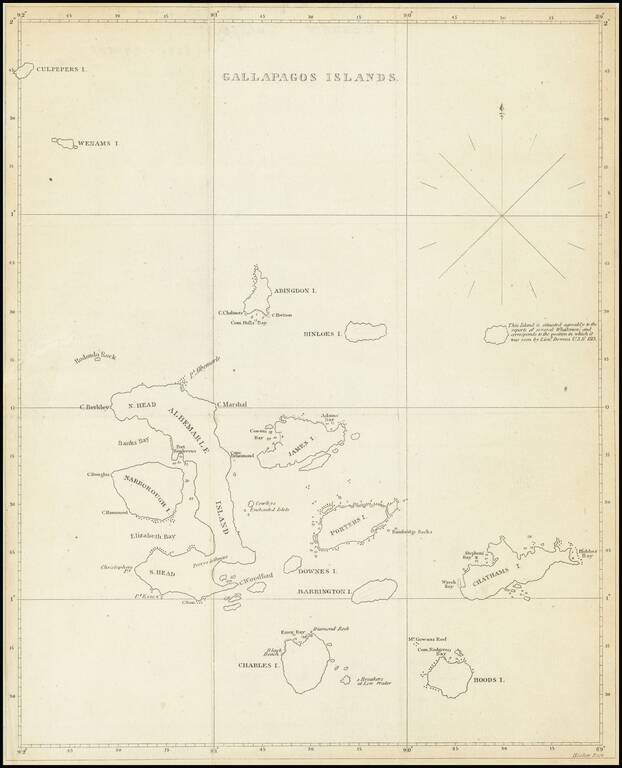
The First American Map of the Galapagos Islands Scarce early 19th Century map showing the Galapagos Islands in detail. An unnamed island (the modern Genovesa) is shown with a note that it "is situated agreably to the report of several Whalemen and...
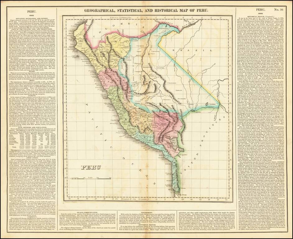
Full color example of this interesting map of Peru, from the second edition of Carey & Lea's Atlas. One of the first separate maps of the newly independent Peru, which was still steeped in Revolution under the irrepressible work of San Martin. The...